Administrative division of Crimea. Map of the Republic of Crimea with cities in detail
By decree of February 2, 1784 The Tauride region was formed, which included Crimea, part of the Northern Black Sea region and the Taman Peninsula.
February 8, 1784 Crimea is divided into 4 districts: Simferopol, Levkopol, Evpatoria, Perekop.
In 1787 the district city instead of Levkopol (the city of Old Crimea was renamed into it) was appointed Feodosia, and therefore Levkopolsky district was renamed Feodosiya.
Paul I by decree of December 12, 1796 abolished the Tauride region and included its territory in the new Novorossiysk province.
Alexander I in 1802 abolished the Novorossiysk province and formed from part of its lands the Tauride province within the borders of the former Tauride region with the same counties; in Crimea there were: Simferopol, Perekop, Evpatoria, Feodosia. By the same decree, the city of Feodosiya was allocated to the city administration.
In 1821 The Kerch-Yenikol city government was established.
In 1829 The Feodosia city government was abolished.
In 1838, the Yalta district was formed.
In 1865 The Sevastopol military governorate was abolished.
In 1873 The Sevastopol city government was established.
After the October Revolution, the Crimean province was formed on the territory of Crimea with the same four districts, and on October 18, 1921. Crimean Autonomous Soviet was created Socialist Republic within the RSFSR.
In 1923 administrative-territorial reform began.
The following districts were formed in Crimea: Akmechetsky, Kerch, Alushta, Sevastopol, Bakhchisarai, Podgorno-Petrovsky, Dzhankoy, Sudak, Evpatoria, Feodosia, Karasubazar, Yalta.
In 1924 Alushta district was abolished, and Podgorno-Petrovsky was renamed Simferopol.
In 1930 in Crimea there were areas:
Old: Bakhchisarai, Simferopol, Dzhankoy, Sudak, Evpatoria, Feytisalsky, Karasubazar, Feodosia, Kerch, Black Sea (formerly Akmechetsky), Sevastopol, Yalta.
New: (since 1930), Alushtinsky (restored), Balaklavsky (until 1931 Sevastopol), Biyuk-Onlarsky, Kuibyshevsky (until 1933 Feytisalsky), Ismail-Perekopsky, Starokrymsky (until 1934 Feodosiysky), Seitlersky, Freidorfsky. Got new names:
Leninsky (until 1931 Kerch). In 1935 appeared: Ak-Sheikhsky, Mark-Saltykovsky, Ichkinsky, Saki, Kalaisky, Telmansky, Larindorfeysky. In 1937 - Zuisky.
In June 1945 The Crimean ASSR was transformed into the Crimean region.
It included the following districts: Azovsky (former Kalaisky), Alushtinsky, Balaklavsky, Bakhchisaraisky, Belogorsky (former Karasubazarsky), Dzhankoysky, Evpatoriya, Zuysky, Kirovsky (former Ismail-Perekopsky), Krasnogvardeysky (former Telmansky), Krasnoperekopsky (new ), Kuibyshevsky, Leninsky, Nizhegorsky (former Seitlersky), Novoselsky (former Freidorfsky), Oktyabrsky (former Biyuk-Onlarsky), Pervomaisky (former Larindorfeisky), Primorsky (former Mark-Saltykovsky), Razdolnensky (former Ak -Sheikhsky), Saki, Simferopol, Soviet (formerly Ichkinsky), Starokrymsky, Sudak, Black Sea, Yalta (abolished in 1948).
In 1954 The Crimean region was transferred to the Ukrainian SSR. In the same year, the Balaklava region was renamed Greater Sevastopol.
The districts were abolished: In 1957. Novoselsky. In 1959 Zuysky, Kuibyshevsky, Primorsky and Starokrymsky.
In 1991 Crimea consisted of 20 districts: Azov, Alushta, Balaklava, Bakhchisarai, Belogorsk, Dzhankoi, Evpatoria, Kirov, Krasnogvardeisky, Krasnoperekopsk, Leninsky, Nizhegorsky, Oktyabrsky, Pervomaisky, Razdolnensky, Saki, Simferopol, Sovetsky, Sudak, Black Sea.
On March 11, 2014, the Supreme Council of the Autonomous Republic of Crimea and the Sevastopol City Council unilaterally adopted a declaration of independence of the Autonomous Republic of Crimea and Sevastopol. The declaration established that if at the upcoming referendum a decision is made to annex Crimea to the Russian Federation, Crimea will be declared a sovereign and independent republic and in this status will turn to Russia with a proposal to accept it into the Russian Federation. Russian Federation as a new entity.
At the all-Crimean referendum on the status of the republic that took place on March 16, 2014, the overwhelming majority of voters cast their votes for the annexation of Crimea to Russia, as evidenced by the official results of the referendum. The next day, March 17, 2014, the Republic of Crimea was unilaterally proclaimed on the territory of Crimea, including Sevastopol, a city with a special status. The republic received the temporary status of a sovereign state and turned to Russia with a request to accept it into the Russian Federation.
On March 18, 2014, an interstate agreement was signed on the admission of the independent Republic of Crimea to Russia and the formation of two new subjects of the Federation - the Republic of Crimea and the federal city of Sevastopol. The agreement provided for a transition period until January 1, 2015, during which the issues of integration of the Republic of Crimea and the city of Sevastopol into the economic, legal, financial and credit systems of the Russian Federation, into the system of government bodies of Russia, issues of military service and execution should be resolved. military duty in the territories of the Republic of Crimea and the city of Sevastopol.
On March 21, 2014, Russian President Vladimir Vladimirovich Putin signed a federal constitutional law on the entry of the Republic of Crimea into the Russian Federation and the formation of new federal subjects. The day before signing, on March 20, the law was adopted by the State Duma and approved on March 21 by the Federation Council. Together with the law, Vladimir Putin approved the ratification of the Treaty on the Admission of the Republic of Crimea to Russia. At the same time, the Crimean Federal District was created by a special decree, and Oleg Evgenievich Belaventsev was appointed plenipotentiary representative of the President of the Russian Federation in the Crimean Federal District.
According to the decree of the President of the Russian Federation Vladimir Putin dated April 2, 2014, the Republic of Crimea was included in the Southern Military District. On April 11, 2014, the Republic of Crimea and the federal city of Sevastopol were included in the list of subjects of the Russian Federation in the Russian Constitution.
On the territory of the Republic of Crimea, after it became part of Russia, the Constitution of the Autonomous Republic of Crimea, adopted by the Verkhovna Rada of the Autonomous Republic of Crimea on October 21, 1998 and came into force on January 11, 1999, continued to apply.
On April 11, 2014, an extraordinary meeting of the State Council of the Republic of Crimea was held, at which they approved the Constitution of the Republic of Crimea, consisting of 10 chapters and 95 articles, its main provisions are similar to the articles of the Constitution of the Russian Federation. According to the new Constitution, the Republic of Crimea is a legal, democratic state within the Russian Federation, an equal subject of the Russian Federation. The source of power in the republic is its people - part of the multinational people of Russia. In the Republic of Crimea, three state languages- Russian, Ukrainian, Crimean Tatar. The highest official is the head of the republic, elected for a term of 5 years by deputies of the State Council of Crimea. On October 9, 2014, Sergei Aksyonov was unanimously elected head of the Republic of Crimea by the State Council of Crimea.
The Crimean Peninsula is located in the northern part of the Black Sea. A satellite map of Crimea shows that from the northeast the area of the peninsula is washed by the Sea of Azov.
Most high point region is considered Mount Roman-Kosh, whose height is 1.5 thousand meters.
Crimea is connected to the mainland by the small Perekop Isthmus.
The territory has three different types of relief: mountainous part, area of hilly plains and plains.
Yandex maps of Crimea clearly demonstrate that the vast territory of the peninsula is crossed by more than 250 waterways. Also in the region large number salt lakes. The most famous and big lake– this is Sasyk-Sivash.
The longest river is the Salgir. There are more than 150 nature reserves on the territory of Crimea. The region has rich recreational resources.
Central regions of Crimea
All cities in the region are connected with each other using bus routes. Also, the areas on the map of Crimea have trolleybus service. There are sea routes. In Kerch there is a ferry crossing through which passengers and cargo are transported to the peninsula from the Krasnodar Territory.
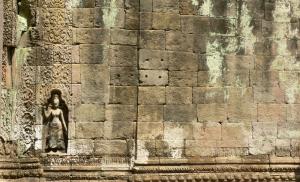
Bakhchisaray district mainly has mountainous terrain. The area is famous for its ancient monuments: ancient cave settlements on mountain plateaus. There is also a nature reserve in this area. Grand Canyon and various nature reserves.
A map of Crimea by regions in the east of the peninsula will help you find the Kirovsky district. The most important attractions of this part of the region are considered to be Old Crimea. In the east of the region there is the Feodosia Reservoir and Lake Achi.
Mining materials include the following materials: gravel, clay and limestone. In economics, the main place is given to agriculture. There are state farm factories and large farms in the area.
On the shore of the Karkinitsky Bay, using the map of Crimea, you can find the Razdolnensky district. Numerous natural resources are concentrated on its territory: healing mud on Lake Bakalskoe, hydrogen sulfide springs, as well as favorable for treatment climatic conditions. Grains, melons, and vegetables are grown on the fertile soils of the region. This area is considered a resort area.
A map of Crimea with villages shows where the Black Sea region is located, which is located on the Tarkhankut Peninsula. The area produces minerals such as shell rock, natural gas and limestone. The resort area of this area is famous budget holiday. There are industrial organizations and agricultural enterprises on the territory.
Map of Crimea with cities and villages
Find and explore famous cities The peninsula will allow a map of Crimea with cities and villages:
- Simferopol is considered the capital of the region and an important industrial center. On its territory there are many food factories and companies: a dairy factory, a confectionery factory, a pasta factory, and a cognac factory.
- Sevastopol is a city of federal significance. It houses the Russian fleet.
- Kerch is small town on the shore of the Kerch Strait. It is in this locality that the ferry crossing is located. This is one of the oldest cities in which many ancient monuments architecture.
- A detailed road map of Crimea will lead to Evpatoria. The city is located on the shores of the Kalamitsky Bay. On its territory there is an extended sanatorium-resort area, as well as Old town with an area of ancient buildings. Evpatoria is famous for its large number of medicinal natural resources: mineral water, brine and healing mud. In the vicinity of the city there are famous lakes: Moinak, Sasyk and others.
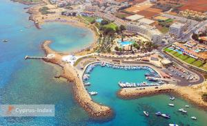
- Feodosia represents transport hub, where road, water and rail routes converge. The resort industry is considered the basis of the economy. There are beach areas in the city, mineral springs and various sanatoriums.
- Yalta is one of the most famous resorts peninsula.
Economy and industry of Crimea
With a map of Crimea with settlements you can find all the enterprises of the city. The main industries of the region include industry, tourism, construction and agriculture.
Scientific centers of various profiles are located on the peninsula. In the southern part there is an astrophysical observatory.
The bulk of industrial production occurs in manufacturing enterprises.
A map of Crimea will help you study the economic objects of the peninsula in detail. The most important industries in the region include: chemical, food, engineering and construction.
Grain farming is developed on the peninsula. Wool, milk and meat are also produced.
There are more than 700 sanatorium-resort institutions and large hotels in Crimea.
The Crimean peninsula is distinguished by its richest recreational resources.
Crimea is large tourist center Black Sea. The territory of the peninsula is divided between two administrative entities: the republic of the same name and the Sevastopol City Council.
Relatively recently, Crimea appeared on the map of Russia - this peninsula became part of our country in March 2014.
Cities and towns of Crimea
Detailed map of Crimea with all roads and routes
The capital of the republic is Simferopol. She has rich ethnic composition: Russians, Tatars, Ukrainians, Belarusians, Azerbaijanis, Armenians, Uzbeks and other nationalities live in it.
There are many resorts of various types on the peninsula, located both on the coast and at some distance from it. As a rule, they are tied to populated areas.
Resort cities of Crimea
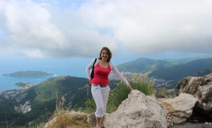
Yalta
Yalta is big resort town on the South Bank. The city is the center of a large agglomeration - Greater Yalta, which includes villages Alupka, Livadia, Oreanda, Massandra.
Yalta has the best climatic conditions for treating patients with diseases of the nervous and respiratory systems. The local ecosystem is unique, as it was formed under the influence of both mountainous and coastal climates.
Within the city there are many historical and architectural attractions. Among the latter, “ Swallow's Nest"- a building on a steep cliff above the sea, resembling medieval castle. In addition, there are many other memorable places in Yalta, including the Livadia, Vorontsov and Massandra palace complexes.
Outside the city there are waterfalls Wuchang-Su, mountains Ayu-Dag And Ai-Petri, lake Karagol, Cape Nature Reserve Martyan. Developed transport infrastructure allows you to get to any of these attractions.
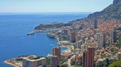
Sevastopol
Sevastopol is a large seaport, location Black Sea Fleet. The city is surrounded mountain range, which may seem interesting to connoisseurs active recreation.
There are many agencies in Sevastopol that are ready to organize diving and windsurfing, horseback riding, and trips along the coast on motor boats and sailing yachts.
Simferopol
Simferopol is located far from the coast, but when traveling to the South Coast it is almost impossible to pass this city. Administrative map Crimea designates it as the center of the republic. Considering the rich history of Simferopol, there are many monuments of the past in the city and near it - the Scythian Naples, house Vorontsova, estate Sabers.
There are many museums and galleries, several theaters and philharmonic societies in Simferopol. Near the city there is the Su-Uchkhan waterfall and the adjacent Kizil-Koba cave, which is an ancient karst system no less than 21 kilometers long.
Alushta
Moving along the mountain highway from Simferopol to the south, you can get to Alushta - the second most popular resort on the Crimean coast of the Black Sea after Yalta. The length of the health and tourism complex of Alushta is about 90 kilometers - this is Big Alushta, located between Partenit and the village of Privetnoye.
Alushta is located in a valley surrounded by the mountain peaks of Demerdzhi, Eklizi-Burun and Roman-Kosh.
You can explore the historical sights of Alushta, including the house-museums of writers Ivan Shmelev and Sergei Sergeev-Tsensky. Outside the city there is also the Museum of Nature of the Crimean Reserve along with an arboretum. There are many attractions and entertainment complexes within walking distance from the shore.
Evpatoria
The city of Evpatoria is located in the western part of the peninsula, among many salt lakes. This - ideal conditions for the activities of balneological hospitals. In addition to the Evpatoria waters, local mud has a healing effect.
Quantity sunny days in the city more than in Yalta. Swimming season in Evpatoria it starts early, since the shallow Kalamitsky Gulf warms up quickly.
In summer, the Evpatoria coast is characterized by breezes that provide cool air with warm water.
Near Evpatoria there are the resorts Zaozernoye, Novofedorovka and Nikolaevka. The city is also located in close proximity to the Evpatoria group of lakes, including the Sivash and Moinaki reservoirs. There is a water park on the Evpatoria beach.
Alupka
The city of Alupka is located in the place where the Main mountain range of the Crimean Mountains comes closest to sea coast. To get here along the winding serpentines, you need a map of the peninsula. The streets in the city are confusing; many neighborhoods have the characteristics of mountain settlements. The length of Alupka along the coast is 4.5 kilometers, and the Ai-Petri peak rises above the city.
Alupka is an integral part of the agglomeration Big Yalta. In addition to resorts, Alupka attracts tourists Vorontsov Palace- an architectural monument from the times of the Russian Empire.
Livadia
The settlement of Livadia is another part of Greater Yalta. The village was once used as a summer imperial residence, and in memory of those times, the Livadia Palace has been preserved, today open to tourists.
Travelers are also interested in Livadia Park, famous for its diversity of plants and shrubs, as well as its unusual landscape. This park is the oldest on the coast. To get to know the surroundings of Livadia in more detail, vacationers can use the services of one of the many agencies that organize excursions - however, you can go for a walk on your own.
Oreanda
The village of Oreanda, along with Alupka and Livadia, is a district of Greater Yalta. Its distinctive feature is its natural landscapes. Fans of active recreation can visit Krestovaya Mountain located near the village and walk along the Tsar’s Path.
Oreanda is famous for its Golden Beach, which is considered the best in Big Yalta. This beach is a natural stretch of coastline strewn with polished pebbles. The local sea air is suitable for treating people with respiratory diseases.
Massandra
Massandra is an eastern suburb of Yalta. Famous wines are produced here: many of the mountain slopes near Massandra are devoted to vineyards. In the village there is a winemaking plant of the same name, which owns a rich collection of wines.
In addition to winemaking, Massandra is famous for the palace of Alexander III, as well as the Massandra Park.
Bakhchisaray
Bakhchisaray, like Simferopol, is a “continental” resort. Despite the lack of beaches, about half a million tourists visit the city every year. They are mainly attracted by the medieval atmosphere of the city. In addition, Bakhchisaray has an advantageous geographical location, and is located at an important transport junction between Sevastopol and Simferopol.
The main attraction of Bakhchisarai is the Khan's palace. In the vicinity of the city you can see " cave cities", as well as magnificent natural attractions: locality located between the Inner and Outer ridges of the Crimean Mountains.
Kerch
Kerch is the most eastern city peninsula, its “sea gate” for those traveling by ferry. The city is interesting because it is a port of both Cherny and Azov seas, and also in close proximity to it there is the water area of Sivash. Both seas, as well as the lake, have different hydrological regimes, so recreation conditions on their coasts differ.
In the outskirts of the city it predominates steppe landscape. Those who wish, in addition to the beaches, can visit the Melek-Chesme mound - an ancient well-preserved burial site, today converted into a museum.
Old Crimea
This city is located in the east of the peninsula in a place where the steppe, mountains and sea touch. The town is remote from the main tourist routes. However, the locality has a developed resort infrastructure, and is suitable for those who want to spend their vacation in solitude, away from noisy places where travelers gather.
There are several galleries and museums in Old Crimea, including the house-museum of Konstantin Paustovsky, as well as the ethnographic museum of the Crimean Tatars.
Nature of Crimea
A detailed map of Crimea in Russian allows you to see that according to the type of landscapes, the peninsula is divided into two zones: the first, steppe, occupies two thirds of its territory, and the second, mountain– remaining space.
The steppe extends from the northern outskirts of the peninsula to its central part, smoothly turns into hills, and then is replaced by mountainous terrain. There are areas in the mountains that are not inhabited by humans.
The nature of the vegetation cover directly depends on the features of the relief. So, grass grows in the steppes, but there are no forests. And vice versa: in mountainous areas trees predominate, especially with a developed root system, which are firmly attached to the rocks. Relict vegetation is common on the South Coast.
Climate and weather of Crimea
The peninsula is located in three climatic macroregions; there are also twenty microregions on its territory. Macroregions due to terrain. First macroregion – steppe– located in the northern and eastern parts of the peninsula, second – foothill and mountain– in the center and closer to the south, and third – South Bank – near the very edge of the Black Sea.
“Home” winds near the coast are rare; they blow much more often in the steppe. Throughout the entire peninsula, air flows from the east and northeast predominate, with the only exception being Feodosia, which is open to western winds.
As for precipitation, in the steppe part of the region there is an insufficient level of moisture. The most precipitation on the peninsula falls on the northern spurs of the Crimean Mountains - more than 1000 mm annually.