Altai Territory: historical, cultural and natural attractions of the region. Monuments of history and culture of the Altai Republic
Description of the presentation by individual slides:
1 slide
Slide description:
Attractions Altai Territory. Compiled by: Natalya Aleksandrovna Maslova, primary school teacher, Belokurikha, Altai Territory
2 slide
Slide description:
3 slide
Slide description:
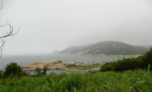
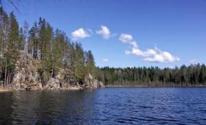
Mount Charming. Altai Territory, Kurinsky District, Kolyvan Village Russia, Western Siberia, Altai, Altai Territory Located 5 km from the village of Kolyvan to the northeast and 6 km from the village named after. March 8th. At the top of Mount Charming there is a grotto resembling the head of a fish, animal or bird with an open mouth (beak) and even an eye. The resemblance to a living creature is even more enhanced if you look into the grotto from the top platform of the rock. From there you can see a wide-open mouth with smooth inner walls, turning into a dark “pharynx” and then into the “larynx” - a thin crevice between stone layers.
4 slide
Slide description:
At the top of Mount Charming there are no other water sources except the lake in the southern part on the slope of the mountain. The lake is shallow, with clear water, brownish-red in color, slightly swampy, with a rocky bottom and a small layer of silt. The lake has the shape of an irregular oval overgrown with birch trees south coast. In the south-eastern part of the shore there is a convenient approach to the water with “steps”. Next to the water, on a flattened rocky outcrop, there is a shallow hole - a hole. Perhaps the edges of the hole were corrected in ancient times, and it was used in rituals. The very name of the mountain – “Charming” – comes from the word “enchantment”. It is believed that sacrifices were made on the shore of the lake to the spirits of the “lower world” - water and earth.
5 slide
Slide description:
Belokurikha healing springs. They are located in the city of Belokurikha, Smolensk district, Altai Territory. The Belokurikha deposit of thermal radon waters is located within a fault located at the junction of the West Siberian Plain and the Altai-Sayan mountainous country in the valley of the Bolshaya Belokurikha River at an altitude of 250 m above sea level. The springs have been known since 1866. The healing properties of hot springs were experienced by local residents of Gudkov and Kazantsev in the middle of the century before last. The researcher of Siberia S.I. paid a lot of attention to the sources. Gulyaev. In 1867, the first patients arrived “for the keys.” The Belokurikha resort dates back to this year, and S.I. Gulyaev is deservedly considered its founder.
6 slide
Slide description:
Belokurikha radon springs are one of the amazing natural phenomena. The deposit is small in area - about a square kilometer; in cross-section it resembles a giant multi-layer granite bowl or a stack of plates placed one on top of the other, the space between which is filled with water. Passing through labyrinths and aquifers, heated and enriched with trace elements and radon, the water is directed towards the slope of the giant bowl, where it emerges to the surface in numerous hot springs. They are unique in their medicinal and chemical properties. Radon waters have anti-inflammatory, analgesic, anti-allergic effects, have a unique ability to reduce cholesterol in the body, and even prevent aging.
7 slide
Slide description:
8 slide
Slide description:
Mount Seven Caves. It is located in the Krasnoshchekovsky district, 5 km downstream of the Ini River from the village of Tigirek, on the left bank. Of great interest is the picturesque Mount Semipeschernaya or Seven Brothers. This is a cliff made of limestone, rising 150 m above the river. Grotto caves of different sizes and shapes have their own names. None of the caves are like the other. Two of them in particular are of particular interest - String and Gloomy.
Slide 9
Slide description:
The Struna Cave is a through, steeply inclined tunnel, the lower exit of which is located at the very edge of the water, and the upper exit is 40 m higher and has the appearance of a sinkhole, the length of the cave is 75 m. Gloomy Cave. The length of the cave is 76 m, the amplitude is 5 m. From the spacious, south-facing entrance there is a narrowing gallery leading in the north direction, ending with a ledge into a grotto with a flat and bowl-shaped floor. The Gloomy Cave is interesting as an archaeological site.
10 slide
Slide description:
11 slide
Slide description:
The mountain is located 56 km from the regional center of Kurya, 8 km east of the village of Kolyvan and 2 km from the village of 8 March. This is the highest mountain of the Kolyvan ridge, it is located at the northern end of the ridge. Its height is 1210 m above sea level. The mountain got its name not by chance: from a distance, the fir forest covering the slopes of the mountain really appears blue.
12 slide
Slide description:
The top of the mountain is represented by rocks, devoid of any vegetation due to weak rocky soil, on which young trees do not take root well. The mountain is dominated by round, dome-shaped shapes, and rocky outcrops are common. A beautiful panorama opens from the top of the mountain. Through the efforts of water and winds, the most unexpected and interesting forms of relief have been created on Sinyukha: sometimes these are arches, sometimes columns, sometimes fantastic animals. The slopes of the mountain are occupied by a fir forest; the flora of Mount Sinyukha includes 541 species of higher vascular plants, 18 of which are included in the Red Book of the Altai Territory. Mount Sinyukha has long been considered a place of pilgrimage. On the top and slopes of the mountain there are several natural granite bowls filled with what many believe to be holy water.
Slide 13
Slide description:
Slide 14
Slide description:
Rock Tserkovka Altai Territory, Belokurikha It has a height of 794 m, is located 4 km southwest of Belokurikha and is a cone-shaped mountain covered with forest with several rocky outcrops. Mount Tserkovka has long become a local landmark of the resort town of Belokurikha. At the top of Tserkovka there is a wonderful view of the Biysk Plain approaching the mountains, the city of Belokurikha, the resort area with sanatoriums and the undulating ridges of the Cherginsky Range. Rock Church is impossible to confuse. She stands on the edge of a steep descent from the ridge of the mountain. The rock is formed by large weathered blocks - outlier rocks. And it narrows from the base to the top. The top of the rock is an onion-shaped block, similar to a church dome, with a cross installed on it. This probably explains the name of the mountain. In past centuries, a sacred tree of the Altai people grew and a chapel stood on the eastern side of the rock. Birds are usually fed near the Tserkovka rock. The birds are so accustomed to people that they sit directly on the hand of those feeding them.
15 slide
Slide description:
16 slide
Slide description:
Slide 17
Slide description:
Mount Maly Monastery, rising 70 m above the valley level. At the top of the mountain there are stone gates, and on the southwestern slope there are about a dozen small karst caves from 2 to 15 m long, as well as a karst arch. In the second grotto of the cave there is a small lake with healing water. The Big and Small Monastery mountains are located in the valley of the Charysh River, near the village of Ust-Pustynka, Krasnoshchekovsky district of the Altai Territory. These are rocks “made” by nature from white marble limestone; they contain numerous grotto caves, towers, and arches. There are 18 caves alone. Rocks, shaped like the building of ancient monasteries, sparkling in the sun with white, gray, blue and pink limestone. The pastel palette gives the Big and Small Monasteries a particularly romantic look.
18 slide
Slide description:
Slide 19
Slide description:
The cave is located in the middle reaches of the Anui River, 50 km upstream from the village of Soloneshnoye, 4 km from the village of Topolnoye. The wide entrance to the cave opens right into the mountainside, a few meters above the road. "Denisova Cave" is a unique archaeological and natural monument. Since 1982, archaeological research has been carried out here; more than 20 cultural layers have already been discovered, characterizing the main stages of ancient history - from the early Paleolithic to the Middle Ages. Many finds are kept in museums in the Altai region and Siberia.
20 slide
Slide description:
The Denisova Cave monument was formed 800 thousand years ago. The water gradually washed away the rock, forming a cavity with two internal dead-end galleries and three external openings (the upper, central entrance and the right cavity). Thanks to the upper opening, the central, vast and convenient part of the grotto was illuminated; in addition, it provided excellent smoke draft. The grotto has always been a good natural refuge for humans and animals.
21 slides
Slide description:
22 slide
Slide description:
It is located in the village of Srostki in the Biysk region of the Altai Territory and is a branch of the Altai Museum of Local Lore. Museum of V.M. Shukshin was opened to visitors in 1978 in the house that he bought for his mother in 1965. At the anniversary Shukshin Days in Altai in 1999, the museum was awarded All-Russian status. In this amazing place, the memory of the famous and beloved writer, director and actor Vasily Makarovich Shukshin is carefully preserved.
Slide 23
Slide description:
The museum complex includes 3 buildings: 1. House-museum of M.S. Shukshina’s (Kuksina) mother - memorial and household exhibition - the house was purchased in 1965 by V.M. Shukshin for the first large fee for the novel "Lyubavina", where he The museum was originally opened in 1978. 2. The main building (the former Strotka school, built in 1928 according to a standard design) was restored and transferred to the museum in 1989. The historical and literary exhibition “The Life and Work of V.M. Shukshin” is presented here. 3. The house where V.M. spent his childhood and youth. Shukshina. Currently, the object is being museumified, and the memorial exhibition “Distant Winter Evenings” has been opened.
24 slide
Slide description:
25 slide
Slide description:
Altai Territory, Soloneshensky district. On the Shinok River in the middle part of the valley there is a cascade of waterfalls. The Shinok River is an amazing and unique natural monument, the uniqueness of which lies in the unprecedented accumulation of waterfalls. The waterfalls of the Shinok River have been known since the turn of the 19th and 20th centuries, but gained popularity a century later. In 1999, the state nature reserve"Cascade of waterfalls on the Shinok River", and in 2000 three waterfalls received the status of natural monuments
26 slide
Slide description:
The Shinok River, whose name in translation from Turkic means “impregnable”, “precipitous”, mostly flows in a picturesque gorge, which is surrounded by a rich cedar forest growing on the slopes of the mountains, which gives an amazing view to the river valley. The Shinok River, a tributary of the Anui, originates on a swampy plateau southwest of Mount Askaty (1786 m) on the border of the Soloneshensky district of the Altai Territory and the Ust-Kansky region of the Altai Republic. The Shinok River valley is deeply incised and has steep, often rocky slopes. Its length from the confluence of its two sources to the mouth is about 30 km, the height difference is 850 m. Most of the Shinok is a rocky riverbed with a rapid current; there are at least 12 waterfalls on the Shinok River.
Slide 27
Slide description:
Cascade of waterfalls on the Shinok River The first of the waterfalls is located approximately 13 km from the mouth and is a steep drop of water, the drop of which is 3 m, the second waterfall is located 0.5 km from the previous one and has a height of about 28 m, and finally One kilometer from the second is the third - the most impressive and highest waterfall, the excess of which is approximately 72 m. The third waterfall, called Gray-haired, is sometimes called by tourists the Giraffe for its extraordinary “neck” - a long flowing stream. From the Giraffe bath, the Waterfall Gorge begins, less than a kilometer long; in the lower part it is limited by the place where the Double Jump or Yog waterfall falls. This waterfall is the second largest, its height is 25 meters. Below the Double Jump you can also see the Tender Mirage waterfall, the height of which is determined to be 10 m.
28 slide
Slide description:
Slide 29
Slide description:
The lake is located at the foot of the northern slope of the Kolyvan ridge, 3 km east of the village. Savvushka in the vicinity of Zmeinogorsk, Altai Territory. Kolyvan Lake is a complex natural monument. This is one of the largest lakes in the southwestern part of the Altai Territory (length 4 km, width 2-3 km). But that's not why it's famous. The shores of this beautiful, calm and very clean lake framed by rocks of bizarre shapes, which the human imagination gives the shape of columns, palaces, fantastic animals, human faces.
30 slide
Slide description:
Kolyvan Lake is compared to a blue gem framed by picturesque rocks. The purity of the water in Lake Kolyvan is evidenced by the fact that a rare water chestnut, chilim, listed in the Red Book, is found here. This is a relict plant preserved from the pre-glacial period. On the territory of Altai, chilim is also found in Lake Manzherok and in several small lakes. Chilim is rich in protein and starch. In ancient times it was used as food and also served as amulets and talismans.
31 slides
Slide description:
32 slide
Slide description:
Lake Bolshoye Yarovoye is located in the central Kulundinskaya steppe, 8 km west of Slavgorod and 400 km from Novosibirsk. Since 1978, Lake Bolshoye Yarovoe has the status of a natural monument. Since ancient times, the legends of the Scythian peoples considered Lake Yarovoye a place where all desires come true! Literally along the bottom of the lake there are two cross-shaped lines, which scientists call anomalous! But it is they, in combination with bitter-salty water, that cleanse our body, our organism, our energy and make our dreams come true! Scientists cannot yet scientifically explain this fact. But this has been known since the first millennium BC, as stated in the ancient legends of the nomadic settlements of Altai.
Slide 33
Slide description:
Salt lake Bolshoye Yarovoye is the lowest point in the Altai Territory - the lake is located at an altitude of 79 m above sea level. Bolshoye Yarovoye is the most valuable wealth in the Altai Territory; it is unique in its properties. The lake is surrounded by a flat plain with virtually no trees. Dirt in the lake Bolshoye Yarovoe has indicators that are not inferior to mud lakes best resorts Russia (Odessa, Saki, Staraya Russa), and can claim one of the first places among therapeutic mud located in Siberia and the Far East. In many physical and chemical indicators and potential, Bolshoye Yarovoye is an analogue of the Dead Lake in Israel.
Slide 34
Slide description:
35 slide
Slide description:
Located in the Kurinsky district, a kilometer east of the village named after. March 8. Lake Beloye - a lake of mysteries The lake lies in a wide basin of the Kolyvan ridge, has a round shape, reaching 3 km in diameter. The area of the lake is 2.7 sq. km, the average depth is 4.5 m, the maximum is 7.4 m. The northern part of the lake shore is flat and gentle, stretches from west to east in the form of a beautiful beach strewn with the finest sand. On the southern and eastern side, the coast is represented by a steep hillside, turning into pebble beach. Along the banks there are thickets of bushes: willow grass, honeysuckle, viburnum, caragana, rose hips. The lake is rich in fish. Roach, ruffe, perch, peled, muksun, and crayfish are found here.
36 slide
Slide description:
Slide 37
Slide description:
Located in the Kuryinsky district of the Altai Territory at the foot of Mount Sinyukha, surrounded by pine trees. Lake Mokhovoye is a natural heritage site of the Altai Territory, one of the most attractive tourist places in the Kurinsky region (and is the most famous after Lake Beloe). The lake has a shallow depth, only about 2 m, and is completely overgrown with aquatic plants. It is famous for the beauty of its shores. The shores of the lake are framed by oddly shaped blocks and rocks made of large granite slabs. The stones are enlivened by the lush greenery of pine and birch trees, and the water surface is decorated with water lilies and other aquatic vegetation
Slide 38
Slide description:
The water in the lake warms up well in summer, and you can swim in it (if you are not afraid of leeches, of which there are plenty in the lake). From mid-June to mid-August, the lake is actively visited by tourists. The lake is an attractive place for fishing enthusiasts. Local residents love to come here for crucian carp and more. Since 1998, Lake Mokhovoye has the status of a natural monument of federal significance.
Slide 39
Slide description:
Monument to V.M. Shukshin on Mount Piket. The bronze monument to Vasily Makarovich Shukshin was unveiled on July 25, 2004 on Mount Piket near the village of Srostki, the work of sculptor Vyacheslav Klykov. The height of the monument is 8 meters, and the weight together with the pedestal, according to some sources, is more than 20 tons. Mount Piket (local name Biket) is known far beyond the village as the site of the Shukshin readings, a folk literary festival, since 1976. This is one of the most attractive places in the village. The Fedulovka River, a tributary of the Katun, flows on the eastern side of the mountain, and the Katun flows along the southern side. The Chuysky tract runs along the northern slope. The height of Picket above sea level is 294 m. The area is more than 140 hectares.
40 slide
Slide description:
41 slides
Slide description:
They are located in the Krasnoshchekovsky district of the Altai Territory on a very steep rocky massif at an altitude of about 40 m above the modern floodplain of the Inya River. In order to get to the Strashnaya cave, you need to walk 2.5 km from the village of Tigerek along the right bank of the Inya River to the north, then cross the suspension bridge to the opposite bank. The entrance to the cave faces southeast. The cave was discovered in 1966 by speleologists from Tomsk University. The Scary Cave is a karst cavity in limestone. The Strashnaya Cave is of greatest interest from an archaeological point of view. The length of the cave is small - 38 meters, but the cultural layer (5 meters) located in it is important. The Hyena Lair Cave is located 4 km from the Strashnoy Cave and is a small karst cavity in the Upper Silurian limestones. Its length is 12 meters. The cave has a spacious entrance grotto, with a fairly flat, almost horizontal floor with an area of 64 square meters. km..
42 slide
Slide description:
43 slide
Slide description:
The caves are located in the Krasnoshchekovsky district, 4 km down the right bank of the Charysh River from the village of Ust-Pustynka. Zagonnaya Cave is located in coral limestones. It has 3 entrances, length – 38 m, height – 2.2 m, width – 12 m. The Zagonnaya Cave is of interest due to the abundant finds of fauna, including the bones of a rhinoceros, horse, deer, bull, llama, tiger, hyena, dog, wolf, bear , marmot, rat, hamster, hare, pika, ermine, roe deer.
44 slide
Slide description:
The Bat Cave is located above the Zagonnaya Cave. The length of the cave is 90 m. It is of interest due to the habitat of a colony of flying animals in it - the pointed-eared bat (whose homeland is India and Egypt), listed in the Red Book of the Russian Federation. This is the only northernmost range of these animals in Russia. Typically, the habitat of these animals is observed in places with a warmer climate. IN winter time bats move to the Nebinskaya cave. The cave is also known for bone deposits containing the remains of Pleistocene mammals. A site of a primitive man of the Old Stone Age, Paleolithic era was discovered in it.
45 slide
Slide description:
46 slide
Slide description:
The Yaschur cave is located in Rudny Altai (Altai Territory), the distant spurs of the Tigiretsky ridge, 2 km northeast of the village of Tigirek, on the right bank of the Ini River, 80 m from the water's edge. The cave has been known to local residents since about the turn of the 1950s-60s. One of the legends says that the fabulous Green Foot-and-mouth disease once lived here; speleologists claim that its petrified spine can be touched in one of the distant passages.
Slide 47
Slide description:
The cave begins with three entrances leading to the large grotto-heart of the cave. In its far wall there is a hole, from which inclined passages with small ledges and a well go down into the depths of the mountain. There are other openings from the grotto. Hidden in the darkness of the cave are bizarre lime deposits - stalactites. The length of the cave passages is more than 200 meters, the depth is more than 30 meters, the maximum width is more than 20 meters.
48 slide
Slide description:
Slide 49
Slide description:
It is located in the Altai region of the Altai Territory, in the upper reaches of the Ustyuba River (the left tributary of the Katun River), near the village of Cheremshanka. Altai Cave is the largest and deepest cave in Altai and Western Siberia, one of the most visited and explored caves in the Altai region. The cave is protected as a geological natural monument.
50 slide
Slide description:
Depth 240 m, total passages 4175 m, the longest cave in Altai, the most complex cave in Siberia. Opened in 1978. The entrance to the cave is located on the side of a karst funnel that closes a ravine with a stream, which disappears into a lake located at the base of the partition, and then appears in the cave. The entrance is a vertical hole 45 cm in diameter.
51 slides
Slide description:
52 slide
Slide description:
The Belaya River is a left tributary of the Charysh and flows through the southern territory of the Altai Territory. The Belaya River is up to 85 m wide and up to 2 m deep. The river is very picturesque and is distinguished by its extraordinary purity; it flows rapidly in a beautiful valley, squeezed by high mountains. The Belaya River attracts tourists not only for its beauty, but also for the opportunity to raft on it.
Slide 53
Slide description:
54 slide
Slide description:
The Kumir River is one of the left tributaries of the Charysh. Located in the Charyshsky district of the Altai Territory. The river is not large, but has a violent character, which makes it attractive for rafting enthusiasts. The Kumir River flows for 40 km in a deep gorge. There are about 17 rapids and 20 rifts in this area. This beautiful river is full of rapids of 2-3 difficulty categories.
55 slide
Slide description:
On the Kumir River, there is amazing picturesque place“Devichy Reach”, which is located near the village of Ust-Kumir. This place, in the middle of a fast-moving river, is unexpectedly quiet, calm with clear water to the bottom. The Kumira pool is rich in minerals. Rare and very beautiful white jasper lies here, and there are also deposits of rock crystal. The river is very picturesque; rafting along it, you can really get an unforgettable experience not only from its frantic nature and all sorts of obstacles encountered along the way, but also from the magnificent scenery coastal areas. The nature here amazes with its pristine purity and beauty.
56 slide
Slide description:
Slide 57
Slide description:
Korgon is the left tributary of the Charysh. It originates on the northern slope of the Korgon ridge. Everywhere the flow of the Korgon River is fast, rapids, and in some places the river forms cascades. This is one of the most picturesque rivers in all of Altai; it is 50 km long. The river flows in a shallow gorge, the river bed is very rocky and rapids. And just before it flows into the Charysh, its valley widens. In total, there are 25 rapids and 40 shivers on Korgon.
58 slide
Slide description:
The river has tributaries Antonov Korgon, Korgonchik, etc. There are several apiaries in the valley. Korgon can be called one of the most interesting rivers of the Altai Mountains for sports rafting, containing numerous obstacles of 3-5 difficulty categories. Korgon, together with the rivers Kumir and Charysh, form the link Kumir - Charysh - Korgon - Charysh, which is the only route of the 5th category of difficulty in Altai. Unpredictability and diversity are the hallmark of this river.
Slide 59
Slide description:
60 slide
Slide description:
The Peschanaya River flows through the territory of the Altai, Smolensky, Soloneshsky districts of the Altai Territory. The Peschanaya pool covers an area of 5,660 square meters. km. It is bounded from the west by the Anuysky ridge, from the east by the Cherginsky, and from the south by the spurs of the Terektinsky and Seminsky ridges. The Peschanaya River belongs to the Ob basin. The Peschanaya River descends from the eastern slope of the Seminsky ridge, from a height of 1600 m, to the Pre-Altai Plain, where it flows into the Ob. More precisely, it does not descend, but quickly runs down the mountains, overcoming obstacles in the form of rifts and rapids, branching into channels and connecting into a single channel.
61 slides
Slide description:
The river path is 276 km long. The Peschanaya River is beautiful and very diverse. Swift water washes over piles of stones, sandbanks, sheer booms, and steep screes. The river is a popular destination for water tourists. The river is also of great interest to fishermen. These places are very popular among fishing enthusiasts; even special fishing tours are organized. The mouth of Peschanaya has the status of a natural monument as an extremely picturesque area. This place is unique in that there are many floodplain lakes and bays, on the banks of which waterfowl nest.
62 slide
Slide description:
63 slide
The region's attractions are very diverse. They include both natural objects and historical and cultural ones. The Altai region conceals many riches. The sights of the region can be described for a very long time. Let us introduce the reader to the main ones.
Waterfalls of the Shinok River
The Shinok River is not among the largest rivers in Russia. This is just a tributary of the Anui, which, in turn, flows into the Ob. Nevertheless, Shinok is one of the most popular tourist sites in the Altai Territory. The fact is that there are beautiful waterfalls on this river. The total length of the seven waterfalls is more than 120 meters. The height of the Giraffe, the largest of them (also called Big Shinok) is 70 m. Small waterfalls reach 10-15 m in height.
The Shinok River attracts tourists not only with its picturesque view, but also with its rich fauna. Very rare species of birds and animals are represented on the territory of the reserve - two-colored deer, musk deer, wild deer, peregrine falcon.
There are several camping areas along the banks of this river. This place attracts tourists, in addition to the waterfalls, because it is located close to where archaeologists have found more than 20 cultural layers dating back to different eras. It was established, in particular, that the Neanderthal site was located here approximately 280 thousand years ago.
Taldinsky or Tavdinsky caves

The Altai region is amazingly beautiful. The attractions of the region, created by nature itself, attract many tourists here. Taldinsky caves are one of the most interesting places to visit. They are a group consisting of more than 30 caves washed out by water. The rocks in which this complex is located stretch for 5 km on the border of the Altai Territory and the Altai Republic. The most popular of the caves is Bolshaya Tavdinskaya. The height difference in it is more than 20 m. There are several routes of varying difficulty for tourists. Another natural monument, a karst arch, is located not far from the Tavdinsky caves. It reaches 5 m in height and 13 in width.
Archaeological finds
These caves are a local natural monument, which the Altai region is so rich in. The attractions of the region attract not only tourists, but also archaeologists. Archaeological expeditions carried out here showed that there were sites of ancient people in this place. For example, fishing gear and ceramic fragments were found. Legends about a treasure hidden in the local caves that belonged to Admiral A. Kolchak are much less reliable. Many people who wanted to find it appeared in the second half of the 20th century, but nothing is still known about the result of their attempts.
Sanctuary "Swan"

The natural attractions of the Altai Territory are unique and diverse. Let's talk about one more of them. In September 1973, the Swan Nature Reserve was established in the Altai Territory. Seven years earlier, a flock of swans flew to the lake located near the village of Urozhainoye for the winter. This happened for the first time since the beginning of the 20th century. Soon it was decided to create a reserve, which includes the lake, as well as the territory adjacent to it. Under state protection there are 38 thousand hectares, which contain such attractions of the Altai Territory as a section of the Katun River, several lakes, about 70 islands, as well as the Zmeinaya and Talitskaya hills. In 1999, after the appointed experimental period, the status of a “reserve” was finally approved. In addition to swans, other birds live here: goldeneye, mallard, black grouse, as well as the merganser, which is listed in the regional Red Book. The fauna is also represented by deer, roe deer, otters, minks, and red foxes. Observation deck was built on the lake for bird watching. It is located 10 m above the water. This distance makes it possible not to frighten the swans and provides tourists with the opportunity to observe them in natural conditions.
Belokurikha

Belokurikha is a balneological resort of federal significance. This one is located at an altitude of about 240-250 m above sea level. It is located at the foot of Mount Tserkovka. At the beginning of the 20th century, the healing properties of local mineral springs. Today, tour operators often mention Belokurikha when describing the sights of the Altai Territory to clients.
Here in the 1920s, an outpatient clinic, an administrative building, a solarium, and a dining room were built. The first visitors could improve their health in the baths of the hydropathic clinic, as well as swim in the local thermal springs. The Altai air itself is healthy, because it contains the same concentration of light air ions - one of the most important healing components - as in famous resorts Europe.
A famous children's resort was evacuated to Belokurikha during the Great Patriotic War. Today, the territory of this resort houses numerous recreation centers, dispensaries, and sanatoriums. Skiing is actively developing in the city. Today, 3 slopes of varying difficulty are equipped for descent. Belokurikha also hosts meetings of defenders of the environment and nature, as well as the Siberian Davos, an international economic conference.
Srostki village

The sights of the Altai Territory are connected not only with nature, but also with the culture of our country. The village of Srostki is one of the oldest settlements on its territory. It gained all-Russian fame thanks to Vasily Shukshin, its native.
Splices were first mentioned in 1753 in a report by Colonel de Garriga. More detailed information about him dates back to 1811. During the census, or audit, carried out at that time, it was recorded that 19 families lived in this village. The first church was built with donations from local residents in 1910.
Today tourists come to Srostki to learn about Shukshin’s life. The memorial museum-reserve of this writer operates in the village. It consists of a depository, an exhibition of the writer’s mother, as well as the house in which Vasily Shukshin himself spent his childhood and youth. Shukshin readings are held annually on Mount Piket, which brings together writers, musicians, and artists from all over the country.
Altai village
The village of Altai (Altai Territory) is also somewhat popular. The attractions of this place today are few, but the tourism and recreational sector in this village has been actively developing in recent years. Here is, in particular, the SEZ On the Bank of the River. Kamenki, not far from the village of Altai, there is a very picturesque area called “Pikhtochki”. It is located on a riverside terrace with rocks covered with pine trees and is one of the most favorite vacation spots for village guests and local residents.
Intercession Cathedral

In the fall of 1898, the foundation stone of the Intercession Cathedral was laid. After 6 years, the first service was held there. The part of the city of Barnaul in which this cathedral is located was considered the poorest at that time. It was inhabited by workers, artisans, townspeople, and peasants. What is even more surprising is that the temple was built precisely with their donations.
The Intercession Cathedral replaced the old wooden church that had been in operation since 1863. Byzantine, or pseudo-Russian, style was chosen for the new building. Religious frescoes, the subjects of which are based on the subjects of paintings by N. Kramskoy, V. Vasnetsov, M. Nesterov, dominate the design of this red brick cathedral.
The Intercession Cathedral, starting in 1917, went through difficult times - it was shelled, the cross on the dome was demolished, and the bell tower was destroyed. Restoration work began in the temple in 1943. For a long time it remained the only functioning temple in the city. Services are currently being held in the Intercession Cathedral. Restoration of its wall paintings was carried out in 2011.
Polyakov Trading House (Red Store)
Barnaul is home to many attractions of the Altai region. The photo of the next one, which we will talk about, is presented below.

This is Polyakov's trading house, built in 1913. This building is now occupied by the "Red" store. It belongs to the merchant period of development of the city of Barnaul and fully reflects all the architectural features inherent in that time. The two-story building, made in an eclectic style, has a U-shaped layout.
Red brick was used to cover the façade. This became the basis for the name of the trading house, which spread among the people. Traditional elements of the Russian style were chosen to decorate the building: openwork forged decorations, folk ornaments made of brick.
In Barnaul in 1917 there was a strong fire. During it, many sights of Altai and the Altai Territory located in this city were destroyed: not only wooden, but also brick and stone buildings. However, the merchant Polyakov was able to save this trading house. Local legend says that workers were ordered to line the wall with felt soaked in water. During Soviet times, the USSR People's Commissariat of Trade department store was located on the ground floor of the building.
Museum of Auto Theft named after. Yu. Detochkina
The city of Barnaul offers tourists interesting historical and cultural sights of the Altai Territory. One of the most unusual museums in Russia is located here. It is dedicated to motorists. However, the exhibits here are not antique or expensive cars. Its main “heroes” are those items that are related to the theft of cars.
This museum was created on the basis of the local rescue service. The first items were received from the city services archive. Law enforcement officials donated a door shot through during the chase, fake license plates and driver's licenses to the collection. The citizens themselves made no less of a contribution. Barnaul residents shared with the museum folk remedies against theft, as well as other inventions. The collection of this museum today contains more than 150 exhibits.
The sights of the Altai region do not end there. We have listed only a few of them. Get to know this amazing place it can take a very long time. Everyone will be able to find something interesting for themselves while exploring the sights of the Altai region and Altai Territory.
The main attraction of the Altai region is its magnificent nature. Picturesque clear lakes, deep mountain rivers, mysterious caves and rocks, mountains covered in legends, endless forests, mineral healing springs. Educational tourism in the Altai Territory is associated with visits to numerous archaeological monuments and museum exhibitions, as well as entire memorial museum complexes created in memory of famous natives of the region. Holidays in Altai can be associated with fishing, hunting, living in nature, active species sports, health-improving activities and even, more recently, gambling.
The most interesting and beautiful places. Photos with names and descriptions of the main attractions
Guide – what to see and where to go? Excursions and routes. List of the best tourism and active recreation sites!
Pine ribbon pine forests
Forests that stretch along rivers in the form of strips ranging from 5 to 40 km wide are called ribbon forests. There are 5 of them in Altai, the largest is the Barnaul pine forest, its length along the Ob River is more than 400 km. The Altai ribbons of forests have no analogues in the world; it is believed that they were formed during the Ice Age. The unique flora and fauna of these places is fascinating; this is one of the most popular holiday destinations among tourists.
Belokurikha resort town
The large balneological resort at the foot of Mount Tserkovki is known far beyond the borders of the region. At the end of the 19th century, radon gases were discovered here. thermal springs with healing mineral water. Not only the water heals here, but also the local air - the amount of air ions in it is twice as high as in the best Swiss resorts, and phytoncides are also present in large quantities. Recently, Belokurikha has also acquired the status of one of the popular ski resorts.

Mount Tserkovka
One of the natural attractions of the Belokurikha resort. The mountain peak with a cross installed on it resembles a church dome, hence the name Tserkovka. You can climb to the very top of the rock, from which a wonderful view of the picturesque surroundings covered with forests opens, on foot along a paved path or on cable car. At the top there is a small cafe where you can have a snack. In winter, the mountain turns into a popular ski resort.

Lake Bolshoye Yarovoye
The famous lake with an area of 53 km 2 is located in the Kulundinskaya steppe, near Slavgorod. The reservoir is known for its miraculous properties, which are due to the presence of healing silt mud and highly mineralized salt water. Data natural resources successfully used in medicine for the treatment and prevention of many diseases. For this purpose, sanatoriums and balneological clinics were built on the coast of the lake.

Denisova Cave
One of the natural monuments of the Altai Territory, on the territory of which archaeologists have been working since the second half of the last century. Tens of thousands of unique exhibits have already been collected - hunting equipment, tools, remains of more than 100 species of ancient animals and plants. It is assumed that our ancestors lived in this area 280 thousand years ago. This is proven by the found remains of an as yet unknown species of people, called Altai, or Denisovan man.

V. M. Shukshin Museum-Reserve
The small village of Srostki in Altai became famous thanks to its famous fellow countryman - Vasily Shukshin. In memory of him, a whole memorial complex has been created here, consisting of several buildings and corners of nature associated with the life of the writer. Among them are the school where Shukshin studied, the house where he spent his childhood and the house he bought for his mother. The museum also includes a local cemetery, Popovsky Island, a small chapel and Mount Piket, famous for the annual Shukshin readings.

Lake Aya
The lake is located near the famous Chuysky tract, on the border between the steppe and mountain Altai, and is very popular among tourists. Its shape resembles a crescent, which is why it has such an unusual name, which is translated from Turkic as “moon”. The climate in this area is quite mild, mountains protect the lake from the wind on all sides, the water is warm in summer, and even children can swim. There are many hotels and tourist centers on the coast, offering water activities.

Turquoise Katun
This is a large-scale tourist area on the banks of the largest river in the Altai Territory - Katun. The resort infrastructure includes numerous hotels, bases, restaurants and cafes, sports grounds, and shopping arcades. There is also an artificial lake with warm water, offering a lot of water activities. You cannot swim in the Katun itself due to the strong current and low water temperature, but, nevertheless, rafting on the river is very popular.

Tavdinsky caves
There are about 500 caves in the Altai mountains, many are recognized as natural monuments, and among them are the Tavdinsky caves, 5 km long. This is a complex of three dozen caves of different shapes and depths, connected to each other. They are located in the valley of the Katun River. The most visited is the Bolshaya Tavdinskaya Cave, electricity is installed inside it, stairs and railings are installed. The ledge in the center of the cave looks like a gnome. According to legend, this is her guardian, and you need to leave him a coin.

Cascade of waterfalls on the Shinok River
The small picturesque Shinok River and its surroundings are a natural monument, a nature reserve, and one of the popular tourist sites in Altai. All this thanks to a cascade of 7 large and small waterfalls of amazing beauty. Their total length is 120 m, and the height of the largest is 70 m. All waterfalls have names, for example, Giraffe or Yog. The river is also interesting for its fauna. Here you can meet rare peregrine falcons, red deer, and two-colored leatherbacks.

Siberian coin
The only entertainment complex in Siberia with an area of more than 2000 hectares, on the territory of which gambling business is permitted by law. It includes a network of exclusive casinos, five-star hotels and villas, shopping and sports centers, a water park, a cinema and concert complex, a snowboard park, a helipad and much more. The gambling zone is located near the Turquoise Katun resort.

Mountain pharmacy-museum in Barnaul
The cozy, homely atmosphere of this establishment will not leave anyone indifferent. Here you will be served delicious tea, offered to taste the famous Altai balsams, given a tour of the pharmacy museum, and revealed the secrets of preparing ancient medicines and pills. By the way, the pharmacy is located in an ancient building - the first brick structure in Barnaul, where the first pharmacy in Altai was opened more than two hundred years ago.

Devil's Finger Mountain
The 250 m high mountain, steeped in ancient legends, is located near Lake Aya. If you look closely, the rocky ledge at its top really resembles a lonely finger sticking out of the ground. From this place the valley of the Katun River and the picturesque Lake Aya appear in all their glory. There is a belief that the mountain heals women's illnesses and gives men strength. Research has confirmed the presence of a geomagnetic node under the cliff, emitting a powerful flow of energy.

Tigireksky reserve
This is relatively young protected area in the south of the Altai Territory, it received its status at the end of the last century. The relief of this area is of interest. There are mountains, forests, cave complexes, and magnificent valleys of the Ini and Belaya rivers. Also here is the Tigirek fortress - a monument architecture XVIII century. The flora and fauna of the protected area are diverse; some species are considered rare and endangered.

Rock Four Brothers
A unique geological monument with a height of about 10-12 m and an area of 75 m2 is located in the south of the city of Belokurikha. If you look closely, you can actually see the outlines of four men standing shoulder to shoulder. You can climb up to the rocks along walking paths, and there is an opportunity to meet chipmunks, squirrels, and rare birds that live here. Since 2000, the rock and its surroundings have received the status of an environmental monument.

Museum "City" in Barnaul
One of the youngest museums, which opened its doors to visitors in 2007 in an ancient building from pre-revolutionary times. The main task of the museum is to show the main historical moments in the life of the city through the fates of people who played an important role in its development. More than 6 thousand museum exhibits - documents, photographs, letters, clothing, household items - allow us to gradually trace the history of the transformation of a small factory village into a modern industrial center of Siberia.

Kolyvan Lake
One of the most famous lakes in the Altai Territory is located near the city of Zmeinogorsk. Its distinctive feature is the rocks of the most bizarre, fabulous shape that frame the perimeter. The lake is also famous for the water chestnuts that grow here in large quantities. This is a rare plant with interestingly shaped fruits, listed in the Red Book. It is believed that it has been preserved since the pre-glacial period. The lake has all the conditions for comfortable relaxation and entertainment.

Royal Kurgan
The largest and most spectacular of these archaeological sites in Altai is located on the banks of the Sentelek River. The diameter of the mound is 46 m, and its height is 2 m. It is assumed that the leader of the tribe was buried here. The uniqueness of the mound lies in the presence of an underground ring of slabs approximately 1.5 m in size, as well as a number of stone steles of different heights, the distance between which is strictly 320 cm. The mound was probably also used as an ancient observatory.

Intercession Cathedral in Barnaul
The first service in the cathedral took place at the beginning of the last century. It was built with donations from parishioners, although it was located in the poorest area of the city. The architecture of the building corresponds to the Byzantine style; frescoes based on paintings by Vasnetsov, Kramskoy, and Nesterov were used in its design. During the years of Soviet power, the cross was demolished from the domes, the bell tower was destroyed, but the temple itself survived. In 2011 it was finally restored.

Arboretum "Kholmogorye"
The best way to take a break from everyday stress and everyday worries is to plunge into the world of coniferous and deciduous greenery, medicinal herbs and shrubs, luxurious flower beds and picturesque alpine hills. The Kholmogorye complex covers an area of 800 hectares. In addition to plant plantations, its territory includes two mirror ponds, a shop with products made from environmentally friendly raw materials, a summer cafe, a tea house, pottery workshops, children's attractions, and a zoo.

White Lake (Kurinsky district)
The lake and its surroundings are very popular among tourists. It is located at the foot of Mount Sinyukha, is small in size and almost perfectly round in shape. Like many natural attractions of Altai, the lake has its own legend. A small island rises in the middle of the pond. Rumor has it that in the old days there was a workshop for making counterfeit silver coins, and there was even more silver in them than in real ones.

Assumption Cathedral in Biysk
In 2003, one of the most majestic Orthodox cathedrals in the Altai region celebrated its centenary. It was built in the Russian-Byzantine style with donations from townspeople and delights not only with its architecture, but also with its magnificent interior decoration. This is one of the few churches that survived the years of Soviet rule, and after the war it remained the only church in the southeast of the Altai Territory where church services were held.

Altai Memorial Museum of G. S. Titov
The unique cosmonautics museum is located in the small village of Polkovnikovo. It consists of two objects: the old school building where the astronaut once studied, and a new building that houses an exhibition on the development of astronautics, as well as materials dedicated to the life and work of German Titov. Here you can see a model of the Vostok-2 spacecraft piloted by Titov, a space suit, a logbook, a piece of lunar soil, etc.

Chuysky Tract Museum in Biysk
The museum is dedicated to the history of the main road of Altai and the stages of its development, starting with a small trail for horsemen and pack animals leading to Mongolia and China, and ending with a state-of-the-art highway. It is symbolic that the museum is located in the house of the merchant Varvinsky, at whose gate the Chuisky tract began. The museum's exposition also introduces the climate of the region, its flora and fauna, a paleontological collection and a magnificent collection of ornamental stones are presented.

State Art Museum of Altai Territory
The museum was founded in the middle of the last century. Its funds include more than 13 thousand exhibits - the best examples of Russian art, Orthodox art, starting from the 16th century, folk art of the Altai Territory and Siberia of the 18th-20th centuries, ancient and Western European art. The museum regularly holds exhibitions, youth festivals, theatrical excursions, meetings with poets and musicians, master classes and play sessions.

Museum "World of Stone" in Barnaul
The private geological museum presents a collection of minerals, ornamental and precious stones not only from the Altai Territory, but also brought from other countries. The basis for the creation of the museum was the personal mineralogical collection of city resident Sergei Berger. Visitors are offered works of Altai folk craftsmen - stone carvers. One of the masterpieces is a cedar branch, which has jade needles, an obsidian stem and snow on a white marble branch.

Mount Sinyukha
The slopes of Sinyukha - the most high point Kolyvansky ridge, densely covered with fir forests, slightly shimmering blue. Hence the name of the mountain. To conquer it, you don’t need any special preparation; you can easily climb to the top along a gentle path. From the height there is a wonderful view of the Beloe and Moss lakes, granite placers, and pine forest. There are several natural granite bowls on the mountain containing pure and tasty water, which is considered holy.

Mount Babyrgan
The height of the northernmost point of the Seminsky ridge is more than 1000 m; since the end of the last century it has been declared a natural monument. Translated from Altai, the name of the mountain means “flying squirrel”. The mountain is believed to be about 300 million years old. It is not difficult to climb it; at the top there is a plateau with rocky outcrops of the most bizarre shapes. From here there is a magnificent panorama of plains on one side and mountains on the other.

Kolyvan stone-cutting plant
One of the main attractions of the Altai Territory is located in the village of Kolyvan. Since the end of the 18th century, Altai craftsmen have been processing jasper, quartzite, and marble, making magnificent vases, bowls, fireplaces, and columns for palaces. The plant’s products, unique in their beauty, can be seen in the largest museums in Russia and other countries. A stone-cutting museum has been opened at the plant, where a collection of samples of various stones and the work of master stone-cutters is presented.

Chapel at the site of the death of Mikhail Evdokimov
In a tragic accident on a highway near the city of Biysk in 2005, the popularly beloved artist and regional governor Mikhail Evdokimov, as well as his security guard and driver, died. A year later, a small chapel of the Archangel Michael was built at the site of a terrible accident. There is also a memorial stone with a memorial plaque, at the foot of which there are always a lot of fresh flowers, and 47 birch trees were planted, according to the number of years lived by the beloved artist.

The Altai Republic is a beautiful and picturesque region located in Western Siberia. It has a long and difficult history. What is she famous for? What nationalities inhabit it? What historical and cultural monuments of the Altai Republic have survived to this day? Let's find out about everything in order.
Brief historical excursion
The history of Altai begins in ancient times - the first settlers settled in this territory back in the 3rd - 2nd centuries. B.C. This was followed by centuries of rule by the Mongols, Turks, Tibetans and other peoples who inhabited China. Basically, these were nomads, conquerors who liked the local lands, so they founded their camps and settlements here. The map of the Altai Republic has been changed many times.
Only around the 17th century did the territory of the current Altai Republic become part of the Russian state. The transformation process took more than three hundred years, and the names of this region changed several times.
Altai on the map of Russia
Looking at the borders of the republic on the map, you can understand that the neighboring countries are Kazakhstan, Mongolia and China, and in the inner part there is the autonomy of Khakassia, Tyva, the Kemerovo region and the Altai Territory. For many centuries, Altai experienced territorial changes, and only in 1992 the territory acquired permanence.
The abundance of neighbors explains the multinationality of this region and the huge layer of diverse cultural heritage. These places are of interest to both archaeologists and connoisseurs of high art. The map of the Altai Republic is rich. Clean air and magnificent scenery make these places ideal for ecotourism.
A look through the centuries: the historical transformation of Altai
The history of the republic dates back several thousand years. During this period, many cultures and nationalities inhabited the territory of the modern republic. There are a large number of archaeological monuments of antiquity left here, which are still of interest to both archaeologists and lovers of antiquity. Altai is an inexhaustible source for research. history and culture of the Altai Republic - mounds, caves, burial grounds, “stone women”, rock writings - and now attract the attention of numerous scientists.

For example, rock writings that can be seen on rocks, stones, sculptures of sanctuaries, inscriptions, or as scientists correctly call them - petroglyphs, are a symbiosis of letters and drawings similar to Chinese characters - all this wealth attracts tourists from all over the world.
Looking at the cultural monuments of the Altai Republic, pictures from the past appear before your eyes. The study and deciphering of these ancient messages provide insight into the life of people in ancient times, their beliefs, conquests and other events. Excavations of settlements in Altai provide the opportunity to observe many important finds that reflect the life and culture of different historical eras. Currently, archaeological research and scientific expeditions continue on the territory of the republic.
Formation of the republic
Among the Altai Republic there are many familiar, familiar monuments to eminent personalities: V.I. Lenin, A.S. Pushkin, as well as the tragic events that the Soviet people experienced: memorials and obelisks to the heroic soldiers of the Great Patriotic War, soldiers of Afghanistan, victims of repression and Holodomor.
The largest part of the attractions belongs to tracts, mounds, burial grounds and caves, the number of which is impossible to count. These monuments receive traditional names, which depend on the location or the name of the archaeologist who found the monument.

Let's consider the most famous monuments and attractions of the Altai Territory: p. Barangol, the Vaskin Log tract, the Biryulinskoe settlement, the village of Urlu-Aspak, the coast of the Kutash River, the village of Kyzyk-Ozek, the village of Maima, the village of Manzherok, the right bank of the Ulalushki River, the village of Urlu-Aspak, the village of Chultukov and others. This list is constantly updated and expanded, since the lands of Altai store in their depths an endless number of ancient relics.
Cultural monuments of Altai
When studying the past of the Altai Republic, a connection is traced between historical events and the appearance of monuments. The culture of the Altai people was formed and developed under the influence of other civilizations and nationalities that inhabited the territory of the republic at different periods of time, and the states that included Altai. Most of these monuments are not only historical and cultural monuments of the Altai Republic, they are monuments of national and international significance. For example, there are numerous statues called stone women.
General concept of stone women
Stone women represent a valuable cultural heritage that has been preserved and has an ancient history. There are more than 250 such statues in the Altai Republic. Stone sculptures are a magnificent and unprecedented art for modern man. Stone blocks are silhouettes of human bodies of different shapes and sizes. On average, their height ranges from 1.5 m to 4 m. Stone women are located in groups in different territories, tracts and villages. Their origin is associated with what is happening on the territory of the republic.

The similarity of the sculptures can be seen in the nature of the depiction of human facial features. At the same time, other features inherent in the human body are poorly visible - arms, torso and legs. Women are a relative concept; in fact, they are men - strong and brave warriors. These monuments left a big mark on the history of mankind and the culture of the Altai Republic.
Gorno-Altaisk - the capital of the Altai Republic
One of the main attractions of the Altai Republic is its capital, Gorno-Altaisk. Due to historical events, this is the only city in the Altai Republic. Gorno-Altaisk is a fairly young city, which appeared less than a hundred years ago. The appearance of the capital of the Altai Territory is tied to 1928; during its short history, Gorno-Altaisk was renamed in 1948 to Oirot-Tura. The status of the capital of the Altai Republic was assigned to Gorno-Altaisk in 1992.
Sights and monuments of Gorno-Altaisk
Gorno-Altaisk - small town, which features a number of attractions. This is a large number of monuments, a square of stones, the Palace of Justice, the square named after. Lenin, an ancient fountain, Victory Park and the National Museum. IN National Museum them. A.V. Anokhin presents more than 50,000 exhibits of archaeological, ethnological, paleontological and other finds; it stores finds and relics of world scale, for example, the mummy of Princess Ukoka. The cultural landmark of Gorno-Altaisk is the Temple of Macarius of Altai and the Church of the Transfiguration of the Lord.

Every year the city grows and develops, the population increases and the territory expands. But it cannot be called a cramped and noisy metropolis, despite the fact that Gorno-Altaisk is, in fact, the only scientific, cultural and industrially developed center of the republic.
Gorny Altai: history and features
Gorny Altai deserves special attention. This is what the Altai Republic itself was previously called, but now this name refers to the part of the Altai Mountains that is located on the territory of the republic. This area is truly picturesque. The mountainous terrain - massifs, intermountain plateaus, winding rivers - contains historical monuments of the republic called golden, information about them can even be found in the UNESCO cultural heritage list. Within mountain range There are also places of worship and archaeological monuments of Altai, for example, the Ak-Alah burial mound, located on the Ukok plateau.
Another attraction of the Altai region, which has more than 155 archaeological monuments belonging to different time periods. The value of these sites is very important to scientists, due to the fact that archaeological finds were stored in stunning conditions of cold and ice. The frozen state made it possible to preserve many valuable mementos, even substances of organic origin: food, mummies and bodies of people, their hair, nails. And now, using knowledge in the field of genetics, scientists are deciphering the picture of the life and way of life of ancient people.
Tourism in Altai
Undoubtedly, the historical and cultural monuments of the Altai Republic attract the attention of a large number of people. First of all, these are people closely associated with the sciences - history, archeology, paleontology, ethnography, as well as specialists - experts in religion, culture, and military affairs. The territory of the Altai Republic is captivating with its magnificent nature: mountain air, clean rivers and lakes, plains rich in vegetation.

Due to the underdevelopment of the industrial sector, the natural beauty remains untouched and pristine. Therefore, people tired of city noise, bustle, soot and smog from factories and cars come to this region. They come to admire the beauty of nature, see cults and ancient monuments, touch the relics of history, and recharge with energy and inspiration. And tourism, in turn, gives development to the Altai Republic itself. Currently, many tourist centers have been built here, providing a varied range of services. Among them are excursions to historical places, a review of interesting and significant archaeological finds: ancient sites, burials, burial grounds. Also popular are visits to the Bolshoi Chulchinsky Waterfall, Lake Teletskoye, and the Edelweiss Valley.
The value of the Altai Republic
The Altai Republic on the map of Russia is unique place. The land here is not covered with railways and endless pipelines. There are no mineral mines, gold or diamond deposits here. There are no oil and gas wells. But there is something that other localities and regions sorely lack - fabulous nature, unsurpassed landscape, terrain, historical, cultural monuments and attractions. Monuments of history and archeology on the territory of the Altai Republic are of world significance. Therefore, many of them are included in the list of objects protected by the state.

It is impossible to tell about all the charms and attractions of Altai. It is also difficult to convey in words how beautiful Altai appears to its visitors. Anyone who visits the republic will not remain indifferent to the unprecedented beauty, picturesque terrain and pictures of the antiquity of this region.
Altai region
Officially. Altai Territory is located in the southeast of Western Siberia, 3419 km from Moscow. Territory 168,000 square km.
Informally. The Altai region is very large and diverse. The topography changes as you move through the area. He seems to be a growing bear, at first quiet and calm, then huge and majestic. This is how steppes and plains grow into foothills and mountains.
Officially. The climate is temperate continental, formed as a result of frequent changes in air masses.
Unofficially. The four seasons have many variations, and come back each year to see a different perspective. You can come in the hot summer, or you can come in the cool and rainy weather. Give me variety! - this is the main rule of Altai weather.
Summer and Altai Mountains
Officially: The Altai Mountains are a complex system of the highest ridges in Siberia, which are separated by deep valleys of mountain rivers and vast basins located inside the mountains.
Informally: The nature of Altai is amazing. Tourists from all over the globe rush to these places to enjoy the beautiful views of high mountains, mountain rivers, mysterious caves and deserted spaces. Immerse yourself in the tranquility and beauty of these places.
The settlement of the Altai Territory has begun
in the 18th century
Young Russia needed metal to produce weapons and coins. The Ural factory owner Akinfiy Demidov founded the first metallurgical plant in 1729 - Kolyvano-Voskresensky. The depths of Altai were also rich in silver. In 1744, Demidov began producing silver. The result of Akinfiy Demidov’s activities in the Altai region was the establishment of a feudal mining industry based on the serf labor of assigned peasants and artisans.
Event tourism in the Altai region
The creation and development of bright, interesting events in the business, cultural, and sports life of the Altai Territory has become the basis for development in the region event tourism. The region annually hosts more than a dozen festivals, forums, and holidays that can attract thousands of tourists from various regions of Russia and from abroad. These are the International Tourism Forum “VISIT ALTAI”, the festival “Blossoming of the Maralberry”, the drinks festival “Altaifest”, the Day of Russia at the “Turquoise Katun”, the festival “Shukshin Days in Altai”, the International Youth Forum of the Asia-Pacific Region, the SCO Forum, the Siberian International Forum on Health and medical tourism, the Altai Wintering holiday and many others.
Beauty and health
Officially. The useful flora of the region has 1184 plant species. The largest group of drugs, including about 100 types widely used in official medicine.
Informally. Decoction, herbal teas, berry fruit drinks - this is what everyone who comes to the Altai Territory should try. Spas, health and wellness centers use products made from Altai herbs.