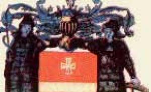
Armyansk is a small town in Crimea with unique attractions. Sights of Armenian Monuments of Armenian
Most northern city on the Crimean peninsula, Armyansk, which is also called the land gate to Crimea, can become an interesting place for educational recreation. Of course, Armyansk is not the most popular tourist destination. Its entire appearance is reminiscent of the Soviet past. The city is not spoiled by tourists, there is no resort excitement, there is no huge influx of vacationers. Meanwhile, the rich history of the city, its unique place The location, steppe beauty and attractions are worth coming here on vacation.
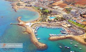
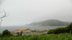
The city is located on the Perekop Isthmus, which connects the Crimean Peninsula to the mainland. Already one geographical location Armyansk is attractive for tourists because, having arrived here, you can visit both the Black Sea and the shores of Lake Sivash, between which the city is located. Beach holiday in Armyansk is represented by an easily accessible small beach located on the North Crimean Canal, wide sand and shell beach areas on the shores of Karkinitsky Bay and numerous wild beaches Lake Sivash. You can always breathe well here, because the air is saturated with the aroma of steppe herbs, the sea and healthy salts Sivash Lake.
The main attractions that a stay in Armyansk cannot do without are local history museum, Perekopsky shaft with a fortress, the Black Sea and Sivash garrisons, numerous Scythian mounds, monuments to the heroes of the Great Patriotic War. By visiting these interesting places, you can get acquainted with the history of the city from the beginning of its foundation in the eighteenth century by Armenian and Greek settlers to the present day. The exposition of the local history museum is very interesting, which tells about the history of Crimea, the famous Perekop Val, the culture and traditions of the inhabitants of this area in different historical periods, and the nature of the region. The exhibits of the Hall of Military Glory are impressive, dedicated to the years of the Civil and Great Patriotic War with interesting declassified materials, historical photographs, letters, personal belongings of soldiers and officers. Very interesting are the rich herbariums, stuffed animals and a diorama called “The Shore of Sivash”, which clearly tell about the nature of northern Crimea. The collection of historical national costumes of Armyansk always attracts the attention of visitors, because in past centuries the “Chumak Highway” passed through it, for which the settlement was called an Armenian bazaar, where many peoples lived, each with their own traditions, culture and religion.
The legendary Perekopsky shaft. For many who come to Armyansk, this is the main purpose of the trip. After all, it is with this fortification that all historical events, all wars and truces, victories and defeats of the northern part of the Crimean Peninsula are connected. He saw Cimmerians and Scythians, ancient Greeks and Romans, Turks and Russians, Reds and Whites, fascists and Red Army soldiers. Perekopsky Val is a landmark that reflects the entire history of the Crimean Peninsula as if in a mirror.
Armyansk is an interesting place that is worth visiting to learn more about Crimea.
1. Mass grave of Russian soldiers, 1854-1855, 1954.
Located between the village of Perekop and CJSC Crimean TITAN. During the Crimean War of 1853-1856. Russian soldiers wounded in fierce defensive battles for Sevastopol were taken to the provincial town of Perekop, where a hospital was built. Warriors who died from wounds were buried not far from the hospital. The exact number of those buried has not been established.
The first monument was opened in May 1881. with the money of the Perekop merchant N.A. Oberov. It was destroyed by the Nazis in 1941. In 1954 a new monument was erected, which has survived to this day.
2. Mass graves of Red Army soldiers who died during the Civil and Great Patriotic Wars
Located on the outskirts of the former civil cemetery. Here are the graves of Prokhor Ivanov, revolutionary sailors and paratroopers - Heroes of the Civil War. Here is also the grave of Viti-miner, 11 years old (no other information), the grave of the soldiers of the Soviet army who defended Armyansk during the Patriotic War, the grave of the Afghan warrior Vasya Rozhkov, the tombstone of the fallen residents of Armyansk during the war in Afghanistan.
3. Mass grave of Soviet soldiers (1944)
Located in the 2nd microdistrict of the city, behind house No. 15. The remains of soldiers of the 51st Army, 19th Tank Corps, 2 rifle battalions of the 1271st Rifle Regiment, 5 separate army rifle company who died during the liberation of Armyansk and the village of Kuraevka are buried in it. At this site there was a concentration camp for Soviet prisoners of war.
4. Mass grave of Soviet soldiers, 1941, 1943-1944.
 Located on Ivanishcheva Street in Victory Park. The remains of soldiers who died in the battles for the liberation of Crimea in the Armyansk region in the spring of 1944 are buried there. The total number of those buried is about 12 thousand. The names of 972 people have been identified.
In 1970 The Eternal Flame is lit. The authors of the monument are L.S. Smerchinsky, E.V. Popov.
5. Monument - T-34 tank
 Located at the intersection of Simferopolskaya and Ivanishcheva streets.
For the heroism and courage shown by the soldiers of the 19th Tank Corps in the battles for Perekop, he was awarded the Order of the Red Banner of Battle and received the honorary name of Perekop. The corps commander, Lieutenant General Vasiliev, was awarded the title of Hero of the Soviet Union. In 1975 In honor of the soldiers of the 19th Tank Corps, this monument was erected in Armyansk.
6. Memorial sign - guards mortar BM-13 "Katyusha"
 The monument is located near the Simferopol-Kherson highway on an artificial hill in honor of the 40th anniversary of the Victory in order to perpetuate the feat of Soviet soldiers who liberated the Perekop land. Dedicated to the artillery soldiers of the 2nd Guards Army.
7. Memorial sign in honor of artillery soldiers (howitzer)
Located at the intersection of Gaidar and Magdesyan streets. Dedicated to the artillery soldiers who liberated the city during the Great Patriotic War.
8. Perekopsky shaft and ditch - the place where battles took place during the Civil and Great Patriotic Wars (center)
 The Perekop Wall served as the basis for the fortifications of Perekop, crossing the isthmus at its narrowest part. The length of the rampart is 8.5 km, the width at the base is over 15 m, the height is 8-11 m. The ditch in front of the rampart is up to 10 m deep and up to 20 m wide. From the east, the rampart abuts the Sivash, from the west - the Black Sea.
In 1957 in the center of the Perekopsky shaft, memorial signs were installed on the mass graves of Soviet soldiers who died in battles on the Perekopsky shaft. A few hundred meters from the mass graves is the command post of Marshal of the Soviet Union A.M. Vasilevsky and Army General F.I. Tolbukhin.
9. Great Perekopsky ditch and rampart. 1 thousand BC - XVIII century AD
 Located in the narrowest flat part of the Perekop Isthmus. The fortification is deployed with a front to the north, begins off the coast of the Perekop Bay, crosses the isthmus in the meridian direction and after 8.5 km ends at the coast of Sivash. The ditch and rampart, first mentioned by ancient writers, were described many times by medieval and later authors. In the 18th century the counter-scarp and scarp were faced with stone. On the floor, northern side of the ditch there is a wide glacis 1.5-2.0 m high, well defined along the entire length of the ditch. The stratigraphy shows the primary fill and later fill.
On the south side of the moat there is a soil rampart.
The Ancient or Great Perekop Wall is a long-term defensive structure unique in terms of its duration of use, built in the 1st millennium BC, it served in the 15th - 16th centuries AD. the basis for a large linear fortification of the era of gun fortification. IN modern times, during the Civil and Great Patriotic Wars it served as the main line of defense of Crimea.
In general, the complex of Perekop fortifications is a striking engineering phenomenon in the history of all eras, reflecting the features of military engineering theories and practices of these eras.
10. Bastion of the Black Sea, XVII - XVIII centuries.
 A heptagonal bastion of unconventional shape, extended in a northern direction, is located 50 m from the shore of the Perekop Bay at the western end of the large Perekop moat and rampart. The image was first published in N. Witzen’s book in the 17th century.
Currently, the eastern and northern facades of the fortification rise to a height of 10 m above the bottom of the ditch.
11. Mass grave of Soviet soldiers, 1944.
Located in the village of Voloshino near a dairy farm. 109 Red Army soldiers who died in April 1944 are buried. upon release from Kula (now the village of Voloshino).
12. Grave of Hero of the Soviet Union I.M. Berezhny, 1944.
 Located on the outskirts of the cemetery in the village of Suvorovo. In the liberation battles for the Crimea, Guard Junior Lieutenant I.M. Berezhnoy, being wounded by a fragment of a thermite shell, burned alive, shot at the enemy until his last breath. I.M. Berezhny was awarded the title of Hero of the Soviet Union posthumously.
13. Memorial sign in honor of I.M. Berezhny, 1944.
In 1975 in the village of Suvorovo it was installed by workers from a team of lead soldering irons at the Titan plant.
14. Grave of soldiers of the separate shock-fire brigade of the 51st division of the Red Army
Located on the south-eastern outskirts of the village of Perekop, not far from the civil cemetery. The remains of 350 soldiers who died in November 1920 were buried.
15. Bust of Karelin P.G. Hero of the Soviet Union.
 Located in the courtyard of school-gymnasium No. 3. Opened May 7, 1977 at the place of death of P.G. Karelin, who, participating in the liberation of Armyansk, during the attack covered the embrasure of the enemy bunker with his chest. UVK school-gymnasium No. 3 in Armyansk bears his name.
16. Memorial sign Stele with a bust of Koryavko I.P.
Located in the microdistrict named after Major General I.P. Koryavko. I.P. Koryavko, commander of the 23rd motorized assault engineer brigade, who participated in the liberation of Armyansk. One of the microdistricts bears his name.
17. Memorial sign with a bas-relief of Lieutenant General I.D. Vasilyev.
 During the liberation of Armyansk, I.D. Vasilyev commanded the 19th Tank Corps. The troops of this corps made invaluable assistance in the liberation of the city. The 1st microdistrict bears his name.
18. Memorial sign to cavalry soldiers.
Located in the northern part of Armyansk near the Armyansk-Kakhovka highway. Cossack guards of the 36th cavalry. regiment 4th Guards The Kuban Cossack Cavalry Corps took part in breaking through the defense of the Perekop Wall and defending the bridgehead on the northwestern outskirts of Armyansk. The regimental headquarters was located at this place. Installed by veterans of the 4th Guards Kuban Cossack Cavalry Corps, Komsomol members of the NPO "Efirmaslo" and pathfinders of the 18th school in Simferopol, in honor of the 40th anniversary of the Victory.
19. Memorial Plaque to the fallen residents of Armyansk (1941-1944).
 Located on Simferopolskaya street, in the Cosmos park. Opened in 1993, it lists the names and initials of all residents of Armyansk who died during the Great Patriotic War.
20. Stele “60 years of the Armed Forces of the USSR”
 It is located 5 km north of Armyansk near the Kakhovskoe highway, next to the Perekopsky shaft. Symbolizes the three assaults of Perekop by the Armed Forces of the USSR.
21. Monument to internationalist soldiers “Veterans of local wars”
 Located in the square of Warriors-Internationalists, near school No. 1. The initiators of its construction are the Council of Afghans, the sponsor of Crimean Titan CJSC. The work was done by engraver V.L. Rassokhin.
22. A memorial sign on the site of the inn.
 Located on the Kakhovskoe highway near the village. Perekop on the site of the inn of the district town of Perekop, where in September 1820, on the way from Crimea to Chisinau, A.S. Pushkin stopped for the night. The memorial sign was installed in 2003 on June 6 as part of the International Pushkin Poetry Festival in Crimea, during the “Year of Russia in Ukraine.” Author of the text: V.P. Kazarin, L.P. Kruzhko.
23. Memorial to the Liberators of Crimea
 Located on Perekopsky Val (to the right of the Kakhovsky highway).
Installed October 5, 2001 The remains of Soviet soldiers who held the defense in 1941 are reburied here. and those attacking in 1943 and 1944.
On the territory of the memorial complex there is a monument in the shape of a cross with imitation fire, 119 individual burials.
24. Grave of soldiers of the Russian army who died in 1920.
Located on the southern side of the Perekopsky Val, opposite the civil cemetery.
The initiator of the burial was L.P. Kruzhko, the sponsor was the Moscow architect Anton Chelobiev. Here lie the ashes of a captain and three non-commissioned officers of the Russian Army. On the stele of the monument are the words of the poet Zygmunt Levitsky, who lived in Armyansk.
25. Perekop Fortress
It is located on the southern side of the large Perekop moat and rampart, 6.0 km east of the shore of the Perekop Bay. Built during the reign of Khan Mengli-Girey in the 15th century. Under Sahib-Giray, 17 towers were erected here, and a ditch was deepened. By the 30s of the XIX century. the fortress lost its military-strategic significance. In the 19th - early 20th centuries. the above-ground part of the stone coverings lining the ground ditches, ramparts, and bastions was dismantled. The Perekop fortress, which appeared at the dawn of the era of firearms, existed for at least 300 years.
26. Monument to the victims of the 1944 deportation.
 Installed in 1994 to commemorate the 50th anniversary of the tragic events.
Armyansk was founded in the 18th century. Greeks and Armenians who moved from a fortress called Or-Kapu. Since 1730, this city was known as Ermeni Bazar. It received its current name in 1921. City status was adopted in 1993, so Armyansk is considered the youngest in.
On the border of Crimea and Kherson region. there is the famous Perekopsky shaft. It stretches at a distance of 7 km from Karkinitsky Bay to Sivash. To protect it, 3 fortresses were erected. The most fortified was Or-Kapu. It was surrounded by several ditches. A fragment of its wall, which is located near the bay, has survived to this day. Its thickness is approximately two meters. The wall is characterized by perfectly smooth masonry and is striking in its strength. The depth of the ditch in some areas reaches 15 meters. The outskirts of Armyansk are fraught with many Scythian burial mounds.
Sights of Armyansk (Crimea)
- Perekopsky shaft.
This is a fortification that separates the peninsula from the mainland. The length of the Perekop shaft reaches 8475 meters, the width near the base is 15 meters. It looks like a moat with a rampart, which in ancient times was filled with water. This allowed merchant ships and patrol ships to cross the Black Sea and enter the Sea of Azov. But over time, the depth of these seas in the isthmus region became unacceptable for such solutions. At the moment, the shaft is no longer capable of fulfilling the role of the “Suet Canal”.
The Perekop Wall acts as the main gate of Crimea, which was destroyed by war and time. Their appearance is no longer as impregnable as before. But even today, Perekopsky Val remains the main attraction of the peninsula and continues to amaze tourists with its scale.
- Bastion Sivashsky.
The structure has a hexagon shape and is located on the banks of the Sivash. At the base of the building is a rectangular platform without a parapet. The fragments of ceramic products found here allow us to make assumptions that the creation of the fortification took place in the 16th-17th centuries. The structure acted as an artillery defense center for a long time.
- North Crimean Canal.
It originates from the Kakhovka reservoir, stretching to Kerch. Its length reaches 402 km, and its capacity is 300 m³/sec. The width of this channel is 150 m with a depth of 7 m.
With its help, water is supplied to Sudak, Kerch, Feodosia, and villages in the Simferopol region. Most of the canal walls are located at a sharp angle. It is also worth noting that the walls are lined with concrete slabs. They are so slippery that, once in the canal, getting out of there will be very problematic.
- Museum of History and Local Lore.
The local celebrity of Armyansk is the museum. In terms of area and number of exhibits, it is not inferior, and in some moments even surpasses the Simferopol Museum. Once here, you can become more deeply acquainted with the history of the northern city of Crimea. The Armenian Museum even became the winner of an all-Ukrainian competition, which was held to determine the best public museum in Ukraine.
It has 6 exhibition halls dedicated to getting to know the city, the Great Patriotic War, the Civil War, nature, the history of the Titan plant, and getting to know the history native land. In particular, household items in the form of dishes and tools that have been preserved from the time of the Khanate are presented here. All of them were found near the Perekopsky shaft.
Climatic conditions and weather features of Armyansk
The city is concentrated in the steppe zone, which has a dry and hot climate. True, the heat is diluted by the presence of vast water areas. Despite the fact that Armyansk is located on the Perekop Isthmus, the sweltering heat is softened by the coolness coming from the Sivash inlet and the Black Sea. Due to this, the air here can boast of the presence of mineral elements such as magnesium, iodine and bromine.
The average temperature in July is around 22 degrees plus. In January, the weather in Armyansk is also not characterized by low temperatures, since it never drops below minus 4 degrees. Precipitation falls mainly in autumn and winter. As for the summer season, it is mostly dry. 
Going on vacation to Armyansk, you will certainly receive a charge of incredible emotions and impressions, and learn a lot about the history of this region. After all, the number of attractions in the city of Armyansk is much greater than presented in this article, so you will definitely have something to do here.
Where do you plan to start your vacation in Armyansk?

This is what the city of Armyansk is called by those entering the sunny peninsula, as well as by local authors, talking about the history of this ancient city. And there is something to brag about: the city is even older than the capital of Crimea - Simferopol. It was founded at the beginning of the 18th century by Armenians and Greeks who moved from the Or-Kapu (Perekop) fortress: when choosing the location, they took into account its convenient position for trade. That is, the city could be considered even older if it were located on the site of its now destroyed ancestor.
Evliya Celebi may have embellished the ancient castle when he wrote:
This stronghold rises to a height of twenty-three arshins. Its circumference is three thousand steps, and on the walls there are 800 battlements - for it is a double citadel. It looks like a pentagon, and next to it are twenty high quadrangular towers... The commandant of the castle and five hundred seimens with guns are young Greeks. The Tatars do not know how to shoot guns and are afraid. There are also five hundred Tatar horsemen in the castle, unusually warlike...
And in 1827, James Webster described his entry into Crimea:
Towards the middle of the day we arrived at Perekop. Here we first met the Tatars, who appeared before us in the form of a caravan of hundreds of carts. Some of them were harnessed to oxen, and some to camels. These people never grease the wheels. The creaking of one of them can be endured; but the noise of four hundred carts was absolutely tormenting. At the same time, the Tatars sang, there was another one who blew a cow’s horn; In addition, saws were sharpened in each van, which completely complemented the concert. Tatars, in their black sheepskin caps and oriental clothes; camels clinging to both sides of the road, numerous bustards walking everywhere, promised us adventure and extremely interesting pictures around.
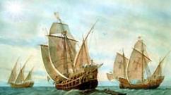
Thanks to this geographical location Perekop has always been of great strategic importance. Became rich in ancient times trading city due to salt deposits located nearby. The notes of Pliny the Elder of the 1st century describe in detail Perekop and the Perekop Isthmus under the name Taphros (from ancient Greek - perekop), and mention a fortress with a large protective rampart.

Entry to Armyansk. Photo: crimeanblog.blogspot.com
His convenient position for trading matters was also noticeable. And the city became known from the middle of the 18th century under the name Ermeni Bazaar (that is, the Armenian Bazaar). And already in 1921 it was renamed Armyansk, and it began to be considered a city only in 1993 (thus, Armyansk is the youngest city in Crimea). There is a version that the name of the settlement does not come from the nationality of its inhabitants, although what should we do with the local natives - the famous composer Alexander Spendiarov and seascape painter Emmanuel Magdesyan?
When entering Crimea, in addition to the traffic police post, you can see and even take a photo against the background of the huge Crimean coat of arms - the griffin. Nearby is a memorial sign dedicated to the launch of the North Crimean Canal (the idea of its construction appeared even before the revolution), and admire the widest and deepest Crimean “river” - this canal itself, which is more than 200 times more powerful than the Salgir...
The city itself is small - about one and a half by one and a half kilometers, consists mainly of five-story buildings from Soviet times. But there are 4 secondary schools, a sports school, a music school, a vocational school and even two branches of institutes, a swimming pool, a football club, etc.
The museum in the city of Armyansk is also a local celebrity. Last December, the museum received a call from Kyiv and said: “You are the best!” So the museum of a small town with a population of 27 thousand took first place. Despite the fact that it had as many as six thousand competitors, among whom there were many worthy ones... We also appreciated this museum, which in terms of area and number of exhibits is no less, and maybe even larger than the Simferopol Museum. Here you could learn a lot about the history of this northernmost city of Crimea.
City of the living and city of the dead
What struck me most was that a huge number of people were buried in the city itself and around it - it turns out that there are more of them than the inhabitants of the city itself. In addition to the city cemetery and the Eternal Flame, near which many soldiers of the Soviet army are buried, there are also brotherly cemeteries near the Turkish Wall...

Sleeping area of Armyansk. Photo: crimeanblog.blogspot.com
For the first time, the Russian army under the command of Vasily Golitsyn approached the Perekop fortress during the Crimean campaign of 1689, but the assault did not take place. The first assault and successful capture of Perekop took place during the 1736 campaign by an army under the command of Christoph Burchard Munnich. In Perekop there was a garrison of three thousand Ottoman Janissaries. After the army reached the Perekop fortifications, on May 21 Minikh gave the order to storm the ramparts.
The assault troops crossed the ditch and, using pikes and slingshots, scaled the wall. Having entered Crimea, the Russians occupied Gezlev (now Yevpatoria), Bakhchisarai and Akmechet (near Simferopol), after which the army returned to Perekop and left Crimea.
The second capture of Perekop took place on July 10, 1771 under the command of Prince Vasily Mikhailovich Dolgorukov-Krymsky, known for the fact that he was later governor-general in Moscow and to whom an obelisk is dedicated in the very center of the Crimean capital. After the annexation of Crimea to Russian Empire Perekop became the center of the district of the Tauride province.
And already in 1920 a new assault took place. The Wrangel troops installed more than 70 guns and 150 machine guns on the earthen embankment; the approaches to the rampart and the ditch were surrounded by barbed wire. And twenty kilometers south of the rampart, the second line of defense was fortified - the Ishun positions. The Red Army stormed the fortifications of Wrangel’s Russian Army on Perekop - at the same time, the conductors of the assault group through Sivash were I. Olenchuk, A. Petrenko, T. Kolomiets and others local residents. By November 9, Perekop was taken and the city was practically destroyed. Subsequently, the village of Perekop appeared nearby, named in memory of the destroyed city.
The next battle for Crimea began on April 8, 1944 with the main attack on the bridgehead on Sivash. Soviet troops had to overcome powerful enemy defenses in the area of Perekop, Ishuni and Sivash. Hitler's command had previously convinced that “Crimea is under lock and key. There is no such force in the world that would be able to break through the German defenses on Perekop and Sivash.”
But the troops of the 4th Ukrainian Front managed to break through the fascist defenses in three days of battles and entered the territory of Crimea. Having heard about the breakthrough of Perekop, Germans from all over Crimea began to sharply retreat to Sevastopol. As residents of Simferopol said, in the middle of the performance at the Russian Theater, the Germans began to whisper, get up and leave. Thus, with the storming of Perekop, the victorious liberation of the peninsula from the fascist invaders began.
Typically, tourists are brought to only one place on the Turkish Wall - where the German fortifications were broken through. But for the whole day they drove us around the entire seven-kilometer isthmus and showed us: here was the city of Perekop, and here Catherine the Great passed through, here they were stormed in 1920, and here in 1944. And everywhere - monuments, mass graves, thousands of buried ...
In Soviet times, they did not allow a monument to be erected on the site where the soldiers of the Russian army who fought on this side in 1920 were buried, but now such a monument has appeared. However, hatred of the fascists is, as they say, “in the blood” of the residents. Here they wanted to erect a monument near the bodies of the Germans found here, but the Armenians became a wall and did not allow this to be done. So the unfinished cross lies lying near the Turkish Wall, and the bodies of the dead lay for a long time in plastic bags in the local museum, until they were taken to the cemetery in Goncharnoye near Sevastopol...
A touch: some local foolish officials ordered to install a large poster with the inscription “May you have mercy!” next to the Turkish Wall, where thousands of soldiers are buried! Is there a greater mockery of the fallen?..
The fabulous life of the "Crimean Titan"
In these difficult times, the residents of the northern city are very calm and look forward with optimism. They know that they have their own breadwinner - the titanium dioxide plant. It is known that titanium is a “space metal”, light and durable. But only five percent of titanium ore goes into space. Its main use is as a dye. This is mainly titanium white; in addition, it is used in the production of rubber products, in glass production (heat-resistant and optical glass), as a refractory (coating of welding electrodes and coatings of casting molds), in cosmetics (soap, tooth powder).
Historical Armyansk. Photo: crimeanblog.blogspot.com
The map in the plant museum shows that almost half the world buys dioxide from our plant - the USA and Australia, India and Brazil, almost all of Europe.
The plant is located ten kilometers from the city and the location for it took a long time to choose back in Soviet times- so that the wind blows less towards the city and there are no harmful emissions. The enterprise is located in the northern part of the Crimean peninsula on the coast of Sivash, not far from its border with the Kherson region and occupies an area of 4?785 hectares.
The decision to build it was made on December 28, 1969. First, in 1971, a complex for the production of ammophos (a valuable fertilizer) was put into operation, in 1973 - aluminum sulfate and liquid glass, in 1974 - red iron oxide pigments, and by 1978 two workshops for the production of pigment titanium dioxide were launched. The closed joint-stock company "Crimean TITAN" was created on August 31, 2004 on the basis of a state joint-stock company and the financial capital of the shareholder represented by the company "Ostchem Germany GmbH", which is controlled by Group DF of businessman Dmitry Firtash.
Journalists, of course, were interested in how hazardous production affects the lives of its residents, what national composition workers and much more. “We don’t keep statistics,” local residents said, but at our plant there are many long-livers who work not just in the office, but in the most hazardous workshops and have no plans to retire...”
The composition of the plant is multinational, and it was interesting to learn about the fate of the “chemists” we encountered at the plant back in Soviet times. This word was used to describe conditionally released prisoners who spent the rest of their sentence not in a colony, but working at a similar chemical enterprise. So, many of them, having served their sentence, continued to live here: what more could you want - Crimea, the sea nearby, workers were given housing and then apartments. So the “chemists” remained chemists.
Titanium dioxide is made from ilmenite, brought from the city of Irshansk, Zhitomir region. The production process itself was depicted in a picture book in the form of a children's fairy tale: “Ilmenite challenged Sulfuric Acid to a fair fight... the Chemist heated up Sulfuric Acid, how it attacked Ilmenite, tearing it apart, separating Iron from Titan.” This is how young “Armenian men and women” get acquainted with the life’s work of their parents.
But the main thing is that the enterprise makes money; the Titan cinema and concert palace, two libraries, a swimming pool, the Titan football center, Centers for children's and youth creativity and culture and leisure, etc. have already been built in Armyansk. The youngest and northernmost city of Crimea continues to make its contribution to the life of the peninsula...
Objects: 12
Attractions in
Armyansk
Attractions in
Armyansk
Armyansk
1521,2226,1883,1856,1644,1643,1612,1597,1123,1122,1121,1116
Old Crimea
The source of St. Panteleimon The source of the holy great martyr Panteleimon is one of the most famous shrines of Eastern Crimea. Its history goes back to ancient times. According to chronicles that have survived to this day, in the 4th-5th centuries. At this place a bloody battle took place between the Huns and Scythians, in which many soldiers died. According to legend, the water in the spring turned red from the blood of the dead.

Old Crimea
Surb-Khach Monastery Surb-Khach is one of the most famous shrines of Crimea. The ancient Armenian monastery is located three kilometers southwest of the city of Old Crimea - one of oldest cities throughout the entire peninsula.
| Surb-Khach Monastery | |
| Temples and monasteries | Old Crimea |
| Rating: no ratings |

Old st. K. Liebknecht, 31
Paustovsky House-Museum The life and creative path of the famous Russian writer K. G. Paustovsky is closely connected with Crimean peninsula. This “promised land” never ceased to amaze the writer, who drew inspiration from it to create his original prose works. Crimean motifs can be traced in the best books written by Georgy Konstantinovich.
| Paustovsky House-Museum | |
| Museums | Old Crimea |
| Rating: no ratings | Check: 40 ₽ |

Armyansk, s. Perekop
Perekop Fortress The northern part of Crimea abounds unusual places, lost among many lakes, streams and swamps. One of these corners is the Perekop Fortress - an outstanding example of military engineering and the territory of numerous battles. Legendary bastion Many researchers believe that the ancient earthworks separating the Crimean peninsula from the mainland were dug by the Cimmerians.

Belogorsky district, village. White Rock
Mount Ak-Kaya - a miracle from the bottom of the sea The Crimean peninsula is known not only for its climate, man-made attractions, but also for its natural beauty. One of these splendors is Mount Ak-Kaya, which is quite unusual in shape and appearance.

Old Crimea
The highest attraction of Old Crimea The Crimean peninsula primarily attracts tourists with its mild climate and unusual beautiful nature. Of course, the most picturesque are mountainous areas. Among the famous natural attractions of Crimea is Mount Agarmysh (the name is translated into Russian as “gray-haired”), which rises almost 730 meters above sea level.
| Mount Agarmysh | |
| Mountains | Old Crimea |
| Rating: no ratings |

Belogorsky district, village. Bee
The Kara-Murza Cave with the gloomy name of the vertical-type Kara-Murza Cave is located on the Karabi mountain range in Crimea. The name of this natural landmark of Crimea is translated into Russian from Tatar as “Black Nobleman”. The total length of the mine is 185 m, depth: 133 m, total volume: 52020 m³ - with an area of 1400 m². The dungeon is assigned a difficulty category of 2A.

Belogorsky district, village Krasnoselovka
Unexplored Crimea: Uskut waterfalls Traveled far and wide, the Crimean expanses can still surprise tourists with an interesting attraction with an aura almost untouched by human presence. Such magical territories include the Uskut waterfalls of Crimea, a place not yet favored by visitors to the peninsula - a natural oasis, wild, primeval beauty.

Belogorsky district, village. Educational
Waterfall of the Three Saints: a healing spring in Crimea There are many beliefs interesting places quite strong properties, including almost magical ones. They say that by diving into the small lake that forms the Three Saints Waterfall, you can get rid of damage and many diseases, and acquire powerful health and vitality.

Museum of History and Local Lore
It allows you to learn a lot about the history of these places. It has several halls, each of which has its own characteristics. There is an exhibition dedicated to Empress Catherine II and her interest in the peninsula.
North Crimean Canal
It was built in 1951 to supply the arid regions of the peninsula. It supplies water to some Simferopol districts, Kerch, and Feodosia. However, this is a seasonal source, that is, it does not supply water all year round.
Rail bus
A very unusual attraction. This is a diesel bus that makes trips to Feodosia and from there through Dzhankoy along the railway line. Thanks to this transport, transportation is carried out in non-electrified areas.
Tourists have the opportunity to look at various military monuments. There are 23 monuments on the territory of the city. For example, in the very center of the city there is a mass grave. There is also a monument to a tank, a guards mortar under famous name"Katyusha".