Bering Sea: geographical location, description. Bering Sea: geographical location, description Bering Sea description according to plan
Our planet is a beautiful blue ball, on which there are many natural and artificial reservoirs. They support the life of all living things on earth, providing shelter for many fish, shellfish and other organisms.
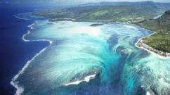
One of the natural bodies of water on our planet is the Bering Sea, the depth, bottom topography and fauna of which are of great interest to many naturalists, tourists and naturalists around the world. It is these indicators that will be discussed in this article.
Between two continents
What is the average depth of the Bering Sea? Before answering this question, let's find out where the reservoir is located.
The Bering Sea, which belongs to the Pacific basin, is a conventional border between two continents - Asia and North America. On the northwestern side, the reservoir washes the coasts of Kamchatka and Chukotka, and on the northeastern side - the shores of Western Alaska.
From the south, the sea is closed by a series of islands (Aleutian and Komandorsky), and from the north it is connected by the strait of the same name with the Arctic Ocean.
These are the islands located along the border Bering Sea(we'll talk about the depth of this a little below):
- On the side of the United States of America (more precisely, the Alaska Peninsula) are territories such as Krusenstern Island, Nunivak, the Pribilof Islands, the Aleutian Islands, King Island, St. Matthew Island and others.
- From the outside Russian Federation The Bering Sea washes only three island territories. This (from the Chukotka Autonomous Okrug), as well as the Commander Islands and Karaginsky Island (the latter are part of the Kamchatka Territory).
A little about geographical discoveries
What is the history of the discovery of the Bering Sea, the depth and remoteness of which at all times has brought many sailors into indescribable awe?
It is known that the reservoir received its name in honor of the first explorer who went on an expedition to Kamchatka back in the 1730s. This man was a Dane by nationality, a Russian officer by vocation - Vitus Ianassen Bering. By order of Emperor Peter I, the fleet captain was instructed to study the northern places in detail and determine the border between the two continents.
The first expedition was devoted to the inspection and development of the eastern coast of Kamchatka and south coast as well as the study of the strait that serves as the border between America and Eurasia. Bering is considered the first representative of Europe to roam these places.
After his return to St. Petersburg, the brave navigator petitioned for the equipment of the second expedition, which took place quite soon and became the largest in history. Six thousand people, led by the fearless Bering, scrupulously studied the waters all the way to Japan. Alaska, the Aleutian archipelago and many other unexplored lands were discovered.
The captain himself reached the American coast and carefully examined the island of Kayak, studying its flora and fauna.

The conditions of the Far North negatively affected the journey of a large expedition. Sailors and explorers faced incredible cold and snow drifts, and endured storms and storms several times.
Unfortunately, returning to Russia, Bering died during a forced winter on one of the islands.
Statistical Facts
What is the depth of the Bering Sea? This reservoir is considered the largest and deepest in the Russian Federation and one of the largest in the world. Why can you say this?
The fact is that the total area of the sea is 2.315 million square meters. km. This is due to the fact that the length of the reservoir from north to south covers one thousand six hundred kilometers, and from east to west - two thousand four hundred kilometers. Scientists even calculated the volume of sea water. It reaches 3,795,000 cubic kilometers. It is not surprising that the average depth of the Bering Sea is impressive in its numbers and values.
Briefly about the main thing
The average and maximum depth of the Bering Sea reaches one thousand six hundred meters and four thousand fifty-one meters, respectively. As you can see, the difference between the indicators is very large. This is due to the fact that most of the water space of the reservoir is occupied by an area with depth indicators of less than five hundred meters. According to the calculations of some scientists, this figure is the minimum depth of the Bering Sea. That is why it is considered a marginal reservoir of the continental-oceanic type.
Location of the most important points
Where is the average and maximum depth of the Bering Sea? As mentioned above, the average indicators of a reservoir cover about half of its entire area. As for the maximum indicators (or the maximum depth of the Bering Sea), they were recorded in the southern part of the reservoir. Here is the specific coordinate: fifty-four degrees north latitude and one hundred seventy-one degrees west longitude. This part of the sea is called deep sea. It was divided by the underwater Bowers and Shirshov ridges into three basins, whose names are: Aleutian, Komandorskaya and Bowers.

However, this also applies to the maximum depth of the Bering Sea. The minimum depth was recorded in its northeastern region. Its length, according to many researchers, reaches about seven hundred kilometers.
Bottom and its characteristics
Scientists have long determined that the structure of the seabed is very interconnected with its depth. The bottom topography of the Bering Sea has clear divisions:
- Shelf. This zone, located in the northern and eastern sides of the sea, has depths of up to two hundred meters and occupies more than forty percent of the entire territory of the reservoir. It is a gently sloping plain with several islands, hollows and low hills.
- Island Shoal. This area is located off the coast of Kamchatka and the Komandorsko-Aleutian island ridge. The surface topography is very complex and may undergo some changes due to the proximity of volcanic and seismic manifestations.
- Continental slope. It is located between Cape Navarin and Unimak Island and is characterized by depth indicators from two hundred to three thousand meters. This area also has a complex sloping topography, the angle of inclination of which ranges from one to three degrees to twenty degrees and above. Here you can see beautiful underwater valleys and canyons with steep steep slopes.
- Deep-sea basin. This zone is located in the center and southwest of the reservoir. It is characterized by small underwater ridges. Due to the complexity of its relief, the deep-sea basin ensures constant water exchange between different parts of the sea.
Temperature
What can you say about the temperature of the air and water? In summer, the water area is quite cool (about seven to ten degrees Celsius). In winter, the temperature can fluctuate from minus one to minus thirty.

The average temperature of water masses in many cases depends on the depth of the Bering Sea. The maximum depth has a temperature of one to three degrees Celsius (plus), while the minimum depth has warmer readings (from seven to ten degrees). At medium depths, temperatures vary between two and four degrees Celsius.
Salinity information
With regard to water salinity, the same principle applies: the greater the depth, the higher the indicators.
At minimum depths, water salinity ranges between twenty-two and thirty-two ppm. The middle zone is characterized by levels of thirty-three to thirty-four ppm, while the salinity of deep-sea waters almost reaches thirty-five ppm.
Freezing water
It is interesting that the surface of the Bering Sea is covered with ice annually in the following ratio: freezing of half of the reservoir is observed within five months, while its northern part can be under the influence of glaciers for seven months or longer.

It is noteworthy that the Gulf of Lawrence, located off the eastern shore of the Bering Sea, may not be cleared of ice masses all year round, while the waters of the Bering Strait are almost never subject to severe freezing.
Rich fauna
Despite the low temperatures and deep waters, the body of water between America and Eurasia is actively inhabited. Here you can find four hundred and two species of fish, four species of crabs, four species of shrimp, two species of shellfish, as well as a large number of mammals, especially pinnipeds.

Let's talk more about the living creatures that inhabit the cold and deep waters of the Bering Sea.
Fish
In the reservoir, different varieties of gobies are most often found. The goby family belongs to bottom-dwelling fish that live in coastal areas.
The body of an adult individual, slightly flattened at the back, can reach forty centimeters in length. It contains dorsal fins (usually two in number) and a suction cup on the belly, with which the fish attaches to the stones. Goby spawning occurs in March-August.
Among the salmonids in the Bering Sea, whitefish and nelma stand out, as well as Pacific salmon, which are valuable commercial fish.
This family is diverse with numerous species and representatives. The body length of salmon can vary from three centimeters to two meters, and the weight of adult and large individuals can reach seven to ten kilograms.
The body of the fish is elongated, compressed at the sides. It has multi-rayed ventral and pectoral fins. There are two pectoral fins (one is normal, and the second is a leathery outgrowth of adipose tissue - a characteristic feature of all salmonids).
Spawning of this fish species occurs only in fresh waters.
Pinnipeds
The most common mammals in the Bering Sea are seals and walruses, which set up real rookeries on the shores of the reservoir.

Seals are very massive sea creatures. For example, an adult can reach about two meters in length, while its weight exceeds one hundred and thirty kilograms. Bearing offspring in this family can last about a year.
The Pacific walrus is another inhabitant of the northern reservoir. Its weight can vary from eight hundred to one thousand seven hundred kilograms. This family is highly prized for its long tusks, which can weigh about five kilograms each.
The skin of walruses is wrinkled and very thick (in some places it can reach ten centimeters in thickness). The subcutaneous layer of fat is also large - about fifteen centimeters.
Quite often, a variety of large cetaceans are found in the Bering Sea - narwhals, humpback whales, sei whales and other mammals, the length of which is measured at several tens of meters, and the weight can reach a hundred tons or more.
Yes, it is impossible to describe in detail all the inhabitants of the underwater depths of the Bering Sea. However, this body of water is famous not only for its rich underwater world, but also a fascinating history of development, a beautiful bottom topography, and an important strategic location. After all, the Bering Sea is the border of two continents, two continents, two states.
Bering Sea
The largest of the Far Eastern seas washing the shores of Russia, the Bering Sea is located between two continents - Asia and North America - and is separated from the Pacific Ocean by the islands of the Commander-Aleutian arc. Its northern border coincides with the southern border of the Bering Strait and stretches along the line of Cape Novosilsky (Chukchi Peninsula) - Cape York (Seward Peninsula), the eastern border runs along the coast of the American continent, the southern - from Cape Khabuch (Peninsula Alaska) through the Aleutian Islands to Cape Kamchatsky, western - along the coast of the Asian continent.
The Bering Sea is one of the largest and deepest seas in the world. Its area is 2315 thousand km 2, volume - 3796 thousand km 3, average depth - 1640 m, greatest depth - 4097 m. The area with depths less than 500 m occupies about half of the entire area of the Bering Sea, which belongs to the marginal seas of mixed continental -oceanic type.
There are few islands in the vast expanses of the Bering Sea. Not counting the border Aleutian island arc and the Commander Islands, the sea contains the large Karaginsky Islands in the west and several islands (St. Lawrence, St. Matthew, Nelson, Nunivak, St. Paul, St. George, Pribilof) in the east.
The coastline of the Bering Sea is highly indented. It forms many bays, bays, peninsulas, capes and straits. For the formation of many natural processes of this sea, straits are especially important, providing water exchange with Pacific Ocean. Their total cross-sectional area is approximately 730 km 2, the depths in some of them reach 1000-2000 m, and in Kamchatka - 4000-4500 m, as a result of which water exchange occurs not only in the surface, but also in the deep horizons. The cross-sectional area of the Bering Strait is 3.4 km 2, and the depth is only 60 m. The waters of the Chukchi Sea have practically no effect on the Bering Sea, but the Bering Sea waters play a very significant role in the Chukchi Sea.

Boundaries of the Pacific Ocean
Different areas of the Bering Sea coast belong to different geomorphological types of shores. Mostly the shores are abrasive, but there are also accumulative ones. The sea is surrounded mainly by high and steep shores; only in the middle part of the western and eastern coasts are wide strips of flat, low-lying tundra approaching it. Narrower strips of low-lying coastline are located near the mouths of small rivers in the form of a deltaic alluvial valley or border the tops of bays and bays.

Landscapes of the Bering Sea coast
Bottom relief
In the bottom topography of the Bering Sea, the main morphological zones are clearly distinguished: the shelf and island shoals, the continental slope and the deep-sea basin. The shelf zone with depths of up to 200 m is mainly located in the northern and eastern parts of the sea and occupies more than 40% of its area. Here it adjoins the geologically ancient regions of Chukotka and Alaska. The bottom in this area is a vast, very flat underwater plain 600-1000 km wide, within which there are several islands, troughs and small rises in the bottom. The mainland shelf off the coast of Kamchatka and the islands of the Komandorsko-Aleutian ridge looks different. Here it is narrow, and its relief is very complex. It borders the shores of geologically young and very mobile land areas, within which intense and frequent manifestations of volcanism and seismic activity are common.
The continental slope stretches from northwest to southeast approximately along the line from Cape Navarin to the island. Unimak. Together with the island slope zone, it occupies approximately 13% of the sea area, has depths from 200 to 300 m and is characterized by complex bottom topography. The continental slope zone is dissected by underwater valleys, many of which are typical underwater canyons, deeply cut into the bottom of the sea and having steep and even steep slopes. Some canyons, especially near the Pribilof Islands, have a complex structure.
The deep-water zone (3000-4000 m) is located in the southwestern and central parts of the sea and is bordered by a relatively narrow strip of coastal shallows. Its area exceeds 40% of the sea area. The bottom topography is very calm. It is characterized by an almost complete absence of isolated depressions. The slopes of some bottom depressions are very gentle, i.e. these depressions are weakly isolated. Among the positive forms, the Shirshov Ridge stands out, but it has a relatively small depth on the ridge (mostly 500–600 m with a saddle of 2500 m) and does not approach the base of the island arc closely, but ends in front of the narrow but deep (about 3500 m) Ratmanov Trench. The greatest depths of the Bering Sea (more than 4000 m) are located in the Kamchatka Strait and near the Aleutian Islands, but they occupy a small area. Thus, the bottom topography makes it possible for water exchange between individual parts of the sea: without restrictions within the depths of 2000-2500 m and with some limitation (determined by the cross-section of the Ratmanov Trench) to depths of 3500 m.

Bottom topography and currents of the Bering Sea
Climate
Geographical location and large spaces determine the main features of the climate of the Bering Sea. It is almost entirely located in the subarctic climate zone, only the northernmost part (north of 64° N) belongs to the Arctic zone, and the southernmost part (south of 55° N) belongs to the temperate latitude zone. In accordance with this, climatic differences between different areas of the sea are determined. North of 55-56° N In the climate of the sea (especially its coastal areas), continental features are noticeably expressed, but in areas far from the coast they are much less pronounced. To the south of these parallels the climate is mild, typically maritime. It is characterized by small daily and annual air temperature amplitudes, large clouds and significant amounts of precipitation. As you approach the coast, the influence of the ocean on the climate decreases. Due to stronger cooling and less significant heating of the part of the Asian continent adjacent to the sea, the western regions of the sea are colder than the eastern ones. Throughout the year, the Bering Sea is under the influence of constant centers of atmospheric action - the Polar and Hawaiian maxima, the position and intensity of which vary from season to season, and the degree of their influence on the sea changes accordingly. It is no less influenced by seasonal large-scale pressure formations: the Aleutian minimum, the Siberian maximum, and the Asian depression. Their complex interaction determines the seasonal characteristics of atmospheric processes.
In the cold season, especially in winter, the sea is influenced mainly by the Aleutian minimum, the Polar maximum and the Yakut spur of the Siberian anticyclone. Sometimes the impact of the Hawaiian High, which at this time occupies the extreme southern position, is felt. Such a synoptic situation leads to a wide variety of winds and the entire meteorological situation over the sea. At this time, winds from almost all directions are observed here. However, the northwestern, northern and northeastern ones noticeably predominate. Their total repeatability is 50-70%. Only in the eastern part of the sea, south of 50° N, are southern and southwestern winds quite often observed, and in some places even southeastern. Wind speed in the coastal zone averages 6-8 m/s, and in open areas it varies from 6 to 12 m/s, increasing from north to south. Winds from the northern, western and eastern directions carry with them cold sea arctic air from the Arctic Ocean, and cold and dry continental polar and continental arctic air from the Asian and American continents. With the winds southern directions polar sea air, and at times tropical sea air, comes here. Above the sea, predominantly the masses of continental Arctic and marine polar air interact, at the border of which an Arctic front is formed. It is located slightly north of the Aleutian arc and generally stretches from southwest to northeast. At the frontal section of these air masses, cyclones form, moving approximately along the front to the northeast. The movement of these cyclones increases northern winds in the west and weakening them or even changing them to the south in the east of the sea. Large pressure gradients caused by the Yakut spur of the Siberian anticyclone and the Aleutian low cause very strong winds in the western part of the sea. During storms, wind speeds often reach 30-40 m/s. Usually storms last about a day, but sometimes they last 7-9 days with some weakening. The number of days with storms in the cold season is 5-10, in some places it reaches 15-20 per month.

Water temperature on the surface of the Bering and Okhotsk seas in summer
Air temperature in winter decreases from south to north. The average monthly temperature of the coldest months - January and February - is 1-4° in the southwestern and southern parts of the sea and -15-20° in the northern and north- eastern regions. In the open sea the air temperature is higher than in the coastal zone. Off the coast of Alaska it can drop to –40-48°. In open spaces, temperatures below –24° are not observed.
In the warm season, a restructuring of pressure systems occurs. Starting in spring, the intensity of the Aleutian minimum decreases, and in summer it is very weakly expressed, the Yakut spur of the Siberian anticyclone disappears, the Polar Maximum shifts to the north, and the Hawaiian Maximum takes its extreme northern position. As a result of this synoptic situation, in warm seasons southwestern, southern and southeastern winds predominate, the frequency of which is 30-60%. Their speed in the western part open sea 4-6 m/s, and in the eastern regions - 4-7 m/s. In the coastal zone, wind speed is lower. The decrease in wind speeds compared to winter values is explained by a decrease in atmospheric pressure gradients over the sea. In summer, the Arctic front moves south of the Aleutian Islands. Cyclones originate here, the passage of which is associated with a significant increase in winds. In summer, the frequency of storms and wind speeds are lower than in winter. Only in the southern part of the sea, where tropical cyclones (typhoons) penetrate, do they cause severe storms with hurricane-force winds. Typhoons in the Bering Sea are most likely from June to October, usually occurring no more than once a month and lasting several days. Air temperature in summer generally decreases from south to north, and it is slightly higher in the eastern part of the sea than in the western. Average monthly air temperatures are the most warm months- July and August - within the sea they vary from approximately 4° in the north to 13° in the south, and near the coast they are higher than in the open sea. Relatively mild winters in the south and cold winters in the north, and cool, cloudy summers everywhere are the main seasonal weather features in the Bering Sea. Continental flow into the sea is approximately 400 km 3 per year. Most of the river water falls into its northernmost part, where the largest rivers flow: Yukon (176 km 3), Kuskokwim (50 km 3 / year) and Anadyr (41 km 3 / year). About 85% of the total annual flow occurs in the summer months. The influence of river waters on sea waters is felt mainly in the coastal zone on the northern edge of the sea in the summer.
Hydrology and water circulation
Geographical location, vast spaces, relatively good communication with the Pacific Ocean through the straits of the Aleutian ridge in the south and extremely limited communication with the Arctic Ocean through the Bering Strait in the north determine the hydrological conditions of the Bering Sea. The components of its thermal budget depend mainly on climatic conditions and, to a much lesser extent, on heat advection by currents. In this regard, various climatic conditions in the northern and southern parts of the sea entail differences in the thermal balance of each of them, which accordingly affects the water temperature in the sea.
On the contrary, water exchange is of decisive importance for the water balance of the Bering Sea. Very large quantities of surface and deep ocean water flow through the Aleutian Straits, and water flows through the Bering Strait into the Chukchi Sea. Precipitation (about 0.1% of the volume of the sea) and river flow (about 0.02%) are very small in relation to the huge area and volume of sea waters, and therefore are less significant in the water balance than water exchange through the Aleutian Straits.
However, water exchange through these straits has not yet been sufficiently studied. It is known that large masses of surface water exit the sea into the ocean through the Kamchatka Strait. The overwhelming mass of deep ocean water enters the sea in three areas: through the eastern half of the Near Strait, through almost all the straits of the Fox Islands and through the Amchitka, Tanaga and other straits between the Rat and Andrianovsky Islands. It is possible that deeper waters penetrate into the sea through the Kamchatka Strait, if not constantly, then periodically or sporadically. Water exchange between the sea and the ocean affects the distribution of temperature, salinity, formation of the structure and general circulation of the waters of the Bering Sea.
The bulk of the waters of the Bering Sea are characterized by a subarctic structure, main feature which is the existence of a cold intermediate layer in summer, as well as a warm intermediate layer located underneath it. Only in the southernmost part of the sea, in areas immediately adjacent to the Aleutian ridge, waters of a different structure were discovered, where both intermediate layers are absent.
Water temperature and salinity

Salinity on the surface of the Bering and Okhotsk seas in summer
The bulk of the waters of the sea, which occupies its deep-sea part, is clearly divided into four layers in summer: surface, cold intermediate, warm intermediate and deep. This stratification is determined mainly by differences in temperature, and the change in salinity with depth is small.
The surface water mass in summer is the most heated upper layer from the surface to a depth of 25-50 m, characterized by a temperature of 7-10° at the surface and 4-6° at the lower boundary and a salinity of about 33‰. The greatest thickness of this water mass is observed in the open part of the sea. The lower boundary of the surface water mass is the temperature jump layer. The cold intermediate layer is formed here as a result of winter convective mixing and subsequent summer heating of the upper layer of water. This layer has insignificant thickness in the southeastern part of the sea, but as it approaches western shores reaches 200 m or more. The minimum temperature was noted at horizons of about 150-170 m. In the eastern part, the minimum temperature is 2.5-3.5 °, and in the western part of the sea it drops to 2 ° in the area of the Koryak coast and to 1 ° and lower in the area of Karaginsky Bay. The salinity of the cold intermediate layer is 33.2-33.5‰ At the lower boundary of this layer, the salinity quickly increases to 34‰.

Vertical distribution of water temperature (1) and salinity (2) in the Bering Sea
In warm years in the south, in the deep-sea part of the sea, the cold intermediate layer may be absent in summer, then the temperature decreases relatively smoothly with depth with a general warming of the entire water column. The origin of the intermediate layer is associated with the influx of Pacific water, which is cooled from above as a result of winter convection. Convection reaches horizons of 150-250 m here, and under its lower boundary an increased temperature is observed - a warm intermediate layer. The maximum temperature varies from 3.4-3.5 to 3.7-3.9°. The depth of the core of the warm intermediate layer in the central regions of the sea is approximately 300 m, to the south it decreases to 200 m, and to the north and west it increases to 400 m or more. The lower boundary of the warm intermediate layer is blurred, approximately it is outlined in the layer of 650-900 m.
The deep water mass, which occupies most of the volume of the sea, does not differ significantly both in depth and in sea area. Over a distance of more than 3000 m, the temperature varies from approximately 2.7-3.0 to 1.5-1.8 ° at the bottom. Salinity is 34.3-34.8‰.
As we move south to the straits of the Aleutian ridge, the stratification of waters is gradually erased, the temperature of the core of the cold intermediate layer increases, approaching in value the temperature of the warm intermediate layer. The waters gradually acquire a qualitatively different structure than Pacific water.
In some areas, especially in shallow waters, the main water masses change, and new masses of local significance appear. For example, in the western part of the Gulf of Anadyr, a desalinated water mass is formed under the influence of continental runoff, and in the northern and eastern parts, a cold water mass of the Arctic type is formed. There is no warm intermediate layer here. In some shallow areas of the sea, cold waters are observed in the bottom layer in summer. Their formation is associated with the vortex water cycle. The temperature in these cold “spots” drops to –0.5-1°.
Due to autumn-winter cooling, summer heating and mixing in the Bering Sea, the surface water mass is most strongly transformed, as well as the cold intermediate layer. Intermediate Pacific water changes its characteristics very slightly throughout the year and only in a thin upper layer. Deep waters do not change noticeably throughout the year.
The water temperature on the sea surface generally decreases from south to north, with water in the western part of the sea being somewhat colder than in the eastern part. In winter, in the south, western part of the sea, the surface water temperature is usually 1-3°, and in the eastern part - 2-3°. In the north throughout the sea, water temperatures range from 0° to –1.5°. In spring, the water begins to warm up and the ice begins to melt, while the temperature rises slightly. In summer, the water temperature on the surface is 9-11° in the south of the western part and 8-10° in the south of the eastern part. In the northern regions of the sea it is 4° in the west and 4-6° in the east. In coastal shallow areas, surface water temperatures are slightly higher than in open areas of the Bering Sea.
The vertical distribution of water temperature in the open part of the sea is characterized by seasonal changes up to horizons of 150-200 m, deeper than which they are practically absent.

Scheme of water exchange in the Okhotsk and Bering Seas
In winter, the surface temperature, equal to approximately 2°, extends to horizons of 140-150 m, below it rises to approximately 3.5° at horizons of 200-250 m, then its value almost does not change with depth.
In spring, the water temperature on the surface rises to approximately 3.8° and remains up to horizons of 40-50 m, then to horizons of 65-80 m it sharply, and then (up to 150 m) very smoothly decreases with depth and from a depth of 200 m it increases slightly to the bottom.
In summer, the water temperature on the surface reaches 7-8°, but drops very sharply (up to 2.5°) with a depth to the horizon of 50 m; below its vertical course is almost the same as in spring.
In general, water temperature in the open part of the Bering Sea is characterized by a relative homogeneity of spatial distribution in the surface and deep layers and relatively small seasonal fluctuations, which appear only to horizons of 200-300 m.
The salinity of the surface waters of the sea varies from 33-33.5‰ in the south to 31‰ in the east and northeast and up to 28.6‰ in the Bering Strait. Water is desalinated most significantly in spring and summer in the areas where the Anadyr, Yukon and Kuskokwim rivers confluence. However, the direction of the main currents along the coasts limits the influence of continental runoff on the deep sea areas.
The vertical distribution of salinity is almost the same in all seasons of the year. From the surface to the horizon of 100-125 m, it is approximately equal to 33.2-33.3‰. Salinity increases slightly from horizons of 125-150 to 200-250 m; deeper it remains almost unchanged to the bottom.
In accordance with small spatiotemporal changes in temperature and salinity, density also changes slightly. The distribution of oceanological characteristics by depth indicates a relatively weak vertical stratification of the waters of the Bering Sea. In combination with strong winds, this creates favorable conditions for the development of wind mixing. In the cold season, it covers the upper layers up to horizons of 100-125 m; in the warm season, when the waters are stratified more sharply and the winds are weaker than in autumn and winter, wind mixing penetrates to horizons of 75-100 m in the deep and up to 50-60 m in coastal areas.
Significant cooling of waters, and in the northern regions, intensive ice formation, contribute to the good development of autumn-winter convection in the sea. During October - November it captures the surface layer of 35-50 m and continues to penetrate deeper.
The penetration boundary of winter convection deepens as it approaches the coast due to enhanced cooling near the continental slope and shallows. In the southwestern part of the sea this decrease is especially large. This is associated with the observed lowering of cold waters along the coastal slope.
Due to the low air temperature due to the high latitude of the northwestern region, winter convection develops here very intensively and, probably, already in mid-January (due to the shallowness of the region) reaches the bottom.
Currents
As a result of the complex interaction of winds, the influx of water through the straits of the Aleutian ridge, tides and other factors, a field of constant currents in the sea is created.
The predominant mass of water from the ocean enters the Bering Sea through the eastern part of the Blizhny Strait, as well as through other significant straits of the Aleutian ridge.
The waters entering through the Blizhny Strait and spreading first in an easterly direction, then turn to the north. At a latitude of about 55°, these waters merge with the waters coming from the Amchitka Strait, forming the main flow of the central part of the sea. This flow supports the existence of two stable gyres here - a large, cyclonic one, covering the central deep-water part of the sea, and a smaller, anticyclonic one. The waters of the main flow are directed to the northwest and reach almost the Asian shores. Here, most of the water turns along the coast to the southwest, giving rise to the cold Kamchatka Current, and enters the ocean through the Kamchatka Strait. Some of this water is discharged into the ocean through western part Blizhny Strait, and a very small part is included in the main circulation.
Waters entering through the eastern straits of the Aleutian ridge also cross the central basin and move to the north-northwest. At approximately latitude 60°, these waters divide into two branches: the northwestern one, moving towards the Gulf of Anadyr and then northeast into the Bering Strait, and the northeastern one, moving towards Norton Sound and then north into the Bering Strait. strait
The speeds of constant currents in the sea are low. The highest values (up to 25-50 cm/s) are observed in the areas of the straits, and in the open sea they are equal to 6 cm/s, and the speeds are especially low in the zone of the central cyclonic circulation.
Tides in the Bering Sea are mainly caused by the propagation of tidal waves from the Pacific Ocean.
In the Aleutian Straits, the tides have irregular diurnal and irregular semidiurnal patterns. Off the coast of Kamchatka, during intermediate phases of the Moon, the tide changes from semidiurnal to daily; at high declinations of the Moon it becomes almost purely diurnal, and at low declinations it becomes semidiurnal. On the Koryak coast, from Olyutorsky Bay to the mouth of the river. Anadyr, the tide is irregular semi-diurnal, but off the coast of Chukotka it is regular semi-diurnal. In the area of Provideniya Bay, the tide again becomes irregularly semidiurnal. In the eastern part of the sea, from Cape Prince of Wales to Cape Nome, the tides have both regular and irregular semidiurnal character.
South of the mouth of the Yukon, the tide becomes irregularly semidiurnal.
Tidal currents in the open sea are circular in nature, and their speed is 15-60 cm/s. Near the coast and in the straits, tidal currents are reversible, and their speed reaches 1-2 m/s.
Cyclonic activity developing over the Bering Sea causes the occurrence of very strong and sometimes prolonged storms. Particularly strong excitement develops from November to May. At this time of year, the northern part of the sea is covered with ice, and therefore the strongest waves are observed in the southern part. Here in May the frequency of waves of more than 5 points reaches 20-30%, and in the northern part of the sea it is absent due to ice. In August, waves and swells over 5 points reach their greatest development in the eastern part of the sea, where the frequency of such waves reaches 20%. In autumn, in the southeastern part of the sea, the frequency of strong waves is up to 40%.
With prolonged winds of average strength and significant acceleration of waves, their height reaches 6-8 m, with winds of 20-30 m/s or more - up to 10 m, and in some cases - up to 12 and even 14 m. Periods of storm waves reach up to 9-11 s, and with moderate waves - up to 5-7 s.

Kunashir Island
In addition to wind waves, a swell is observed in the Bering Sea, the greatest frequency of which (40%) occurs in autumn. In the coastal zone, the nature and parameters of waves are very different depending on the physical and geographical conditions of the area.
Ice cover
For most of the year, much of the Bering Sea is covered in ice. Ice in the sea is of local origin, i.e. are formed, destroyed and melted into the sea itself. A small amount of ice from the Arctic basin, which usually does not penetrate south of the island, is brought into the northern part of the sea through the Bering Strait by winds and currents. St. Lawrence.
Ice conditions in the northern and southern parts of the sea differ. The approximate boundary between them is the extreme southern position of the ice during the year - in April. This month the edge runs from Bristol Bay through the Pribilof Islands and further west along the 57-58th parallel, and then drops south to the Commander Islands and runs along the coast to the southern tip of Kamchatka. The southern part of the sea does not freeze at all. Warm Pacific waters entering the Bering Sea through the Aleutian Straits push floating ice to the north, and the edge of the ice in the central part of the sea is always curved to the north.
The process of ice formation begins first in the northwestern part of the Bering Sea, where ice appears in October and gradually moves south. Ice appears in the Bering Strait in September. In winter, the strait is filled with solid broken ice, drifting north.
In the Gulf of Anadyr and Norton Sound, ice can be found as early as September. In early November, ice appears in the area of Cape Navarin, and in mid-November it spreads to Cape Olyutorsky. Off the coast of Kamchatka and the Commander Islands, floating ice usually appears in December and only as an exception in November. During winter, the entire northern part of the sea, up to approximately the 60° parallel, is filled with heavy, hummocky ice, the thickness of which reaches 6-10 m. To the south of the parallel, the Pribilof Islands are found broken ice and isolated ice fields.
However, even during the peak of ice formation, the open part of the Bering Sea is never covered with ice. In the open sea, under the influence of winds and currents, ice is in constant motion, and strong compression often occurs. This leads to the formation of hummocks, maximum height which can reach up to 20 m. Due to periodic compression and rarefaction of ice associated with tides, piles of ice, numerous polynyas and clearings are formed.
Fixed ice, which forms in closed bays and bays in winter, can be broken up and carried out to sea during stormy winds. The ice from the eastern part of the sea is carried north into the Chukchi Sea.
In April the border floating ice moves as far as possible to the south. From May, the ice begins to gradually collapse and retreat to the north. During July and August the sea is completely clear of ice, but even during these months ice can be found in the Bering Strait. Strong winds contribute to the destruction of the ice cover and the clearing of ice from the sea in summer.
In bays and bays, where the desalinating influence of river flow is felt, conditions for ice formation are more favorable than in the open sea. Winds have a great influence on the location of ice. Surge winds often clog individual bays, bays and straits with heavy ice brought from the open sea. On the contrary, rushing winds carry ice out to sea, sometimes clearing the entire coastal area.

Bird market
Economic importance
Fish of the Bering Sea are represented by more than 400 species, of which only no more than 35 are considered important commercial species. These are salmon, cod, and flounder. Perch, grenadier, capelin, sable fish, etc. are also caught in the sea.
The BERING SEA, a marginal sea in the northern part of the Pacific Ocean between the continents of Eurasia and North America, washes the shores of the USA and Russia (the largest of its Far Eastern seas). It is connected in the north by the Bering Strait to the Chukchi Sea, separated from the Pacific Ocean by the Aleutian chain and the Commander Islands. Area 2315 thousand km 2, volume 3796 thousand km 3. The greatest depth is 5500 m. The coastline is heavily indented, forming many bays (the largest are Karaginsky, Olyutorsky, Anadyrsky - Russia; Norton, Bristol - USA), bays, peninsulas and capes. Karaginsky Islands (Russia), St. Lawrence, Nunivak, Nelson, St. Matthew, Pribilof Islands (USA).
The shores of the Bering Sea are diverse, with predominantly high, rocky, heavily indented bay shores, as well as fjord and abrasion-accumulative shores. Leveled accumulative banks predominate in the east, where the deltas of the large Yukon and Kuskokwim rivers are located.
 Relief and geological structure bottom . According to the nature of the bottom topography, the Bering Sea is clearly divided into shallow and deep-water parts approximately along the line from Cape Navarin to Unimak Island. The northern and southeastern parts lie on a shelf with depths of up to 200 m (prevailing depths are 50-80 m) and a width in the northeast of up to 750 km (46% of the sea area) - one of the widest in the World Ocean. It is a vast plain, slightly inclined to the southwest. In the Quaternary period, the shelf periodically drained and a land bridge emerged between the continents of Eurasia and North America. Within the shelf there are large depressions - Anadyr, Navarin, Khatyr, etc., filled with Cenozoic terrigenous deposits. Depressions can be reservoirs of oil and natural combustible gas. A narrow continental slope with depths of 200-3000 m (13%) and with large bottom slopes almost throughout its entire length turns into a deep-sea bed with steep ledges, in many places cut by underwater valleys and canyons. The sides of the canyons are often steep and sometimes steep. In the central and southwestern parts there is a deep-water zone with depths of over 3000 m (37%), bordered in the coastal zone by a narrow strip of shelf. The underwater Shirshov Ridge with depths above the ridge of 500-600 m, stretching south from the Olyutorsky Peninsula, divides the deep-water part of the sea into the Komandorskaya and Aleutian basins; it is separated from the island arc by the Ratmanov Trench (depth about 3500 m). The flat bottom of both basins is slightly inclined to the southwest. The Shirshov Ridge is a complex zone of junction of two lithospheric plates (Commander and Aleutian), along which until the mid-Miocene the oceanic crust piled up (possibly with underthrusting). The foundation of the Aleutian Basin is of Early Cretaceous age and is a fragment of the Mesozoic oceanic lithospheric plate Kula, which separated in the Cretaceous from the Pacific plate by a large transform fault, transformed in the Paleogene into the Aleutian island arc and the deep-sea trench of the same name. The thickness of the Cretaceous-Quaternary sedimentary cover in the central part of the Aleutian Basin reaches 3.5-5 km, increasing towards the periphery to 7-9 km. The foundation of the Commander Basin is Cenozoic in age and was formed as a result of local spreading (the spreading of the bottom with the new formation of oceanic crust), which continued until the end of the Miocene. The paleospreading zone can be traced to the east of Karaginsky Island in the form of a narrow trough. The thickness of the Neogene-Quaternary sedimentary cover in the Commander Basin reaches 2 km. In the north, the Bowers Ridge (a former Late Cretaceous volcanic arc) extends in an arc to the north from the Aleutian Islands, outlining the basin of the same name. The maximum depths of the Bering Sea are located in the Kamchatka Strait and near the Aleutian Islands.
On the shelf, bottom sediments are mainly terrigenous, near the shore - coarse sediments, then sands, sandy silts and silts. The sediments of the continental slope are also predominantly terrigenous, in the area of Bristol Bay - with an admixture of volcanogenic material, and there are numerous outcrops of bedrock. The thickness of sediments in deep-sea basins reaches 2500 m, the surface layer is represented by diatomaceous silt.
 Climate. Most of the Bering Sea is characterized by a subarctic climate, in a small area north of 64° north latitude it is arctic, and south of 55° north latitude it is temperate maritime. Climate formation occurs under the influence of the cold masses of the Arctic Ocean in the north, the open spaces of the Pacific Ocean in the south, adjacent land and centers of atmospheric action. In the open part of the Bering Sea, far from the influence of continents, the climate is maritime, mild, with small amplitudes of air temperature fluctuations, the weather is cloudy, with fog and large amounts of precipitation. In winter, under the influence of the Aleutian Low, northwest, north and northeast winds predominate, bringing cold maritime Arctic air, as well as cold, dry continental air. Wind speed off the coast is 6-8 m/s, in the open sea - up to 12 m/s. Often, especially in the western part of the sea, stormy conditions develop with winds up to 30-40 m/s (lasting up to 9 days). The average air temperature in January - February is from 0. -4 °C in the south and southwest to -15. -23 °C in the north and northeast. Off the coast of Alaska, air temperatures dropped to -48 °C. In summer, the influence of the Hawaiian anticyclone increases; southerly winds with speeds of 4-7 m/s prevail over the Bering Sea. In the southern part, on average, tropical typhoons with hurricane-force winds penetrate once a month. The frequency of storms is lower than in winter. The air temperature in the open sea ranges from 4 °C in the north to 13 °C in the south; in coastal areas it is noticeably warmer. Annual precipitation ranges from 450 mm in the northeast to 1000 mm in the southwest.
Hydrological regime. The river flow is about 400 km 3 per year. Up to 70% of the flow comes from the Yukon (176 km 3), Anadyr (50 km 3), and Kuskokwim (41 km 3) rivers, with more than 85% of the flow occurring in spring and summer. Compared to the volume of the sea, the amount of fresh flow is small, but river waters flow mainly into the northern regions of the sea, leading to a noticeable desalination of the surface layer in summer. The peculiarities of the hydrological regime are determined by limited water exchange with the Arctic Ocean, relatively free connection with the Pacific Ocean, continental runoff and desalination of water when ice melts. Exchange with the Chukchi Sea is difficult due to the small cross-sectional area of the Bering Strait (3.4 km 2, average depth above the threshold 39 m). The numerous straits connecting the Bering Sea to the Pacific Ocean have a cross-section total area 730 km 2 and depths of over 4000 m (Kamchatka Strait), which contributes to good water exchange with Pacific waters.
In the structure of the Bering Sea, four water masses are mainly distinguished in the deep-sea part: surface, subsurface intermediate cold, intermediate Pacific warm and deep. Salinity changes with depth are small. Both intermediate water masses are absent only near the Aleutian Islands. In certain parts of the Bering Sea, in particular in coastal areas, other water masses are formed depending on local conditions.
Bering Sea surface currents form a counterclockwise gyre, which is significantly influenced by prevailing winds. Along the coast of Alaska to the north follows the Bering Sea branch of the warm Kuroshio currents, which partially leaves through the Bering Strait and, receiving the cold waters of the Chukchi Sea, moves along the Asian coast to the south and forms the cold Kamchatka Current, which intensifies in the summer. The speed of constant currents in the open sea is low, about 6 cm/s; in the straits the speed increases to 25-50 cm/s. In coastal areas, circulation is complicated by periodic tidal currents, reaching 100-200 cm/s in the straits. Tides in the Bering Sea are irregular semidiurnal, irregular diurnal and regular diurnal, their character and magnitude vary greatly from place to place. The average tide height is 1.5-2.0 m, the highest - 3.7 m - is observed in Bristol Bay.
The surface water temperature in February varies from -1.5 °C in the north to 3 °C in the south, in August, respectively, from 4-8 °C to 9-11 °C. The salinity of surface waters in winter is from 32.0‰ in the north to 33.5‰ in the south; in summer, under the influence of melting ice and river runoff, salinity decreases, especially in coastal areas, where it reaches 28‰, in the open part of the sea, respectively, from 31.0‰ in the north to 33‰ in the south. The northern and northeastern parts of the sea are covered with ice every year. The first ice appears in September in the Bering Strait, in the northwest - in October and gradually spreads to the south. During winter, the Bering Sea is covered with heavy ice up to 60° north latitude. All ice forms and melts in the Bering Sea. Only a small part sea ice carried through the Bering Strait into the Chukchi Sea and by the Kamchatka Current into the northwestern region of the Pacific Ocean. The ice cover collapses and melts in May - June.
History of the study. The Bering Sea is named after Captain Commander Russian fleet V. Bering, whose name is associated with the discoveries in the 1st half of the 18th century - the Bering Strait, the Aleutian and Commander Islands. The modern name was introduced into use in the 1820s by V. M. Golovnin. Previously called Anadyrsky, Bobrovy, Kamchatsky. The first geographical discoveries of the coasts, islands, peninsulas and straits of the Bering Sea were made by Russian explorers, fur traders and sailors at the end of the 17th and 18th centuries. Comprehensive studies of the Bering Sea were carried out especially intensively by Russian naval sailors, hydrographers and naturalists until the 1870s. Before the sale of Russian America (1867), the entire coast of the Bering Sea was part of the possession of Russian Empire.
Economic use. There are about 240 species of fish in the Bering Sea, of which at least 35 are commercial species. Fishing is carried out for cod, flounder, halibut, Pacific perch, herring, and salmon. Kamchatka crab and shrimp are caught. Inhabited by walruses, sea lions, and sea otters. On the Commander and Aleutian Islands there are fur seal rookeries. The open sea is home to baleen whales, sperm whales, beluga whales and killer whales. On the rocky shores there are bird colonies. The Bering Sea is of great transport importance as part of the Northern Sea Route. Main ports- Anadyr, Provideniya (Russia), Nome (USA).
The ecological state of the Bering Sea is consistently satisfactory. The concentration of pollutants increases in river mouths, bays, and ports, which leads to a slight reduction in the size of aquatic organisms in coastal areas.
Lit.: Dobrovolsky A.D., Zalogin B.S. Seas of the USSR. M., 1982; Bogdanov N.A. Tectonics of deep-sea basins of marginal seas. M., 1988; Zalogin B.S., Kosarev A.N. Seas. M., 1999; Dynamics of ecosystems of the Bering and Chukchi seas. M., 2000.
The Bering Sea is located in the north of the Pacific Ocean, from the waters of which it is fenced off by the islands of the Commander-Aleutian chain. It occupies a leading position in terms of area and depth among the Russian seas. The world map clearly shows that its waters wash the shores of two continents: Asia and America.
Scientists believe that the reason for the formation of the reservoir was the action of tectonic processes, through which the Komandor-Aleutian ridge was cut off from the Pacific Ocean. At the beginning of the 18th century, the coastal zone was studied by Russian explorers. In the 30s, Timofey Perevalov developed a map of the area of Kamchatka and Chukotka, which D. Cook visited several decades later.
The sea is named after Vitus Bering, who explored it in 1725–1743; before that it was called Bobrov or Kamchatka. The reservoir washes the shores of the Russian Federation and the United States of America. You can get to it by air travel to the port cities of Anadyr and Nome.
Key indicators:
The sea is located in three climatic zones:
- Arctic (northern part);
- temperate marine (southern zone);
- subarctic (central part).
About 80% of the reservoir is covered with ice for ten months of the year; in the southern region, the warm Aleutian Current prevents freezing of the water surface. Strong storms in the west, with wind gusts reaching 40 m/s, arise under the influence of the Siberian anticyclone.
Famous sea explorers
Large-scale exploration of the world's oceans, with the aim of finding new territories, began at the end of the 15th century. In 1648, S.I. Dezhnev passed through the Strait, later called the Bering Strait. In the 18th century, expeditions under the command of V.I. Bering and A.I. Chirikov reached the shores of North America.

Oceanographic work in the North Pacific Ocean was carried out by I.F. Krusenstern, Yu.F. Lisyansky, O.E. Kotzebue, F.F. Bellingshausen, M.P. Lazarev and other sailors.
Vitus Bering
V.I. Bering in 1724 was appointed commander of the First Kamchatka Expedition, its task was to explore the seas of the northern region of the Pacific Ocean and search for the strait between the two continents.
As a result of the journey of 1725-1730. The following were included on the world map:
- Karaginsky, Anadyrsky, Kamchatka bays.
- Providence Bay.
- Island of St. Lawrence.
- Bering Strait.
- Avacha Bay.

The result of the second expedition (1733-1743), during which V. Bering died, was the discovery of the Shumaginsky, Evdokeevsky, St. Stephen's, Kodiak, St. Marciana Islands.
I.F. Krusenstern and Yu.F. Lisyansky
I.F. Krusenstern and Yu.F. Lisyansky made the first circumnavigation of the world under the flag of the Russian navy. In the period 1803-1806. they collected data on climate, atmospheric pressure, specific gravity, density and other indicators sea water.
F.P. Litke
F.P. Litke was a Russian admiral who conducted research in the Arctic and Pacific Oceans.

In 1826 - 1829 under his leadership, the Pribilof Islands were discovered and the Karaginsky archipelago was explored, and a description was compiled west coast Bering Sea.
S.O. Makarov
In 1887-1888 S.O. Makarov conducted research concerning the distribution of water density. He noted that warm water, which has a high specific gravity, is located closer to the surface near the Commander Islands than off the coast of the Kamchatka Peninsula.
K.M. Deryugin, P. Schmidt, G.A. Ushakov
In the 20s of the 20th century, K.M., Deryugin, together with P. Schmidt and G.A. Ushakov compiled maps of the distribution of temperature and salinity in the waters of the Bering Sea.
P.A. Moiseev
The Bering Sea on the world map is located in the northern zone of the Pacific Ocean, where in 1958-1963. ichthyologist P.A. conducted his research. Moiseev. The achievement of the Bering Sea scientific and fishing expedition was the discovery of habitat areas for halibut, sea bass, and grenadiers.
A little earlier, under his leadership, large concentrations of flounder were discovered off the coast of Sakhalin. These fish have become the object of fishing in the seas of the Far East.
G.E. Ratmanov
In 1935 G.E. Ratmanov took part in the study of the Bering Sea; during the expedition, traces of intermediate Atlantic waters were discovered; the oceanologist managed to obtain confirmation of their existence and collect accurate data in 1940.
Flowing rivers
About 120 rivers flow into the Bering Sea, 2 of which are the largest:

Currents in the sea
Constant currents in the sea are formed under the influence of tides, winds and the influx of water from the straits of the Aleutian chain. The main flow passes at longitude 170°, it goes around the Rat Ridge, after which it heads east, forming a circulation above the depression of the reservoir.
In the north of the sea it diverges in two directions: towards the Bering Strait and along the coast of Kamchatka. Surface currents include: Kuroshio (-1.7 °C) and Kamchatka (1.7 °C).
Representatives of flora and fauna
IN flora The Bering Sea is dominated by:
- diatoms floating freely in the water layer;
- bottom plants are common in coastal areas;
- kelp and fucus are used by the population as food raw materials.

In addition to commercial fish: salmon, chum salmon, sockeye salmon, pink salmon, the reservoir is also inhabited by whales, seals, and walruses. Hunting for these mammals is carried out solely for the needs of local residents. There are katrans and polar sharks in the sea, which do not pose a danger to people.
Bird markets are organized on the rocks: gulls, puffins, guillemots, terns, loons. For 1 sq. km can accommodate 200 thousand individuals.

Fur seal rookeries are located on the Pribilof and Commander Islands. Despite the limited production, their numbers are decreasing. According to scientists, the decline in population is facilitated by garbage pushed by the sea onto the coast.
Main port cities
The Bering Sea on the world map is limited by Chukotka and Kamchatka with the western, northern zone of Alaska - with the eastern and Aleutian Islands - with the southern side. There are two port cities on the shores of the reservoir.
Anadyr is the most eastern city Russia Population of the capital of Chukotka Autonomous Okrug is 15 thousand people, area - 20 square meters. km. Winter in the settlement lasts seven months, during which blizzards and snow storms are observed. The average summer temperature is + 11 °C, in January it reaches -22 °C.

Nom – small town State of Alaska with a population of about 4 thousand people, average temperature reaches – 45 °C, which prevents dense settlement of the region. It was founded as locality for gold miners, the number of inhabitants then was 20 thousand people, in the 30s. In the 20th century, the “gold rush” passed, and about a thousand people remained in the settlement.
Large bays
TO large bays seas include:
| Name | Location |
| Anadyrsky | Between capes Chukotsky and Navarin. |
| Karaginsky | Between the Ilpinsky and Ozernaya peninsulas. |
| Olyutorsky | North-eastern coast of Kamchatka. |
| Norton | Near Steward Peninsula |
| Bristol | Southwest coast of Alaska. |
| Cross | Off the southern coast of the Chukotka Peninsula. |
Large islands of the sea
The largest islands in the Bering Sea are:

Use of the sea
The Bering Sea is actively exploited in two directions: fisheries and maritime transport. It catches various types of fish (mainly salmon) and whales. Marine transportation of fish products is developed within the water area.
Fisheries
The fauna of the reservoir includes 315 species of fish, 25 of which are used for fishing by three countries: the Russian Federation, the USA and Japan. Russia's annual catch is about 600 thousand tons. The main catches are: pollock, pink salmon, flounder, halibut, herring, and grenadiers. The most valuable fishing object is salmon, which live in the west of the sea and off the eastern coast of the Kamchatka Peninsula.

Cod fishing occurs in the Anadyr-Navarinsky region, Karaginsky Bay, as well as in the west and east of Kamchatka. Pollock is caught in the West Bering Sea, Chukotka zones and Karaginsk subzone. Flounder stocks are located in Bristol Bay, and sea bass, halibut and sablefish are caught in the area.

The Bering Sea is one of the productive regions of the World Ocean (1500 kg/sq. km). Due to active fishing, stocks of salmon, Kamchatka crabs, and cod are depleted.
Maritime transport
The Bering Sea on the world map is a semi-enclosed body of water in the Pacific Ocean between the continents of Asia and North America. In its western part there is a road that connects the Far Eastern ports with the Northern Route. The predominant cargoes are oil products, fish, and timber, which are transported to the eastern regions of the continent.
Fishing in the sea
The main prey in the Bering Sea are: flounder, mackerel, char, halibut, pink salmon, and gobies. Salmon can be caught off the eastern coast of the Kamchatka Peninsula. The abundance of zooplankton attracts gray whales, killer whales, and sperm whales; quotas are introduced for the catch of cetaceans, which prevents a decline in the populations of these mammals.

Fishing without a permit to catch aquatic biological resources is prohibited, with the exception of species that can be caught freely in accordance with Russian legislation. In Russia, due to inaccessibility, tourist and fishing tours are not conducted in the region. Sea fishing is popular among the population of America and Canada.
The sea is fraught with many mysteries, for example, there are interesting information regarding depth, discoverer, strong winds and icebergs in the waters of the Bering Sea.
The deepest sea washing Russia
The Bering Sea is the deepest in the Russian Federation. The maximum elevation reaches 4151 m below sea level.
Who actually discovered
In 1740, the ships “St. Peter” under the command of V. Bering and “St. Paul”, captained by A.I. Chirikov went on the Second Kamchatka Expedition. At the end of June 1741, due to bad weather conditions The ships lost sight of each other.

V. Bering's package reached the shores of America on July 20, and a few months later suffered a severe shipwreck; the commander himself died in December of the same year on the island, which was later named in his honor. A.I. Chirikov approached the coast of North America on July 15.
In 1818, the Beaver (or Kamchatka) Sea was renamed the Bering Sea at the suggestion of the leader of two round-the-world expeditions V.M. Golovin.
Lingering storms
A feature of the Bering Sea is frequent and prolonged storms. The cause of strong winds is the seasonal variability of circulation processes. The reservoir is influenced by the Aleutian depression, which includes cyclones from Japan.

Storm activity intensifies in September and reaches its climax in November-December; hurricanes may not subside for 7 days in a row.
Icebergs in summer
The northern part of the Bering Sea is covered with ice for more than half the year. In mid-April, the process of clearing the reservoir of ice begins; in the event of a severe winter, currents can bring icebergs to the west even in summer period. Wandering icebergs can accumulate and pile on top of each other, but thanks to strong winds, they are quickly destroyed.

Nevertheless, sea vessels traveling along the Northern Sea Route need icebreakers.
The region's economy includes two components: fishing and shipping. Despite its northern location on the world map, which explains the low water temperatures (in winter they reach -23 ° C), the Bering Sea is not lifeless; it contains 28 species of macrophyte algae, about 300 species of fish, as well as sharks and whales , fur seals.
On the coast of the reservoir there is the Tymlat fish processing plant. The Northern Sea Route runs through the reservoir, thanks to which the eastern part of the continent is supplied with fish products, timber, and oil.
Article format: Lozinsky Oleg
Video about the Bering Sea
Bering Sea - features, location, flora and fauna:
The former inland sea of the Russian Empire is now the easternmost possessions of our state. The northeastern territories are still waiting for their conquerors. One of the storerooms natural resources this part of the planet is the Bering Sea, geographical location which not only plays a significant role in the development of local regions, but also opens up enormous prospects for Russia’s expanding economic activity in the Arctic latitudes.
Bering Sea. Description
The northern edge of the Pacific Basin is the most extensive of all the seas washing the shores of Russia. Its area is 2,315 thousand km 2. For comparison: the surface of the Black Sea is five and a half times smaller. The Bering Sea is the deepest of the coastal seas and one of the deepest in the world. The lowest elevation is at a depth of 4,151 m, and the average depth is 1,640 m. Deep-water areas are located on the southern side of the water area and are called the Aleutian and Commander basins. It is surprising that with such indicators, about half of the seabed is only half a kilometer away from the sea surface. The relative shallowness of the sea allows us to classify the sea as a continental-oceanic type. The northern Far Eastern reservoir holds 3.8 million km 3 of water. Most scientists explain the origin of the Bering Sea by being cut off from the rest of the ocean by the Commander-Aleutian ridge, which arose as a result of global tectonic processes in the distant past.
History of discovery and development
The modern hydronym comes from the name of the first European explorer Vitus Bering. The Dane, in Russian service, organized two expeditions in 1723-1943. The purpose of his travels was to search for the border between Eurasia and America. Although the strait between the continents was discovered by topographers Fedorov, Gvozdev and Mashkov, it was later named after the hired navigator. During Bering's second expedition, the territories of the North Pacific Ocean were explored and Alaska was discovered. On ancient Russian maps, the northern body of water is called the Bobrov Sea, or the Kamchatka Sea. The coast has been explored by Russian explorers since the beginning of the 18th century. Thus, Timofey Perevalov in the 30s compiled a map of some territories of Kamchatka and Chukotka. Thirty years later, D. Cook visited these places. The tsarist government sent expeditions here under the leadership of Sarychev, Bellinghausen and Kotzebue. The modern name was proposed by the Frenchman Fliorier. This term came into wide use thanks to the Russian navigator Admiral Golovnin.
Description of the geographical location of the Bering Sea
Geomorphological characteristics are determined by natural boundaries coastline in the east and west, a group of islands in the south and a speculative boundary in the north. The northern border adjoins the waters of the strait of the same name, connecting with the Chukchi Sea. The demarcation runs from Cape Novosilsky on Chukotka to Cape York on the Seward Peninsula. From east to west the sea stretches for 2,400 km, and from north to south - 1,600 km. The southern border is marked by the archipelagos of the Commander and Aleutian Islands. Pieces of land in the ocean outline a kind of giant arc. Beyond it is the Pacific Ocean. The northernmost edge of the largest body of water on the planet is the Bering Sea. The geometric pattern of the water area is characterized by a narrowing of the water space towards the Arctic Circle. The Bering Strait separates two continents: Eurasia and North America - and two oceans: the Pacific and the Arctic. The northwestern waters of the sea wash the shores of Chukotka and the Koryak Upland, the northeastern waters wash the west of Alaska. The flow of continental waters is negligible. From the side of Eurasia, Anadyr flows into the sea, and on the shores of Alaska the legendary Yukon has its mouth. The Kuskokuim River flows into the sea in the bay of the same name.

Coast and islands
Numerous bays, bays and peninsulas form the rugged coastal pattern that characterizes the Bering Sea. The Olyutorsky, Karaginsky and Anadyrsky bays are the largest on the Siberian shores. The vast bays of Bristol, Norton and Kuskokwim are located on the shores of Alaska. The few islands are different in origin: continental islands are small areas of land within the boundaries of the continental plateaus, islands of volcanic origin make up the inner, and folded ones make up the outer belt of the Commander-Aleutian arc. The ridge itself stretches 2,260 km from Kamchatka to Alaska. The total area of the islands is 37,840 km2. The Commander Islands belong to Russia, all the rest are USA: Pribylova, St. Larentia, St. Matvey, Karaginsky, Nunivak and, of course, the Aleuts.
Climate
Significant fluctuations in average daily temperatures, more typical of continental landmasses, characterize the Bering Sea. Geographical location is a determining factor in the formation of the region's climate. Most of the sea's territory is in the subarctic zone. The northern side belongs to the Arctic zone, and the southern side to temperate latitudes. The western side is cooling more strongly. And due to the fact that the Siberian territories adjacent to the sea warm up less, this part of the water area is much colder than the eastern one. Over the central part of the sea in the warm season, the air warms up to +10 °C. In winter, despite the penetration of Arctic air masses, it does not fall below - 23 °C.

Hydrosphere
In the upper horizons, the water temperature decreases towards northern latitudes. The waters washing the Eurasian coast are colder than the North American zone. In the coldest time of the year off the coast of Kamchatka, the sea surface temperature is +1...+3 °C. Off the coast of Alaska it is one or two degrees higher. In summer, the upper layers warm up to +9 °C. The significant depth of the straits of the Aleutian ridge (up to 4,500 m) promotes active water exchange with the Pacific Ocean at all levels. The influence of the waters of the Chukchi Sea is minimal due to the shallow depth of the Bering Strait (42 m).
In terms of the degree of wave formation, the Bering Sea also occupies first place among the seas of Russia. Which ocean is the higher water area is reflected in the characteristics of the degree of storminess of the periphery. Significant depths and storm activity are the result of strong waves. For most of the year, waves with a height of water crests of up to 2 m are observed. In winter, there are a number of storms with wave heights of up to 8 m. Over the last hundred years of observations, cases of waves up to 21 m high have been recorded in ship log books.
Ice conditions
The ice cover is local in origin: the massif forms and melts in the water area itself. The Bering Sea in the northern part becomes covered with ice at the end of September. First of all, the ice shell binds closed bays, bays and the coastal zone, and the range reaches its greatest distribution in April. Melting ends only in mid-summer. Thus, the surface in the high latitude zone is covered with ice for more than nine months a year. In the Gulf of St. Lawrence, off the coast of Chukotka, in some seasons the ice does not melt at all. The southern side, on the contrary, does not freeze throughout the year. Warm masses from the ocean enter through the Aleutian straits, which push the edge of the ice closer to the north. The sea strait between the continents is clogged with pack ice most of the year. Some ice fields reach a thickness of six meters. Off the coast of Kamchatka, drifting massifs are found even in August. Piloting ships traveling along the Northern Sea Route requires the participation of icebreakers.

Animal and plant life
Gulls, guillemots, puffins and other feathered inhabitants of the polar latitudes establish their colonies on the coastal rocks. Along the gently sloping shores you can find rookeries of walruses and sea lions. These real monsters of the Bering Sea reach a length of more than three meters. Sea otters are found in large numbers. Marine flora is represented by five dozen coastal plants. In the south the vegetation is more diverse. Phytoalgae promote the development of zooplankton, which in turn attracts many marine mammals. Humpback whales, representatives of the gray and toothed species of cetaceans - killer whales and sperm whales - come here to feed. The Bering Sea is exceptionally rich in fish: the underwater fauna is represented by almost three hundred species. Sharks also live in northern waters. The polar fish lives at great depths, and the dangerous predator - the salmon - does not show aggression towards people. Without a doubt, the depths of the sea have not yet revealed all their secrets.

Between Asia and America
Small groups of fur traders began to develop the northeastern waters in the 40s of the 18th century. The islands of the Aleutian archipelago, like a huge natural bridge, allowed traders to reach the shores of Alaska. The position of the Bering Sea, namely its ice-free part, contributed to the establishment of busy shipping between Petropavlovsk on Kamchatka and the newly built strongholds on the American mainland. True, Russian expansion in America did not last long, only about eighty years.
Territorial disputes
During the reign of M.S. Gorbachev, an agreement was concluded on concessions in favor of the United States of a significant part of the sea and continental shelf with a total area of almost 78 thousand km 2. In June 1990, USSR Foreign Minister E. Shevardnadze and Secretary of State D. Baker signed a corresponding agreement. The domestic trawl fleet has lost the opportunity to catch fish in the middle part of the sea. In addition, Russia has lost a significant segment of the promising oil-bearing province on the shelf. The bill was approved by the US Congress that same year. In Russia, the agreement is constantly criticized and has not yet been ratified by parliament. The dividing line was named Shevardnadze - Baker.

Economic activity
The region's economy consists of two components: the fishing industry and maritime transport. Inexhaustible fish resources contribute to the active activities of Russian fishing companies. Many processing plants have been built on the coast of Kamchatka. Herring, salmon, cod and flounder species are fished on an industrial scale. On a small scale, mainly in the interests of the indigenous population, hunting of marine animals and cetaceans is allowed. In recent years, scientific interest in this Far Eastern region has increased. This is mainly caused by the search for hydrocarbon deposits on the shelf. Three small oil basins have been discovered off the coast of Chukotka.
Klondike at the bottom of the ocean
Comprehensive research has not yet been carried out at the sea depths, the purpose of which would be to search for minerals or collect geological data for further promising searches. Within the boundaries of the water area, mineral deposits are unknown. And in coastal areas, deposits of tin and semi-precious stones have been discovered. Hydrocarbon deposits have been discovered in the Anadyr Basin. But on the opposite coast, they have been plowing up the bottom in search of yellow metal for several years. A hundred years ago, the impetus for the development of the region was gold found on the shores of the Yukon and the subsequent gold rush. The Bering Sea at the beginning of the 21st century gives new hope. The thirst for profit gives rise to ingenious technical devices. An ordinary excavator, a screen for sifting inert materials and an improvised room resembling a construction trailer in which an electric generator is placed are installed on an old barge. Such technical “monsters” of the Bering Sea are becoming increasingly widespread.

Discovery Channel Original Project
For the fifth season in a row, the American popular science television channel Discovery has been monitoring the fate of those seeking easy money. As soon as the water area is freed from ice, prospectors from all over the world gather on the coast of Alaska, and the gold rush resumes in the northern latitudes. The Bering Sea off the coast has shallow depth. This will allow you to use available tools. An improvised fleet defies the elements. The treacherous sea tests everyone's strength and courage, and the seabed is reluctant to share its treasures. Only a few lucky people were enriched by the gold rush. The ice of the Bering Sea allows some enthusiasts to continue work in winter. Over the course of several episodes of the documentary, you can watch three teams of gold miners risking their lives for the treasured handful of yellow metal.