The Giant's Causeway is a natural phenomenon in Northern Ireland. Giant's Causeway
All about the Giant's Causeway Northern Ireland, 100 km from Belfast. How to get there and what to see. The history of the appearance of hexagonal pillars.
There is no more popular attraction in the North than the Giant's Causeway. All tourists who come to these regions want to see this phenomenon.
True, "The Giant's Causeway" Giant's Causeway, other names - “Giant’s Causeway”, “Giant’s Causeway”) - just a poetic name inherited from ancient legend. The mythical giants were not involved in her creation and never moved on the huge boulders. However, about 40,000 basalt pillars, sunk vertically into the ground, are carefully fitted to each other. And they give the impression of a man-made object. So what is the Giant's Causeway?
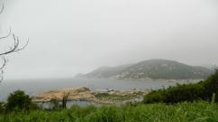
Beginning of the Giant's Causeway (Antrim Plateau, Northern Ireland)
The stone massif descends in tiers into the sea from the steep shore. The pillars-columns form stone steps, unevenly spaced. It's as if time and sea waves They have aged their formerly beautiful appearance. In profile, most columns are hexagonal in shape. This geometry allows individual elements to touch each other more closely.
Occasionally on the Giant's Causeway there are pillars with five to eight sides. The length of the tallest columns can reach 12 meters or more.
How to get to the Giant's Causeway?
The Giant's Causeway is located in Northern Ireland, 3 kilometers from small town Bushmills. You can also get there by tourist bus from Belfast - the distance is about 100 km. Group tours visiting the Trail and all the locations associated with the Game of Thrones series cost around 60 € per person.
An interesting option for independent travelers is to travel from Belfast to Bushmills. And from there on the steam railway to the Giant's Causeway.
- By bus. From the stop War Memorial Flight No. 172, 402, 402a departs. Buses run every 30-40 minutes. To Giants Causeway The Nook There are only three stops where you need to get off. From there, you will have to walk about another 30 minutes along the coast to reach the visible part of the Giant's Causeway.
- On a vintage train. The most romantic way to get to the Causeway of the Giants is to take a diesel train to Bushmills Platform. Six times a day, from 11:00 to 16:30, it delivers tourists to the popular attraction. The train takes longer than the bus - about 15 minutes. But the views along the way are fabulous, and the children are delighted with the trip. More details on the website.
Ride the Bushmills Railway Tram-train from Bushmills to the Giant's Causeway:
On the official website www.translink.co.uk you can see the bus and train schedules (from Belfast to Bushmills, for example). And check ticket prices.
Excursions in Great Britain
The most interesting excursions are routes from local residents to Tripster. It's better to start with (see iconic places British capital, outline walking routes). Then go for the whole day to. During an 8-hour excursion with transfer, you will have the opportunity to walk around the city and see the dancing of stone giants.
Versions about the origin of the Giant's Causeway
For those for whom it is important to prepare for the trip and study everything about the object of interest, we have two versions of the origin of the Giant’s Causeway.
1. The Legend of Mac Quill and Fingal
As one of the existing myths says, the giant road was built by a giant who lived in these places, named Mac Quil. Wanting to reach the coast of Scotland by sea, he installed countless basalt pillars on the seabed, constructing a road for himself. In Scotland, Mac Quill had to fight his enemy Fingal.
When the work was finished, McQuil decided to rest, falling asleep on the seashore. At this time, Fingal crept up to the giant, making his way to Ireland along the stone columns. However, Mac Quila's wife noticed the enemy in time and decided to scare him. She shouted to Fingal that the sleeping giant was her child. But soon the husband will return to see the uninvited guest out. Fingal was quite surprised by the size of the baby and, imagining Mak Kuil, decided not to tempt fate.

Walk along the Giant's Causeway in Ireland
Retreating, he fled to Scotland along the Giant's Causeway. True, destroying it on the go in order to avoid persecution by the father of the family. Those fragments of the road that have survived to this day can be seen today on the Antrim plateau.
2. Scientific explanation
Scientists studying the phenomenon of the Giant's Causeway have a different opinion. In ancient times, when the earth's landscapes were just being formed, a large number of large volcanoes arose in these places, spewing liquid hot lava consisting of basalt. Molten lava flowed down the hills towards the sea at a speed of 50 km/hour. At the same time, she could cover considerable distances.
As a result, the basalt deposits crystallized and cracked from the cold, forming hexagonal column-like structures.
Tourists who do not agree with the opinion of scientists in Northern Ireland are invited to personally come to the location of the surviving fragments of the Giant's Causeway. And feel the elements of this natural creation with your own hands. Perhaps someone will come up with a more convincing version than those known so far.
Hotels in the Giant's Causeway area
You can travel from Belfast to Bushmills and walk the Giant's Causeway in one day. Buses and trains run frequently. As a last resort, you can leave by night train. But this does not stop romantics who want to spend the night overlooking the inhospitable Irish cliffs. The place is fascinating, there are places to walk in the surrounding area.
So the large number of hotels on the outskirts of Bushmills does not surprise anyone. By the way, the prices there are quite reasonable by British standards.
The Giant's Bridge is located 100 km from Belfast (the capital of Northern Ireland). And 3 km from the town of Bushmills.The Giant's Causeway is about 40 thousand closely spaced basalt pillars on the northeast coast of Northern Ireland. Their tops, like pavement cobblestones, lead in ledges from the foot of the coastal cliffs and gradually disappear into the sea. Most of the pillars are somehow incomprehensibly shaped like almost perfect hexagons. They, like pieces of a giant stone puzzle, stretch along the seashore for three kilometers.
For fifteen thousand years now, the Giant's Causeway has been resisting the unbridled storms of the North Atlantic here. For many centuries, the strange regularity of its stone columns forced local shepherds and fishermen to invent legends about it. They came up with their own story of its origin long before this secret was truly revealed by science.
Giant interethnic conflict
According to legend, the pillars extending into the sea are the remains of a road built by the Irish giant Fin McCool. He decided to build it after he was challenged to battle by a giant from Scotland named Benandonner.
To get to his rival who lived overseas, McCool began to tear off huge stones from the coastal cliffs and throw them into the sea. Thus came the 25-mile road leading to Benandonner's lair, a cave on the Scottish island of Staffa. Now Fin could cross the North Strait along it and teach the insolent a lesson.
However, the construction of the road tired him so much that he decided to rest first - he returned home and went to bed.
The next morning, while Fin McCool was still fast asleep, his giantess wife was awakened by the sound of menacing footsteps. It was the huge and terrible Benandonner who was the first to use the new road and was approaching. When she saw him, she thought: “My husband will never be able to cope with this,” and quickly threw a blanket and a child’s cap over the sleeping man.
-Where is Fin? - Benandonner roared, approaching their house. -Where is this coward hiding?
- Be quiet, you'll wake up our baby! – the wife answered, pointing to her sleeping husband.
Benandonner looked at the “child” and immediately panicked. If Fin's son was so big, then what would his father be like? The Scotsman decided not to find out and hastily retreated to his cave. Along the way, he destroyed the road built by Fin so that he could not catch up with him.
Legendary riddles and scientific answers
It was not without reason that the legendary Fin McCool built his road to the small island of Staffa. Folk legend chose this tiny piece of land because it is composed of the same basalt pillars as Northern Ireland's Giant's Causeway. The external similarity of the two places gave rise to a single explanatory myth.
Interestingly, from a scientific point of view, the basalt columns of Staffa and the Giant's Causeway actually have a common origin. It, of course, has nothing to do with the “showdown” of the legendary giants, and is due to the unity of their geological history.
The basalt pillars of the Giant's Causeway descend from the foot of the coastal hills and disappear into the sea.
The scientific world first learned about the Giant's Causeway in 1693, when Sir Richard Bulkley of Trinity College Dublin reported it to the Royal Society of London. The news caused considerable confusion in educated circles of the time. This was the first time that science dealt with basalt pillars, and heated debate began over the reasons for their appearance. Some considered the Giant's Causeway to be the work of man, others - the result of unknown natural processes, and some were even seriously inclined towards the “giant” theory.
The first true idea about the origin of the Road appeared on the pages of the scientific press in 1768 in one of the volumes of illustrations for the epoch-making French “Encyclopedia”. As a commentary on the engraving with its image, the French geologist Nicolas Desmarais (1725 - 1815) suggested a volcanic reason for its appearance. Later studies confirmed that he was right.
The Real Story of the Giant's Causeway
Today we know that the Giant's Causeway arose about 60 million years ago, when the separation of Europe and North America began.
During that period, as a result of the divergence of the Eurasian and North American lithospheric plates, gaps began to form in the earth’s crust, through which basaltic lava repeatedly poured onto the surface. As it solidified, it formed the huge Tulean lava plateau, the area of which scientists estimate is at least 1.3 million km 2 .
Subsequently, it was torn apart and hidden by the waters of the North Atlantic Ocean. Today its remains are scattered over vast areas from Norway, Scotland and Ireland to Faroe Islands, Iceland and eastern Greenland. The Giant's Causeway and the basalt pillars of Staffa Island are the most famous results of its formation.
In total, three phases of volcanic activity were noted in the area of the Giant’s Causeway during the emergence of the Tulean Plateau. These are known as the lower, middle, and upper basalts and are separated by two long periods of relative calm when the surface of the erupted and solidified lava was eroded. The erosion of the oldest, lower basalt layer created the conditions for the formation of the Road.
During the first of these "erosive" periods, water flows cut numerous valleys into the lower basalts. Later, when the lava of medium basalts poured out, its huge masses accumulated in these valleys and began to cool there very slowly. It was the low cooling rate that became the key factor in the appearance of the stone pillars of the Giant's Causeway.
 The Giant's Causeway going out to sea. Similar basalt pillars are found on the Scottish island of Staffa on the other side of the North Channel.
 As scientists have found out, when basalt contracts during slow cooling, it begins to crack. In most cases, cracks form at an angle of 120° because this releases greatest number excess surface energy at phase boundaries. This is how hexagonal horizontal sections of future basalt columns are formed.
As the cracks cool, they move from the surface deeper into the massif. Their length depends on the thickness of the basalt layer: the thicker it is, the longer the pillars are formed. The greatest height of the columns of the Giant's Causeway is 12 meters, and this is far from a record. In exceptional cases, such as in the American state of Wyoming, they can reach a hundred or even more meters in height.
The thickness of the columns is also mainly determined by the cooling rate: the lower it is, the larger the diameter of the columns that appear. The average thickness of the pillars of the Giant's Causeway is 30 cm.
Approximately two million years after the formation of the pillars, new eruptions occurred in the area of the future Giant's Causeway. Their result - a layer of upper basalts - was not massive enough to generate its own stone columns, but it was quite enough to hide the existing ones for a long time.
 Hexagon is the most common cross-sectional shape of basalt pillars, since the angle between its adjacent sides is exactly 120°. Columns with a different number of faces are formed less frequently.
 Glaciers helped the future Giant's Causeway see the light of day again. During the last glacial maximum, they “scraped off” the later geological layers that covered it and exposed basalt columns. Then, when the glacier began to retreat about 15 thousand years ago, sea levels rose and the Giant's Causeway took on its current form.
World Heritage Site
Since the Giant's Causeway is an exemplary example of processes related to the geological evolution of the Earth, and at the same time is also associated with cultural heritage Northern Ireland, it is protected by numerous conservation statuses.
The most significant of these is the UNESCO World Heritage Site status awarded to the Giant's Causeway and the adjacent Causeway Coast in November 1986. In addition, the Road, along with the coast, is a state nature reserve, and is also part of one of the so-called “areas of special scientific interest”.
On the way to the Road
Over the past 300 years, the Giant's Causeway has become one of the symbols of Northern Ireland and its most popular tourist attraction. The first tourists began to appear here almost immediately after Sir Bulkley’s “discovery”. In the 19th century, their flow became massive, especially after the construction of a hydroelectric tram line in the 1880s, linking the Road with the resort town of Portrush.
Today, a huge number of tourists click their camera shutters every year on the Giant’s Causeway. In 2014 alone, 788 thousand visitors from all over the world visited here.
Getting to the famous basalt pillars is not difficult. The Giant's Causeway is located in County Antrim, 3.2 km from the village of Bushmills. A trip here by private car from Belfast will take 1 hour 25 minutes, from Derry - 1 hour 10 minutes, from Dublin - 3 hours 45 minutes.
You can use public transport: Take the train from Belfast or Derry to Coleraine. Further – 17.7 km by bus.
 Another close-up of the basalt pillars of the Giant's Causeway.
 The Causeway Coast is open all year round without any time restrictions. Four convenient walking paths lead to the faceted pillars from the official entrance. A walk along them, as well as along the coast itself, is free. If desired, you can pay triple additional service: visiting a new tourist center(opened in July 2012), an audio guide in 9 languages (including Russian) and a booklet diagram.
For centuries now, the rugged symmetry of the basalt pillars of the Giant's Causeway has never ceased to intrigue and inspire visitors. Walking through it is like traveling back in time. Its steps lead simultaneously to the creative cataclysms of the million-year-old past and to the foggy legends of Irish antiquity. Without a visit here, no trip to Northern Ireland can be considered complete.
River bent into an arc
At first glance at this sharp bend of the Colorado River in northern Arizona, USA, it becomes clear where its name - Horseshoe - comes from. With its almost perfectly symmetrical 270 degrees of turn, this river meander really does look a lot like a horse’s “shoe.” The unusual shape, picturesque cliffs more than 300 meters high and relative accessibility have made the Horseshoe an extremely popular tourist attraction. Today it is one of the most recognizable and frequently photographed natural landmarks in the southwestern United States.
How to bend an entire river into an arc
Geologists believe that the Arizona Horseshoe arose about 5 million years ago, when, as a result of tectonic uplift of the Colorado Plateau, ancient river Colorado, on the border of the future states of Arizona and Utah, was forced to adapt to the new terrain. Following faults in the local sandstone massifs, she gradually carved an entire canyon into them. Today it is known as the Glen, and the Horseshoe is its most intricately curved section.
 The color of the rocks and water at Horseshoe changes throughout the day. Some of the best shots are taken at sunset.
 In 1963, the canyon was almost completely flooded by the waters of the huge Powell Reservoir. It retained its original appearance only in the southernmost part, about 24 km long (where, in fact, the Horseshoe is located).
By the way, Glen is the northern neighbor of the famous Grand Canyon, which has a very similar geological history.
Easily accessible beauty
Horseshoe is one of those few phenomenal beautiful places, which can be reached by travelers with almost any physical ability. It is located just 6.5 km southwest of the Arizona town of Page, from which Highway 89 leads to the bend. A dirt road turns off from it between mileposts No. 544 and No. 545, and then almost immediately there is a special parking lot and the beginning of walking trail. A short climb to a small gazebo on the hill, then a gentle descent - and the mighty curve of the Horseshoe opens before your eyes.
Generally walking a round trip distance of about a couple of kilometers takes about 45 minutes.
You can go to the Horseshoe all year round; no permits or separate tickets are required to visit it. You will only have to pay for access to the Glen Canyon National Recreation Area, on whose territory the Horseshoe is located. Access costs $25 per private vehicle and is valid for up to seven days.
It is prohibited to litter, disturb wildlife in any way, or leave marks in the National Recreation Area. You can walk dogs on a short leash (no longer than 1.8 m).
When going to the Horseshoe, it is recommended to take with you more water(at least 1 liter per person), as well as sunglasses and a hat, since there is no shade on the trail except for the gazebo halfway. For those who are interested in photography, a wide-angle lens is a must—without it, the scale of the Horseshoe simply cannot be captured. Of course, you should be careful observation deck– there are no railings or fences on it.
 The elevation above sea level at the Horseshoe Lookout is 1,285 m. The elevation above the Colorado River is just over 300 m. There are no guardrails, so caution must be exercised. In July 2010, a tourist from Greece fell here and died.
 From the point of view of the beauty of the landscape best time to visit the Horseshoe - from approximately 9:30 am (when the river gets rid of the thick shadow) until noon. At noon itself, due to the lack of shadows, the view of the famous bend will be somewhat flat. The evening until sunset inclusive is also a good option, but in this case the sun will shine in your eyes.
There are several other first-class attractions located in relative proximity to the Horseshoe. Thus, directly north of Page is the impressive wall of the Glen Canyon Dam, 220 meters high, beyond which the Powell Reservoir begins. 45 km west of Horseshoe lies the famous Arizona Wave - a sandstone rock formation of absolutely incredible beauty. And 12 km in the opposite direction (that is, to the east) is the no less famous Antelope Canyon.
And finally, southwest of the bend, downstream the Colorado River begins Grand Canyon- one of the most unusual and impressive geological objects on the globe.
Remarkable fresh
At the top of one of the taiga-covered mountain ranges of the Gremyachinsky region Perm region there is a powerful rock mass cut by deep cracks. Large and not so large crevasses crossing it crosswise form a bizarre labyrinth, reminiscent of the streets, alleys and squares of some long-abandoned settlement. This is the so-called Stone Town, one of the most popular tourist places in the modern Kama region.
Three names for one place
Today, Stone Town is widely known not only to Perm residents, but also to many guests of the region. Despite the remoteness, a constant flow of travelers comes here all year round. However, this was not always the case: a couple of decades ago, only a few local residents knew about the Stone Town, and even then under completely different names.
 Cracks in the rock mass of Stone Town form a network of large and small “streets”.
 The fact is that modern tourists called this place Stone Town, but earlier for half a century it was called “Turtles”. This name was given to it in the middle of the 20th century because of the characteristic shape of the two highest rock outcrops by residents of the neighboring mining villages of Shumikhinsky and Yubileiny, founded in 1953 and 1957, respectively. However, this name was not the original one: old-timers of the “oldest age” settlement In this area - the village of Usva - these rocky outcrops have long been known as the Devil's Settlement.
This name is not uncommon for Ural toponymy. Not far from Yekaterinburg, for example, there is a spectacular mountain of the same name, very popular among tourists and climbers. In addition, objects with a similar name are found in other regions of Russia, since it was customary to call rock massifs and stone ridges of unusual shapes “devil’s fortifications.” It is obvious that people, not knowing the true geological reasons, attributed their construction to evil spirits.
History of appearance
How did the Perm Stone City actually arise?
Scientists have found that 350 - 300 million years ago there was a delta of a large river in this place. Its mighty streams brought with them large masses of sand, which over time turned into powerful sandstone deposits. Later, as a result of the movement of tectonic plates that caused the formation of the Ural Mountains, the territory of the future Stone City was raised high above sea level and began to be weathered.
 Quartz sandstone of Stone Town. The brown color is due to the admixture of iron hydroxides.
 Over many millions of years, water, wind, temperature changes and chemical processes have deepened and expanded the cracks in the rock that appeared during the tectonic uplift. This led to the emergence of the current “streets” and “alleys”, the width of which is at the moment can reach eight and depth – twelve meters. In other words, from a scientific point of view, the Permian Stone City is a cluster of weathering remnants composed of fine-grained quartz sandstones.
Road to Stone Town
Considering the great popularity of the Stone Town today, it is difficult to believe that it is not even mentioned in the old guidebooks to the Kama region. Nevertheless, this is so - the rush demand for the Gremyachin remains has appeared among Perm travel enthusiasts only in the last fifteen to two decades, and before that they were due to poor transport accessibility were practically unknown to the mass tourist.
Fortunately, the situation has changed since then, and today you can easily get to Stone Town by car. The general route is as follows: first the road to Usva (188 kilometers from Perm, 383 from Yekaterinburg), then about another two kilometers along the highway towards Kizel. Then turn right to the villages of Shumikhinsky and Yubileiny and five kilometers along the forest dirt road to the parking lot. Further, turning left from the road, about a one and a half kilometer march along a clearly visible path and among the trees the first remnants of the Stone City will begin to be visible.
At the top of the Rudyansky mountain
Since the Stone Town is located not far from the main peak of the Rudyansky Spoy mountain range (526 meters above sea level), the trail from the dirt road to the remains goes up a small slope. The ridge begins on the outskirts of the village of Usva and stretches 19 kilometers north to the city of Gubakha. It was named Rudyansky because of the Rudyanka River flowing in its southern part, in the basin of which iron ore was mined at the beginning of the 19th century. Spoys in the Perm region used to be the name for long, forest-covered mountain ranges without sharply defined peaks.
 Rocky outcrop Turtle – main symbol Perm Stone Town.
 The stone city (not counting the numerous single stones scattered around it) is divided into two unequal parts. The first rock outcrops that tourists come to belong to the so-called Big city. It is in it that the two largest local remains rise - the Big and Small Turtles, because of which the Devil's Settlement changed its name in the 1950s.
The smaller of these remains, due to its similarity in shape to a sitting bird, is today better known to tourists as the Feathered Guardian. The larger one, accordingly, is now more often called simply Turtle. Between him and the Feathered Guardian there is a vast and almost horizontal area - the so-called Square. Tourists get to it along Prospect, the widest (up to four meters) and longest crack in the Stone City. The almost vertical walls of Prospect reach eight meters in height in some places.
 The feathered guardian, like the Turtle visible behind him, often becomes the object of annual rock-climbing competitions held in Stone Town between rescuers of the Ministry of Emergency Situations, mountain tourists and speleologists of the Perm region.
 To the right and left of the Prospect there are narrow cracked streets. One of them (the one that goes around the Turtle) has the highest – up to 12 meters – walls in the city. Along the other two you can climb above the rock massif and from there in all its glory you can see in front of you and Stone Guardian, and Turtle.
About 150 meters north of the Big City is the Small City. Despite its much smaller area compared to its neighbor, it is also very interesting and picturesque. Its main “street,” for example, is even more spectacular than the Avenue described above. In addition, there is a curious stone ridge with a through hole in the base. The only problem is that there is no clear path to the Small Town and it is not always easy to find.
You can come to Stone Town at any time of the year, but it is especially beautiful here on sunny autumn days. At this time, you can wander endlessly through its streets immersed in bright colors. That is why at the end of August and at the beginning of autumn there is the largest influx of visitors in the Stone Town.
However, many tourists come here in winter, when both the outcrops themselves and the trees growing right on them are effectively covered with snow-white caps of snowdrifts. Therefore, when going to Stone Town in the winter months, you should not be afraid that the local trails will be impassable due to deep snow. They will certainly be well trodden by groups of previous visitors.
 The stone city is located immediately west of the main peak of the Rudyansky ridge. From here you can enjoy unforgettable views of the endless ocean of the Ural taiga.
 Before visiting the Stone Town, you need to stock up on water, since there are no large water sources. Also, since since 2008 this landscape natural monument of regional significance has received the status of a specially protected natural area, certain rules of behavior must be followed.
Firstly, you can make fires in Stone Town only in specially equipped places, using only dead wood and dead wood (cutting down living trees and shrubs is prohibited). Secondly, you cannot litter and leave unextinguished fires behind. Thirdly, it is prohibited to disturb animals and make inscriptions on rocks, stones and trees. Violation of these rules threatens with a fine of up to 500 thousand rubles.
Stone Town is not the only natural attraction in the vicinity of the village of Usva. Not far from it there is, for example, such a “flagship” of the tourism industry of the Perm region as the Usvinsky Pillars - a huge and extremely photogenic stone ridge with the picturesque remnant of the Devil’s Finger. Rafting on the Usva River is also very popular among Perm residents.
In general, stone town-like weathering remains associated with selective destruction mountain ranges, are one of the most spectacular geomorphological objects of the Kama region. There are especially many of them on flat tops Northern Urals, such as the Chuvalsky Kamen, Kuryksar, Larch ridges and on the Kvarkush plateau.
The Giant's Causeway has several names, including the Giant's Causeway and the Giant's Causeway. The volcanic formations located in Northern Ireland are among the world's natural treasures, which is why a considerable number of tourists seek to look at the unusual cliffs.
Description of the Giant's Causeway
From above, this amazing natural wonder resembles a sloping road that descends from the cliffs and goes into the Atlantic Ocean. Its length on the coast reaches 275 meters, and approximately another 150 meters stretches under water. The size of each column is about six meters, although there are also twelve-meter pillars. If you take a photo from above the cliff, you can see honeycombs tightly packed together. Most posts have a hexagonal cross-section, but some have four, seven or nine corners. 
The pillars themselves are quite hard and dense. This is explained by their composition, which is dominated by magnesium and basaltic iron with a quartz content. It is because of this that they are not subject to decay under the influence of winds and waters of the Atlantic Ocean.
Conventionally, the natural structure can be divided into three sections. The first is called the Great Trail. Here the columns have a cascading structure in the form of steps. Towards the bottom they level out into a road up to 30 meters wide. Next are the Middle and Small trails, reminiscent of protruding mounds. You can walk on their tops, as they are flat in shape. 
Another unusual area is the island of Staffa. It is located 130 km from the coast, but here you can also see columns similar to those that go under water. Another notable place for tourists on the island is Fingal's Cave, the depth of which reaches 80 meters.
Hypotheses about the emergence of a miracle of nature
During the study of the Giant's Causeway, scientists put forward various hypotheses about where such columns came from. Among the popular versions are the following explanations:
- the pillars are crystals formed on the seabed that was once located in Northern Ireland;
- the columns are petrified bamboo forest;
- the surface was formed as a result of volcanic eruptions.

It is the third option that seems closest to the truth, since it is believed that the magma that has come to the surface, after a long period of cooling, begins to slowly crack, causing the layer to resemble a honeycomb, going far deep into the earth. Due to the basalt base, the magma did not spread over the ground, but lay down in an even layer, which later became like columns.
Despite the fact that this hypothesis seems to scientists the most reliable, it is not possible to test it for truth, since hundreds of years must pass before a similar effect can be repeated in practice.
The Legend of the Giant's Causeway
The story is retold among the Irish of the giant Finn Mac Cumal, who had to fight a terrible foe from Scotland. To connect the island with Great Britain, the resourceful giant began to build a bridge and became so tired that he lay down to rest. His wife, hearing that the enemy was approaching, wrapped her husband in swaddling clothes and began baking cakes. 
When the Scot asked if Finn was sleeping on the shore, his wife said that it was just their baby, and her husband would soon arrive for the decisive fight. The resourceful girl treated the guest to pancakes, but first baked cast iron frying pans in them and left only one for Finn without an unusual additive. The Scotsman could not bite a single cake and was extremely surprised that the “baby” ate it without difficulty. 
Thinking how strong the father of this child must be, the Scot hastened to escape from the island, destroying the bridge that had been built behind him. The amazing legend is liked not only local residents, but also fuels interest in the Giant’s Causeway among tourists from different parts of the world. They enjoy walking around the area and enjoying the landscapes of Ireland.
About 40 thousand huge stone columns are so closely adjacent to each other that it seems that some giant - a hero of Irish myths and legends - installed them here. The diameter of these pillars is from 30 to 50 centimeters, they have smooth tops and several edges (the quarter has five, the rest have four, seven and even nine corners). The Giant's Causeway (or as it is also called - the Giant's Causeway) is located in Northern Ireland near small town Bushmills. It encircles the cliffs that are located on the Causeway Coast, and then gradually goes under water towards Scotland.
The scale of this amazing place is amazing. If you look at the Giant's Causeway from above, it really looks extremely similar to a stone-paved road that stretches along the coast for 275 meters and goes into the Atlantic for another hundred and fifty meters.
The average height of the pillars is approximately six meters, although it is not uncommon to see columns twelve meters high. If you look at them from above, they are somewhat reminiscent of a honeycomb, since they organize hexagons between themselves that are so close to each other that it is quite difficult to insert even a thin knife between them.


Absolutely all the pillars are dark in color and incredibly hard - scientists are natural phenomenon explained by the fact that they consist mainly of basalt rich in magnesium and iron, which also has a small amount of quartz. Thanks to this composition, the columns are able to successfully withstand the destructive effects of winds and stormy waves of the Atlantic Ocean.
The columns of the Giant's Causeway in Ireland form three groups of sites:
- Big trail. The columns of this group are the largest and begin near rocky mountains. At first they look like a cluster of huge stone steps, some of which reach up to six meters in height. Closer to the water, the steps gradually level out until they begin to form a stone-covered path, which is 20 to 30 meters wide.
- Middle and Small trails. The pillars of these groups are located near the Great Path and are shaped more like mounds than a road. Since each of these pillars has a flat top, it is possible to carefully (especially near water, because they are extremely wet and slippery) move from one pillar to another.
- Staffa Island. 130 km from the coast there is a small desert island Staffa (translated as “island of pillars”), on which there is a continuation of these columns. Between these pillars is the main attraction of the island - the huge Fingal Cave, which is about 80 meters long.
Cliffs
The columns themselves on the Causeway Coast are located around cliffs, to which people later gave rather original names. For example, two of them were named after the Harp (the columns from this cliff descend in a curved line to the coast) and the Organ (the straight and tall pillars that are located near it are very reminiscent of this musical instrument).


There are cliffs with such interesting names as the Giant's Loom, the Giant's Coffin, the Giant's Guns, the Giant's Eyes. Here you can also look at the Giant's Shoe - a two-meter cobblestone that resembles this shoe (it was even calculated that the giant who wore such a product must have been at least 16 meters tall).
Chimneys of the Giant's Causeway
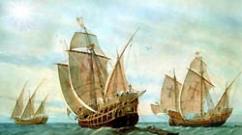
There's one more thing interesting place on the Giant's Causeway - chimneys, which several centuries ago frightened the already defeated "Invincible Armada".
This happened for a banal reason. Some pillars of the Giant's Causeway in Ireland not only tower on the coast, but also from the sea look like the chimneys of a huge castle. The Spaniards confused him with him and fired cannons at “enemy territory” - that is, absolutely deserted territory.
This story ended in tears for the Spaniards: their ship crashed on the rocks, and many people died. The treasures found from the ship, after they were raised from the bottom of the sea, can now be seen in the Ulster Museum, which is located in Belfast.
Legend
It is not surprising that the Giant's Causeway has its own legends and myths that explain its appearance and formation.
The ancient Irish believed that the Giant's Causeway was built by the Irish giant Finn Mac Cool in order to reach his sworn enemy, the Scotsman, who lived in the Hebrides, and fight him in order to decide who was stronger.

Further versions are slightly different from each other. According to one of them, seeing that his opponent was larger and more powerful than him, Finn ran away. And when he saw that the Scot was pursuing him, he persuaded his wife to swaddle him like a child and leave him to sleep on the shore. According to another version, while the Irishman was building a road, he was so tired that he fell asleep on the coast, and his wife, seeing that his rival was approaching, swaddled him and passed him off as a child.
In any case, having seen the huge “baby”, the Scottish giant decided that it was better not to mess with his father and ran away, and so that the Irishman would not catch up with him, he destroyed the path.
Studying
Interestingly, the Giant's Causeway became widely known only at the end of the 17th century, when the Bishop of Derry began to intensively advertise it amazing place. And at the beginning of the 19th century, tourists began to appear here en masse.


Despite the fact that this area by the Department environment Northern Ireland declared national reserve, there are absolutely no areas closed to the public, and tourists can walk wherever they want and wherever they can get to. Tourists in this country quite like this fact.
The Giant's Causeway is unique in that, despite the fact that something similar exists in other parts of the globe, it is here that largest cluster similar pillars. It is not surprising that for many centuries scientists have debated how exactly the Trail arose.
Some of them claimed that the giant pillars are actually huge crystals that arose a long time ago at the bottom ancient sea. Others said the pillars were actually petrified bamboo forest.
Nowadays, most scientists agree that the largest lava plain in Europe once existed here. It was formed thanks to a huge layer of limestone, which is located under the territory of Northern Ireland. In ancient times, molten lava flowed out through its faults during volcanic eruptions, which covered the earth with a layer of 180 meters, after which it began to cool and harden. But it did not become a shapeless mass because it was based on basalt.
After some time, during cooling, the lava began to slowly decrease in volume, and thanks to the basalt, hexagonal cracks formed on its surface. As the inner layers of magma began to cool, these cracks began to deepen and formed hexagonal columns.
This theory was confirmed by a group of scientists from Toronto, who, after experiments, were able to prove that the slower the magma cools, the larger the columns are. Thus, the secret of the appearance of such an amazing natural phenomenon as the Giant's Causeway in Ireland was revealed... Or not?
The Giant's Causeway in Northern Ireland is a unique natural phenomenon: interconnected basalt hexagonal columns create amazing landscapes reminiscent of a natural pavement. The trail is the result of the activity of an ancient volcano; the ledges were formed when a lava flow cooled. There is another version of the appearance of a bizarre trails: the road was built by the hero of Celtic myths, Finn Mac Cumal.
The Causeway of Giants could indeed serve as a road: the columns of different heights (from 6 to 12 meters) seem like a staircase, and the cracks are the result of a sloppy layout of the nature trail.
In 1986, the Giant's Causeway was listed World Heritage UNESCO.
To visit the Giant's Causeway, you should choose comfortable clothes and shoes, preferably with rubberized soles.
It is better to plan a trip to the Causeway of Giants from late spring to autumn. There are no tours along the Giant's Causeway in winter. Be careful: the weather in the north of Ireland is quite changeable. In strong winds and rain, approaching the cliff can be dangerous.
Tourist office where you can get detailed information o Giant's Causeway and buy souvenirs, located at 44 Causeway Road. When purchasing a ticket, tourists receive an audio guide in Russian (English, French, German, Spanish, Italian, Polish, Japanese and Mandarin are also available).
How to get there
The Giant's Causeway is located in the north-east of Northern Ireland, 100 km from Belfast. Bus service connects the Giant's Causeway and Belfast: tourist buses run (mainly in summer), can also be reached by bus 252, circular route which runs along the picturesque Antrim coast.
From late spring to early autumn, you can get to the Giant's Causeway by tourist buses from Bushmills, as well as from another attraction in Northern Ireland -. In summer, minibuses also run from the tourist office.
You can also travel from Belfast and Londonderry by Translink trains (www.translink.co.uk). The nearest railway stations to the Giant's Causeway are Portrush and Coleraine, from where regular buses run to the coast.
Steam railway connects Bushmills and the Giant's Causeway; The station is located 200 meters from the main entrance to the natural park.
Travel time from Belfast by car is about one and a half hours. Follow the M2 until the junction with the A26. Turn right and follow until you turn onto the M2. Once past Ballymena, continue on the A26 to Ballymoney. Turn right and follow Ballybogy Road until it meets Priestland Road. Turn right again and continue to Causeway Road.
Location
Giant's Causeway is located in County Antrim in .