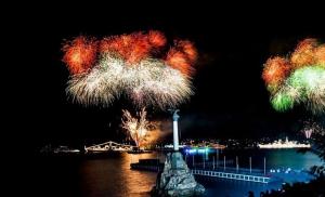
Which countries are washed by the Mediterranean? All about the Mediterranean Sea
Its total area is 2,500,000 km², and the deepest point is located off the coast of Greece, and is 5,121 m. However, the average depth of the sea is approximately 1,500 m. The Mediterranean Sea is connected to the Atlantic Ocean through the narrow Strait of Gibraltar between Spain and Morocco, which is only 22 km in width.
The Mediterranean Sea has historically played an important role in international trade, which has been a strong factor in the development of the region around it.
History of the Mediterranean
Region around Mediterranean Sea has a long history that dates back to ancient times. For example, tools from Stone Age times have been discovered by archaeologists along its shores, and it is believed that the Egyptians began sailing it in 3000 BC. e. The region's early people used the Mediterranean Sea as a trade route and a way to move around or colonize other regions. As a result, the sea was controlled by several ancient civilizations. These include the Minoan, Phoenician, Greek and later Roman civilizations.
However, in the 5th century. BC e. The Roman Empire fell, and the Mediterranean Sea and the region around it came to be controlled by the Byzantines, Arabs and Ottoman Turks. By the 12th century, trade in the region grew as Europeans began their exploration expeditions. Although trade in the region declined in the late 1400s as European traders discovered new waterways to India and Far East. However, in 1869, after the opening of the Suez Canal, trade in the region began to increase again.
In addition, the opening of the Suez Canal, connecting the Mediterranean and Red Seas, also became an important strategic location for many European countries. As a consequence, the United Kingdom and France began to build colonies and naval bases along the seashores.
Today the Mediterranean Sea is one of the busiest seas in the world. Trade and shipping are very well developed, and fishing in the sea waters is also significant. In addition, tourism makes up a large part of the region's economy, thanks to its mild climate, beautiful beaches, developed cities and ancient historical sites.
Geography of the Mediterranean Sea
The Mediterranean Sea is a very large sea that is bounded by Europe, Africa and Asia, and extends from the Strait of Gibraltar in the West to the Dardanelles and Suez Canal in the East. Since the Mediterranean Sea is connected to the ocean only by the narrow Strait of Gibraltar, it is characterized by very weak tides, and its waters are warmer and saltier than those of the Atlantic Ocean. This is because evaporation exceeds precipitation and runoff, and circulation sea waters occurs less actively than if the sea were more connected with the ocean. However, enough water flows into the sea from the Atlantic Ocean that the sea level is not subject to large fluctuations.
Geographically, the Mediterranean Sea is divided into two different basins - the Western and Eastern Basins. The Western Basin extends from Cape Trafalgar in Spain and Cape Spartel in Africa west to Cape Et-Tib in northeastern Tunisia. The Eastern Basin extends from the eastern border of the Western Basin to the shores of Syria and Palestine.
In total, the Mediterranean Sea is bordered by 22 states, as well as several different territories. Some of the countries with borders along the Mediterranean coast include: Spain, France, Monaco, Malta, Turkey, Lebanon, Israel, Egypt, Libya, Tunisia and Morocco. It also borders several smaller seas and is home to more than 3,000 islands. The largest of these islands include Sicily, Sardinia, Corsica, Cyprus and Crete.
The landforms around the Mediterranean Sea are varied, with highly indented coastlines in the northern regions. High mountains and steep, rocky cliffs are common in the region. In other areas, although the coastline is flat, deserts predominate. The water temperature of the Mediterranean Sea also varies, but in general it fluctuates between 10° and 27° C.
Environmental threats to the Mediterranean Sea

The Mediterranean Sea is home to countless different species, and the majority of its waters come from the Atlantic Ocean. However, because the Mediterranean Sea is warmer and saltier than the ocean, these species have had to adapt. Porpoises, bottlenose dolphins and loggerhead sea turtles are common in the sea.
There are a number of threats to the Mediterranean Sea. Invasive species are one of the most common threats, as ships from other regions often bring non-native species, as well as Red Sea inhabitants entering the Mediterranean through the Suez Canal. Pollution is also a big problem, with coastal cities dumping chemicals and waste into the sea. Overfishing and tourism threaten biodiversity and integrity, as both industries put pressure on the natural environment of the Mediterranean Sea.
Mediterranean countries
Due to the large size of the Mediterranean Sea and its intercontinental location, it borders 22 countries in Europe, Africa and Asia. Below is a list of all Mediterranean countries, sorted by continent and with information on area, population and capitals.
Mediterranean countries of Africa
1) Algeria:
Area: 2381741 km²
Population: 40,400,000 (as of 2016)
Capital: Algiers
2) Egypt:
Area: 1010408 km²
Population: 96,492,600 (as of 2017)
Capital: Cairo
Note: The bulk of Egypt's territory is in Africa, with the exception of the Sinai Peninsula, which is located in Asia.
3) Libya:
Area: 1759541 km²
Population: 6,293,253 (as of 2017)
Capital: Tripoli
4) Morocco:
Area: 710850 km²
Population: 33,848,242 (as of 2015)
Capital: Rabat
5) Tunisia:
Area: 163610 km²
Population: 11,304,482 people (as of 2016)
Capital: Tunisia
Mediterranean countries of Asia
6) Israel:
Area: 20770-22072 km²
Population: 8,816,440 (as of 2018)
Capital: Jerusalem
7) Lebanon:
Area: 10452 km²
Population: 6,006,668 people (as of 2017)
Capital: Beirut
8) Syria:
Area: 185180 km²
Population: 17,064,854 (as of 2014)
Capital: Damascus
Mediterranean countries of Europe
10) Albania:
Area: 28748 km²
Population: 2876591 (as of 2017)
Capital: Tirana
11) Bosnia and Herzegovina:
Area: 51129 km²
Population: 3,531,159 (as of 2016)
Capital: Sarajevo
12) Croatia:
Area: 56594 km²
Population: 4,154,200 (as of 2017)
Capital: Zagreb
13) Cyprus:
Area: 9251 km²
Population: 1,170,125 (as of 2017)
Capital: Nicosia
14) France:
Area: 640679 km²
Population: 67,201,000 (as of 2017)
Capital: Paris
15) Greece:
Area: 131957 km²
Population: 11,183,716 (as of 2017)
Capital: Athens
16) Italy:
Area: 301338 km²
Population: 60,589,445 (as of 2017)
Capital: Rome
17) Malta:
Area: 316 km²
Population: 445,426 (as of 2014)
Capital: Valletta
18) Monaco:
Area: 2.02 km²
Population: 37,863 (as of 2016)
Capital: Monaco
19) Montenegro:
Area: 13810 km²
Population: 622,387 (as of 2016)
Capital: Podgorica
20) Slovenia:
Area: 20273 km²
Population: 2,065,895 (as of 2017)
Capital: Ljubljana
21) Spain:
Area: 505990 km²
Population: 46354321 (as of 2016)
Capital: Madrid
22) Türkiye:
Area: 783562 km²
Population: 79,463,663 (as of 2016)
Capital: Ankara
Mediterranean Sea
The Inland Mediterranean Sea is located between 30 and 45° N latitude. and 5.3 and 36° E.
It is deeply cut into the land and represents one of the most isolated large sea basins in the World Ocean. In the west, the sea communicates with the Atlantic Ocean through the narrow (15 km wide) and relatively shallow Strait of Gibraltar (depths at the threshold to the west of the strait are about 300 m); in the northeast - with the Black Sea through the even shallower straits of the Bosphorus (the depth of the threshold is less than 40 m) and the Dardanelles (the depth of the threshold is about 50 m), separated by the Sea of Marmara. The transport connection between the Mediterranean Sea and the Red Sea is carried out through the Suez Canal, although this connection has virtually no effect on the processes occurring in the sea.

At the entrance to the Suez Canal
The area of the Mediterranean Sea is 2,505 thousand km 2, the volume is 3,603 thousand km 3, the average depth is 1438 m, the greatest depth is 5121 m.
Complex outlines coastline, a large number of peninsulas and islands of different sizes (among which the largest are Sicily, Sardinia, Cyprus, Corsica and Crete), as well as the highly dissected bottom topography, determine the division of the Mediterranean Sea into several basins, seas and bays.

In the Venetian lagoon
Apennine Peninsula and about. Sicily is divided by the sea into two basins. In the western basin, the Tyrrhenian Sea is distinguished, and in a number of works also the Alboran Sea, the Balearic (Iberian) Sea, the Gulf of Lion, the Ligurian Sea and the Algerian-Provencal basin. The shallow Tunisian (Sicilian) Strait and the narrow Strait of Messina connect the western basin of the sea with the eastern, which in turn is divided into central and eastern. In the northern part of the central basin is the Adriatic Sea, which communicates through the Strait of Otranto with the Ionian Sea, which occupies the central part of the basin. In its southern part there are the gulfs of Greater and Lesser Sirte. The Creto-African Strait connects the central basin of the sea with the eastern one, often called the Sea of Levant. In the northern part of the eastern basin is the island-rich Aegean Sea.

Turkish port of Alanya in the Mediterranean Sea
The relief of the northern coast of the sea is complex and varied. The shores of the Iberian Peninsula are high, abrasive, and the Andalusian and Iberian mountains come close to the sea. Along the Gulf of Lyon, west of the Rhone delta, there are swampy lowlands with numerous lagoons. To the east of the Rhone, spurs of the Alps approach the sea, forming shores with rocky headlands and small bays. West Coast along the Apennine Peninsula Tyrrhenian Sea quite heavily indented, steep and steep banks alternate with low ones, and there are flat alluvial lowlands composed of river sediments. The eastern shores of the Apennine Peninsula are more leveled, in the north they are swampy, low, with a large number of lagoons, in the south they are high and mountainous.
Strong ruggedness and complexity of the relief are characteristic of the entire coast of the Balkan Peninsula. High, steep shores with small bays predominate; a huge number of small islands are scattered along the coast in the sea. The coast of the Asia Minor Peninsula on the side of the Aegean Sea has the same complex relief, while the southern shores of the peninsula are composed of larger landforms. The entire eastern coast of the sea is flat, without capes or bays.
The southern coast of the Mediterranean Sea, in contrast to the northern one, is much more leveled, especially the smoothed relief in the eastern basin of the sea. In the west the shores are high, and the Atlas Mountains stretch along the sea. Towards the east, they gradually decrease and are replaced by low-lying sandy shores, the landscape of which is characteristic of the huge African deserts located south of the sea. Only in the southeastern part of the sea, in the vicinity of the Nile delta (about 250 km), is the coast composed of sediments from this river and has an alluvial character.
Climate
The Mediterranean Sea is located in a subtropical climate zone; coastal mountain systems prevent the invasion of cold air masses from the north. In winter, a pressure trough stretches over the sea from west to east, around which centers of high pressure are located. In the west there is a spur of the Azores anticyclone, in the north there are spurs of the European High. The pressure is also increased over North Africa. Intensive formation of cyclones occurs along the frontal zone.
In summer, a ridge of high atmospheric pressure forms over the Mediterranean Sea, and only over the Levant Sea there is an area of low pressure.
A clearly defined seasonal change in wind directions is observed only along the southern shores of the western part of the Mediterranean Sea, where predominantly westerly winds blow in winter and easterly winds in summer. Over most areas of the sea, north-west winds prevail all year round, and over the Aegean Sea - north and north-east.
In winter, due to the development of cyclonic activity, there is a significant recurrence of storm winds; in summer, the number of storms is insignificant. The average wind speed in winter is 8-9 m/s, in summer about 5 m/s.
Some areas of the sea are characterized by different local winds. IN eastern regions in the summer season there are stable north winds(aethesia). In the area of the Gulf of Lyon, the mistral is often repeated - a cold, dry north or northwest wind of great strength. For east coast Adriatic Sea It is characterized by bora - a cold, dry northeast wind, sometimes reaching the strength of a hurricane. The warm southerly wind from the deserts of Africa is known as sirocco.
It carries a large amount of dust, causes an increase in air temperature to 40-50° and a drop in relative humidity to 2-5%. Most of the Mediterranean coast has strong breezes.
The lowest air temperature is in January: it varies from 14-16° on the southern coast of the sea to 7-8° in the north of the Aegean and Adriatic seas and to 9-10° in the north of the Algerian-Provencal basin.
During the summer season, the highest temperature is observed in August. This month it rises from 22-23° in the north of the Algerian-Provencal basin to 25-27° on the southern coast of the sea, and reaches a maximum (28-30°) off the eastern shores of the Levant Sea. In most of the Mediterranean Sea, the average annual change in air temperature is relatively small (less than 15°), which is a sign of a maritime climate.
The amount of precipitation over the sea decreases in the direction from northwest to southeast. Near the European coast, annual precipitation exceeds 1000 mm, and in the southeast of the sea it is less than 100 mm. Most of the annual precipitation falls in the autumn-winter months; in summer, rain is very rare and has the character of thunderstorms.
Hydrology
River flow along most of the coast is low. The main rivers flowing into the sea are the Nile, Rhone and Po.
In general, due to the predominance of evaporation over precipitation and river runoff, a freshwater deficit is created in the sea. This leads to a decrease in the level, which in turn causes a compensatory influx of water from the Atlantic Ocean and the Black Sea. At the same time, in the deep layers of the Strait of Gibraltar and the Bosphorus, saltier and denser Mediterranean waters flow into neighboring basins.
Sea level
Seasonal changes in sea level are insignificant, their average annual value for the entire sea is about 10 cm, with a minimum in January and a maximum in November.
Tides in the Mediterranean Sea are predominantly semidiurnal and irregular semidiurnal; only in some areas of the northeastern coast of the Adriatic Sea are diurnal tides observed. The tide in most of the water area does not exceed 1 m. The highest tides are recorded in the area of the Strait of Gibraltar and the Alboran Sea (from 3.9 to 1.1 m). Tidal currents in the open sea are weakly expressed, but in the Straits of Gibraltar, Messina and Tunis they reach significant values.
Non-periodic level fluctuations caused by storm surges (sometimes in combination with high tide) can reach large quantities. In the Gulf of Lyon, with strong southern winds, the level can rise by 0.5 m; in the Gulf of Genoa, with a stable sirocco, a rise of up to 4 m is possible. Almost the same increase in level (up to 3.5 m) is observed with storm winds of the southwestern quarter in the northern parts of the Tyrrhenian Sea. In the Adriatic Sea, with southeastern winds, the level can rise to 1.8 m (for example, in the Venetian Lagoon), and in the bays of the Aegean Sea, with strong southern winds, the range of surge fluctuations reaches 2 m.
The strongest waves in the sea develop in autumn and winter, during the period of active cyclonic activity. At this time, the wave height quite often exceeds 6 m, and in strong storms reaches 7-8 m.
Bottom relief
The topography of the seabed has many morphological features characteristic of an oceanic basin. The shelf is quite narrow - mostly no wider than 40 km. The continental slope along most of the coast is very steep and cut underwater canyons. Most of the western basin is occupied by the Balearic Abyssal Plain with an area of about 80 thousand km 2. In the Tyrrhenian Sea there is a central abyssal plain, on which many seamounts stand out. The highest seamount rises 2850 m above the sea floor. The peaks of some mountains on the mainland slope of Sicily and Calabria rise above the surface of the sea, forming the Aeolian Islands.
The morphology of the bottom of the eastern basin of the sea differs markedly from the morphology of the western basin. In the eastern basin, vast areas of the bottom represent either a complexly dissected median ridge or a series of deep-sea depressions. These depressions stretch from the Ionian Islands, south of the islands Crete and Rhodes. In one of these depressions the greatest depth of the Mediterranean Sea is located.
Currents
Circulation on the surface of the Mediterranean Sea is formed by Atlantic waters entering the sea through the Strait of Gibraltar and moving east along the southern shores in the form of the meandering North African Current. On its left side there is a system of cyclonic gyres, on the right - anticyclonic ones. The most stable cyclonic gyres in the western basin of the sea are formed in the Alboran Sea, the Algerian-Provencal basin, and the Tyrrhenian Sea; anticyclonic - off the coast of Morocco and Libya.
Through the Strait of Tunis, Atlantic waters enter the central and eastern basins of the sea. Their main flow continues to move along the African coast, and part of them deviates to the north - into the Ionian and Adriatic, as well as into Aegean sea, being involved in a complex system of cyclonic gyres. Among them, the Ionian, Adriatic, Athos-Chios, Cretan (in the Aegean Sea) and Levantine gyres should be mentioned. To the south of the North African Current, anticyclonic gyres are distinguished in the gulfs of Little and Greater Sirte and the Cretan-African one.
In the intermediate layer, Levantine water moves from the eastern basin of the sea to the west, towards the Strait of Gibraltar. However, the transfer of Levantine waters from east to west does not occur in the form of a single intermediate countercurrent, but in a complex way, through a system of numerous circulations. Two-layer, oppositely directed flows of Atlantic and Levantine waters are clearly visible only in the Straits of Gibraltar and Tunis.
The average speeds of the resulting water transfer are low: in the upper layer - up to 15 cm/s, in the intermediate layer - no more than 5 cm/s.
In the deep layers, water moves weakly from the formation centers in the northern regions of the sea to the south, filling the sea basins.

Vertical distribution of salinity (‰) on a longitudinal section through the Strait of Gibraltar (arrows - current directions)
The nature of water exchange in the straits plays an important role in the formation of the hydrological structure of waters in different basins of the Mediterranean Sea. Thus, the depth of the threshold in the Strait of Gibraltar completely isolates the Mediterranean Sea from the influx of cold deep waters of the Atlantic Ocean. Atlantic waters cover layers from the surface to 150-180 m, current speeds in which are 20-30 cm/s, in the narrowest part of the strait - up to 100 cm/s, and sometimes significantly higher. Intermediate Mediterranean waters move in the deep part of the strait relatively slowly (10-15 cm/s), but above the threshold their speed increases to 80 cm/s.
The Strait of Tunisia, with depths above the rapids of no more than 400-500 m, is important for water exchange between the western and eastern parts of the sea. This excludes the exchange of deep waters in the western and central basins of the sea. In the strait zone, in the surface layer, Atlantic waters are transported to the east, and in the bottom layer, Levantine waters flow through the rapids in a westerly direction. The transport of Levantine waters predominates in winter and spring, and that of Atlantic waters in summer. The two-layer water exchange in the strait is often disrupted, and the current system becomes very complex.
The Strait of Otranto, in the form of a narrow trench, connects the Adriatic and Ionian seas. The depth above the threshold is 780 m. Water exchange through the strait has seasonal differences. In winter, at depths of more than 300 m, water moves from the Adriatic Sea; at a horizon of 700 m, speeds of 20-30 cm/s are recorded. In summer, in the deep layers of the strait there is a current from the Ionian Sea to the north at a speed of 5-10 cm/s. However, even in summer there may be a southerly current in the bottom layer above the threshold.
The Bosphorus and Dardanelles straits, as well as the Sea of Marmara, connect the Mediterranean Sea (via the Aegean) with the Black Sea. The shallow depth in the straits significantly limits water exchange between the Mediterranean and Black Seas, the hydrological conditions of which are very different. Water exchange in the straits is determined by differences in water density, differences in levels of neighboring seas, and synoptic conditions.
The denser, highly saline waters of the Aegean Sea in the bottom layers of the Dardanelles Strait penetrate into the basin of the Sea of Marmara, fill it and then enter the Black Sea in the bottom layer of the Bosphorus Strait. Desalinated, much less dense Black Sea waters flow into the Aegean Sea with a surface current. Throughout the straits there is a sharp vertical density stratification of water layers.
The boundary of multidirectional flows rises from north to south from 40 m at the entrance to the Bosphorus to 10-20 m at the exit from the Dardanelles. The highest flow rate of Black Sea water is observed on the surface and quickly decreases with depth. Average speeds are 40-50 cm/s at the entrance to the strait and 150 cm/s at the exit. The lower current carries the waters of the Mediterranean Sea at a speed of 10-20 cm/s in the Dardanelles and 100-150 cm/s in the Bosphorus.
The influx of Black Sea waters into the Mediterranean Sea is approximately two orders of magnitude less than the influx of Atlantic waters. As a result, the waters of the Black Sea influence the hydrological structure only within the Aegean Sea, while the Atlantic waters are present almost everywhere, right up to the eastern regions.
Water temperature
In summer, the surface water temperature increases from 19-21° in the northwestern part of the sea to 27° and even higher in the Levant Sea. This temperature pattern is associated with increasing continentality of the climate with distance from the Atlantic Ocean.
In winter, the general nature of the spatial distribution of temperature remains the same, but its values are significantly lower. In February, in the northwestern part of the sea and in the north of the Aegean Sea, the temperature is 12-13°, and off the northern shores of the Adriatic it even drops to 8-10°. The highest temperatures are observed off the southeastern coast (16-17°).
The magnitude of annual fluctuations in water temperature in the surface layer decreases from 13-14° in the north of the Adriatic Sea and 11° in the Aegean Sea to 6-7° in the area of the Strait of Gibraltar.
The thickness of the upper, heated and mixed layer in summer in cyclonic gyres is 15-30 m, and in anticyclonic gyres it increases to 60-80 m. At its lower boundary there is a seasonal thermocline, under which the temperature decreases.
During winter cooling, convective mixing actively develops in the sea. In the Algerian-Provencal basin and some other northern areas of the sea, convection extends to great depths (2000 m or more) and contributes to the formation of deep waters. Favorable conditions for the development of convection are also present in the Tyrrhenian, Ionian and Levantine seas, where it covers a layer of up to 200 m, sometimes more. In other areas, winter vertical circulation is limited to the upper layer, mainly up to 100 m.
Spatial differences in temperature decrease rapidly with depth. Thus, at a horizon of 200 m, its values vary from 13° in the western part of the sea to 15° in the central basin and to 17° in the Levant Sea. Seasonal temperature changes at this depth are no more than 1°.

Water temperature on a latitudinal section in the Mediterranean Sea in summer
In the layer of 250-500 m there is a maximum temperature associated with the spread of warm and salty Levantine waters. In summer, it appears over most of the sea, with the exception of the eastern basin and the southern part of the Aegean Sea; in winter it is less pronounced. In this layer, the temperature drops from 14.2° in the Strait of Tunis to 13.1° in the Alboran Sea.
The deep water column is characterized by a very uniform temperature. At a horizon of 1000 m its values are 12.9-13.9°, in the bottom layer - 12.6-12.7° in the Algerian-Provencal basin and 13.2-13.4° in the Levant Sea. In general, the temperature of the deep waters of the Mediterranean Sea is characterized by high values.
Salinity
The Mediterranean Sea is one of the saltiest in the World Ocean. Its salinity almost everywhere exceeds 36‰, reaching 39.5‰ on the eastern shores. Average salinity is about 38‰. This is due to a significant fresh water deficit.
Salinity on the sea surface generally increases from west to east, but in the northern regions of the sea it is higher than along the African coast. This is explained by the spread of less saline Atlantic waters along the southern coast to the east. The difference in salinity between the northern and southern regions of the sea reaches l‰ in the west and decreases to 0.2‰ in the Levant Sea. However, some coastal areas in the north they are influenced by river flow (Gulf of Lion, northern part of the Adriatic Sea) or desalinated Black Sea waters (northern part of the Aegean Sea) and are characterized by low salinity.
The Levant Sea and the southeastern Aegean Sea experience the highest salinity in summer, due to intense evaporation. In the central basin, where Levantine and Atlantic waters mix, there are large salinity ranges (37.4-38.9‰). The minimum salinity is in the western basin, which is directly influenced by the Atlantic Ocean. It varies here from 38.2‰ in the Ligurian Sea to 36.5‰ in the Alboran Sea.

Salinity on a latitudinal cross-section in the Mediterranean Sea in summer. 1 - advection of Atlantic waters; 2 - advection of Levantine waters
In winter, salinity is distributed basically the same as in summer. Only in the Levant Sea does it decrease slightly, and in the western and central basins does it increase. The magnitude of seasonal changes in surface salinity is about 1‰. As a result of the development of wind and convective mixing in winter, a layer of uniform salinity is formed, the thickness of which varies from region to region.
Almost the entire Mediterranean Sea is characterized by the existence of a salinity maximum, the formation of which is associated with Levantine water. The depth of its occurrence increases from east to west from 200-400 to 700-1000 m. Salinity in the maximum layer gradually decreases in the same direction (from 39-39.2‰ in the eastern basin to 38.4‰ in the Alboran Sea).
In the water column deeper than 1000 m, salinity remains virtually unchanged, remaining within the range of 38.4-38.9‰.
There are three main water masses in the Mediterranean Sea: Atlantic surface water, Levantine intermediate water and deep waters of the western and eastern basins.
The Atlantic water mass is present in almost all parts of the sea, occupying the upper layer 100-200 m thick, sometimes up to 250-300 m. The core of the Atlantic waters, characterized by a minimum salinity in summer, is mainly located at horizons of 50-75 m, which mostly corresponds to the layer thermocline. In winter, the depth of its occurrence increases in the direction from west to east from 0-75 to 10-150 m. The temperature in the core in summer in the western basin is 13-17 °, in the eastern - 17-19 °, in winter - 12-15 and 16, respectively ,9°. Salinity increases from west to east from 36.5-38.5 to 38.2-39.2‰.
The Levantine intermediate water mass is distinguished throughout the sea in a layer of 200-700 m and is characterized by a maximum salinity. It is formed in the Levant Sea, where in the summer intense salinization of the surface layer of water occurs. During the cold season, this layer cools and, during the development of winter vertical circulation, sinks to intermediate horizons. From the place of formation, Levantine water moves towards the Strait of Gibraltar towards the surface Atlantic water. The speed of movement of Levantine waters is several times less than that of the Atlantic (about 4-5 cm/s); it takes about three years to travel to the Strait of Gibraltar.
The core of intermediate water descends as it moves west from 200-300 m in the eastern basin to 500-700 m near Gibraltar. The temperature in the core decreases accordingly from 15-16.6 to 12.5-13.9°, and salinity - from 38.9-39.3 to 38.4-38.7‰.
Deep waters are formed in the northern regions of the Mediterranean Sea due to winter cooling and the intensive development of convective mixing, reaching depths of 1500-2500 m in some areas. These areas include the northern part of the Algerian-Provencal basin, the Adriatic and Aegean seas. Thus, each sea basin has its own source of deep water. The threshold of the Strait of Tunis divides the Mediterranean Sea into two large deep basins. The temperature of the deep and bottom waters of the western basin is in the range of 12.6-12.7°, salinity - 38.4‰; east of the Strait of Tunis, the temperature rises to 13.1-13.3°, reaching 13.4° in the Levant Sea, and salinity remains very uniform - 38.7‰.
The significantly isolated Adriatic Sea is distinguished by its unique hydrological structure. Its shallow northern part is filled with surface Adriatic water, which is a product of mixing the waters of the Ionian Sea with coastal runoff. In summer, the temperature of this water mass is 22-24°, salinity is 32.2-38.4‰. In winter, with intense cooling and the development of convection, the surface water is mixed with the transformed Levantine water entering the sea and the deep Adriatic water mass is formed. Deep water fills the basins of the Adriatic Sea and is characterized by uniform characteristics: temperature is in the range of 13.5-13.8°, salinity is 38.6-38.8‰. Through the Strait of Otranto, this water flows into the bottom layers of the central basin of the Mediterranean Sea and participates in the formation of deep waters.

Port Said
Fauna and environmental issues
The fauna of the Mediterranean Sea is characterized by great species diversity, which is associated both with the long geological history of the sea and with environmental conditions. Fish are represented by 550 species, and about 70 of them are endemic: certain types of anchovy, gobies, stingrays, etc. Here you can find anchovy, sardine, mackerel, horse mackerel, flying fish, mullet, bonito, plume, etc. However, there are few large concentrations of fish, the number individual species is small. The largest concentrations of fish form in winter, while in spring and summer, during fattening and spawning, they remain more scattered. Longfin and common tuna, sharks, and stingrays also live in the Mediterranean Sea. Longfin tuna is constantly present here, and common tuna, like many other fish species, migrates in the spring and summer to feed in the Black Sea.
One of the most productive areas of the Mediterranean Sea was its southeastern part, influenced by the river flow. Nile. Every year, a significant amount of nutrients and various suspended minerals entered the sea with the river waters. A sharp reduction in river flow and its intra-annual redistribution after the regulation of the Nile by the construction of the Aswan hydroelectric station in the early 60s. worsened the living conditions of all marine organisms and led to a decrease in their numbers. The decrease in the desalination zone and the flow of nutrient salts into the sea led to a decrease in the production of phyto- and zooplankton, the reproduction of fish stocks (mackerel, horse mackerel, sardine, etc.) decreased, and commercial catches decreased sharply. Due to increased economic activity, pollution of the Mediterranean Sea is progressively increasing, where the environmental situation has become threatening.
The Mediterranean Sea is a unique basin that separates three continents. The Mediterranean countries include countries of the European Union, Asia and Africa. Tourists always associate the Mediterranean with a mild climate, warm water, delicious food and have a good rest. The area of this world's largest sea is more than 3 million square meters. km, and it includes the Black Sea, the Sea of Marmara and the Sea of Azov. Let's consider which countries wash the waters of the Mediterranean and where it is better to relax according to your interests.
It washes 21 states. All these countries are located on the gentle coasts of the big sea in the world, and the coastal zone of these countries is distinguished by well-maintained beaches and warm, gentle waters. Let's look at where the Mediterranean Sea is located on the world map with the countries around it. On the coastline of the Mediterranean Sea there are resorts in the following countries:
- Morocco - Tangier and Saidia.
- Spain – , Almeria, Barcelona, Cartagena, Ibiza, .
- Algeria - Bejaia, Oran, Annaba.
- France – Cote d'Azur, Nice, Saint-Tropez, Corsica.
- Tunisia – Kelibia, Monastir, Bizerte.
- Italy – Alghero, Sardinia, Syracuse.
- Libya - Tripoli, Kufra, Misrata, Ubari, Tobruk.
- Monaco - The entire state is one whole resort.
- Egypt - Alexandria, Dellis, El Alamen, Baltim.
- Malta - Valletta, Sliema, St Julian's, Bugiba.
- Israel - Nahariya, Haifa, Ashdod, Acre, Herzliya.
- Slovenia – Portoroz, Isoloa.
- Lebanon - Juni, Tyre.
- Croatia – Dalmatia, Istria.
- Syria - Latakia, Badrouseigh, Al-Samra.
- Bosnia and Herzegovina – Neum.
- Türkiye - Izmir, Bodrum, Marmaris, Kemer, Antalya, Alanya, Belek.
- Montenegro – Budva, Milocer, Petrovac.
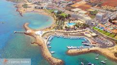
- Cyprus – Larnaca, Limassol, Protaras, Tuscany.
- Albania – Vlora, Himara, Saranda.
- Greece - Crete, Kythira, Methoni, Rhodes.
 Also access to sunny beaches have such countries on the Mediterranean as the Palestinian State and Northern region Cyprus, as well as Dhakelia, Gibraltar and Akrotiri. Undoubtedly, the most popular among tourists from this list of countries are Greece, Spain, Turkey, Cyprus, Egypt, Italy and France. This is where lovers flock beach holiday from all over the planet, because here they are equipped best beaches and resort areas.
 The depth of the Mediterranean Sea is quite varied and depends on the region. Conventionally, the Mediterranean can be divided into three main basins - western, central and eastern. What depth is in each of the basins can be seen on the depth map, because the bottom topography of such a huge reservoir differs in structure in each region. The maximum depth is observed in southern Greece in the deep-sea trench and is 5120 m. However, the average depth of the Mediterranean Sea does not exceed 1540 m.
The length and width of the Mediterranean Sea is not indicated accurately; the fact is that the basin is constantly changing its boundaries and it is almost impossible to calculate exact values. The length of the Mediterranean Sea from the northernmost to the southernmost section is approximately 3200 km, and from the western to the easternmost point 1200 km. Total area is 2,500 sq. km. The water temperature in the winter months is 12C°, and in the high summer season 25C°.
 An interesting fact: scientists believe that the Mediterranean basin is nothing more than the remains of the ancient prehistoric Tethys oceanic basin, which covered the main part of the planet with water. In addition to the Mediterranean, these remnants also include the Black Sea, the Aral and the Caspian. Today, the Mediterranean is connected to the Atlantic Ocean by a strait called the Strait of Gibraltar, this is known to everyone, but not many know that this strait passes between two rocks that were on Earth in the times of ancient heroes and were then called the Pillars of Hercules.
To understand what washes the Mediterranean Sea, you should look at geographical images of the planet. Satellite filming and paper maps you can see that four largest peninsulas crash into the waters of the Mediterranean Sea, these are the Apennine, Balkan, Iberian peninsulas and Asia Minor. Also in the Mediterranean waters there is a cluster of the largest islands, which are also loved by tourists, in the first place are Sicily, Ibiza, Crete, Malta and Rhodes.
Interesting history of the Mediterranean. This is one of the largest seas on our planet, its area (with the Marmara, Black and Azov seas) is about three million square kilometers.
Depth of the Mediterranean Sea
This is one of the deepest seas: maximum depth of the Mediterranean Sea- 4404 meters. It washes three parts of the world: Europe, Asia, Africa. Famous rivers flow into it: Nile, Danube, Dnieper, Don, Po, Rhone. The greatest civilizations in cultural history flourished on its banks. And it cannot be compared with any other sea! In the memory of mankind, this sea behaved quite normally. In winter it thundered with cruel storms, in summer it invited its gold sandy beaches into warm and gentle waters. Sometimes volcanoes erupted on its coasts and in its depths, sometimes local uplifts and subsidences of the bottom occurred. But all this did not make serious changes to the outlines of its banks. However, today science is not content with the short memory that humanity has; it explores in more detail the origin of the Universe (in more detail:) in which it lives, and which it has, and the seas on which it floats. Including the Mediterranean Sea.Mediterranean six million years ago
Almost two hundred years ago, back in 1833, the English geologist Charles Lyell studied the history of the Mediterranean Sea. He noticed that approximately six million years ago marine fauna Mediterranean, which had mixed features of the Atlantic and Indian faunas (for the Mediterranean Sea initially had outlets into both great oceans of the earth), basically died. Charles Lyell - studied the history of the Mediterranean Sea. Living conditions in the waters of the sea became unbearable: it quickly became shallow, and the salinity of its waters increased sharply. This could only happen in one case: external waters - ocean waters - stopped flowing into the sea basin, and the sea was left on a starvation diet. If geographical maps drawn in those days, the place of the famous sea would be occupied by a dead desert. It would be a completely special desert, lying, according to some scientists, more than two kilometers below sea level. True, there would have been several lakes left in it, into which rivers flowed, but, despite the constant influx of fresh water, these lakes were so salty that almost nothing living was found in them. Only a few dwarf species of mollusks and snails that could withstand the ultra-high salinity of their habitat remained. The desert floor of the Mediterranean Sea was cut by deep canyons; along them flowed into the remaining small salt lakes those great rivers that still flow into it today. Back at the end of the 19th century, during the search for groundwater, they discovered the ancient bed of the Rhone, a river flowing into the Mediterranean Sea at south coast France. In the delta, it was covered with sediments about a kilometer deep. Russian geologist I. S. Chumakov, who worked on the construction of the Aswan hydroelectric dam, while drilling, discovered a narrow deep gorge, cutting through the granite thickness of the continent two hundred meters below today's sea level. But Aswan is located more than a thousand kilometers from the mouth of the great river! In today's Nile Delta, wells three hundred meters deep were unable to reach the bottom of the ancient canyon. Chumakov believes that here it descends to a depth of about one and a half kilometers below modern sea level. Similar narrow gorges-canyons were discovered at different times in Algeria, Syria, Israel and other countries lying around the modern Mediterranean Sea. All of them were formed at a time when the Mediterranean Sea did not exist.
 History of the Mediterranean Sea and its structure
Scientists who studied history of the Mediterranean Sea and its structure, found that over the course of millions of years, the opening and closing of the strait connecting the sea with the ocean occurred repeatedly. The drying out of the sea proceeded quite quickly: it only took about a thousand years. It probably took no more time to refill it with ocean waters. At the same time, at the junction of the reservoirs, a powerful waterfall arose, in which the total height of the water fall reached two to three kilometers, and the water flow exceeded the flow of Niagara Falls by about a thousand times. The history of the Mediterranean Sea is measured in millions of years. Engineers of the 20th century developed a project for the construction of a giant vessel in the Strait of Gibraltar, which would operate on the difference in water drops in the Atlantic Ocean and the Mediterranean Sea. In order for this difference in drops to occur, the sea is supposed to be “dried out” somewhat, preventing the influx of Atlantic waters into it. After all, about one and a half thousand cubic kilometers of water evaporate from its surface every year. Well, when the difference in levels reaches fifty meters, powerful hydraulic turbines will be turned on... In addition to using the gigantic power of the planned power plant, the project has other plans. Large spaces will be exposed that can be used for planting vineyards and fruit trees. However, this project is unlikely to be implemented: it could lead to climate changes throughout Europe, which cannot be compensated for by any benefits. But science is not yet able to foresee these consequences in advance. About five and a half million years ago, a powerful earthquake destroyed mountain range, separating the Atlantic Ocean from the Mediterranean Sea, and formed the Strait of Gibraltar. But in those days, the Mediterranean Sea could receive an influx of water from another source. No, we're not talking about Indian Ocean. In those days, east and north of the Mediterranean Sea lay a gigantic lake-sea. It completely covered the Black, Azov, Caspian and Aral seas. Of course, the waters of this huge lake-sea would have poured into the almost waterless basin of the Mediterranean Sea in those days, but the path was cut off by the then young Carpathians. By the way, the waters of this lake-sea, in all likelihood, were either fresh or only slightly brackish. The Black Sea was practically fresh in those years. And even when its contours approached modern ones. And this was about three million years ago... Salty waters of the Mediterranean Sea were able to penetrate Black Sea basin approximately 370 thousand years ago. Their influx stopped 230 thousand years ago. After this, new movements of the earth's crust in the area of the straits of the Sea of Marmara closed the passage.
  Waters of the Mediterranean Sea in the Black Sea basin. The Black Sea switched to being fed only by the waters of inflowing rivers and began to quickly become desalinated. Rostov scientist discovered the first phase of salinization of the Black Sea B. L. Soloviev. In the area of the city of Sukhumi, he found the fossilized remains of salt-loving Mediterranean mollusks and was able to accurately determine their age. This discovery was made already in the 70s of the twentieth century. After this, the Black Sea experienced a series of successive salinizations and desalinations. The next salinization occurred about 175 thousand years ago, then 100 thousand years ago, then 52 thousand years ago. 38 thousand years ago the sea again became fresh and remained so for several tens of thousands of years. And only 7 thousand years ago, when the doors of the Sea of Marmara once again opened, another salinization of the Black Sea occurred, which continues to this day.
  Salinization of the Black Sea occurred 7 thousand years ago. Of course, today a person can separate the Black Sea basin from the influx of salty waters from the Mediterranean Sea; moreover, by building a dam, it will be possible to build a fairly powerful power plant on the resulting water difference. But is it necessary to build such a dam? How to calculate the climate changes that its construction will cause? After all, then the shallow waters will be exposed. A significant part of the Sea of Azov will dry up. There will only be freshwater lake, fed by the waters of the Don River. What will happen to the famous resorts of Crimea and the Caucasus coast? What will happen to well-equipped ports and berths? No, the construction of such a dam and power plant is unlikely to have more pros than cons. The age and history of the Mediterranean Sea is measured in millions of years.
 The Mediterranean Sea is an inland sea of the Atlantic Ocean located between Eurasia and Africa. This water area has an average depth of 1.5 km and washes the shores of many countries, including Italy, Greece, France, Spain, Turkey, Israel, Egypt, etc. Narrow expanses of water - the Strait of Gibraltar, the Dardanelles, the Bosphorus, the Suez Canal - connect the Mediterranean Sea basin with The Atlantic Ocean, the Black Sea, the Sea of Marmara, and the Red Sea, respectively.
The Mediterranean region is considered the cradle of ancient civilizations; powerful ancient states competed for dominance over its coast. The warm, dry and favorable Mediterranean climate and bright blue sea attract people from all over the world. Even the name of the Mediterranean Sea is rich in its history.
Interesting facts: The Mediterranean Sea includes the Tyrrhenian Sea adjacent to the western Italian coast; the Adriatic Sea, stretching along the eastern coast of Italy; Ionian Sea, located between Sicily and Crete; The Aegean Sea, separating Greece and Turkey, etc.
Ancient civilizations of the Mediterranean
 Mediterranean Sea on the world map
 The historical region in the Mediterranean basin was inhabited by many ancient peoples - Phoenicians, Egyptians, Carthaginians, Greeks, Romans and Middle Eastern cultures (Arab, Persian, etc.). The sea in the center of the region was a transport route, a route for traders and travelers, which contributed to the development of trade and the establishment of cultural ties between the peoples of the Mediterranean.
Interesting facts: The largest islands in the Mediterranean Sea are about. Sicily, o. Sardinia, belonging to the territory of Italy; O. Cyprus, french island Corsica and the Greek island of Crete.
The most famous Mediterranean civilizations are: Greek city-states and Phoenicians. The ancient Greeks called the sea by the names of individual parts of the reservoir (“Cretan Sea”, “Sea of Io” (Ionian), etc.), since they did not have a common name for the entire water basin. Among the Carthaginians the name “Syrian Sea” was common; in Egypt the body of water was called “Great Green Water”.
"Our Sea" (Mare Nostrum)
 Territory of the Roman Empire in the 2nd century
 Greece, Carthage, Egypt and Rome vied for control of the Mediterranean coast. The Romans, who conquered the Mediterranean region before the 2nd century, called the sea Mare Nostrum, which translated means “Our Sea”. The term Mare Nostrum was originally used by the Romans to refer to the Tyrrhenian Sea after their conquest of Corsica, Sicily, Sardinia during the Punic Wars with Carthage. By the first half of the 1st century BC. e. Roman rule extended from the Iberian Peninsula to Egypt, and the term "Our Sea" came to be used to refer to the entire Mediterranean Sea. Other Roman names for the Mediterranean Sea are also known, including “Inland Sea” (Mare Internum), since the coastal lands belonged to the Roman Empire at its height.
"Mediterranean Sea" (Mare Mediterraneum)
 Strait of Gibraltar
 In the 7th century, the name “Mediterranean Sea” (Mare Mediterraneum) spread. The term Mediterraneum comes from the Latin mediterraneus (Latin medius - middle, terra - earth), which translated means “in the middle of the earth”, “surrounded by the earth”. This name is justified in relation to the location of the sea, since it is surrounded by land, the coastline breaks are narrow: the width of the Strait of Gibraltar, connecting the sea in the western part with the Atlantic Ocean, is only 14 km; Dardanelles Strait – 1.3 km. The ancient Romans also discovered that the Mediterranean Sea is located at the center of the Earth.
The hydronym “Mediterranean Sea” was first used in the 3rd century by the Roman antiquarian writer Gaius Julius Solinus in the geographical work “On the Worthy of Memory.”
Other names
In the Old Testament the Mediterranean Sea is called " Western sea» due to the fit to west bank Holy Land. In biblical texts the name “Sea of the Philistines” is also found, which arose on behalf of the people who inhabited the Mediterranean coast near Israel. However, the name “Great Sea” or simply “Sea” prevails.
In Hebrew, Mediterranean means “Middle Sea”; in Arabic and Turkish - “White Sea”, because in eastern countries white signified west. The term may also have arisen in opposition to the "Black Sea".
Interesting fact: The Mediterranean Sea is one of the saltiest and warm seas World ocean. Winter water temperature is on average 10 °C, in summer – 22 °C. The average salinity of the Mediterranean Sea (38‰) exceeds the average salt concentration in the Atlantic Ocean (35‰).
Thus, the ancient peoples who inhabited the Mediterranean region gave different names to the sea around which they were located: “Western Sea”, “Great Sea”, “Inland Sea”, etc. The Romans, having conquered the entire Mediterranean region, called the body of water “Our Sea” (Mare Nostrum). In the 7th century, the hydronym Mare Mediterraneum (“Mediterranean Sea”), which comes from the Latin word mediterraneus and is translated as “sea among the earth,” “sea surrounded by earth,” spread.
This is due to the fact that the sea is located among the lands that made up civilization Ancient world, it is surrounded on all sides by land, with the exception of narrow straits. In addition, the ancient Romans considered the Mediterranean Sea to be the center of the Earth. The meaning of the Mediterranean Sea, like its name, remains to this day - it is a transport and trade route that connects three parts of the world - Europe, Asia and Africa.
If you find an error, please select a piece of text and click Ctrl+Enter.