Caspian Sea height above sea level. Caspian Sea
The Caspian Sea is simultaneously considered both an endorheic lake and a full-fledged sea. The reasons for this confusion are brackish waters and a hydrological regime similar to the sea.
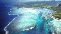
The Caspian Sea is located on the border of Asia and Europe. Its area is about 370 thousand km 2, its maximum depth is just over one kilometer. The Caspian Sea is conventionally divided into three almost equal parts: Southern (39% of the area), Middle (36%) and Northern (25%).
The sea washes simultaneously the Russian, Kazakh, Azerbaijani, Turkmen and Iranian shores.
Shore Caspian Sea (Caspian Sea) has a length of approximately 7 thousand kilometers, if you count it together with the islands. In the north, the low seashore is covered with swamps and thickets, and has multiple water channels. The eastern and western coasts of the Caspian Sea have a winding shape; in some places the shores are covered with limestone.
There are many islands in the Caspian Sea: Dash-Zira, Kur Dashi, Dzhambaisky, Boyuk-Zira, Gum, Chigil, Here-Zira, Zenbil, Ogurchinsky, Tyuleniy, Ashur-Ada, etc. Peninsulas: Mangyshlak, Tyub-Karagan, Absheron and Miankale. Their total area is approximately 400 km 2.
Flows into the Caspian Sea more than a hundred different rivers, the most significant are the Ural, Terek, Volga, Atrek, Emba, Samur. Almost all of them provide 85–95% of their annual flow to the sea.
The largest bays of the Caspian Sea: Kaydak, Agrakhansky, Kazakh, Dead Kultuk, Turkmenbashi, Mangyshlaksky, Gyzlar, Girkan, Kaydak.

Climate of the Caspian Sea
The Caspian Sea is located in three climatic zones: subtropical climate in the south, continental in the north and temperate in the middle. In winter, the average temperature varies from -10 to +10 degrees, while in summer the air warms up to about +25 degrees. During the year, precipitation ranges from 110 mm in the east to 1500 mm in the west.
The average wind speed is 3–7 m/s, but in autumn and winter it often increases to 35 m/s. The most windy areas are the coastal areas of Makhachkala, Derbent and the Absheron Peninsula.
Water temperature in the Caspian Sea ranges from zero to +10 degrees in winter, and from 23 to 28 degrees in the summer months. In some coastal shallow waters the water can warm up to 35-40 degrees.
Only the northern part of the sea is subject to freezing, but in especially cold winters the coastal zones of the middle part are added to it. Ice cover appears in November and disappears only in March.

Problems of the Caspian region
Water pollution is one of the main environmental problems of the Caspian Sea. Oil production, various harmful substances from flowing rivers, waste from nearby cities - all this negatively affects the condition of sea water. Additional troubles are also caused by poachers, whose actions reduce the number of fish of certain species found in the Caspian Sea.
Rising sea levels are also causing serious financial damage to all Caspian countries.
According to conservative estimates, restoring destroyed buildings and taking comprehensive measures to protect the coast from flooding costs tens of millions of dollars.

Cities and resorts on the Caspian Sea
The most big city and the port washed by the waters of the Caspian Sea is Baku. Among others settlements Azerbaijan, located in close proximity to the sea, are Sumgayit and Lankaran. On the eastern shores is the city of Turkmenbashi, and about ten kilometers from it by the sea is the large Turkmen resort of Avaza.
On the Russian side, on the seashore there are the following cities: Makhachkala, Izberbash, Derbent, Lagan and Kaspiysk. Astrakhan is often called a port city, although it is located approximately 65 kilometers from the northern shores of the Caspian Sea.

Astrakhan
There are no beach holidays in this region: along sea coast there are only continuous reed thickets. However, tourists go to Astrakhan not for idle lying on the beach, but for fishing and various types of active recreation: diving, catamaran riding, jet skiing, etc. In July and August, excursion ships ply along the Caspian Sea.

Dagestan
For a classic seaside holiday, it is better to go to Makhachkala, Kaspiysk or Izberbash - this is where not only good sandy beaches are located, but also decent recreation centers. The range of entertainment on the seashore on the Dagestan side is quite wide: swimming, healing mud springs, windsurfing, kiting, rock climbing and paragliding.
The only disadvantage of this direction is the underdeveloped infrastructure.
In addition, among some Russian tourists There is an opinion that Dagestan is far from the most peaceful territory that is part of the North Caucasus Federal District.

Kazakhstan
A much calmer environment can be found in the Kazakh resorts of Kuryk, Atyrau and Aktau. The last one is the most popular tourist city Kazakhstan: there are many good entertainment venues and well-maintained beaches. In summer, the temperature here is very high, reaching up to +40 degrees during the daytime, and dropping only to +30 at night.
Disadvantages of Kazakhstan tourist country— the same poor infrastructure and rudimentary transport links between regions.

Azerbaijan
The most the best places Baku, Nabran, Lankaran and other Azerbaijani resorts are considered for holidays on the Caspian coast. Fortunately, everything is fine with the infrastructure in this country: for example, several modern comfortable hotels with swimming pools and beaches have been built in the Absheron Peninsula area.
However, in order to enjoy a holiday on the Caspian Sea in Azerbaijan, you need to spend a lot of money. In addition, you can only get to Baku quickly enough by plane - trains rarely run, and the journey from Russia itself takes two to three days.
Tourists should not forget that Dagestan and Azerbaijan are Islamic countries, so all “non-believers” need to adapt their usual behavior to local customs.
If you follow simple rules of stay, nothing will spoil your vacation on the Caspian Sea.
Holidays on the shores of the Caspian Sea– an excellent alternative for those who want to have a pleasant rest away from the hustle and bustle.
And also to gain new impressions and vitality, to improve the health of children, but does not have the financial means to travel to distant warm countries.
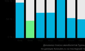
Cheap flights to Makhachkala
General information
The Caspian Sea, which is the most large lake in the world, stretches from North to South for about 1200 km. Its width is on average up to 320 km. The water surface area is about 370 thousand km2. The level of the Caspian Sea is almost 28 meters below ocean level.

The maximum depth was recorded in the South Caspian depression and is 1025 meters.
The unique sea-lake is rich in small islands, about 50 of them.
More than 100 rivers flow into the sea, among them the Volga, Ural, Kura, Atrek, Terek and others.
The Caspian Sea is famous for its unique flora and fauna.
In its warm waters you can find more than 850 species of fish and animals, and more than 500 species of plants. Many representatives of flora and fauna are listed in the Red Book.

The sea is rich in fish, including valuable sturgeon. The Caspian seal lives in warm waters. There are no sharks or other fish that are predatory and dangerous to humans.
Nature lovers can visit the famous Astrakhan International Biosphere Reserve. This is a magnificent natural monument.
In spring and summer, people especially come here to admire an amazingly beautiful phenomenon: fields of blooming lotus.
Russian resorts of the Caspian Sea
The length of the coast of the Russian part of the Caspian Sea is more than 600 kilometers.
Large sandy beaches, warm sea, pleasant weather - excellent prospects for organizing a quality summer holiday.
The best Russian resorts The Caspian Sea is located in Dagestan.

Makhachkala, Kaspiysk, Izberbash, Lagan, Derbent, Dagestan Lights - famous seaside resort towns.
Climate
The coast of the Astrakhan region has a temperate climate. Warm weather lasts from the first days of May until the first half of September.
During the season, clear, warm weather prevails ( average temperature 24-25 0 C). Cloudy days and rain are rare.
Most hot month- July.

In summer, the sea water warms up to 23-28°C along the entire length of the Russian coastline.
Accommodation
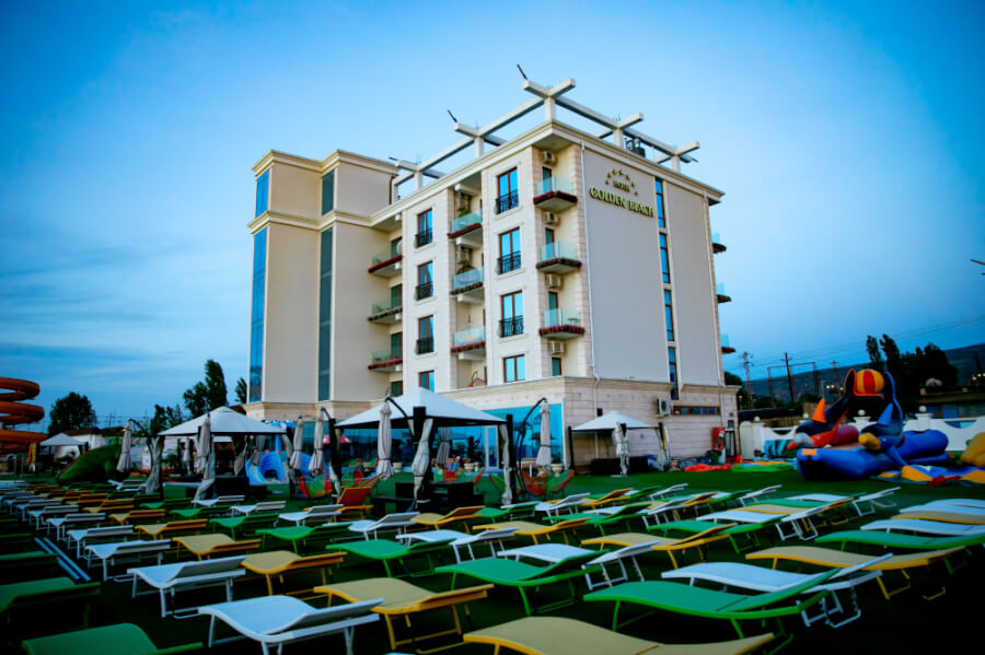
There are more than 150 boarding houses and recreation centers on the Caspian coast of Russia.
Vacationers can buy a ticket in advance or register on the spot.

In Derbent and Kaspiysk, tourists will be warmly greeted by the staff of large, comfortable hotels.
Small cozy hotels are also available for vacationers. family vacation. You can find comfortable housing in the private sector. Prices are very affordable .
How to get there?
You can get to the Astrakhan coast of the Caspian Sea by the following route: by train or plane to the regional center of Astrakhan, and then by bus, taxi or by water transport to your destination.
The resorts of Dagestan can be reached by local transport(bus, taxi) from the capital of the republic, Makhachkala, which can be reached by train or intercity bus.
Treatment
Those who wish can relax and undergo treatment at the Caspiy sanatorium, which is located on the seashore 40 km from Makhachkala.
This hydropathic clinic with healing mineral baths is equipped with modern diagnostic equipment.

The course of treatment is designed for 21 days, which gives a noticeable balneological effect.
Sanatorium "Lezzet"- climatic, sea, balneo-mud resort on the Caspian Sea. It is located 8 kilometers from Makhachkala airport.
Specialized areas: diseases of the nervous, musculoskeletal, genitourinary, digestive, cardiovascular, respiratory systems, gynecological problems and infertility.
The resort will help you combine seaside holidays with treatment "Talgi". The health resort is located in Makhachkala.
Specialization: treatment and prevention of diseases of the joints, nervous and genitourinary systems. Unique sulfide waters with hydrogen sulfide are used for treatment.
Recreation and entertainment
All resorts and health resorts on the Russian coast have developed infrastructure and created conditions for a good rest:
- sports facilities;
- cafes, restaurants;
- various attractions;
- Boat trips, fishing, and thematic excursions are organized for those interested.

Holidays in the Astrakhan region
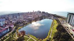
The city of Astrakhan is located in the Caspian lowland in the delta of the Volga River. This ancient city included in tourist tours and popular among travelers.
Guests are attracted by the wonderful architectural ensembles, majestic churches, interesting museums.
At the end of summer and autumn, you can enjoy the famous Astrakhan watermelons and fragrant melons from the garden.

From the regional center to the Caspian Sea is only 60 km.
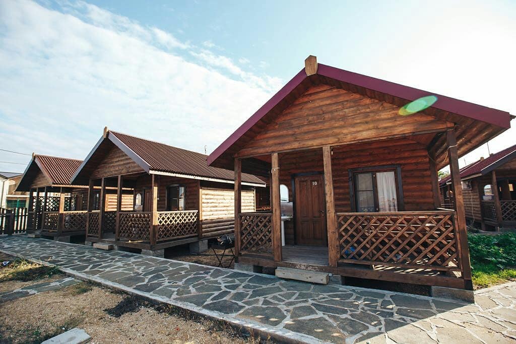
The most common and affordable housing for vacationers and tourists in the Volga delta and on the Caspian coast are recreation centers. As a rule, these are small cozy houses located in picturesque corners.
"Dardanelles", recreation center
The Astrakhan region is an excellent region for lovers of fishing and outdoor activities.
Fishermen have long chosen the Dardanelles recreation center, located in the Volga River delta.
In the modern building, the rooms are equipped with air conditioning, refrigerators, and bathrooms.

Dardanelles
For vacationers, high-quality meals are provided three times a day.
At the base restaurant you can prepare delicious dishes from your own catch.
Vacationers have a sauna and billiards at their disposal. Guests are offered a variety of excursions, including to Astrakhan, boat trips on the sea and the Volga.
Address: s. Zaton, Kamyzyaksky district, Astrakhan region (base 9 km).
"Tortuga", fishing base
"Tortuga" in terms of cost of living is not very different from "Dardanelle".
A standard house has comfortable furniture, household appliances, necessary utensils, and bathrooms. It is very comfortable for families with children to stay here.

Those who wish can stay in a floating house. Necessary for fishing Equipment can be rented on site.
Address: s. Vyshka, Limansky district, Astrakhan region.
Country of mountains - Dagestan- offers tourists the sandy beaches of the Caspian Sea, ski resorts, unique nature and culture, ancient monuments and wonderful national cuisine.

And although the idea of holidays in Dagestan is perceived ambiguously due to doubts about safety, many guests come to the republic. This mountain region is very beautiful and original.
Resort complex "Chindirchero"
This popular holiday destination welcomes guests all year round.
In summer, guests can enjoy relaxing by the sea.
For vacationers:
- windsurfing;
- kiting;
- rafting.

Chindirchero
All conditions for paragliding and rock climbing have also been created.
In winter, Chindirchero is a popular ski resort.
Address: s. Ginta, Akushinsky district, Makhachkala,
Derbent
Derbent, a city with a history of 5 thousand years, is one of the most attractive resorts for tourism on the shores of the Caspian Sea.
Derbent region is a subtropical paradise with the riot of nature and plenty of sun. The beauty of the sea coast is framed by picturesque mountains.
Derbent has many ancient monuments and interesting sights. Vacationers can enjoy exciting excursions, including helicopter ones. There are hotels, inns, and tourist centers both in the city and in its surroundings.
The most popular hotels in Derbent:
- Hotel Krasny Bak;
- Hotel Complex Europe;
- Elit Hotel.
The resort can be reached by train or regular minibus from the bus station of Makhachkala or Kaspiysk. The Moscow - Baku train stops in Derbent.
Izberbash
This colorful city is located at the foothills of the Greater Caucasus, covered with picturesque forests.
Izberbash
The warm sea, extensive sandy beaches, and amazing landscapes attract tourists.
The combination of sea and mountain air and the presence of healing mineral springs make it possible to improve your health.
Tourist base "Priboy"
The windows of the three-story building of the tourist center offer magnificent views. The living rooms have all the necessary amenities, air conditioning and TVs. Vacationers have a clean, well-maintained beach at their disposal.

The camp site offers delicious, healthy food, a cozy bar, and a guarded parking lot.
Address: pos. Primorsky, Izberbash.
Reviews
“We came for the first time from Orenburg. Nature is simply a miracle! Everything is so beautiful – I didn’t part with my camera. The base itself is a most picturesque corner. An ideal place to relax. It’s a pity that we didn’t provide complete information and came for a three-day tour.
Next time we'll try to stay longer. Excellent service. Such hospitality and cordiality is rare to find. We left with great regret. We will definitely come back."
“There are beaches in Derbent. But most of them are rented from private owners. City beaches usually quickly fill with garbage and are poorly cleaned, and this fact does not even soften the charm of clear, beautiful, warm sea water.”
Resorts of Kazakhstan on the Caspian Sea
Amazing nature and warm healing water of the sea make holidays in the Caspian Sea very attractive.
People come to Kazakhstan to the coast to relax and improve their health. It offers comfortable sandy beaches, natural mineral springs and healing mud.

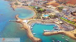
Aktau is the only city near the Caspian Sea in Kazakhstan.
On the Kazakh coast, the infrastructure is not yet very developed. However, there are already many pleasant places where tourists come with pleasure.
How to get there?
You can only get to Aktau by train or plane.
Getting there by road is difficult not only because of the very long distance, but also because of the quality of local roads.
Climate
On the coast of the Caspian Sea, winters are mild and summers are dry and warm.
On a summer day, the air temperature rises to +30..+32 degrees, and at night drops to +20 degrees.
The beach season lasts from May to September.

Accommodation
There will be no problems with accommodation in Aktau, even if you do not come with a tour package. There are more than 20 modern comfortable hotels in the city.
The most popular of them:
- "Aktau";
- "Chagala" ;
- "Zheruyik".
Treatment
On the Kazakh shore of the Caspian Sea, two large medical and health complexes can be distinguished:
- “Kenderli” – 300 km from Aktau;
- Steagle, near the city.
The unique balneological hospital “Chagala” is located within the city.
Recreation and entertainment
"Kenderlik"
A sports and fitness complex is located near Aktau. It attracts lovers of active recreation.
This modern complex meets all international norms and standards.

Kenderli
Guests stay in small cozy cottages located on the shore or in comfortable hotel rooms, which include a sauna, indoor pool, solarium and winter garden.
At the service of vacationers billiard room, gyms, tennis courts, outdoor summer swimming pool, football and volleyball courts, bowling alley, dance floor, bars and restaurant.
"Chagala", sanatorium
The sanatorium-preventorium “Chagala” (“Chaika”) offers quality rest and recreation. This is a unique balneological hospital. It is located on the shores of the Caspian Sea, within the city of Aktau.

Guests are offered one and double rooms with amenities. The sanatorium building has a comfortable winter garden where you can relax and admire exotic plants.
Vacationers can visit entertainment center, casino, technology park, roller skating area.
New impressions will be given sightseeing tours By historical places and natural monuments of Mangyshlak.
Address: Aktau, mn 1, coastal zone.
On the seashore, 18 kilometers from Aktau, there is a modern sports and recreational entertainment center “Stigl”.
There are two hotels on the territory of the center. This complex is equipped in accordance with international standards.

On its territory there is a unique sea sauna, SPA salon, fitness center, massage rooms, as well as cafes, restaurants, and attractions.
, Kazakhstan, Turkmenistan, Iran, Azerbaijan
Geographical location

Caspian Sea - view from space.
The Caspian Sea is located at the junction of two parts of the Eurasian continent - Europe and Asia. The length of the Caspian Sea from north to south is approximately 1200 kilometers (36°34"-47°13" N), from west to east - from 195 to 435 kilometers, on average 310-320 kilometers (46°-56° c. d.).
The Caspian Sea is conventionally divided according to physical and geographical conditions into 3 parts - Northern Caspian, Middle Caspian and Southern Caspian. The conditional border between the Northern and Middle Caspian runs along the line of the island. Chechen - Cape Tyub-Karagansky, between the Middle and Southern Caspian Sea - along the line of the island. Residential - Cape Gan-Gulu. The area of the Northern, Middle and Southern Caspian Sea is 25, 36, 39 percent, respectively.
Coast of the Caspian Sea

Coast of the Caspian Sea in Turkmenistan
The territory adjacent to the Caspian Sea is called the Caspian region.
Peninsulas of the Caspian Sea
- Ashur-Ada
- Garasu
- Zyanbil
- Khara-Zira
- Sengi-Mugan
- Chygyl
Bays of the Caspian Sea
- Russia (Dagestan, Kalmykia and Astrakhan region) - in the west and northwest, the length of the coastline is about 1930 kilometers
- Kazakhstan - in the north, northeast and east, the length of the coastline is about 2320 kilometers
- Turkmenistan - in the southeast, the length of the coastline is about 650 kilometers
- Iran - in the south, the length of the coastline is about 1000 kilometers
- Azerbaijan - in the southwest, the length of the coastline is about 800 kilometers
Cities on the Caspian Sea coast
On the Russian coast there are cities - Lagan, Makhachkala, Kaspiysk, Izberbash and the most southern city Russia Derbent. port city Astrakhan is also considered to be part of the Caspian Sea, which, however, is not located on the shores of the Caspian Sea, but in the Volga delta, 60 kilometers from the northern coast of the Caspian Sea.
Physiography
Area, depth, volume of water
The area and volume of water in the Caspian Sea varies significantly depending on fluctuations in water levels. At a water level of −26.75 m, the area is approximately 371,000 square kilometers, the volume of water is 78,648 cubic kilometers, which is approximately 44% of the world's lake water reserves. The maximum depth of the Caspian Sea is in the South Caspian depression, 1025 meters from its surface level. In terms of maximum depth, the Caspian Sea is second only to Baikal (1620 m) and Tanganyika (1435 m). The average depth of the Caspian Sea, calculated from the bathygraphic curve, is 208 meters. At the same time, the northern part of the Caspian Sea is shallow, its maximum depth does not exceed 25 meters, and the average depth is 4 meters.
Water level fluctuations
Flora
The flora of the Caspian Sea and its coast is represented by 728 species. The predominant plants in the Caspian Sea are algae - blue-green, diatoms, red, brown, characeae and others, and flowering plants - zoster and ruppia. In origin, the flora is predominantly of Neogene age, but some plants were brought into the Caspian Sea by humans deliberately or on the bottoms of ships.
History of the Caspian Sea
Origin of the Caspian Sea
Anthropological and cultural history of the Caspian Sea
Finds in the Khuto Cave off the southern coast of the Caspian Sea indicate that man lived in these areas approximately 75 thousand years ago. The first mentions of the Caspian Sea and the tribes living on its coast are found in Herodotus. Around the V-II centuries. BC e. Saka tribes lived on the Caspian coast. Later, during the period of settlement of the Turks, in the period of the 4th-5th centuries. n. e. Talysh tribes (Talysh) lived here. According to ancient Armenian and Iranian manuscripts, Russians sailed the Caspian Sea from the 9th-10th centuries.
Research of the Caspian Sea
Research of the Caspian Sea was started by Peter the Great, when, on his order, an expedition was organized in 1714-1715 under the leadership of A. Bekovich-Cherkassky. In the 1720s, hydrographic research was continued by the expedition of Karl von Werden and F.I. Soimonov, and later by I.V. Tokmachev, M.I. Voinovich and other researchers. At the beginning of the 19th century, instrumental surveys of the shores were carried out by I. F. Kolodkin, in the mid-19th century. - instrumental geographical survey under the direction of N. A. Ivashintsev. Since 1866, for more than 50 years, expeditionary research on the hydrology and hydrobiology of the Caspian Sea was carried out under the leadership of N. M. Knipovich. In 1897, the Astrakhan Research Station was founded. In the first decades of Soviet power, geological research by I.M. Gubkin and other Soviet geologists was actively carried out in the Caspian Sea, mainly aimed at searching for oil, as well as research into the water balance and level fluctuations of the Caspian Sea.
Economy of the Caspian Sea
Oil and gas production
Many oil and gas fields are being developed in the Caspian Sea. Proven oil resources in the Caspian Sea are about 10 billion tons, total oil and gas condensate resources are estimated at 18-20 billion tons.
Oil production in the Caspian Sea began in 1820, when the first oil well was drilled on the Absheron shelf near Baku. In the second half of the 19th century, oil production began on an industrial scale on the Absheron Peninsula, and then in other territories.
Shipping
Shipping is developed in the Caspian Sea. There are ferry crossings on the Caspian Sea, in particular, Baku - Turkmenbashi, Baku - Aktau, Makhachkala - Aktau. The Caspian Sea has a shipping connection with Sea of Azov through the Volga, Don and Volga-Don Canal rivers.
Fishing and seafood production
Fishing (sturgeon, bream, carp, pike perch, sprat), caviar production, as well as seal fishing. More than 90 percent of the world's sturgeon catch occurs in the Caspian Sea. In addition to industrial mining, illegal fishing of sturgeon and their caviar flourishes in the Caspian Sea.
Recreational resources
Natural environment of the Caspian coast with sandy beaches, mineral waters and healing mud in the coastal zone creates good conditions for relaxation and treatment. At the same time, in terms of the degree of development of resorts and the tourism industry, the Caspian coast is noticeably inferior to the Black Sea coast of the Caucasus. At the same time, in recent years, the tourism industry has been actively developing on the coasts of Azerbaijan, Iran, Turkmenistan and Russian Dagestan. In Azerbaijan, the resort area in the Baku region is actively developing. At the moment, a world-class resort has been created in Amburan, another modern tourist complex is being built in the area of the village of Nardaran, and holidays in the sanatoriums of the villages of Bilgah and Zagulba are very popular. A resort area is also being developed in Nabran, in northern Azerbaijan. However high prices, in general, the low level of service and lack of advertising lead to the fact that Caspian resorts almost no foreign tourists. The development of the tourism industry in Turkmenistan is hampered by a long-term policy of isolation, in Iran - by Sharia laws, due to which mass holidays of foreign tourists on the Caspian coast of Iran are impossible.
Environmental issues
Environmental problems of the Caspian Sea are associated with water pollution as a result of oil production and transportation on the continental shelf, the flow of pollutants from the Volga and other rivers flowing into the Caspian Sea, the life activity of coastal cities, as well as the flooding of individual objects due to rising levels of the Caspian Sea. Predatory production of sturgeon and their caviar, rampant poaching lead to a decrease in the number of sturgeon and to forced restrictions on their production and export.
International status of the Caspian Sea
Legal status of the Caspian Sea
After the collapse of the USSR, the division of the Caspian Sea has long been and still remains the subject of unresolved disagreements related to the division of Caspian shelf resources - oil and gas, as well as biological resources. For a long time, negotiations were ongoing between the Caspian states on the status of the Caspian Sea - Azerbaijan, Kazakhstan and Turkmenistan insisted on dividing the Caspian along the median line, Iran insisted on dividing the Caspian by one-fifth between all Caspian states.
In relation to the Caspian Sea, the key is the physical-geographical circumstance that it is a closed inland body of water that does not have a natural connection with the World Ocean. Accordingly, the norms and concepts of international maritime law, in particular, the provisions of the UN Convention on the Law of the Sea of 1982, should not be automatically applied to the Caspian Sea. Based on this, in relation to the Caspian Sea it would be unlawful to apply such concepts as “territorial sea”, “exclusive economic zone", "continental shelf", etc.
The current legal regime of the Caspian Sea was established by the Soviet-Iranian treaties of 1921 and 1940. These treaties provide for freedom of navigation throughout the sea, freedom of fishing with the exception of ten-mile national fishing zones and a ban on vessels flying the flag of non-Caspian states sailing in its waters.
Negotiations on the legal status of the Caspian Sea are currently ongoing.
Delineation of sections of the Caspian seabed for subsoil use
The Russian Federation concluded an agreement with Kazakhstan on delimiting the bottom of the northern part of the Caspian Sea in order to exercise sovereign rights to subsoil use (dated July 6, 1998 and the Protocol thereto dated May 13, 2002), an agreement with Azerbaijan on delimiting adjacent areas of the bottom of the northern part of the Caspian Sea (dated September 23, 2002), as well as the trilateral Russian-Azerbaijani-Kazakh agreement on the junction point of the demarcation lines of adjacent sections of the Caspian Sea bottom (dated May 14, 2003), which established geographical coordinates dividing lines limiting the areas of the seabed within which the parties exercise their sovereign rights in the field of exploration and production of mineral resources.
The coastline of the Caspian Sea is estimated at approximately 6,500 - 6,700 kilometers, with islands - up to 7,000 kilometers. The shores of the Caspian Sea in most of its territory are low-lying and smooth. In the northern part, the coastline is indented by water streams and islands of the Volga and Ural deltas, the banks are low and swampy, and the water surface in many places is covered with thickets. The east coast is dominated by limestone shores adjacent to semi-deserts and deserts. The most winding shores are on the western coast in the area of the Absheron Peninsula and on the eastern coast in the area of the Kazakh Gulf and Kara-Bogaz-Gol.
Peninsulas of the Caspian Sea
Large peninsulas of the Caspian Sea:
* Agrakhan Peninsula
* The Absheron Peninsula, located on the western coast of the Caspian Sea on the territory of Azerbaijan, at the northeastern end of the Greater Caucasus, on its territory the cities of Baku and Sumgait are located
* Buzachi
* Mangyshlak, located on the eastern coast of the Caspian Sea, on the territory of Kazakhstan, on its territory is the city of Aktau.
* Miankale
* Tub-Karagan
There are about 50 large and medium-sized islands in the Caspian Sea total area approximately 350 square kilometers.
Largest islands:
* Ashur-Ada
* Garasu
*Hum
* Dash
* Zira (island)
* Zyanbil
* Cure Dasha
* Khara-Zira
* Sengi-Mugan
* Chechen (island)
* Chygyl
Large bays of the Caspian Sea:
* Agrakhan Bay,
* Komsomolets (bay),
* Mangyshlak,
* Kazakh (bay),
* Turkmenbashi (bay) (formerly Krasnovodsk),
* Turkmen (bay),
* Gizilagach,
* Astrakhan (bay)
* Gyzlar
* Hyrcanus (formerly Astarabad) and
* Anzeli (formerly Pahlavi).
Rivers flowing into the Caspian Sea
130 rivers flow into the Caspian Sea, of which 9 rivers have a delta-shaped mouth. Large rivers flowing into the Caspian Sea are the Volga, Terek (Russia), Ural, Emba (Kazakhstan), Kura (Azerbaijan), Samur (Russian border with Azerbaijan), Atrek (Turkmenistan) and others. The largest river flowing into the Caspian Sea is the Volga, its average annual flow is 215-224 cubic kilometers. The Volga, Ural, Terek and Emba provide up to 88 - 90% of the annual runoff of the Caspian Sea.
Basin of the Caspian Sea
The area of the Caspian Sea basin is approximately 3.1 - 3.5 million square kilometers, which is approximately 10 percent of the world's closed water basin area. The length of the Caspian Sea basin from north to south is about 2500 kilometers, from west to east - about 1000 kilometers. The Caspian Sea basin covers 9 states - Azerbaijan, Armenia, Georgia, Iran, Kazakhstan, Russia, Uzbekistan, Turkey and Turkmenistan.
Coastal states
The Caspian Sea washes the shores of five coastal states:
* Russia (Dagestan, Kalmykia and Astrakhan region) - in the west and north-west, coastline length 695 kilometers
* Kazakhstan - in the north, northeast and east, coastline length 2320 kilometers
* Turkmenistan - in the southeast, the length of the coastline is 1200 kilometers
* Iran - in the south, coastline length - 724 kilometers
* Azerbaijan - in the southwest, coastline length 955 kilometers
Cities on the Caspian Sea coast
The largest city and port on the Caspian Sea is Baku, the capital of Azerbaijan, which is located in the southern part of the Absheron Peninsula and has a population of 2,070 thousand people (2003). Other major Azerbaijani Caspian cities are Sumgait, which is located in the northern part of the Absheron Peninsula, and Lankaran, which is located near the southern border of Azerbaijan. To the South-East of the Absheron Peninsula, the oil workers’ village of Neftyanye Kamni is located, the buildings of which stand on artificial islands, overpasses and technological sites.
Large Russian cities - the capital of Dagestan, Makhachkala, and the southernmost city of Russia, Derbent - are located on the western coast of the Caspian Sea. Astrakhan is also considered a port city of the Caspian Sea, which, however, is not located on the shores of the Caspian Sea, but in the Volga delta, 60 kilometers from the northern coast of the Caspian Sea.
On the eastern shore of the Caspian Sea there is a Kazakh city - the port of Aktau, in the north in the Ural delta, 20 km from the sea, the city of Atyrau is located, south of Kara-Bogaz-Gol on the northern shore of the Krasnovodsk Bay - the Turkmen city of Turkmenbashi, former Krasnovodsk. Several Caspian cities are located on the southern (Iranian) coast, the largest of them is Anzeli.
Area, depth, volume of water
The area and volume of water of the Caspian Sea varies significantly depending on fluctuations in water levels. At a water level of −26.75 m, the area was approximately 392,600 square kilometers, the volume of water was 78,648 cubic kilometers, which is approximately 44 percent of the world's lake water reserves. The maximum depth of the Caspian Sea is in the South Caspian depression, 1025 meters from its surface level. In terms of maximum depth, the Caspian Sea is second only to Baikal (1620 m) and Tanganyika (1435 m). The average depth of the Caspian Sea, calculated from the bathygraphic curve, is 208 meters. At the same time, the northern part of the Caspian Sea is shallow, its maximum depth does not exceed 25 meters, and the average depth is 4 meters.
Water level fluctuations
The water level in the Caspian Sea is subject to significant fluctuations. According to modern science, over the past 3 thousand years the amplitude of changes in the water level of the Caspian Sea has been 15 meters. Instrumental measurements of the level of the Caspian Sea and systematic observations of its fluctuations have been carried out since 1837, during which time the highest water level was recorded in 1882 (-25.2 m), the lowest in 1977 (-29.0 m) , since 1978, the water level has risen and in 1995 reached −26.7 m; since 1996, there has again been a downward trend in the level of the Caspian Sea. Scientists associate the reasons for changes in the water level of the Caspian Sea with climatic, geological and anthropogenic factors.
Water temperature
Water temperature is subject to significant latitudinal changes, most clearly expressed in winter, when the temperature varies from 0-0.5 °C at the ice edge in the north of the sea to 10-11 °C in the south, that is, the difference in water temperature is about 10 °C. For shallow areas with depths less than 25 m, the annual amplitude can reach 25-26 °C. On average the water temperature is west coast 1-2 °C higher than in the eastern sea, and in the open sea the water temperature is 2-4 °C higher than near the coasts. Based on the nature of the horizontal structure of the temperature field in the annual cycle of variability, three time periods can be distinguished in the upper 2-meter layer. From October to March, the water temperature increases in the southern and eastern regions, which is especially noticeable in the Middle Caspian. Two stable quasi-latitudinal zones can be distinguished, where temperature gradients are increased. This is, firstly, the border between the Northern and Middle Caspian, and, secondly, between the Middle and Southern. At the ice edge, in the northern frontal zone, the temperature in February-March increases from 0 to 5 °C, in the southern frontal zone, in the area of the Absheron threshold, from 7 to 10 °C. During this period, the least cooled waters are in the center of the South Caspian Sea, which form a quasi-stationary core.
In April-May, the area of minimum temperatures moves to the Middle Caspian Sea, which is associated with faster heating of waters in the shallow northern part of the sea. True, at the beginning of the season in the northern part of the sea large number heat is spent on melting the ice, but already in May the temperature here rises to 16-17 °C. In the middle part the temperature at this time is 13-15 °C, and in the south it increases to 17-18 °C.
Spring warming of water evens out horizontal gradients, and the temperature difference between coastal areas and the open sea does not exceed 0.5 °C. Warming up of the surface layer, starting in March, disrupts the uniformity of temperature distribution with depth. In June-September, horizontal homogeneity in the temperature distribution in the surface layer is observed. In August, which is the month of greatest warming, the water temperature throughout the sea is 24-26 °C, and in the southern regions it rises to 28 °C. In August, the water temperature in shallow bays, for example, in Krasnovodsk, can reach 32 °C. The main feature of the water temperature field at this time is upwelling. It is observed annually along the entire eastern coast of the Middle Caspian and partially penetrates even into the Southern Caspian.
The rise of cold deep waters occurs with varying intensity as a result of the influence of northwest winds prevailing in the summer season. The wind in this direction causes the outflow of warm surface waters from the coast and the rise of colder waters from the intermediate layers. Upwelling begins in June, but it reaches its greatest intensity in July-August. As a result, a decrease in temperature is observed on the surface of the water (7-15 °C). Horizontal temperature gradients reach 2.3 °C at the surface and 4.2 °C at a depth of 20 m.
The source of upwelling gradually shifts from 41-42° north. latitude in June, to 43-45° north. latitude in September. Summer upwelling is of great importance for the Caspian Sea, radically changing the dynamic processes in the deep-water area. In the open areas of the sea, at the end of May - beginning of June, the formation of a temperature jump layer begins, which is most clearly expressed in August. Most often it is located between horizons of 20 and 30 m in the middle part of the sea and 30 and 40 m in the southern part. Vertical temperature gradients in the shock layer are very significant and can reach several degrees per meter. In the middle part of the sea, due to the surge off the eastern coast, the shock layer rises close to the surface.
Since in the Caspian Sea there is no stable baroclinic layer with a large reserve of potential energy similar to the main thermocline of the World Ocean, then with the cessation of the prevailing winds causing upwelling and with the beginning of autumn-winter convection in October-November, a rapid restructuring of temperature fields to the winter regime occurs. In the open sea, the water temperature in the surface layer drops in the middle part to 12-13 °C, in the southern part to 16-17 °C. In the vertical structure, the shock layer is eroded due to convective mixing and disappears by the end of November.
Water composition
The salt composition of the waters of the closed Caspian Sea differs from the oceanic one. There are significant differences in the ratios of concentrations of salt-forming ions, especially for waters in areas directly influenced by continental runoff. The process of metamorphosis of sea waters under the influence of continental runoff leads to a decrease in the relative content of chlorides in the total amount of salts sea waters, an increase in the relative amount of carbonates, sulfates, calcium, which are the main components in the chemical composition of river waters. The most conservative ions are potassium, sodium, chlorine and magnesium. The least conservative are calcium and bicarbonate ions. In the Caspian Sea, the content of calcium and magnesium cations is almost two times higher than in the Sea of Azov, and the sulfate anion is three times higher. The salinity of water changes especially sharply in the northern part of the sea: from 0.1 units. psu in the mouth areas of the Volga and Ural up to 10-11 units. psu on the border with the Middle Caspian.
Mineralization in shallow salty bays-kultuks can reach 60-100 g/kg. In the Northern Caspian, during the entire ice-free period from April to November, a salinity front of a quasi-latitudinal location is observed. The greatest desalination, associated with the spread of river flow across the sea, is observed in June. The formation of the salinity field in the Northern Caspian Sea is greatly influenced by the wind field. In the middle and southern parts of the sea, salinity fluctuations are small. Basically it is 11.2-12.8 units. psu, increasing in the southern and eastern directions. With depth, salinity increases slightly (by 0.1-0.2 units psu).
In the deep-sea part of the Caspian Sea, in the vertical profile of salinity, characteristic deflections of isohalines and local extrema are observed in the area of the eastern continental slope, which indicate processes of bottom sliding of waters salinizing in the eastern shallow waters of the South Caspian. The magnitude of salinity also strongly depends on sea level and (which is interconnected) on the volume of continental runoff.
Bottom relief
The relief of the northern part of the Caspian Sea is a shallow undulating plain with banks and accumulative islands, the average depth of the Northern Caspian Sea is about 4-8 meters, the maximum does not exceed 25 meters. The Mangyshlak threshold separates the Northern Caspian from the Middle Caspian. The Middle Caspian is quite deep, the water depth in the Derbent depression reaches 788 meters. The Absheron threshold separates the Middle and Southern Caspian Seas. The Southern Caspian is considered deep-sea; the water depth in the South Caspian depression reaches 1025 meters from the surface of the Caspian Sea. Shell sands are widespread on the Caspian shelf, deep-sea areas are covered with silty sediments, and in some areas there is an outcrop of bedrock.
Climate
The climate of the Caspian Sea is continental in the northern part, temperate in the middle part and subtropical in the southern part. In winter, the average monthly temperature of the Caspian Sea varies from −8 −10 in the northern part to +8-10 in the southern part, in summer period- from +24-25 in the northern part to +26-27 in the southern part. The maximum temperature recorded on the east coast was 44 degrees.
The average annual precipitation is 200 millimeters per year, ranging from 90-100 millimeters in the arid eastern part to 1,700 millimeters along the southwestern subtropical coast. Evaporation of water from the surface of the Caspian Sea is about 1000 millimeters per year, the most intense evaporation in the area of the Absheron Peninsula and in the eastern part of the South Caspian Sea is up to 1400 millimeters per year.
Winds often blow on the territory of the Caspian Sea, their average annual speed is 3-7 meters per second, the wind rose is dominated by north winds. In the autumn and winter months, winds become stronger, with wind speeds often reaching 35-40 meters per second. The most windy areas are the Absheron Peninsula and the environs of Makhachkala - Derbent, where the highest wave was recorded - 11 meters.
Currents
Water circulation in the Caspian Sea is related to runoff and winds. Since most of the drainage occurs in the Northern Caspian Sea, northern currents predominate. An intense northern current carries water from the Northern Caspian along the western coast to the Absheron Peninsula, where the current divides into two branches, one of which moves further along west bank, the other goes to the Eastern Caspian Sea.
Animal world
The fauna of the Caspian Sea is represented by 1809 species, of which 415 are vertebrates. 101 species of fish are registered in the Caspian world, where most of the world's sturgeon stocks are concentrated, as well as freshwater fish, like roach, carp, pike perch. The Caspian Sea is the habitat of fish such as carp, mullet, sprat, kutum, bream, salmon, perch, and pike. The Caspian Sea is also home to a marine mammal, the Caspian seal. Since March 31, 2008, 363 dead seals have been found on the coast of the Caspian Sea in Kazakhstan.
Flora
The flora of the Caspian Sea and its coast is represented by 728 species. The predominant plants in the Caspian Sea are algae - blue-green, diatoms, red, brown, characeae and others, and flowering plants - zoster and ruppia. In origin, the flora is predominantly of Neogene age, but some plants were brought into the Caspian Sea by humans deliberately or on the bottoms of ships.
Origin of the Caspian Sea
The Caspian Sea is of oceanic origin - its bed is composed of oceanic-type crust. It was formed approximately 10 million years ago, when the closed Sarmatian Sea, which lost contact with the world's oceans approximately 70 million years ago, was divided into two parts - the "Caspian Sea" and the Black Sea.
Anthropological and cultural history Caspian Sea
Finds in the Khuto Cave off the southern coast of the Caspian Sea indicate that humans lived in these areas approximately 75 thousand years ago. The first mentions of the Caspian Sea and the tribes living on its coast are found in Herodotus. Around the V-II centuries. BC e. Saka tribes lived on the Caspian coast. Later, during the period of settlement of the Turks, in the period of the IV-V centuries. n. e. Talysh tribes (Talysh) lived here. According to ancient Armenian and Iranian manuscripts, Russians sailed the Caspian Sea from the 9th - 10th centuries.
Research of the Caspian Sea
Research of the Caspian Sea was started by Peter the Great, when, on his order, an expedition was organized in 1714-1715 under the leadership of A. Bekovich-Cherkassky. In the 1820s, hydrographic research was continued by I. F. Soyomov, and later by I. V. Tokmachev, M. I. Voinovich and other researchers. At the beginning of the 19th century, instrumental surveys of the shores were carried out by I. F. Kolodkin, in the mid-19th century. - instrumental geographical survey under the direction of N. A. Ivashintsev. Since 1866, for more than 50 years, expeditionary research on the hydrology and hydrobiology of the Caspian Sea was carried out under the leadership of N. M. Knipovich. In 1897, the Astrakhan Research Station was founded. In the first decades of Soviet power, geological research by I.M. Gubkin and other Soviet geologists was actively carried out in the Caspian Sea, mainly aimed at searching for oil, as well as research into the water balance and level fluctuations of the Caspian Sea.
Oil and gas production
Many oil and gas fields are being developed in the Caspian Sea. Proven oil resources in the Caspian Sea are about 10 billion tons, total oil and gas condensate resources are estimated at 18-20 billion tons.
Oil production in the Caspian Sea began in 1820, when the first oil well was drilled on the Absheron shelf. In the second half of the 19th century, oil production began on an industrial scale on the Absheron Peninsula, and then in other territories.
In addition to oil and gas production, salt, limestone, stone, sand, and clay are also mined on the coast of the Caspian Sea and the Caspian shelf.
Shipping
Shipping is developed in the Caspian Sea. There are ferry crossings on the Caspian Sea, in particular, Baku - Turkmenbashi, Baku - Aktau, Makhachkala - Aktau. The Caspian Sea has a shipping connection with the Sea of Azov through the Volga, Don and Volga-Don Canal rivers.
Fishing and seafood production
Fishing (sturgeon, bream, carp, pike perch, sprat), caviar production, as well as seal fishing. More than 90 percent of the world's sturgeon catch occurs in the Caspian Sea. In addition to industrial mining, illegal fishing of sturgeon and their caviar flourishes in the Caspian Sea.
Recreational resources
Natural environment of the Caspian coast with sandy beaches, mineral waters And therapeutic mud in the coastal zone creates good conditions for recreation and treatment. At the same time, in terms of the degree of development of resorts and the tourism industry, the Caspian coast noticeably loses Black Sea coast Caucasus. At the same time, in recent years, the tourism industry has been actively developing on the coasts of Azerbaijan, Iran, Turkmenistan and Russian Dagestan.
Environmental issues
Environmental problems of the Caspian Sea are associated with water pollution as a result of oil production and transportation on the continental shelf, the flow of pollutants from the Volga and other rivers flowing into the Caspian Sea, the life of coastal cities, as well as the flooding of individual objects due to rising levels of the Caspian Sea. Predatory production of sturgeon and their caviar, rampant poaching lead to a decrease in the number of sturgeon and to forced restrictions on their production and export.
Border dispute over the status of the Caspian Sea
After the collapse of the USSR, the division of the Caspian Sea has long been and still remains the subject of unresolved disagreements related to the division of Caspian shelf resources - oil and gas, as well as biological resources. For a long time, negotiations were ongoing between the Caspian states on the status of the Caspian Sea - Azerbaijan, Kazakhstan and Turkmenistan insisted on dividing the Caspian along the median line, Iran insisted on dividing the Caspian by one-fifth between all Caspian states. In 2003, Russia, Azerbaijan and Kazakhstan signed an agreement on the partial division of the Caspian Sea along the median line.
Coordinates: 42.622596 50.041848
CaspAndyskoe mOre(Caspian) is the largest enclosed body of water on Earth. In size, the Caspian Sea is much larger than lakes such as Superior, Victoria, Huron, Michigan, and Baikal. According to formal characteristics, the Caspian Sea is an endorheic lake. However, given its large size, brackish waters and a regime similar to the sea, this body of water is called a sea.
According to one hypothesis, the Caspian Sea (among the ancient Slavs – the Khvalynsk Sea) received its name in honor of the Caspian tribes who lived BC on its southwestern coast.
The Caspian Sea washes the shores of five states: Russia, Azerbaijan, Iran, Turkmenistan and Kazakhstan.
The Caspian Sea is elongated in the meridional direction and is located between 36°33΄ and 47°07΄ N latitude. and 45°43΄ and 54°03΄ E. (without Kara-Bogaz-Gol Bay). The length of the sea along the meridian is about 1200 km; average width – 310 km. The northern coast of the Caspian Sea is bordered by the Caspian lowland, the eastern coast by the deserts of Central Asia; in the west the Caucasus Mountains approach the sea, in the south the Elburz ridge stretches near the coast.
The surface of the Caspian Sea is located significantly below the level of the World Ocean. Its current level fluctuates around -27...-28 m. These levels correspond to a sea surface area of 390 and 380 thousand km 2 (without the Kara-Bogaz-Gol Bay), a water volume of 74.15 and 73.75 thousand km 3, average depth is approximately 190 m.
The Caspian Sea is traditionally divided into three large parts: the Northern (24% of the sea area), the Middle (36%) and the Southern Caspian (40%), which differ significantly in morphology and regime, as well as the large and isolated Kara-Bogaz-Gol Bay. The northern, shelf part of the sea is shallow: its average depth is 5–6 m, maximum depths are 15–25 m, the volume is less than 1% of the total water mass of the sea. The Middle Caspian is an isolated basin with an area of maximum depths in the Derbent depression (788 m); its average depth is about 190 m. In the South Caspian, the average and maximum depths are 345 and 1025 m (in the South Caspian depression); 65% of the sea's water mass is concentrated here.
There are about 50 islands in the Caspian Sea with a total area of approximately 400 km2; the main ones are Tyuleniy, Chechen, Zyudev, Konevsky, Dzhambaysky, Durneva, Ogurchinsky, Apsheronsky. The length of the coastline is approximately 6.8 thousand km, with islands - up to 7.5 thousand km. The shores of the Caspian Sea are diverse. In the northern and eastern parts they are quite rugged. Here are located large bays Kizlyarsky, Komsomolets, Mangyshlaksky, Kazakhsky, Kara-Bogaz-Gol, Krasnovodsky and Turkmensky, many bays; off the west coast - Kyzylagachsky. The largest peninsulas are Agrakhansky, Buzachi, Tyub-Karagan, Mangyshlak, Krasnovodsky, Cheleken and Apsheronsky. The most common shores are accumulative; areas with abrasion shores are found along the contour of the Middle and Southern Caspian Sea.
Over 130 rivers flow into the Caspian Sea, the largest of which are the Volga , Ural, Terek, Sulak, Samur, Kura, Sefidrud, Atrek, Emba (its flow enters the sea only in high-water years). Nine rivers have deltas; the largest are located at the mouths of the Volga and Terek.
The main feature of the Caspian Sea, as an endorheic reservoir, is instability and a wide range of long-term fluctuations in its level. This most important hydrological feature of the Caspian Sea has a significant impact on all its other hydrological characteristics, as well as on the structure and regime of river mouths and coastal zones. In the Caspian Sea level varied in the range of ~200 m: from -140 to +50 m BS; at -34 to -20 m BS. From the first third of the 19th century. and until 1977, sea level dropped by about 3.8 m - to the lowest level in the last 400 years (-29.01 m BS). In 1978–1995 The level of the Caspian Sea rose by 2.35 m and reached -26.66 m BS. Since 1995, a certain downward trend in level has been dominant - to -27.69 m BS in 2013.
During major events, the northern shore of the Caspian Sea shifted to the Samara Luka on the Volga, and perhaps further. At maximum transgressions, the Caspian Sea turned into a drainage lake: excess water flowed through the Kuma-Manych depression into the Sea of Azov and further into the Black Sea. In extreme regressions south coast The Caspian Sea shifted to the Absheron threshold.
Long-term fluctuations in the level of the Caspian Sea are explained by changes in the structure of the water balance of the Caspian Sea. Sea level rises when the incoming part of the water balance (primarily the water flow of rivers) increases and exceeds the outgoing part, and decreases if the influx of river water decreases. The total water flow of all rivers averages 300 km 3 /year; while the five largest rivers account for almost 95% (the Volga gives 83%). During the period of the lowest sea level, in 1942–1977, the river flow was 275.3 km 3 /year (of which 234.6 km 3 /year was the Volga runoff), precipitation - 70.9, underground flow - 4 km 3 /year, and evaporation and outflow into the Kara-Bogaz-Gol Bay are 354.79 and 9.8 km 3 /year. During the period of intense sea level rise, in 1978–1995, - respectively 315 (Volga - 274.1), 86.1, 4, 348.79 and 8.7 km 3 /year; in the modern period - 287.4 (Volga - 248.2), 75.3, 4, 378.3 and 16.3 km 3 /year.
Intra-annual changes in the level of the Caspian Sea are characterized by a maximum in June–July and a minimum in February; the range of intra-annual level fluctuations is 30–40 cm. Surge level fluctuations occur throughout the sea, but they are most significant in the northern part, where with maximum surges the level can rise by 2–4.5 m and the edge “retreat” by several tens kilometers inland, and during surges it will drop by 1–2.5 m. Seiche and tidal level fluctuations do not exceed 0.1–0.2 m.
Despite the relatively small size of the reservoir, there is strong excitement in the Caspian Sea. The highest wave heights in the Southern Caspian Sea can reach 10–11 m. Wave heights decrease in the direction from south to north. Storm waves can develop at any time of the year, but they are more frequent and more dangerous in the cold half of the year.
In the Caspian Sea as a whole, wind currents predominate; Nevertheless, in the estuary coastal zones of large rivers, runoff currents play a significant role. In the Middle Caspian, cyclonic water circulation predominates, in the Southern Caspian - anticyclonic. In the northern part of the sea, patterns of wind currents are more irregular and depend on the characteristics and variability of the wind, bottom topography and coastal contours, river flow and aquatic vegetation.
Water temperature is subject to significant latitudinal and seasonal changes. In winter, it varies from 0–0.5 o C at the ice edge in the north of the sea to 10–11 o C in the south. In summer, the water temperature in the sea averages 23–28 o C, and in shallow coastal waters in the Northern Caspian Sea it can reach 35–40 o C. At depths, a constant temperature is maintained: deeper than 100 m it is 4–7 o C.
In winter, only the northern part of the Caspian Sea freezes; in severe winter - the entire Northern Caspian and coastal zones of the Middle Caspian. Freeze-up in the Northern Caspian lasts from November to March.
Water salinity changes especially sharply in the northern part of the sea: from 0.1‰ at the mouth shores of the Volga and Ural to 10–12‰ on the border with the Middle Caspian. In the Northern Caspian Sea, the temporal variability of water salinity is also great. In the middle and southern parts of the sea, salinity fluctuations are small: it is generally 12.5–13.5‰, increasing from north to south and from west to east. The highest water salinity is in the Kara-Bogaz-Gol Bay (up to 300‰). With depth, the salinity of water increases slightly (by 0.1–0.3‰). The average salinity of the sea is about 12.5‰.
More than a hundred species of fish live in the Caspian Sea and the mouths of the rivers flowing into it. There are Mediterranean and Arctic invaders. The fish species are goby, herring, salmon, carp, mullet and sturgeon. The latter include five species: sturgeon, beluga, stellate sturgeon, thorn and sterlet. The sea can produce up to 500–550 thousand tons of fish annually, if overfishing is not allowed. Of the marine mammals, the endemic Caspian seal lives in the Caspian Sea. 5–6 million waterfowl migrate through the Caspian region annually.
The economy of the Caspian Sea is associated with oil and gas production, shipping, fishing, seafood, various salts and minerals (Kara-Bogaz-Gol Bay), and the use of recreational resources. The explored oil resources in the Caspian Sea amount to about 10 billion tons, the total resources of oil and gas condensate are estimated at 18–20 billion tons. Oil and gas production is carried out on an ever-increasing scale. The Caspian Sea is also used by water transport, including along the river-sea and sea-river routes. The main ports of the Caspian Sea: Astrakhan, Olya, Makhachkala (Russia), Aktau, Atyrau (Kazakhstan), Baku (Azerbaijan), Noushehr, Bandar-Anzeli, Bandar-Torkemen (Iran) and Turkmenbashi (Turkmenistan).
Economic activities and hydrological features of the Caspian Sea create a number of serious environmental and water management problems. Among them: anthropogenic pollution of river and sea waters (mainly with petroleum products, phenols and surfactants), poaching and reduction of fish stocks, especially sturgeon; damage to the population and coastal economic activities due to large-scale and rapid changes in the level of the reservoir, the impact of numerous dangerous hydrological phenomena and hydrological-morphological processes.
The total economic damage for all Caspian countries associated with the rapid and significant recent rise in the level of the Caspian Sea, the flooding of part of the coastal land, and the destruction of coastlines and coastal structures, amounted to an estimated amount of 15 to 30 billion US dollars. Urgent engineering measures were required to protect the coast.
A sharp drop in the level of the Caspian Sea in the 1930s–1970s. resulted in less damage, but it was still significant. Navigable approach channels became shallow, the shallow seaside at the mouths of the Volga and Ural became heavily overgrown, which became an obstacle to the passage of fish into the rivers to spawn. Fish passages had to be built through the mentioned seashores.
Among the unresolved problems is the lack of an international agreement on the international legal status of the Caspian Sea, the division of its waters, bottom and subsoil.
The Caspian Sea is the object of many years of research by specialists from all Caspian states. Such domestic organizations as the State Oceanographic Institute, the Institute of Oceanology of the Russian Academy of Sciences, the Hydrometeorological Center of Russia, the Caspian Research Institute of Fisheries, the Faculty of Geography of Moscow State University, etc. took an active part in the study of the Caspian Sea.