Hiking routes in Svaneti. Hiking through the mountains from Racha to Svaneti
Unfortunately, there is very little information about May trips to Georgia, and the vast majority of it is from cyclists. We went, now I understand why - no one goes there in May, it’s quite the off-season - and there’s still a lot of snow, and it doesn’t hold well, and it rains constantly, in general, you need to prepare for hardships and hardships, and not for sunny Svaneti. Although more experienced comrades warned me about wet snow, rain and the off-season, I completely misjudged the scale.
To prepare for the trip, we managed to find one story about the May campaign in Georgia (Prikazbechye) -https://www.risk.ru/blog/202027
I also used the report of Mikhail Golubevhttp://mountain.ru/article/article_display1.php?article_id=6876 (and a more artistic version of it:https://www.risk.ru/blog/203143 ) and consulted with experienced colleagues =)
Thank you, Sergey Morenko!
Day 1 (April 29). Mestia and Chvabiani
Work - taxi - airport - Kutaisi. Oh, those wonderful times when there were direct flights from Kharkov to Georgia!
There were three of us flying from Kharkov - me and a couple of colleagues (Galya and Andrey), and in Kutaisi we were already waiting for our Kyiv friends who had arrived a few hours earlier (another Andrey and Nikita) and our wonderful driver Georgy, who had refueled with a couple of Red Bulls before the long night journey.
Like the most motion sick person, I sat in the front seat, although it didn’t work out the first time - the car turned out to be right-hand drive. We left the airport around 2 a.m. local time. We reached Zugdidi in about an hour and a half, late at night, when the city was dreaming its most vivid dreams with the lights turned off. And at about 4 in the morning, with the snoring of the guys in the back seats, we were already driving along the serpentine road to Mestia. I remember the amazingly starry, already real mountain sky at one of the turns and the echoing tunnels with ringing drops familiar from the previous hike. Dawn found us not far from Mestia, illuminating the alluring snow-capped ridges.
We were in Mestia somewhere between 6 and 7 in the morning, and the Georgians, sleeping soundly at that time, left no chance to eat hot khachapuri, khinkali and other chinandali.
The situation was corrected by the traditionally wrong direction chosen at the start, which is why we walked along the Mestiachala River to the Mestia airport, where I suspected something was wrong - 4 years ago we walked past it to the Lekhzyr cross and the Chalaat glacier, and finally looked at the GPS. We had breakfast there on the river bank, weighed and repacked our backpacks and headed back to the center of the village. By the time we returned, the first khachapur-khinkal establishments had just opened, selling us delicious and very salty khachapur, hot tea and the energy to move on in exchange for an hour and a half and a little lari.
View of Mestia from the airport
And so it turned out that we actually set out on the route around 11 am. Moreover, if I had looked at the GPS while still in the car, a significant part of the road could have been driven through - there is an excellent concrete road from Mestia. But maybe it was for the better - it was an excellent acclimatization day, with a very slow and small climb, a good road, still quite heavy backpacks and beautiful views.

Ushba from the concrete road
I was surprised that from the concrete road along the Mulkhura River (or Maklkra, the maps did not agree among themselves) Ushba is clearly visible. It seems that last time there was such fog that nothing further than the neighbor could be seen.

Group on a concrete road
By 16:00 we reached the village of Chvabiani. On one side of the road there is a huge pasture, on the other there are several houses. We asked the owner of the last house where we could stay - he without hesitation offered his yard for some 10 GEL per person. We decided to look around first, we are tourists, it doesn’t seem right to start a hike from a paid parking lot. We walked through the pasture - it was blowing mercilessly, at the far end there was a cliff, below was a dirty river after the rains. And it blows too. And in general, 10 lari is not such a big amount. So we returned to the last house :)
The next question for this evening was what to do next. It was obvious that it was not May. Well, that is, according to the calendar it’s May, but it feels like the end of February or the beginning of March, and it’s not clear what the condition of the trail is. So we decided to walk forward a little and take a look. We walked along the trail that crosses the nearest ridge and descends into Adishi (our goal for the next couple of days). You can walk relatively normally up to about 1500-1600 m, although there are areas of wet snow. From 1700 large snowfields of very wet snow begin, into which you fall as if into a feather bed. Into a wet, cold feather bed. And in areas where the trail goes along a ravine, the gully is filled to the top with wet snow. Plus, sunny Svaneti lives up to its name from the first hours and drizzles us with rain. It’s possible to get through it shorter, but it’s long, painful and unsafe. In these couple of hours I fell 5 times, got wet, dirty and was very impressed by the difference between the season and the off-season in the mountains.


Views from the Chvabiani - Adishi trail
But at home in the camp there was already a very hot and very cheesy soup, tea, a soft warm sleeping bag and other amenities waiting for us.
According to the results of the evening reconnaissance, the only way available to us to get to Adishi was the road. Therefore, in the morning we boiled tea for all the thermoses (Galya held the position of honorary boiler for the entire trip by a wide margin), cut as much of the vegetable gardens as possible and reached almost the top of the serpentine. This serpentine has moved 5 kilometers uphill in 4 years (Google measured all 6 km there), and continues to be very actively built. In general, Georgia is very pleased with such active development; it’s nice to come to the country in a few years and watch how the infrastructure develops.

Concrete road near the pass towards Adishi

View from the pass
Under constant light rain (sunny Svaneti once again lives up to its name) we went out to the Ushguli pass, ate a pass chocolate bar and moved down. In general, the pass here is quite conventional, the entire ascent is along a concrete road with Kamaz trucks, and the descent is along a good dirt road. Further, all the roads are only dirt, but relatively passable; at the end of spring they are cleared with a bulldozer from winter landslides (we just caught this time), and an ordinary gazelle moves along them quite normally. We managed to cut several turns of the serpentine along a well-turned-up path, the sun just came out, there were flowers all around, green grass - cute and pleasant, you could just feel spring. We came to the confluence of Adishchala and Enguri, and I almost took the guys up along the Enguri. It’s good that after the first approximate failure on a hike, I start checking the map and GPS more often. Then we bravely walked about 10 km along the road along Adishchala to Adishi. The climb is quite boring, brightened up only by a beautiful river and occasional rocky faults. On this day, I really wanted to get to the ford, where most of the groups cross Adishchala and go to the beginning of the climb to the lane. Chhunderi. We reached the village in about 3 hours, with breaks to rummage around in our backpacks and apply sunscreen (it was washed off by the rain and we had to apply it often).

Road near the Adishchaly River (not far from the confluence with the Enguri)
The village turned out to be very small, many houses were abandoned, and there were traditional cowsheds in the courtyards. Despite this, two houses have guesthouse signs on them. In the village, a huge Alabai, very downtrodden and intimidated, followed us, and we spent almost an hour trying to drive him away. In the end, water and fire worked, almost a bottle of gas was used up, a couple of bottles of water were poured out, but the dog still returned to the village. In general, animals in the villages are treated quite well, this was the only dog in such a terrible condition that we came across, and the psychological state of the animal was especially terrible - clearly they only communicate with him by shouting and sticking. Now I think that maybe it wasn’t worth making so much effort to drive him away - he would have left on his own. On the other hand, we would have nothing to feed him, and we didn’t want to pick up extra lichens.

Path to the ford above Adisha
After all these adventures, it was already beginning to get dark, but the first adequate parking spot came across that same ford. The place is really great and I'm really glad we got there. Ahead there is an excellent view of the Lardaad glacier (or Laard, again the maps differ in the readings), you can drink tea and admire best traditions mountain hikes. The slope near the tents is southern, practically snow-free, the river is nearby, but at a lower level, and behind you can see the ridge separating the Adishchala and Inguri rivers. There it became clear that our chances of crossing were practically zero - the river was partially covered by a snow bridge of unknown thickness, the size of the river itself under the bridge was also unclear, the snow was wet and did not hold very well. The opposite slope, along which one would have to climb, is completely covered with snow, in the couloirs there are traces of avalanches. We decided to spend the night and look at it all again in the morning.

Avalanche trail in front of the camp

Evening photos
Day 3 (May 1). Day trip near the glacier
In the morning it became obvious that our initial plans with the given group composition and equipment were completely impracticable and we had to admit our complete unpreparedness for these conditions. Having sorted out the maps, it was decided that in the remaining days it would be quite possible to walk through the nearby valleys and see almost everything that was planned, but from a different angle. The current day was made a rest day for the sake of borscht and the desire to take a closer look at the glacier.
After breakfast we headed to the glacier. Almost immediately we went along the orographically right side of the valley - we didn’t want to get into the slush of snow near the river. Because of this, we found ourselves separated from the tongue of the glacier by a pocket of moraine along which a stream flowed. This is actually why it was not possible to approach the glacier itself - the moraine pocket is filled with snow, the moraine itself is very loose and also waist-deep or more in snow. The comb is narrow, loose, and uncomfortable. Galya and Andrey decided to try to walk along the ridge and promised to return in 30-40 minutes. The rest simply climbed higher up the slope to admire the glacier from the side. After 2 hours, when I found all the phone numbers of the rescuers, thought through the organization of transportation and first aid, contacting the insurance company and other nuances, the Gulens appeared on the same ridge. It turns out they were taking pictures there. It’s good that while we were waiting for them there was no heavy rain, and sometimes the sun even showed up.

View to the left of the place where we were waiting for the guys. The Laard (Lardaad) glacier and the right bank moraine are visible

View to the right from the same place
The rest of the day we took pictures, admired the scenery, cooked borscht and shivered from the cold (me). The severity and beauty of the May Caucasus is simply off the charts. You sit at one and a half thousand, and the views around you are as if there are all four of them. Ice, snow, glaciers and rapid streams, avalanches and rocky slopes. At sunset, the snow-covered opposite slope was flooded with viscous, pink syrup-like sun rays, painted in warm caramel shades, as if it wasn’t May at all, but real summer and warmth. It looked great with hot borscht and even hotter tea!


More evening photos
Day 4 (May 2). Ushguli.
We got up early, there was a big transition ahead - it was planned to return to the confluence of Adishchala and Enguri and walk along the Enguri to the village of Khalde, thus going around the ridge and getting into the desired valley in a roundabout way. Near Adisha we met two Poles with snowshoes. It turned out that they had already been here a couple of days ago and also realized that they couldn’t get through with their feet, so they returned to Mestia and rented snowshoes for the next attempt.
Well, we, like smart climbers, decided to go around the mountain.
A familiar Alabai was waiting for us in Adishi, it’s good that at least this time the owner was nearby and held him back so that he wouldn’t tag along with us. Accompanied by alternating sun and rain, we cheerfully (as far as possible with breaks to potter around) descended to the confluence, and were just about to sit down to rest and collect our thoughts when a gazelle stopped near us. The driver said “Ushguli?” - “Ushguli!” we answered, and for a hundred lari we saved a day’s trek by getting to the center of the village in an hour (and the trek there is 25 km, and all with a decent climb, although the views are very good).

Ushguli
Thus, we had a spare day, which we decided to spend in the Enguri Valley.
By the time we arrived, the constant Svaneti rain had begun to pour in, a hundredfold increasing the difficulty of overcoming the khachapur-chai obstacles in the village. Only the steel will and hysteria of the leader saved us from spending the night in a guesthouse and taking a shower.
We had lunch on a hill near the church, on which a crossed-out woman in pants was painted. There was a proposal to take them off and go to the church, but something told me that the logic of programmers and monks may not agree on this issue. So the men went to fetch water.
For an overnight stay, we simply tried to find a flat place as far from the village as possible. The road runs along the Enguri, sometimes clinging to the riverbed, sometimes moving away from it. Probably in summer the climb here is easy and boring. Now the road is blocked by large snowfields, often snow bridges, with paths trodden by cows. True, not everything that is good for a cow is good for a tourist. It was quite normal for the cows to walk through the snow, then wade through the river and then through the swamp. Just think, his hooves will get dirty. But we didn’t want to go there at all.
The only suitable place for spending the night was the pebble shallows at the place where the river divides into several branches. Everything higher was covered in snow and not particularly smooth. We chose a relatively flat area higher from the water and settled down there. Galya and Andrey found an old fireplace on the sidelines and burned something all evening, the rest, as if they were lazy and did not want to get lost, sat near the burner.
Unfortunately, from this overnight location the glacier was not visible, only the slopes gently curving towards Shkhara and the Karetta Pass.

View from the overnight site
Day 5 (May 3). Lazy day (I'm having a lazy day)
The sunny Svaneti rain poured all night, by about 10 o'clock it subsided a little and we crawled out under the tent. Part of the group went to Ushguli for khachapuri and soda, the rest lay under the tent, played board games and cooked porridge. Wet groups of tourists, all without backpacks, wandered past in the incessant rain towards the Shkhara glacier. On way back they invariably wandered into the windings of cow paths and found themselves on the shallows between two large branches of the Inguri, from where they then forded or walked back to the place where the branches become smaller. We have already started placing bets on which of the groups will realize that they are lost and help them as much as possible. There were surprisingly many non-Russian speaking groups. We helped one of them cross the river and got to talking. It turned out that they were French, and in response to my “Mont Blanc... Matterhorn... what?” they said that there are a lot of people there and everything is too lived-in, but here there is real wild nature. They offered us cheese for our help. I imagined a dorblu with parmesan and enthusiastically agreed. We were given a piece of terribly salty Georgian cheese and went to the guesthouse to enjoy the wild nature.
The comrades, inspired by the khachapur tour, rested and ran to the glacier, promising to return in an hour and a half. They returned two days later, already in the dark, and said that everything was beautiful there and we should go. But we had a great rest day with an all-inclusive meal in the form of rain and porridge with sprats.
And in the evening we even saw the stars. Not for long, but what difference does it really make, stars in Svaneti are rare guests.
Day 6 (May 4). Shkhara and Kaal community
Early in the morning, inspired by the stories of the guys, we set out for Shkhara. The trail always follows the orographically right bank of the river, gradually deepening into crooked forests and becoming covered with snow. Making our way along other people's tracks, and when they ended - along stones or snow, we got out onto the Shkhara moraine and along it we approached the very edge of the glacier's tongue, we even managed to prick it with the toe of our boot. The glacier has melted very much, only a small cracked piece is visible. To the left (orographically) the path to Lake Namkuami is clearly visible, but everything is covered with a thick layer of snow and it is obvious that even if we get to the lake, we still won’t see water. It was pouring heavily from the surrounding slopes, so we didn’t linger too long. We quickly ran back down in our footsteps, and, remembering the sad experience of yesterday's groups, pressed ourselves to the left edge of the valley and walked around the tangle of branches of the Enguri. The entire radial took about 3 hours.

On the way to the Shkhara glacier

Shkhara Glacier
We ate in the camp, quickly threw everything into our backpacks before it got too wet (the rain never stopped) and set off for Ushguli. The taxi drivers hid from the rain, but for a hundred lari they certainly agreed to give us a ride. Moreover, the car was brought by a very, very young guy, whom Andrey from Kiev looked at with great apprehension. It turned out that he believes that you can only drive with older drivers - since the driver was able to live to an old age on these roads and with their driving style - he is definitely a very experienced and careful person.
Fortunately, we were driven to the place by an experienced Svan, whom Andrei considered trustworthy. He dropped us off in a cozy clearing in the Kaal community, next to the turn to the Zaresho-Khalde glacier, showed us a spring and wished us good evening. It was the warmest and greenest overnight stay on the hike, with a toad in the spring and a fire.
Day 7 (May 5). Zaresho-Khalde
In the morning we called Georgiy, explained where we needed to be picked up (thanks to the kind family from the roadside guesthouse for allowing us to use their phone) and ran up to the Zaresho-Khalde glacier - the third one we were supposed to see on the route. There is housing only close to the road, with only a few cow pens higher up. The road is clearly little used and is gradually being destroyed. We passed several abandoned houses - it seemed like there had been a village here before. And in the community itself there are many abandoned houses near the road. Along the way, we walked around and climbed over several snow patches of different sizes, went to look at a geyser on the slope (which, as expected, turned out to be a damaged water pipe), admired the waterfalls on the steep slopes of the river, waited out the rain and at the same time had lunch under an awning and found a group of abandoned shepherd’s houses. It was decided that these houses were good and we should spend the night in them. Our trio threw their things into the house that seemed to be the cleanest and ran away to look at the glacier, while Galya and Andrey remained to arrange their life in the warmest house (with a stove).

On the way to the Zaresho-Khalde glacier
On the way to the glacier, I carefully avoided all the wet or steep places, and in the end we climbed very high on the slope, winding along cow paths, and came out to the glacier well above its tongue. The descent was very steep, it was wet and snowy below, a stormy river flowed from under the tongue of the glacier, and the glacier itself, in the best Svaneti (or Svan?) traditions, was covered with dense clouds. But we encountered such wild, harsh and deserted beauty only here. Sitting in ringing silence, hearing only the muffled noise of the river below and the rustle of the wind somewhere above - this is exactly what is so missing in the ordinary daily bustle.

View towards the shepherd's cottages

View towards the glacier
We returned to our houses at dusk. The guys already had complete comfort - a melted stove, a cleaned house, warmth and food. We set up the middle of the tent in the neighboring house, closed the door with an awning to prevent the wind from blowing, and we also felt great.
Days 8 and 9 (May 6 and 7) transfer to Batumi and a day in Batumi.
The morning started with an epic fail. The alarm clock, set in the evening, of course went off, but according to Ukrainian time, which is an hour less than Georgian. As a result, we slept peacefully for the hour planned for the walk to the Chkhunderi pass. We decided to run to the pass, ran up the most direct and shortest route and, as always, it turned out that this was the place from where we could see the place where we needed to go. The pass takeoff and the circus in front of it were covered with a thick layer of our favorite wet snow, time was running out, so we did not go to the pass itself. But we saw traces of snowshoes in the snow; apparently the Poles we met had successfully crossed to this side.

View from the overnight stay in the shepherd's huts

The house where we spent the night
Downstairs we had a quick breakfast, admiring the view of the Main Caucasian Ridge (perhaps for the first time in a week we saw it without fog), threw our things into our backpacks and ran to the road. We descended as expected quickly, the weather on the last day decided to please us with sunshine, the road was familiar and pleasant, and the end of the active part of the hike beckoned below.
Georgy had been waiting for our appearance for a couple of hours, clutching his head and saying, “Poor car!” He told me how he drove 10 km along a terrible dirt road, loaded us and our backpacks, and our move to Batumi began.
Just those 10 km on the dirt road were the calmest, here you can’t accelerate more than 20 km/h. In Mestia we stopped at new museum history of the region, looked at ancient coins and equipment, basked in the sun and moved on. This move was probably the most extreme part of the entire trip. I am sure that overtaking oncoming traffic at a speed of 150 km/h in a right-hand drive car is much more extreme than spending the night in the mountains in the rain and snow.
Unfortunately, we did not find the reservoir on the Enguri in its very beautiful view. The water was drained, the remaining water was muddy and completely different from the sky-blue sea that we found on our last visit.
We arrived in Batumi very late, around 10 pm. We moved into the apartment that Georgy found for us (it seemed like we could have found it much cheaper ourselves, but we had neither the desire nor the opportunity, and we didn’t book anything in advance). The main thing is that there was hot water and a working washing machine. Clean and beautiful, we went for a walk around the city and looked for something to have dinner. But alas, in Batumi in May, either very expensive and very pretentious restaurants are open at night, or nothing. With great difficulty we found a more or less acceptable cafe, had dinner, walked around the city and went to sleep.
The next morning, Galya and Andrey ran off to the market very early, and we slowly and sadly resurrected, drank coffee and wandered off to get acquainted with the city. I don't like it at all resort towns, and resort towns in May in the rain are a very sad sight. The experience was brightened up by the cable car ride and the huge, long and well-groomed embankment.

Embankment in Batumi
Lifehack for those who want to eat in a real Georgian cafe with the most authentic cuisine: you need to go in the opposite direction to the sea until people start stopping you and asking what you are looking for. Then you need to ask them where they go to eat if they don’t cook at home. Most will say that such cases do not happen, but they will still recommend something. So we ended up in “Tavaduri” at the intersection of Pushkin and Lermontov streets (I don’t know if the same names will remain there). There's more than enough flavor there - your choice of food is fatty, salty, cilantro, or all at once; Russian is poorly understood, and English is even worse, but it was cheap, plentiful and extremely tasty. So we came there for dinner.
Days 9 and 10 (May 8 and 9) Batumi Botanical Garden and Kutaisi
In the morning we went to the botanical garden with all our backpacks. They couldn’t fit into the minibus, they rarely go, so they allowed the taxi drivers to drag them into their lair and take them to the park.
Batumi Botanical Garden is a beautiful, huge park, with many landscaped areas, themed gardens, beautiful views of the sea and Batumi, quiet and peaceful, with an excellent large beach. We walked there all day and walked around a third at best. You can stay overnight in the botanical garden with a tent, it costs 15 GEL. Not much cheaper than a hostel (or not cheaper at all), but the opportunity to walk longer in the garden, sit near quiet sea without a noisy city behind you, they more than pay for the price of an overnight stay. In addition, in the morning there is a train going directly from the botanical garden to Kutaisi.

Bamboo grove in the botanical garden

Observation deck

Japanese kindergarten
The security and other employees of the botanical garden, like all the Georgians we met, were very friendly and sympathetic - they looked after our backpacks all day, told us where everything was and other little things. And when in the evening we tried to buy wine from them, they refused to sell it, only to treat us. True, they clearly have more experience in treating people than we do, we gave up quickly and ingloriously, and in the morning one of the participants said, “God forbid we ever hear this alaverdi again!”
Therefore, the next trip is planned to leave the mountains directly to the airport =)
In the morning we boarded the train to Kutaisi. There is an electronic ticket seller there. You throw a 2 lari coin at him and he issues a ticket. Then the conductor came and said that the ticket cost 1 lari, and you had to press something so that the ticket would come out after the first lari. He said that it was written there on the screen. Surely it was, but in Georgian!
After 4 hours we disembarked in Kutaisi, having rested a little after Alaverda. The train station security guard understood the situation and agreed to keep our backpacks with him until the evening for a reasonable fee.
Kutaisi is cute and familiar: the Bagrati Temple with the Borjomi mountains on the horizon, figs on the streets, unfortunately still green, the Rioni, stormy and muddy, completely different from the clear mountain river that I saw 4 years ago. Locals said this reservoir is being drained somewhere, but usually the river is clean.

Rioni
We walked around the whole city a couple of times in a circle, found a small local botanical garden, the entrance to which for visitors is 20 times more expensive than for locals, admired the views from the old churches, drank coffee in different places and left for the airport, back to Kharkov working days.
A review of the trek from Racha to Svaneti on foot was sent to me by email from Nasima, whom I met in Gebi on the day of their departure along this difficult mountain route. All the events described were described personally by the participants themselves, on my behalf only the publication of the report.
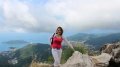
Inspired, we, a company of “wild” tourists from sunny Tatarstan, set off in August 2017 to the unexplored Georgian region, mountainous Racha! And we didn’t regret it at all, although our stay in this wonderful corner Georgia was replete with adventures, sometimes dramatic. A few words about our team - me, the leader of “wild” tourism, and two of my now former students, who, while studying at the theater, of course saw the mountains only on TV, as Vysotsky sang.
So, we took a taxi from Kutaisi to Oni, and from there, in a broken-down police car, we drove to the once large village of Gona, and there we learned that from the village of Gebi there is a marked path along which you can walk all the way to Ushguli! This inspired us very much, and we began to find out how many kilometers it was and how many days of travel it was. The answers, in particular from the person who gave us a lift, and the border guards, were very different, and in general, everyone told us - there is one steep climb, but everything goes along the river and the path itself was recently marked, because a lot of tourists began to disappear?!
After exploring the surroundings of Gona, we completed our creative tasks - we shot three films on two phones! They kept running out of charge, and we constantly ran to the border guards to charge them. Besides them and us, there lived one family in the village, with whom we, of course, visited and even sang a Georgian song in Russian, which we learned in Gon (then we sang it everywhere where necessary and not necessary).
Sketches from the “film set” in the vicinity of the village of Gona.


We decided to go from Racha to Ushguli, to Svaneti, but first stopped at, the guesthouse of which is becoming more and more popular and growing... Having had a good meal there, the next day we “rushed” up the Rioni River and reached the village of Breli - this is a small mountain village of several houses. We had a picnic there on the side of the road, bought bread and, having already had some fun, walked along a really marked path, enjoying the mountain air, stunning views and enjoying the sun, sky and water. So, together and cheerfully, we began to climb “one steep climb in total”, the Vatsistskhveri Pass (2910m), we climbed it for 1.5 days. Well, a very steep climb! Dripping with sweat, crunching his joints and entire skeleton under the weight of his backpacks, driving away huge insects with green eyes. When my eyes once again grew dark, I firmly decided that I would never, ever climb higher than the hills in my life for anything... And when I woke up in the morning and rested, I wanted to stay here forever - this is how I imagine heaven on earth! My charges were also happy, we joked, fooled around and were incredibly happy, as they say in novels. The guys also went to the glacier and lay there in the snow, cooling off...


Then we decided to go down, although there was no longer a path, and we went where the sign on the pass showed, although I, as seasoned tourist, I intuitively felt that I had to go to the right. The guys convinced me (there were two of them!) that we should take it to the left. As a result, we found ourselves on an almost vertical descent - we descended for a painfully long time, losing strength and backpacks along the way - they rolled down like balls, throwing out their contents along the way, we collected them with sadness. Having descended lower, it became clear to us that the descent was not there and we were heading in the wrong direction. In the evening, having found a more or less flat area for one tent, they went to bed alive and unharmed. And then, warming up in the tent and driving away gloomy thoughts, I heard someone’s voices, as if people, not tourists at all, had come for a picnic and were singing a Ukrainian song, flirtatious female voices were heatedly discussing something... I told my friends, What I hear: people are having fun nearby. They immediately wanted to rush at night from the incomprehensible cliff on which we had pitched the tent, to people, to the fire, to food... I calmed the guys down, saying that visiting them in the morning would be much more polite and appropriate. The three of us began to listen and agreed at the same time and honestly to say what exactly each of us heard (because I had doubts about the sounds - they seemed somehow unreal) and together we heard what two men were now saying!!!
In the morning we saw that our tent was standing in impassable bushes on a cliff, a rather stormy river was flowing under us and no one was around: no fire, no smoke from it. What kind of mirages we heard at night is still unclear, was it a parallel world, or the bizarre sound of the river and wind, the breath of the mountains? It's good that we didn't go anywhere at night...
During the day we found a decent descent, then a suitable ford, safely crossed the Tskhenistskali River and... then we went in the other direction to find the marking. We searched for her until the evening, we were very tired from the heat, from the load, from the fact that we had eaten almost nothing and from the fact that our mood was spoiled - after all, each of us understood that we were lost! Already in complete despair, while tying the lace on my shoe, I saw a naked male torso and it was not a mirage! It was a guy from Slovakia named Lubomir - he came across the river to us and spoke Russian, but most importantly - he had a map! So unexpectedly we were saved!
After spending the night on the shore, in the morning we followed the map, which we had previously photographed with an almost dead phone, cheerfully reached the sign on the site, around which there were bags of cement, scraps of cellophane and other signs of the activities of people who were engaged in marking, and for some reason it felt like they are tired of labeling that they are also tired and maybe went along the river to mom, dad, wife, etc., drink wine or eat khachapuri - because the labeling ended there. It’s good that the Slovak managed to explain to us that in this area he was walking along the river, then the water ran out... something like that. We had to spend the night on the slope again - we were completely exhausted without food, although our recent savior offered us “toadstool”, but we modestly refused, and then we learned that translated into Russian this is our buckwheat.

In the morning we rushed to take the Lapuri pass, climbed in 45 minutes, but at the top we were disappointed - the slope was too steep! True, there were railings hanging there, about 30 meters, and then there was a very problematic section of the descent, you couldn’t do it without ropes. From the pass, the houses of the Zeskho mountain camp were already visible, clearly visible. And I, remembering our mediocre descent the day before yesterday, made a strong-willed decision - to send the guys for help, and stay at the pass with my backpacks. Help has arrived! How and where from is another story. In the end, we got to the alpine camp, but unfortunately not to Ushguli.
Summary: if anyone wants to make a similar trip on their own, then it is better to move from Ushguli to Gebi, although it all depends on preparation and equipment. Based on our experience, you should not rely only on markings, you need to have a map and modern systems navigation. A route map can be found on the Internet. This year we plan to go exactly this way: from the alpine camp from the side of Svaneti in the direction of Gebi (Racha). The hike will begin around August 5, 2018 - so join us! The route ahead is very steep, literally and figuratively!!!
Hiking around Svaneti has become extremely popular in recent years. It seems that everyone has already come here to see the Caucasus and Georgia. At the same time, when preparing for the trip, we could not find a detailed and complete description of it, water points, places to spend the night, etc.
Having covered 100 kilometers of mesmerizing panoramas, we learned everything you need to successfully complete this route. Here we will provide information for those who want to go to independent hike in Svaneti. After all, it’s not difficult at all, and there are excellent markings along the entire trail as a bonus.
In this article we tried to pay attention useful information, and our impressions can be read in the text, which was written directly from the mountains.
Mestia - Zhabeshi
Although the route actually starts from Mestia, they found the markings already behind the settlement, having walked a kilometer of the way. In Mestia we stayed at the guesthouse "Manoni" - it's very close from there. You can navigate to this guesthouse, it’s on the maps.
By the way, about how to get to Mestia itself, it is written
From "Manoni" you need to head for the airport. We walked for about 10 minutes and found a turning point near the police station - there we turned right. At the first major turn we turned left again. The road quickly turned into a dirt road. Here we came across the first sign of this hike and, soon, the first column with signs.

Near the start the route is well marked. In some places the markers are lost, but due to the limited choice of directions, it is difficult to get lost. Before the sharp rise there is a post with signs. Seeing him is problematic. Look carefully up to your right hand.
After passing through the bushes, we emerged onto a wide, well-trodden path. A little more and we reached the first pass. From here there is a magnificent view of the Svan settlement and the mountains. It's convenient to take a break here. We were lucky to see how everything was buried in clouds.

After the pass, the quality of the road deteriorated significantly. The rain made the situation worse, and we had to move through liquid, sticky mud. There is space for exactly one person, there are a lot of tourists and a queue forms. All in all, not the coolest part of the hike.
Along the way we came across a patch of pine where we waited out the heavy rain. From here there is also a beautiful panorama of Svaneti. The landscapes are more rural than mountainous, but extremely pretty. One can feel serenity in every smooth bend of the relief.
On the track nearby there was a place to spend the night with water. Even though it was only 3 p.m., we were planning to stop there because of the annoying rain.

Unfortunately, the stream had dried up and the place was infested with cows. These animals love to feast on the tents of unlucky tourists. I had to continue the transition. And the markers eventually descended from the hill onto the concrete road. For some reason we decided to go straight, as it turned out, towards the village. It turned out to be funny because the rest of the tourists went on the trail and we finally got to enjoy a little of the wildness of the adventure.
Before the village there was no normal trodden ground. We went straight through the fence. For unknown reasons, the marks turned out to be inside the village too. They took us to the same road, just a little further along the route. The village here is interesting, also with turrets, and, surprisingly, not abandoned. We didn't regret stopping by.

When we got out onto the road, we realized: the river had descended onto the road along with us. There was a "flood". It seems they didn’t think of directing the flow of water through a pipe, and it simply crossed the highway. The cars did not drive, but floated. Fortunately, we were able to cross the river upstream and remained dry.
Almost immediately the river needs to be crossed again. Here it is already more serious, and it was not possible to simply put it on top of the concrete, so they built a normal bridge. Hooray!
After the bridge the road goes up, and our route stretches along the riverbed. At first we were glad that we were leaving the roadway. As it turned out, I still had to walk next to cars, but I was up to my ears in shit. Dejected. The first car passing stopped. A blue-eyed Georgian (apparently a Svan) offered to give us a lift, then he offered us chacha, then cannabis, then we should go visit him. The four of us squeezed into the back seat and agreed only to the first offer.
That’s how right away, at the very beginning of the trip to Svaneti, we became acquainted with the hospitality of the Georgians (in fact, even earlier, on the way to Mestia). We are very lucky. If it weren’t for this nice man, we would have walked another 5 kilometers in the rain and without any pleasure. This is perhaps the most unpleasant section of the route.

They themselves did not understand how they ended up in Zhabeshi. There are guesthouses and shops here. But the coolest thing is a huge pasture with cows and pigs. There are just tons of animals, and juicy light green grass is everywhere.
While driving in the car, the rain stopped and life finally got better. We climbed the hill behind the village and set up camp. An “iron” stream flows nearby. The water here is incredibly tasty and sparkling. We've never tried anything like this before.

When the clouds cleared, we finally saw the mountains. Now it became clear that these are not mountains like the Carpathians: rocky and harsh, with coolness and even something mystical blowing from there.
Zhabeshi - Adishi
From our overnight stay we could see Ushba. We were glad that the beauty of the Caucasus was somewhere nearby. But alas, the route immediately turned into a forest, along which we sadly climbed to the pass. It seemed that we were no longer in the Caucasus, but somewhere in a Carpathian village. We were accompanied by birch trees and horses - they are hired by tourists who are too lazy to walk and carry their bodies with backpacks.

Little by little we passed through the forest and came to a pass. What we saw was disappointing: it turns out that the trail led us to the ski lifts and the road. Markers have disappeared in this area. Experimentally we found out that you need to go up the road a little and turn right. Then you need to walk a little along the dirt road, looking for the path on your right. We were lucky to spot a marker on the trail.
Marking resumed, and we could safely continue our journey towards Adishi. It took less than two hours to reach the village. There are many guesthouses here that offer accommodation and dinner. It’s a pity that they don’t offer dinner without shelter, and there doesn’t seem to be a shop in Adishi.

Therefore, we walked past the houses and began to prepare food ourselves. There was almost no firewood, since the number of tourists clearly exceeded the number of trees. We used a burner. It’s definitely worth taking it on a hike in Svaneti.
By the way, we stopped for the night in the ruins of a house. The walls protected us from the cows that wanted to chew on our awning in the morning.
Adishi - glacier - Chkhutnieri pass
Tourists near Adishi advised us to walk a little further to the river in the evening and stop on the bank. The fact is that the river flows from a glacier, which freezes a little at night and melts during the day, causing the river to significantly change its depth and swiftness. It probably should have been done that way. But we never listen to anyone, which is why at noon we found ourselves on the bank of a wide, cold stream.

When we read reports on the Internet about the hike in Svaneti, we thought that it would definitely not be a problem for us to get to the other side. After all, tourists are often so gentle, not like us :) In fact, when we got closer, our self-confidence diminished. It immediately became clear that it would be impossible to cross in any random place: the current was very strong, and the cold was causing my muscles to cramp.
After half an hour of searching, we found a point where the riverbed bifurcated into wide and relatively small rivers. The transition took the same amount of time. We had to carry things separately, and then drag the girls around. In total we crossed the river 5 times.
The Svans offer transportation on horseback for 5 GEL per person. In principle, the service is relevant. But we didn’t regret our decision, as it turned out to be a fun adventure.
Although it was worth spending the night here and leaving early in the morning. You will find a good overnight place after crossing a small river, that is, between two channels. But it must be cold to sleep here, because there is a glacier very close.

We saw the glacier itself in all its glory when we climbed a little to the Chkhutnieri Pass. For the first time in our lives we encountered such a huge accumulation of ice and snow. Impressive!
You can walk to the pass from the river in an hour and a half. The path is sharp. From here there are good views, very quickly the glacier and the village remain far below.
You can spend the night by going down from the pass. There are a couple of abandoned houses right below it. We stopped in one of them. A stream flows nearby, but there is little firewood.

In the evening we did not even suspect that there were huge Rocky Mountains. Waking up and leaving the house, we were dumbfounded with delight!
Chkhutnieri pass - Iprali - Ushguli

There seem to be a couple of locals in Iprali. You can spend the night and eat there. But these people were not particularly hospitable towards us.
At the exit from Iprali there is a branch of the route to Mami. We headed for Ushguli and continued along the road. They walked along it all day until they reached their goal. I don't remember anything interesting about this day. Those tourists who arrive by transport are right (the locals offer, they didn’t ask the price).

We liked Ushguli more than other villages. Svans really live here, the farm is large and well-kept. People were just collecting hay for hundreds of cows running around. Everything is very colorful and cute.
You can spend the night in a guesthouse. Or you can do what we did: cross the river (through the village) and set up camp on a small hill. There's a stream running there, but the cows are shitting in it. To get normal water, you have to go upstream.

You can happily spend a day or two in the Ushguli community. Almost every house has a cafe with local dishes. People seemed positive and smiling to us. In addition to food, they offer to visit a small museum and visit inside the tower. But the whole point is in the atmosphere: in Ushguli you feel as if you have moved into the Middle Ages. The place is definitely worth a visit. This is one of the best things about hiking in Svaneti.

From here private minibuses go to civilization. It’s easy to negotiate with any driver and leave. And for lovers of wilder travel there is a continuation of the route along the Svaneti ridge.
Hiking route: Mestia - Zhabeshi - Adishi - lane. Chkhutnieri - Iprali - Ushguli
Number of nights: 3-5
Good places to stay overnight: above Zhabeshi, after Adishi, near the glacial river, abandoned houses after Chkhutnieri, above Ushguli
Water on the route: above Zhabeshi (there are regular and iron streams), after the ski lifts, before and after Adishi, after Chkhutnieri and several before Ushguli
Trekking route around Svaneti on Google Maps.
Abbreviations
LP – local obstacle (pass, peak, traverse, bunch of passes),
1A, 1B, 2A, 2B, 3A, 3B – k.t. LP,
1A* (and other c.t. with *) – in the declared route the possibility of exceeding the c.s. for half a category (for example, 1A* - maybe 1B),
Glad. – radially,
Dol. – valley,
L. – glacier,
Versh. – top,
p/p – first passage (of the pass),
village - village,
lane - pass,
lake - lake,
gr., deg. – degrees,
1.2 – mileage coefficient in comparison with that measured on the map, taking into account the mountainous terrain,
dh – height change,
N-GU – experience of participation in a mountain hike N k.s.,
N-GR – experience in leading a mountain trek N qualifier,
Tr. – herbaceous,
Os. – scree,
Sk. – rocky,
Sn. – snowy,
Ld. – ice,
m/k – route book,
hands - supervisor.
|

|

Route taken:
Sat down. Zhabeshi – dol. Zanner – l. Zanner – per. Semi (2A, 3769) – l. Kitlod - dollar Tviber - l. Iret - trans. Bashil (1B, 3442) – l. Lekzyr – dollar Mestiachala – l. Chalaat - trans. Gul 1st (1B, 3321) + lane. Gulichala Verkhniy (1B, 3300) – dol. Gulichala - sat down. Mazeri – radially: [dol. Dolra - dol. Kvish - l. North Kvish - trans. Seven (not reaching 1 pitch) (2A rad., 4080 m)] – sat down. Mazeri
Deviations from the planned route, reasons
1. There is no radial exit from the l. Zanner towards Tetnuld.
2. Radial access to the Ushba glacier was not made.
3. Lane not passed. Dolra-Hevay (1B*).
More details about deviations from the route will be discussed in the technical description.
Passed local obstacles
Route schedule
|
Date |
Route |
Km, x1.2 |
Vere-wok |
Heights |
+ dh |
|
|
Carrying the delivery into the valley. Tweeber from the villages. Zhabeshi |
||||||
|
Ascent to the Zanner Valley |
||||||
|
Traverse of the left side of the Zanner valley |
||||||
|
Access to the tongue of the Zanner glacier (lower) |
||||||
|
Ascent to the l. Zanner (Upper) |
||||||
|
Per. Semi (2A, 3769) – top. Kitlod overnight stays |
||||||
|
Descent into the valley Kitlod |
||||||
|
A slight rise in the dollar. Tviber |
||||||
|
Brod r. Tviber - the mouth of the river. Zer – radially beyond the transfer to the lower reaches of Tviber |
2400-2500-2000-2500-2400 |
|||||
|
L. Tviber – l. Iret |
||||||
|
Per. Bashil (1B, 3442) – l. Lekzyr – lvl. "Lekzyr Cross" |
||||||
|
Descent along the valley Mestia reached the mouth of the river. Murquam |
||||||
|
Brod r. Murkvam - dollar Chalaat - l. Chalaat |
||||||
|
lane Gul 1st (1B, 3321) + lane. Gulichala Verkhniy (1B, 3300) – dol. Gulichala |
||||||
|
Descent to the village. Mazeri, analysis of the delivery |
||||||
|
Rising by dollar Dolra before merging with Kvish |
||||||
|
Dol. Dolra to foreheads - ford of the Dolra sleeves - return to the merger with Kvish |
||||||
|
Lifting to l. North Kvish |
||||||
|
Radial exit to lane. Seven (one rope short of the saddle) |
||||||
|
Descent to the confluence of Dolra and Kwish |
||||||
|
Descent to the village. Mazeri |
||||||
|
Total: |
146 |
1 9 |
|
9050 |
9250 |
Results of the route traveled
Duration – 20 days
LP 1B – 2 pcs.
LP 2A – 2 pcs.
Total mileage – 146 km
Altitude gain + loss – 18.3 km
Maximum altitude – 4100 m
Average altitude of overnight stay – 2520 m
Participants of the hike
|
Year |
Experience |
Job title |
||
|
Golubev |
5GU, 4GR, 2GR-winter |
Supervisor, |
||
|
Alexandrovna |
unbending intention |
Zavpit in the mountains |
||
|
Voronenko |
4GU, 2GR, 2GU-winter |
|||
|
Commissioners Leonidovich |
Remmaster |
|||
|
Sergeevich |
Financier, head of ideology |
Check-in, check-out, passes, gas, transfer
The path from Russia to Svaneti can be divided into several parts, which allows groups to find the best options for themselves, based on price/travel time/comfort.
General view of the travel route - Vladikavkaz - checkpoint "Verkhniy Lars" - Kazbegi (Stepantsminda) - Tbilisi - Zugdidi - Svaneti (Mestia).
Vladikavkaz is the capital of the Republic of North Ossetia-Alania, the starting point on the way to Georgia.
Located in Vladikavkaz
Bus station (43° 3"30.16" 44°38"35.56") (hereinafter coordinates taken from Google Earth). For tourists traveling to Georgia, it is not relevant, since flights are only within the Russian Federation.
Beslan Airport (43°12"11.01" 44°36"18.83"). It is located approximately 25 km from Vladikavkaz.
Railway station (43° 2"15.85" 44°41"17.70"). Located directly within the city.
The square in front of the railway station is the gathering place for all taxi drivers. If you have not booked transport in advance, then you should come to them. Transport can be ordered in advance from Ruslan Dzodziev: [email protected]
When tourists appear on the square, taxi drivers immediately flock from all sides. They start shouting over each other, almost forcibly pushing your things into their cars, etc. Therefore, it is better to enter into a dialogue with one driver, step aside with him and calmly discuss all the issues. You can be provided with both passenger vehicles (with installed luggage racks) and minibuses. We chose the following option - for 5 people + 5 backpacks +6 bags of food - we took 2 cars. Transfer to Tbilisi cost 8,000 rubles.
Don't be surprised if they tell you that after crossing the border you will need to change cars. This is a common practice among local taxi drivers - on the way to the border, they call their Tbilisi colleagues and find out which of them is traveling towards Russia. “Our” taxi driver helps you cross the border, then takes you until you meet your Georgian colleague, where the exchange of tourists takes place :-). “Our” picks up those who are going to Russia, “their” taxi driver picks you up and takes you to your final destination. No one will take any additional money from you. Apparently Georgian taxi drivers don’t really like to cross our border, which is why they carry out such an exchange.
When ordering transport, you can choose two end points -
1. The maximum option - you take a taxi to Tbilisi (41°42"34.55" 44°47"34.89") with all the desired stops - Narzan, admire Kazbek, Cross Pass, tunnels, observation decks, reservoir, etc.
2. A less expensive option is to take a taxi to Stepantsminda (42°39"26.43" 44°38"45.00" (former urban-type settlement of Kazbegi) (from Vladikavkaz 34 km to the border + 14 km to Stepantsminda). Next
a) an “ordinary” minibus (Ford Transit class cars) for 10 lari (200 rubles) goes non-stop to Tbilisi.
b) a “tourist” minibus (Ford Transit class cars) for 15 lari (300 rubles) goes to Tbilisi, but at the same time makes several stops in “tourist” places.
There will be no problems with placing backpacks - minibus drivers are accustomed to tourists, so they will help you arrange everything in the minibus. Minibuses run without a schedule, as they fill up.
If you choose the option with minibuses, then lari can be bought both from taxi drivers in Vladikavkaz and in Stepantsminda.
Checkpoint "Verkhniy Lars". Russia is separated from Georgia by the Verkhniy Lars checkpoint (42°46"2.52" 44°37"55.94"). It is located 34 km from the Vladikavkaz railway station. Automobile gearbox! That is, you can only cross it by transport. If you hitchhike, then to cross the border you will have to ask someone to get into the car. In summer, transport is allowed from 6 a.m. to 10 p.m. At the same time, the queue on the Russian side is growing exponentially with every morning hour. That's why it is extremely important to leave Vladikavkaz as soon as possible in the morning and get to the checkpoint. Also, the success of a quick passage depends on the skill of the taxi driver driving you. So, for example, from the moment we arrived at the tail of the line at the checkpoint to the immediate approach to the checkpoint gate, about an hour passed. Moreover, if our taxi driver had not asked every second car to move and let us through, it would have taken us 3 hours.
It should be noted that there is no “civilization” either at the approaches to the border or after crossing it, so it is better to take care of water, snacks, and a toilet (there is a toilet at the checkpoint) in advance.
If your group gathers in Vladikavkaz throughout the day and you do not have time to cross the border on the same day, then you can stay at the Kadgaron Hotel (the red building to the right of the railway station). As of August 2012, triple room (one room, three beds, no air conditioning, desk, TV, refrigerator, toilet and shower) 3,500 rubles/room. Double (filling too) 1900 RUR/room. The price includes breakfast (buffet, quite edible and varied). There is a minimarket on the ground floor of the hotel, there is a store opposite and on the station square. The neighboring building is the railway police department. If possible, ask for a room with windows facing the courtyard and not the street, as drivers passing by in cars make a lot of noise at night.
So, after crossing the Russian part of the border you will arrive at the Georgian checkpoint. There are no queues here, a maximum delay of 5-7 minutes, a souvenir photo for the Georgian police and wishes for a “pleasant holiday.”
After Stepantsminda the road begins to gain altitude to the Krestovy pass (more than 2300 m). Before and after the pass the road is broken - the road surface is being repaired, new tunnels are being laid, and the sides of the road are being strengthened. The section is very slow and dusty. The distance is 15-20 kilometers, but in time it can take at least an hour. After Gudauri (42°28"38.77" 44°28"27.18") the road is already very good, with long serpentines it goes down the valley and then after 130 km leads to the capital of Georgia - Tbilisi.
If you take a taxi, you will be taken directly to the Tbilisi railway station. If you are traveling by minibus, it arrives at the bus station near the Didube metro station (41°44"58.36" 44°46"44.72"). You can get to the railway station either by metro or by bus.
ADVICE Since further movement from Tbilisi is possible only at night (see below), it is recommended to spend the current day exploring the sights along the route to Tbilisi. This is better than spending half a day at Tbilisi station at +40*. (there is air conditioning inside the station, but they couldn’t pack food into backpacks and drop bags inside the station; we had to park outside)
ABOUT METRO . Metro, it’s also metro in Tbilisi :-). There are two lines in the city, more than 20 stations. The fare is 50 tetri (10 rubles), plus an electronic card 2 lari (40 rubles).
Tbilisi railway station(41°43"14.64" 44°47"55.79"). A large modern building that includes the railway station itself and a large shopping complex. On the territory of the complex there is a large supermarket (1st floor), currency exchange office (1st floor), railway ticket office (3rd floor), food court (4th floor). Well, the most important thing you will need upon arrival in Tbilisi is a toilet :-). Look for signs on the 1st floor (near the exchange office) and 4th (in the food court area). On the third floor near the cash registers behind the benches there are working sockets where you can charge your equipment. Toilets are paid, 0.5-1 lari (10-20 rubles), so save your small money.
Further movement from Tbilisi towards Svaneti is possible in several ways.
1. Airplane. Small modern Canadian planes are ready to take you in a couple of hours to the heart of Svaneti - Mestia. The airport is located near Tbilisi. However, we rejected the aircraft option for the following reasons.
Planes fly to Mestia several times a week, but not every day. (that is, you need to adjust the timing of the trip in advance to the departure of the plane).
The plane departs at 12 noon, which means you either need to arrive in Tbilisi the day before, stay in a guesthouse, lose part of the day and only fly out the next day. Or, on the day of arrival in Vladikavkaz, stay there overnight in a hotel, the next day try to cross the border at 6-7 am and try not to miss the plane. In general, despite the obvious advantages of flying by plane, the options are not very convenient.
It is prohibited to carry gas on an airplane, and it is not available for sale in Mestia. This argument finally influenced our decision to abandon the aircraft.
2. By bus to Zugdidi (42°30"36.60" 41°51"37.07"). About 300 km through half the country and the large cities of Gori and Kutaisi. Buses of the "Eurotour" type are single- and double-decker. Unfortunately, nothing was learned from Tbilisi about their schedule and launch location.
3. By hired transport to Zugdidi, or to Svaneti. The most expensive option, since in Georgia gasoline costs about 44-46 rubles per liter. Accordingly, for a transfer of 300 km they will ask for a considerable amount. There were five of us - we would not have fit in one passenger car, and hiring a whole minibus for five turned out to be very expensive.
4. Personal vehicles. The most successful option in terms of time costs is no need to waste time waiting for the train, searching for cars, etc. If it’s also good to stock up on gasoline in Russia, then for a small company best option. Particularly pleasing is the absence of traffic cops on the roads of Georgia. This option was chosen by the Baumants group of 4 people. From Moscow to Svaneti and back by your own car. Several tour groups from Ukraine rented a bus that took them directly from Kyiv to Mestia.
5. Train. This is the method chosen by 99% of tourists heading to Svaneti. Therefore, do not be surprised to meet Czechs, Finns, Israelis, Germans, etc. on the train. etc.
Everyone goes by train to Zugdidi - this is the closest and largest transport hub, located relatively close to Svaneti.
Train schedules and prices can be found on the website railway.ge. You can also buy tickets in advance using a plastic card.
There is a night train from Tbilisi to Zugdidi with departure at 23:00 and arrival at 7:00 am. The train has a compartment and a reserved seat, but all tickets are sold out in advance. There are a couple of seated carriages left for tourists. Large, quite comfortable chairs, in two rows of two each. Above the chairs there are wide shelves for backpacks. The downside is that there is no air conditioning and in 40* heat during the day, the hot air takes a long time to cool down. Only by two o'clock in the morning was it possible not to wipe off the sweat :-). For a more “comfortable” journey, it is recommended to take with you an inflatable pillow under your neck, earplugs, a blindfold and some kind of fleece to lean against the window. This train costs 14 lari (280 rubles) per person.
Zugdidi. At the station in the morning, the train is greeted by a dozen taxi drivers with transport for every taste. Most choose minibuses equipped with overhead racks for backpacks. The cost of moving is 15 GEL (300 rubles). It is about 120 km from Zugdidi to Mestia. Of these, the first 20 pass along the plain, then the road goes above the Inguri reservoir and then begins an “almost eternal and endless” climb up and up. Starting from a height of 100m.a.s.l. from Zugdidi you finish at an altitude of 1400m above sea level.
On the way, you can ask the driver to stop at a roadside cafe and have breakfast.
We can provide the following phone numbers from the business card that we were given in Zugdidi:
Flight Zugdidi-Mestia, Ford Transit, daily at 8:00, 12:00, 16:00, 15 GEL, +995 599 91 55 71, +995 593 91 04 37.
ADVICE. For most tourists, Mestia is the end point, however, if your group starts not from Mestia, but from some nearby communities (for example, from Mazeri to pass under Ushba, or from Zhabeshi to climb the glaciers of the Tsanner Valley), then it is better to agree with the same the driver will drop you off rather than look for you on the spot new transport. So, having paid a small amount, we made a transfer to Mazeri, and then, taking the rest of the tourists to Mestia, we drove another 15 km along the valley to the extreme community of Zhabeshi, where our route began.
This is such a difficult and varied path that must be taken to get to Svaneti.
This is the schedule our group came up with.
Zero day. Departure from Moscow by evening train to Vladikavkaz
First day. A day on the train.
Second day.
9.30 arrival in Vladikavkaz
9.30-11.00 Gathering the group, raiding the store, communicating with taxi drivers, bringing extra things to the taxi driver’s home.
11.00 departure from Vladikavkaz.
14.00 both customs are behind.
14.00-17.00. “exchange of tourists” (see above), stop at Narzan, road to Tbilisi.
17.30-23.00 unloaded onto the railway, waiting for the train, forming transfers.
Third day.
8.00 arrival in Zugdidi
9.00 start towards Mestia
14.00 stop at a cafe, delivery of supplies, travel from Mestia to Zhabeshi. Finish.
Obviously, on the third day there is no point in going somewhere - a hard night on the train, a long journey and fatigue are behind us.
There is a bank in Mestia where you can exchange rubles for lari.
The return road is built as follows.
1. Transfer from Svaneti to Zugdidi. Minibuses run constantly from Mestia. It should be noted that if you finish in any other place, then finding transport immediately on the spot to Zugdidi is very problematic. In the best case, they will agree to take you to Mestia for an amount of at least 100 lari (2000 rubles). In this case, the distance will be 15-20 km. Therefore, either finish closer to Mestia, or arrange transport in advance.
2. The train from Zugdidi to Tbilisi leaves at 22:00 or 23:00. An alternative could be buses leaving an hour later from the station square. The driver promised air conditioning and a view of the night cities of Georgia. Bus ticket 15 GEL, train ticket 14 GEL.
Taxi Tbilisi-Vladikavkaz. Most likely, on the way “there” the driver will offer to meet you. Feel free to agree and ask for a discount. Most likely he will agree - he will already have a guaranteed order.
Tbilisi-Kazbegi minibus. Minibuses run from the Didube bus station (see above). The main thing here is to choose a simple minibus, and not a “tourist” one (see above), since the task is to get to Kazbegi with a minimum number of stops. In Kazbegi, you can either hire a taxi or make an appointment in advance.
REMEMBER. Russian customs in reverse direction This is a huge lottery! And, since you will arrive there after lunch, there is a possibility of huge queues and many hours of waiting.
Useful phone numbers: Tbilisi-Vladikavkaz, Gogi, Mercedes E-Class or Niva: (+995) 599 93 31 20, 568 93 31 20. It will also help organize transfers on other types of vehicles.
Rezo from Mazeri, brother of the border guard, Ford Transit minibus, 150 GEL from Mazeri to Zugdidi: +995 599 568 185.
Minibus Ford Transit, 150 GEL from Mazeri to Zugdidi, Shalva. We traveled with him from Mazeri to Zugdidi. The phone number has not been preserved, but you can find out from Rezo +995 599 568 185.
Opel Vectra station wagon – Tbilisi - Kazbegi – Vladikavkaz: +995 591 708 180, Bezhani
Additional information on Georgia, Svaneti, transport, accommodation, etc. you can get from the following posts:
Border passes were issued on site in Mestia, at the headquarters behind the airport. The procedure is quick - copying passports and a map with the route, writing out a pass in Georgian and wishing you a good journey. In principle, it is advisable to check in at the outposts at the entrances to the gorges. In our case, this is in Zhabeshi and Mazeri. In Zhabeshi we checked in, but in Mazeri we didn’t notice the outpost, we didn’t check in, but it turned out to be of no use to anyone.
Gas cylinders were ordered in Vladikavkaz from Ruslan Dzodziev, his email. mail above. Ruslan provided the contacts of the driver who took us to Stepantsminda.
Lile-tour company (easy to find on the Internet).
Phone number of Avgan Naveriani from Zhabeshi: +995 599 30 13 36
Technical description of local obstacles
Two transfers - in the Tviber valley and in the village. Mazeri - the hike was divided into 3 approximately equal stages of 6-7 days. In Mazeri they left a drop off at the house of Zakria Kvitsiani +995 595 70 25 88. His house is not in Mazeri itself, but 2-3 km down the valley.
The technical description is divided into 3 stages of the campaign, and each stage is a description of a separate LP. Cards are given one at a time for each stage. Time is given in net running time (NHV), river banks are given orographically, unless otherwise indicated.
STAGE 1
|

Per. Semi (2A, 3769)
So, towards evening we set up tents near Avgan Naveriani’s house in the village. Jabeshi. In the remaining time, we make a transfer to the Tviber valley, as long as there is enough time. From the Naveriani house we go down to the Mulkhura River, across which there is a bridge a little below its formation by the Tviber and Tsanner rivers. Mulkhura impresses with its power of a dark gray raging stream! After the bridge, from a lonely abandoned house up to Tviber along its right bank with a traverse 5-50 m above the riverbed, there is a good path. In areas of impenetrable thickets, it is literally cut through where the clamps are - marked with tours and paint on how to get around them. The trail is very beautiful: behind every new bend or exit from a section of the forest there is something new, and on the right along the way, in a narrow canyon littered with huge boulders, the mighty Tviber roars madly, spraying into foamy spray.
After a relatively steep climb, the trail leads to the first estuarine step, where the forest becomes higher and you can walk through it, but the undergrowth consists of a carpet of rhododendrons and azaleas. The path here is no longer cut, but trodden, making it more difficult to walk. We pass an arch made of stone blocks leaning on each other (on one of them there is a memorial plaque, there are platforms, but the water is only in the muddy Twiber). Behind an arch somewhere in the forest, in a pile of stones off to the side of the path, we hide a drop-off. It's difficult to say the exact location. We return to Zhabeshi along the ascent route.
The day before, we asked Avgan Naveriani in as much detail as possible about how to go to the Zanner glacier. The general meaning is “first according to that [op. right], then this bank.” And a certain staircase was mentioned. Neither he nor his son could indicate exactly where to go on the map. The border guards in Zhabeshi also gave the same information that we should go first along the right bank, then the left bank. (it’s better to register with them - they will copy your passports and route directions).
It also became known that the path described in the old description was always along the op. on the right bank up to the glacier, no - rocky cliffs.
Departure at 9.30. Along a dirt road in 10 minutes we reach the bridge over the Zanner above its confluence with Twiber. Here is the mill mentioned in the old description (Photo 1).
We cross Zanner to the right bank. There is a good trail there. But soon she becomes quite weak and often gets lost. When thickets of crooked forest with rhododendron began, it was completely lost. Apparently, in this place we need to look for it higher up the slope. We try to walk along the water, but there are steep earthen cliffs. On one very steep earthen slope I had to throw a rope for a gymnastic belay. Through the impassable jungle, with great difficulty and a considerable amount of time, we reach the path again - a narrow corridor in the thickets. The trail leads to the Narazn spring and a bridge. Behind the bridge there is a logging road going down to Zhabeshi. This is where we had to go.
From Zhabeshi to the bridge the total time is 2 hours. On the opposite bank it would be 3 times faster...
But which shore next? The path continues on the right, and the logging road goes up on the left. It is clear that such roads usually lead to a dead end, but there was an instruction to go first along one bank, then the other. There is no passage along the right bank to the glacier, and it is not clear whether there will be another bridge. The river is impassable. Perhaps there will be a branch of the trail from the road... We follow it along the left side of the valley, gaining a lot of height. Indeed, we find a semblance of a branch - a traverse of an easily passable coniferous forest. But the path is lost. However, the slope is acceptable as long as there are no thickets. Having gone quite far from the bridge, we run into gullies, which we can bypass much higher up the slope. I would have to go back here, but it’s such a shame :). Having walked around the steep slopes from above, we go diagonally down, still hoping to find the path. In some places it looks like a wide path overgrown with old forest, along which it is impossible to walk - constantly going around the bushes from above or below. Further on the path of the slope traverse there is a wide beam, we also cross it with a traverse, with a drop in height. Its far slope is made of soft earth, abundantly sprinkled with pine needles and dry branches, steeply up to 40 degrees, length 100 meters. But there is no undergrowth. Having climbed the slope, we come out to large moss-covered boulders on a gentle slope. It's much easier to walk. Bypassing the thickets of crooked woods, along rocky, grassy slopes we come across impenetrable thickets that still need to be passed. With great difficulty and laying out the last of the day, we finally made our way to the first water after lunch - a large stream, which on the kilometer map is marked north-northwest from the mark of 3360.2. Descent to the stream along a very steep grassy slope of 20 m.
The time is about 19 hours (about 2 km and 7.5 hours of total time from the bridge), and, given the nature of the slope of the left side of the Zanner, it is unknown how long it will take to get to the next stream. We decide to look for a place for tents, which are not found at +- 100 m altitude along the stream - it flows everywhere with a slope of 15-25 degrees. The Zanner River is 200 meters high. We leveled a small area under one tent (Photo 2a) next to another place where, partially under a huge stone, we managed to level out an area where you can stretch the awning (Photo 2b). A fun start to the hike, but everyone enjoyed it :)
Sometimes it rains in the evening and at night.
Immediately from the place where we spend the night at the “first” stream we climb into a pitch-black, indescribable, impassable jungle of crooked forests with rhododendron-azale undergrowth on a slope of 20-25, sometimes 30 degrees, steepness. We climb decisively, as if into a fire to escape the fire :). There is no way around it - below there are pressures of the river, at the top the thickets lead to the rocks. It takes about 5 minutes to overcome one bush. Often, overcoming it is possible either by grabbing a bush and using a pendulum (the legs do not support the rhododendron), or by throwing it on - putting on a backpack. With fierce rage, with heavy backpacks, dripping with sweat, growling and screaming :), we wage a long-hour battle with this lovely Zanner forest. To move forward, we use any clearing, even if we need to gain and lose tens of meters in height. When the impassability becomes a little better, we see a high rocky pressure ahead (the base of the buttress); we go around the pressure from above through the only, apparently, passage (the thickets are better, but still difficult to pass through). Then you have to go down to the right (in one place on a steep dangerous slope there is 40 m of rappelling). Along the shelf under some long wall we go beyond the buttress. A further part of the valley opens up: nothing good.
The thickets are gone, coniferous forest, rare bushes, but the slope has become very steep. We are losing altitude by 35-40 degrees. grassy-talus shelves, bypassing rocky outcrops, to a slightly sloping clearing not high above the river. The clearing seems like a paradise oasis from above, but in reality it is overgrown with some 2-meter flowers, burdocks, hogweeds, and at least not nettles. There is another pressure ahead, this time conglomerate grass. We gain altitude through kurums overgrown with burdocks, then traverse a more or less suitable forest. Having run into creepy thickets, we rush down and to the right towards the river. You can see a gently sloping scree (!) place with a stream (!!) (we haven’t drunk since the morning), it seems that we are about to be there, but, emerging from the thickets, we see a steep conglomerate slope under our feet. The steps are not cut, you can only get around through the thickets (not an option). We throw the rope and descend simply on two hands. From the rope along the river, through 20 m of live scree, overgrown with tall grass (every stone is alive), we come to a scree with a stream. A (relatively) heavenly place! We make tea and have a snack.
We walk along the shore along living stones overgrown with grass. Ahead, the path is blocked by a steep cliff leading into the roaring, terrible Zanner. The bypass is visible from above. Luckily, we discover a rocky bed of a dry stream. Along it we quickly gain height to the rocks, below them we traverse and descend through a passable low-growing forest. We hit a cliff. Rappelling 5 m along steep rocks, then a flattening slope. Pulling from a tree. Next, we go around a small rocky outcrop and find ourselves at the “second” stream from the map.
The time is 19:00, and what lies ahead, and whether there will still be water, is not clear. We level the site for a long time on the inclined slope, put up a tent (Photo 3) and an awning for the residents of the second tent. We study the map and navigator - in a day we walked 400 meters in a straight line!
From the overnight stay there is a view of the deep, narrow, bubbling Zanner Canyon:
As we will understand later, it is in the area of this canyon, somewhere where we did not see, that there is the very “staircase” that Avgan spoke about. It connects the path of the right bank and the left bank from the moment when the left one becomes normally passable.
Along the gentle slopes of the sheep's foreheads we rise to a flattening - the gentle top of a rocky cape, around which the canyon makes a bend. We don’t see a bridge (staircase). The canyon looks intimidating, and crossing it would certainly be an exciting adventure. Stone tourists appear briefly. We go around the rocky belt from above, then go down to the screes and gently sloping sheep's foreheads. Tours appear again, let's go on them. There are no thickets, the mood is fighting. In some places there are even remnants of a trail and a freshly trampled trail. As we learn later, the Baumanites passed through the day before us. We follow a weak path to the confluence of Zanner and Nageb. There are places for tents, water is only in the lighter Nageb than Zanner. There are also places on the opposite bank of the Nageb. The lower Zanner canyon ends here and the upper one begins a little higher (Photo 5, below). 1.5 hours from the overnight stay.
Across Nageb there was a bridge made of 4 not the best type of logs. The water slightly floods them, they are damp. The first one crosses the tree with a belay, attaches a 45 m rope also to the tree (along the axis of the bridge there was no closer to the tree). The latter takes off with insurance from the target shore.
|

A little further along the right bank of the Zanner is the magnificent Narzan. The tracks of the group that passed from Narzan go sharply up 10 m along a steep grassy slope and enter a “normal” forest, in comparison with what was there the previous two days. The tracks are barely noticeable, but the general direction is obvious - traverse the left side of the Zanner, bypassing its main rocky pressure (a river in a canyon) and bypassing individual rocky ledges.
Having gained height, the “trail” got lost in a wooded slope with a steepness of 20-25 degrees, thinned out by frequent medium-sized beds of dry and simple streams. The upper Zanner canyon opens (Photo 5):
As you can see in this photo, there really is no passage on the starboard side (just a rocky cliff), and it is doubtful that there could be one at all. The left side sheep's foreheads look much simpler, but nevertheless it is not clear how passable they are.
We approach the first massif of rocks, along them we rise along the stream along a steep scree slope to the border of the conglomerate and steep rocks. It turned out to be possible to walk along this border (something like a couloir); they even found traces of yesterday's (as it later turned out) predecessors. As indicated in Photo 5, we cross 4 ridges formed in a conglomerate of lateral moraine washed by flows. Each ridge had its own characteristics and methods of overcoming, which make no sense to describe, because... Over time, a lot can change here, because... The moraine is gradually eroded. The moraine consists of uncemented conglomerate and the steps are generally easy to form. But you have to walk with caution - in some places you will fly far.
After moraine scallops, traverse the steep tr. slope we approach the second array of foreheads. Let's take a look at the stone tours. The path is also marked in Photo 5, it runs through an intricate “labyrinth” along shelves and crevices, everywhere on foot, frequent tours. Without them, it would have taken much longer to find the way - with a lot of reconnaissance. So we took the simplest route. As a result, we come out onto a wide, gently sloping shelf. The exit point is marked by a stone with a white bag on it (it may rot in the future). As a guide to the descent, a small puddle 2x2 m in a monolithic rock is located 20 m above the place where you need to start descending.
An inclined shelf, partially overgrown with trees and covered with medium and large scree, leads to an inflection point where you can put up tents, but there is no water. According to the results of reconnaissance, further traverse of the left side is pointless; you need to go down a steep scree slope (250 m high, 25-30 degrees, rocky) to the tongue of the Zanner glacier (lower, or Oish) (Photo 6). The place is dark and majestic. Due to the rapid retreat of the glacier, there is little vegetation; fresh piles of scree are everywhere.
It started to rain at the bend. Let's quickly look for a place to bivouac. As indicated in Photo 7, there are flat areas slightly below the glacier, but clear water is far away, and it looks somewhat dangerous due to the overhanging rocks and steep scree above.
We find a sandy area on the moraine-covered tongue of the glacier, level it and set up camp. Water in clear streams on the glacier.
Finally we are in a plant-free zone, the hike begins :).
Rain at night and in the morning. After waiting for it to finish, we leave at 11.30.
Along the surface moraine of the right side of the lower Zanner glacier, then on flat ice in 1.5 hours we reach the turn of the glacier to the right towards Tetnuld, where the Oish glacier is already (Photo 8).
We turn onto moraines to the left along the path from the glacier, where there are areas with water. We had breakfast a long time ago, we have a snack with tea. There is a tent on the sites. Soon its inhabitants arrived - Muscovites mainly from MSTU. They plan to traverse Gestola-Tetnuld. The author of the report hopes that they will contact him.
From the sites we first walk along the perennial gray snowfield in the direction of the la. Zanner (upper) past a powerful waterfall (Photo 9):
Then, along a section of steep living scree, we climb onto a slightly flatter tr.-os. slope, and climb to the left along the path between the river and steep rocks, avoiding rock outcrops. It starts to rain heavily.
An increasingly steep scree moving slope leads to rocks (foreheads). In them you need to find a passage along the shelves and grassy couloirs. The length of the section is about 50 m. After the foreheads we go out to the ridge of the right-bank moraine and walk along it a little. On the right along the way, a steep scree slope leads to steep rocks, on the left - into a canyon of a powerful stream. Approaching the ice covered with mud, opposite the waterfall (Photo 10), we find a wide, slightly inclined place, where we hastily set up an awning and wait, wet, for the rain. From overnight stays at the glacier turn 1 hour 20 minutes. Luckily, the rain stops after half an hour. We level the sites and set up camp. Gradually the sky clears and freezes.
When it got dark, the moon came out, illuminating Tetnuld - an unforgettable sight!
Beautiful weather! Tetnuld sparkles with streams of icefalls!
As shown in Photo 13, we go around the end of the Zanner glacier along moraines, steep in places, and come out onto flat ice (Photo 14). 50 minutes from the overnight stay.
The GKH and the further path opens.
Along a flat, slightly inclined open glacier, avoiding a few cracks that cannot be jumped over, we approach the turn to the lane. Semi (Photo 15). 2 hours from access to flat ice. The pass is not yet visible.
We have a snack and tea on a scattering of stones, and continue to climb. A non-steep, but heavily broken take-off (crampons, long detours around faults) leads to an ice plateau, the ice is still open. The lane opens. Semi (Photo 16).
Approaching closed ice, we make contact. A non-steep firn takeoff leads to a flattening “drag”. In Photo 16 the distances are hidden; in fact, the rod is quite long. The Semi Pass is a wide horizontal junction of the Zanner and Kitlod glaciers. If there is a tour, it is high above the saddle in the scree, where I didn’t want to climb. 2 hours from the lunch place (as mentioned earlier - CHV, unless otherwise indicated).
Descent from the lane Semi on l. Kitlod first goes in a westerly direction along the GKH along a gentle snow slope (Photo 17). You shouldn’t go close to the GKH - there are rockfalls. True, the stones quickly stop in the muddy snow.
Along the way we admire an unknown beautiful peak of at least 3800 m in the watershed of Kitlod and Zanner (Photo 18).
Having passed under the slopes of the GKH to the west along a wide, gently sloping snow shelf (Photo 19), leaving powerful faults on the left along the way, we turn in a wide arc to the left, also under the rocks we go out onto flat open ice, where we unravel and go to the visible Upper Kitlod overnight camps (Photo 20 ). From the pass about 1.5 hours.
In fact, as it turned out later, we didn’t get to the overnight camps themselves (sites with walls and a small amount of garbage), and they weren’t particularly good, and there was no water. And where we stopped (Photo 20) there were spacious, perfectly flat clearings made of hardened soft, non-staining clay, and clean water nearby. The place is great! The height is 3250 m. The Kitlod glacier is impressive - in front of us is an extensive ice field of 2x3 km. Because of this, of course, it is not hot at night, but the views are worth it.
We leave at 9 am. We traverse the moving talus slope on the right side of the valley above the glacier to the “real” Upper Kitlod overnight camps. There are many leveled areas with walls, but there is neither water nor the views that we had. Perhaps there is less wind here in bad weather. Apparently, over time, for some reason this place lost water. The former mass attendance is also confirmed by memorial plaques on the stones about the dead. From these overnight stays, a very badly torn icefall from edge to edge opens to the left along the way, and a path of descent around it along a steep scree onto relatively flat ice below it (Photo 21).
It took 30-40 minutes to descend from the overnight stop to the foot of the icefall. In the opposite direction, given the nature of the slope, it will take 2-3 times longer.
Having reached a (relatively) flat section of the glacier, inspired by the quick exit to Tviber, we cheerfully walk along the right side of the glacier not far from the rocks, easily avoiding numerous cracks, without crampons. Near the rocks, the glacier is heavily covered with mud and stones (Photo 22), but further from the rocks there are many cracks that cannot be crossed on foot, so you have to walk along the rocks.
And so, 20 minutes after leaving the scree on the ice, we run into an ice-stone “mess” with ice faults. On the right along the way there are steep smooth rocks, on the left there is a second, small icefall. This is the same rantkluft from the already ancient description of the Semi Pass in the book “Chegem, Tviber, Bezengi”. You have to put on crampons, systems, and full ice equipment. There is no point in describing specific areas, because... Every year the ice situation changes. As a result, we hung 3 ropes of the railing (the last 2 of them were in the rain - Svaneti... :-)) and we used all 7 drills we took with us “just in case” :). Partial locations for hanging the railings are shown in the following 3 photographs:
|

|

After the 3rd pitch we finally emerge again onto gently sloping ice covered with mud and scree. From here we go out onto clear ice away from the rocky starboard side. Soon the steepness of the ice allows you to remove the crampons. The lower stage of the icefall has been bypassed. We spent 3 hours on the railings alone - the photo does not convey many of the nuances of getting lost, essentially in an icefall. Everyone was wet and hungry - we made tea and a snack under the tent on the stones (Photo 26). Photo 26 shows a general view of the descent from V. Kitlodskiye overnight camps to the lunch site. The plateau between the two steps of the icefall disappears.
As far as we saw, in this place, which, apparently, is the middle Kitlod overnight stay, there is nowhere to put up tents. Apparently, reconnaissance is needed, and there are sites somewhere, but we saw medium and large scree everywhere.
Along the scattering of large stones to the right of the glacier, going around the steep sheep's foreheads on the right, we come out onto the tr.-os. slope with a steepness of 10-15 degrees. (Photo 27), which below ends with a conglomerate towards the glacier. We traverse the gentle slope above the conglomerate to a large impassable ravine with a stream. We descend to the left of the ravine and come out to an area of very steep scree, partly with conglomerate. In front of the glacier, the slope flattens out, and it becomes possible to cross the ravine 20 meters above the ice. Getting out onto the ice itself is difficult. We continue to traverse the very mobile medium-talus slope on the right side of the valley (Photo 28), gaining a little height to go around the conglomerate slope. The end of the glacier opens with lakes, which we go around on the right with a traverse of steep scree (Photo 29).
Below the lakes, the Kitlod River, we go under the stones for a while. We take a break on the left bank. We see that below there is a powerful snow bridge (obviously many years old). Therefore, after a break, we go a little along the left bank (the right one is a steep scree going into the water), then we cross the snow bridge to the right bank, where the valley widens. We are looking for a place to spend the night, because... It’s already 19 o’clock. Gradually, the scree turns into a grassy slope, and areas of crooked forest appear. Having reached the spring streams, we find places for tents on the pebbles of the old river bed, where we set up camp. From the lunch place 3 hours total time.
Next we go to the Tviber glacier, down Kitlod and to the right along the way. From our overnight stay on the right bank of the Kitlod (red triangle in Photo 30), we first walk along the shore, but run into the “Tsanner” windfall. You have to go around it much higher on the scree:
From the scree we descend to the flat bottom of the Tviber valley, covered with medium and large scree with relatively sparse trees. The Toth glacier opened (Photo 31):
The Twiber glacier has retreated greatly in comparison with the map. Closer to its tongue there are many places for tents on the pebbles and there are clear streams. We set up a camp and part of the group tries to go for a drop-off point, which, as described at the beginning of the report, is located on the right bank of the Tviber in its lower reaches. It is impossible to switch to Tviber even in the morning. We see that the river flows out of the grotto of the Tviber glacier and we decide to cross the river along the glacier. However, it turns out that there is also a second grotto, from which a powerful stream also flows. And it is impossible to bypass it - above the left bank rises 30-degree dirty ice about 100 m long, over which hang the stones of the surface cover, ready to fly at any moment, i.e. It's dangerous to hang railings there.
We do reconnaissance along the left bank, but we don’t find the bridge. Meanwhile, there is more and more water, and it is too late to make a canopy crossing. Therefore, we spend the night on the left bank of the Tviber and plan to cross early in the morning the next day. At lunch we ate the last food of the 1st stage, and for dinner there is only one Snickers for everyone and a handful of nuts and tea. For breakfast - tea :).
In the morning we make a canopy crossing over the stream from the left grotto (Photo 33) on two high stones. The stream from the right grotto, part of the group fords at the spill point into two streams, part of the group goes around the glacier. We gather together on the banks of the Zehr River, the right tributary of Twiber. There are places for tents at the confluence, and there is a weak spring near the bank of Twiber. We set up camp, and part of the group goes for a transfer to the lower reaches of Tviber.
We cross the Zehr River in the morning without any problems, although the flow is also quite serious. After 500 meters we find a narzan spring, a shelter made of stones under an overhanging stone, traces of a fire, some firewood. And the main thing is the marking of the trail, namely its upper end. This means that a marked route has been made here (marking in the form of white and yellow stripes).
Following the markings, partly along the real trail, we first go along the shore, then we gain height, bypassing the pressure, then we descend a little and again gain significant height, bypassing the “Gateway of Georgia” tract - a canyon, sandwiched on the left by steep rocks and on the right by the rocks of a huge ram’s forehead (Photo 34 ).
After the forehead, the trail descends, bypassing the forest, along steep screes and leads out into tall grass, sometimes getting lost. There are places to spend the night, clean water (just when the trail gets lost). It is very important to find her again, because... the underlying forest is impassable without a path. It first traverses the forest horizontally, then gains height along it and leads to the ruins of a stone house. From here it descends high above the river canyon (there are areas with clear water) either through meadows or through crooked forests and leads back to the river. We find our drop-off point, throw it into our backpacks and return to camp along the ascent route.
The trail is very tiring. Both up and down you have to gain height and then lose it. Therefore, the total increase or decrease in height from Zhabeshi to the Zer River is significantly greater than the difference in heights between these points, and this must be taken into account when planning the passage of this valley.
The trail is well described on the website http://www.svanetitrekking.ge/rus/tviberi_info.htm
Finally, I came to Georgia at the invitation of my old friends, people just like me, (without the towers, out-of-town, sunny and happy) people, forever in love with the mountains and.
What can I say now, here in Adjara? Any mountain hike in Georgia, if it is organized correctly – and “Trip Georgia” tries to do it that way – is not just an event in your life, no. As a result, this is a transformation of everything that you knew and saw before in your life. This is the starting point. From the familiar you, as you have seen yourself for many years, to the real you.
A six-day hike in Georgia, the Adjara region, my feelings.
I didn’t notice the mileage and altitude gain (as usual), I didn’t pay attention to the warm tropical showers and cold overnight stays, I didn’t worry about passing steep slopes and rocks; I walked on snow “tongues” - in July! - and recognized this land and these mountains with my feet, step by step. I have seen a lot - Crimea, the Urals, Turkey, Cyprus. Comparisons are not appropriate here: a multi-day hiking trip in Georgia, as it is, is different from everything you could see (and imagine!) before, believe me. Gentle sun and fog of clouds on the peaks, blooming rhododendrons in the alpine meadows of Adjara, bear tracks very close to your tent, long treks along mountain ranges, swimming in hidden lakes (2300 m above sea level), communication with local residents– shepherds, beekeepers, hunters (the distance of 30 km between them is “neighbors”)... What is this? I probably can't express it in one word. Delight? Astonishment? Confusion? Charm? Words are not enough, no! You just need to see it once...
What struck me most was the interaction with the local residents of Georgia in the Adjara region.
They live at high altitudes, over 2000 m, in incredible plank huts called “nomads” from May to September. They herd livestock and take apiaries to alpine meadows, earn money for the season, and that’s how they live. None of them speak Russian. But the concept of “guest” is sacred for them. We just came in to buy bread. No, it turns out that this is not possible! In a huge plank “nomad”, on the second floor, above the cowshed, a table of national Georgian dishes was laid for us: fresh, just from the oven, shoti bread, matsoni, Adjarian cheese, kaimagi, lobio, tomatoes, herbs and fiery chacha. The most important thing: we understood each other. And we drank a couple of glasses for friendship. For unity. For this land and its guests...
Now I’m already home, in Batumi. And you know what I understood for last days? , as they are, is an absolutely parallel reality to us. There you see all things as they are. There you find yourself - just as you are. As he always was. In fact.