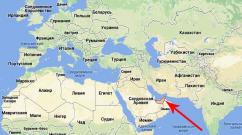
Distance between Yalta and Bakhchisarai. How many km from Yalta to Bakhchisarai
Over the years, I have traveled to Crimea in every possible way, so I will be happy to share my experience.
By car
There are 3 roads leading to Bakhchisarai from Yalta and all of them deserve attention.
Through Alushta and Simferopol
This route is the first one that comes to mind. Its length is 115 km.
The E105 road goes straight from Yalta. First, to Alushta it goes along the sea, then turns and passes through the mountains. The road is of good quality, wide and well leveled. Trolleybuses run along this road, so despite the mountains there are no sharp turns, long climbs or serpentine roads, even on the Angarsk Pass. In summer the road is very busy, but there are no long queues. In winter, you don’t need any special preparation to drive along this road.
This is a picturesque road that runs along the sea.
Via Foros
The second option for getting to Bakhchisarai is through. The length of this route is also 115 km.
In this case, you need to leave Yalta towards Sevastopol along H19. This road is called the South Coast Highway. It is narrower and more winding than the E105, and in summer it is also overloaded with cars. Alternatively, you can take a parallel road - T2709. This is the old Sevastopol Highway, at first this road goes closer to the sea than the South Coast Highway, but then in Alupka they intersect and the Sevastopol Highway goes right under the mountains. Several years ago the road was damaged by landslides, then repaired and opened to traffic.
The Sevastopol highway is more winding, but it passes through resort villages.
Before Foros, T2709 goes up to the Foros Church and the Baydar Gate, and H19 goes along the sea. Then both roads are connected into one. Before entering the Yalta ring, you need to turn onto P27, which then exits onto H06 and to Bakhchisarai. If you go straight on the roundabout, you will have to drive through, and this will take a lot of time.
Before reaching the Yalta Ring, you can also turn onto T0105 and go through the villages to Bakhchisarai, the route will be shortened by 10 km, but the road here is in very poor condition.
This route is also worthy of attention. The South Coast Highway is in good condition, and along the Sevastopol Highway there are many attractions from the Russian Empire period.
Via Ai-Petri
For quite a long time this route was not available to me due to my weak vestibular apparatus. This route is the shortest and most extreme - 83 km.
In addition to the cableway leading to Mount Ai-Petri, there is a highway T0117. First you need to take H06 towards Foros, and then go up to the plateau through Vinogradnoye. The climb is about 25 km of serpentine with blind turns. The road is narrow, and in summer cars rush by constantly. As one guide told me, it’s a kind of attraction to take the cable car up to Ai-Petri and then come down along this road.
Climbing the mountain, you can enjoy beautiful views of the coast, weather permitting. After driving a little along the plateau, the road begins to twist and go down again. Here again a 20 km descent awaits. There are few cars on this side of the mountain; mostly people travel along it to the Grand Canyon of Crimea. After turning into the canyon, the road is no longer steep and has no sharp turns. Further through Sokolinoe, Aromat, Kuibyshevo the road goes to Bakhchisarai.
The distance Yalta - Bakhchisarai along the highway is 80 km, in a straight line - 37 km. In English countries, the length of this route is 50 miles by road and 23 miles as the crow flies. The trip from Yalta to Bakhchisarai by car will last approximately 1 hour 8 minutes.
The road map is highlighted in red on the map and runs near 2 settlements. To plot the route Yalta - Bakhchisarai for a car and find out how many kilometers between these settlements, the exact coordinates of cities, roads and other geographical objects were used.
Gas stations along the route are shown on the map. The total number of gas stations is 2, including:
Rosneft: 2
To find out what traffic jams are on the Yalta-Bakhchisarai road now, check the “Traffic” box and enlarge the map. To find out how to travel from Yalta to Bakhchisarai by car through intermediate cities and towns, list them when calculating the distance. To get a map diagram of the road route in a convenient format, click.
Attention!
To plot the route and calculate the distance, precise satellite coordinates of roads and settlements were used. We do not guarantee 100% accuracy and are not responsible for the route constructed.
While on vacation in Crimea, it is worth making a trip to Bakhchisarai.
With your own transport this will not be difficult, especially since you can use several directions.
The distance from Yalta to Bakhchisarai is approximately one hundred and twenty kilometers, depending on which road you choose. It's a little over an hour's drive.
The most common and easiest way is through the cities of Alushta and Simferopol. The road is very picturesque and also does not require special driver training, even in winter.
First you will have to drive close to the sea, and then among the mountains. Despite this, the road is good, without sharp turns or climbs.
The fact is that this route is also intended for trolleybuses and buses. And although in summer there is practically no traffic jams on it.
From Simferopol, turning to the side, you will soon reach Bakhchisarai. It is impossible to drive through it. It is located next to the road. Yalta Bakhchisarai distance can be calculated on the map.
There is also a road that runs through the small resort village of Foros. This is the South Coast Highway, which goes towards Sevastopol.
The road is very narrow with many sharp turns, but on the other hand it is worthy of respect. If heavy traffic bothers you, you can use the adjacent road.
This is an old highway, which also runs close first to the sea, and then next to the mountains. The road was recently repaired so that its condition is quite tolerable.
Despite the fact that the road is very winding, it passes through several resort villages, where you can take a short walk or relax. In front of Foros there is a church and the Baydar Gate.
You will need to turn away from them without going to Sevastopol. Since traveling around the city will take a lot of time. You can drive through the villages and drive straight into Bakhchisarai, but the road here is in terrible condition.
 If you have excellent health, then you can consider the shortest road that passes through Ai-Petri. From Bakhchisarai to Yalta the distance is difficult for many to overcome, since this path is very steep.
It is possible to go up by cable car and go down by car. This track is, of course, for those who love extreme driving.
It is very narrow and consists of blind turns, and there is a lot of traffic on it. But it is the shortest. Climbing higher you can admire the coast, provided the weather is clear. This road is open only in the summer and then only if there is no fire hazard, and in the winter it is closed due to snow.
Those who don't have a car can get there by bus.
Related materials:

The cleanest beaches of Crimea
The black depths of the Black Sea bring surprises. Where can we assume the cleanest beaches in Crimea? It would seem that in a place remote from cities, industrial enterprises and...

Yalta, sights not obvious - secret
Yalta is remarkable for its contrasts. Beautiful nature, a characteristic city and a predatory population with a special specialty - hunting for vacationers. The sea, the healing climate and the beauty of nature...

Kerch beaches, which one to choose?
The city of Kerch is located in the very east of the Crimean Peninsula, it is washed by 2 seas at once - the Azov and the Black. The city itself is not a resort, but it is not...
Using our website, you can plot the route Bakhchisarai - Yalta both by car and by public transport (bus, train). All routes are formed based on maps from Yandex and Google services. We are glad that our service was useful to you and you were able to find out how to get by car from Bakhchisaray (Russia) to Yalta (Russia).
Distance between Bakhchisaray and Yalta
If you drive along the road by car, the distance between Bakhchisaray, Bakhchisaray district, Republic of Crimea and Yalta, Yalta city council, Republic of Crimea is 84.8 km.
- Travel time
1 hours, 42 minutes
excluding traffic jams and time for rest and food
- Fuel consumption
with a consumption of 10 liters per 100 kilometers
- Travel costs
at a fuel cost of 35 rubles per liter
- Straight line distance
distance between centers of cities, towns, villages
- Distance by road
according to the Yandex Maps service for 2015
- Tell friends
| Start of the route | |||
| ↓ | Less than 1 minute - 0 km | ||
| Bakhchisaray, | Less than 1 minute | 0 km | |
| ↓ | 5 minutes - 2 km | ||
| Mostovoe village, Bakhchisarai district, Republic of Crimea, Russia | 5 minutes | 2 km | |
| ↓ | 3 minutes - 2.2 km | ||
| Zheleznodorozhnoe village, Bakhchisarai district, Republic of Crimea, Russia | 8 minutes | 4.2 km | |
| ↓ | 3 minutes - 3.9 km | ||
| village of Siren, Bakhchisarai district, Republic of Crimea, Russia | 12 minutes | 8.1 km | |
| ↓ | 2 minutes - 2.4 km | ||
| Khoja Sala village, Bakhchisarai district, Republic of Crimea, Russia | 14 minutes | 10.4 km | |
| ↓ | 15 minutes – 16.1 km | ||
| Golubinka village, Bakhchisarai district, Republic of Crimea, Russia | 30 minutes | 26.5 km | |
| ↓ | 1 minute – 1.8 km | ||
| Polyana village, Bakhchisarai district, Republic of Crimea, Russia | 32 minutes | 28.2 km | |
| ↓ | 4 minutes - 5.4 km | ||
| Sokolinoe village, Bakhchisarai district, Republic of Crimea, Russia | 36 minutes | 33.6 km | |
| ↓ | 21 minutes - 22.1 km | ||
| Okhotnichye village, | 58 minutes | 55.7 km | |
| ↓ | 29 minutes - 22.2 km | ||
| urban-type settlement Vinogradnoye, Yalta City Council, Republic of Crimea, Russia | 1 hours, 27 minutes | 77.9 km | |
| ↓ | 14 minutes - 6.9 km | ||
| Yalta, Yalta City Council, Republic of Crimea, Russia | 1 hours, 42 minutes | 84.8 km | |
Fuel consumption calculator:
Flights
We have selected several air ticket options for this route. The search for air tickets was carried out taking into account price and departure time. If you want to buy an inexpensive air ticket Bakhchisaray - Yalta or on another route, then follow the link.
Aeroflot Russian Airlines
(AAQ) Chemburka village → (ODS) Odessa
Railway tickets
Do you need inexpensive train tickets to Yalta or Bakhchisarai? We will help you in this matter. Follow the link. .
Bus tickets
Do you need inexpensive tickets for intercity or international buses in Yalta or Bakhchisarai? We will help you in this matter. Follow the link. Tickets for intercity buses.
Closest airports to Yalta
- Sevastopol, Russia.
Closest airports to Bakhchisarai
- Sevastopol, Russia.
- Chemburka village, Anapa urban district, Krasnodar region, Russia.
- Odessa, Odessa City Council, Odessa region, Ukraine.
- Gelendzhik, Gelendzhik urban district, Krasnodar region, Russia.
Hotels
Do you need to find and book an inexpensive hotel in Yalta or Bakhchisarai? Our website has a convenient online hotel booking resource. Just follow the link.
The distance from Yalta to Bakhchisaray is 84 km. Information about the distance was obtained by plotting a route along highways. It is important to know the number of kilometers to calculate travel time and estimate travel costs. So, according to the map, the length of the road from Yalta to Bakhchisarai is 84 km. Using the average vehicle speed and the calculated mileage, we find that the approximate travel time will be 1 hour 31 minutes. Also, based on the number of kilometers and the current price of gasoline, you can calculate the cost of the trip and stock up on the required amount of fuel. When traveling long distances, determine in advance at which kilometer of the route you will make rest stops. Our map will help you find the shortest route from Yalta to Bakhchisarai, which will reduce your costs and eliminate unnecessary travel time. The thick line indicates the path you have chosen. Sometimes it is interesting to know the number of kilometers traveled in other units of measurement: 84 km. km = 52.2 miles. The "Print version" function allows you to print a map from Yalta to Bakhchisarai.If you are planning a long-distance trip, you should remember a few simple but important rules: - carefully prepare your car for a long trip: check the level of engine oil, coolant, windshield washer fluid, make sure all lighting, etc. are functioning properly. - check the tire pressure. It is very important that it matches the pressure recommended for your vehicle. - prepare a spare tire and a tow rope - no one is immune from a tire puncture or breakdown on the highway, you should foresee possible troubles in advance and avoid them. - choose roads with high-quality surfaces - this will extend the life of your “iron horse” and save your nerves. When preparing for a trip, think through everything to the smallest detail so that the trip leaves pleasant memories and not a headache.