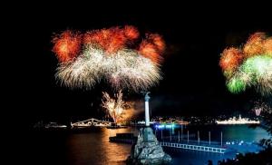
Ukok tours. Wonders of the Ukok Plateau: how and why to go to one of the most inaccessible places in Altai
This hike is exploration, which means there will definitely be adventures!
Detailed description of what will appear after the hike in August 2019.
The Ukok Plateau is the most mystical, mysterious and most inaccessible place in the Altai Mountains. It is located in the very south, on the border of four states: Russia, Kazakhstan, China and Mongolia, at an altitude of about 2000 meters and is included in the World Heritage Fund. natural heritage UNESCO.
We have to travel 957 kilometers in off-road vehicles to see fantastic landscapes that are truly mesmerizing and will penetrate to the core.
Almost every day we will make radials from which we will bring amazing photographs!
For fishing enthusiasts there will be time to catch trophy grayling. And the fishing on the plateau is simply gorgeous!
We will climb into the very wilderness of the Altai mountains - to places where it is quite difficult to get on foot or on horseback, in order to touch the untouched primeval beauty, surrounded by mystical mountains and ancient mounds.
You will see the legendary mounds of the Ukok plateau, its “Deer Stones”, the burial place of the “Princess of Altai”, as well as the Tabyn-Bogdo-Ola ridge and the lion’s share of Altai attractions that stretch along the Chuysky tract.
We will visit the natural places of power of the Altai Mountains to absorb the flow of vital energy, allowing us to be “reborn again.”
We will spend the night in the places where our ancestors lived a thousand years ago, about which there were corresponding traces on the rocks.
We will ford several deep mountain rivers.
After traveling along the Ukok plateau, we will raft on catamarans along the upper Chuya! We will raft along the beautiful Kurai steppe. There will be no difficult rapids on the river!)
And, of course, we’ll take a steam bath in a hot bathhouse!
The other side of this fantastic tour is the healing of the body. After all, we make sure to visit the Teply Klyuch radon springs. Such baths generally increase vitality, improve heart function, normalize blood pressure, and promote the healing of wounds and various injuries.
The instructor on this route is Sergey Biryukov On top of that, he’s also a professional photographer, which means you’re guaranteed cool photos from the trip;)
Program by day
Day 1
Meet in Barnaul. We drive all day along the famous Chuysky tract. On the way, lunch in the canteen. Overnight at a campsite near the village of Kurai in cozy tents. We will cover 700 km by car.
Day 2
We wake up, pack the camp, have breakfast and hit the road. During the move we will see
the Kyzyl-Chin valley (local Mars), the village of Beltir (the epicenter of the powerful earthquake of 2003), we will cross the Chui valley and pass the customs post on the Tarkhata River. Overnight on the banks of the Tarkhata River. We will travel 100 km by car.
Day3
We drive up the gorge of the Tarkhata River and climb to the Dzhumalinsky Pass (2750 m). From the pass there is a stunning view of the South Chuya Range. Next is another pass, then radon springs. You may have to walk 2-3 km and ford small rivers.
Day 4
After descending from the Teply Klyuch pass (2900), the Ukok plateau begins. Overnight at the foot of the Tabyn Bogdo Ola mountain range on the shore of Lake Gusinoye.
Day 5
Moving from the lake Gusinoye to lake Alakhinskoe. There will be two passes along the road, the rivers Muzdy-bulak, Ak-alakha and Kara-alakha. The Bertek tract is the “heart of Ukok”, with ancient burials and one of them, “Altai Princess”, is famous throughout the world.
Day 6
Day on Lake Alakhinskoe. We're not going anywhere today. We will walk all day through the most beautiful places, and fishermen will catch trophy grayling! In the evening it will be a HOOT!)
Day 7
Transfer to the Teply Klyuch pass. We'll take photos along the way!
Day 8
Transfer to the Chuya River. We set up camp and get ready for rafting.
Day 9
Rafting on the Chuya River from the village of Chagan Uzun. There will be no difficult rapids on the river! Let's calmly walk along the river and admire the Kurai steppe! Overnight in tents on the banks of the Chuya River
Day 10
Rafting along the Chuya River to the village of Kurai. After the rafting, we disassemble the catamarans and take a steam bath! Festive dinner!
Day 11
Moving to the city of Barnaul, 700 km
Tell your friends!
If you like a relaxing holiday, then a trip to the famous Altai plateau Ukok is not for you. In it you will have to face a lack of comfort, a difficult road, and radically changing weather. But also, of course, with unearthly beauty. We tell you why you should go to the Ukok plateau, how to get there and what to prepare for on such a trip.
Kobsev, CC BY 2.5, at ru.wikipedia
Why do tourists flock to Ukok?
The Ukok plateau is located in the southern part of the Altai Mountains. This is a protected area included in the list of UNESCO World Heritage Sites. One of most beautiful places on Earth, which is also of cultural and archaeological value.
Locals consider Ukok a sacred territory, where the entrance to the so-called “mountain world” is located - the world of higher beings with superpowers. Esotericists believe that the entrance to Shambhala may be located on the plateau. But tourists go to Ukok for other things.
1. Silence
Any human economic activity is prohibited on the Ukok Plateau. Due to the fact that the place is inaccessible, there are almost no people there. Therefore, you can fully enjoy the silence and sounds of nature. For this reason, those who are tired of the bustle of the city flock here.
2. Self-knowledge
On the way to Ukok and on the plateau itself you will have to face pristine nature. There are no roads in the usual sense; the settlement of Kosh-Agach, from which cars usually leave for the plateau, is located about 150 km from it. There is also no cell phone service in Ukok, as well as the usual information noise. In such circumstances, a person dives into himself, begins to better understand his capabilities and limitations, as well as his true goals and values. They say that in Ukok you get the feeling that time has stopped.
Yoga tours are organized on the plateau, esotericists come here, and shamanic rituals are performed here.
3. Incredible sunsets and sunrises
Ukok has unusual sunshine, which can vary greatly during the day due to the weather. It creates a mystical atmosphere, a feeling of the unreality of the world. Rain, fog, snow, clouds or clear skies - all of this greatly affects the light and the landscape as a whole. Sometimes there is an unusual glow over the mountains. According to legend, Genghis Khan saw him and ordered to name one of the mountain ranges “Five Holy Peaks” (Tabyn-Bogdo-Ola).
4. Meeting with wild animals
Since Ukok has untouched nature, there is a high chance of seeing animals and birds in natural conditions. You can meet wild horses, wolves, gophers, foxes, eagles, golden eagles, cranes and so on. Scientists take photographs of rare animals on Ukok. For example, a snow leopard.
5. Unearthly landscapes
“The feeling that the sky has come closer to the earth” is how some tourists talk about the beauties of Ukok. In the steppe at an altitude of more than two thousand meters there is not a single tree, but there are numerous rivers and lakes with white or clear water. Framed by snow-covered plateaus mountain ranges. They also contain glaciers that never melt. They say that no photograph can convey the beauty of these places.
6. Mounds
There are more than 150 archaeological sites on Ukok - burial sites from different archaeological periods. Here in 1993 they found the famous mummy, which was called the “Altai princess Kadyn”. Tourists can also see the mounds.
The main attractions of Ukok
There are several places and objects on Ukok where tourists are most often taken.
1. Bertek tract
This tract became famous throughout the world because the famous mummy, the “Altai princess Kadyn,” was found here in 1993. The find was unexpected and raised many questions among scientists. The woman was Caucasian, clearly of high status, and six horses and jewelry were buried with her. Local residents consider her the foremother of people and the patroness of this territory. Now the mummy is in the Gorno-Altaisk museum, built especially for her.
2. Lakes Kaldzhin-Kol and Kaldzhin-Kol-Bas
The largest bodies of water on the Ukok plateau are connected to each other by a drain. They are of glacial origin, like most reservoirs on Ukok. The lakes have gentle shores, and the water warms up to 20 degrees Celsius. So it’s quite possible to take a swim.
3. Bertek writing
A unique cluster of ancient drawings - petroglyphs - was found on the Kyzyl-Tas rock. More than 120 characters are carved there, the oldest drawings date back to the Stone Age, and most of them date back to the Iron Age and Scythian times. There are many scenes of hunting and different animals - camels, ibex, wolves, dogs. There are several ritual scenes related to fertility and procreation.
4. Tabyn-Bogdo-Ola ridge and Nairamdal peak
Ridge Tabyn-Bogdo-Ola - mountain range, located at the convergence of the borders of Russia, Mongolia and China. The glaciers that are located on it are the largest in Altai. They feed the largest rivers in the region - Katun, Irtysh and Kobdo (flows in Mongolia). The watershed between the river basin of the Arctic Ocean and the drainless basin of Central Asia runs along the ridge (it has no connection with the World Ocean).
The massif has five peaks over 4 thousand meters high. The highest of them is Mount Nairamdal (the second name is Kuiten-Uul). Until the middle of the 20th century it was considered highest point Altai (in fact it is Mount Belukha). The knot is considered sacred among Buddhists (Altai, Tuvan, Mongolian and Chinese peoples). Legends about the mysterious country of Belovodye converge here.
5. Confluence of the Kalguta and Akalakha rivers
Akalakha is the largest river in Ukok, a drainage for other rivers. The place where it merges with Kalguta is beautiful in itself. There is also a view of the Tabyn-Bogdo-Ola ridge. At the confluence, tourists often set up camp, stop for the night and fish for grayling.
6. Teply Klyuch Pass and Dzhumalinsky Spring
The Ukok plateau is located behind the Teply Klyuch pass. Here is the most accessible road on the plateau. And at the beginning of the pass there is the Dzhumalinsky spring. It's rare thermal spring containing radon, which never freezes. There are small houses where you can take radon baths. There are also simple wooden houses for overnight stays. At the top of the Teply Klyuch pass there is a small lake.
7. Geoglyphs of Ukok
The plateau has huge geometric designs made on the surface of the earth. They can only be seen from above. To obtain such a pattern, the top layer of soil is removed. Lighter layers appear on the surface, and they create the image. It is not known when and by whom the geoglyphs were made on Ukok. The drawings resemble griffins - mythological creatures revered by the Scythians. Altai State University professor Igor Ivanov discovered the geoglyphs of Ukok.
When to go to the Ukok plateau?
The tourist season on the Ukok plateau is very short - about one month. It starts at the end of July and lasts until about the end of August. This is due to the harsh climate of the plateau. 10 months of the year it itself and the entrances to it are covered with snow. But even during the short summer in Ukok, not everyone manages to visit it. There is a belief that the plateau “does not allow” those who are “not ready” to visit it. It happens that the weather deteriorates, the roads wash out and cars cannot overcome the pass. Or worse, it snows unexpectedly.
How to get a pass to the plateau?
Since Ukok is a border area, you must obtain a special permit to visit it. At the border post in Kosh-Agach, the website explained that a pass to visit the border area on Ukok is legally issued within 15 days (but may be ready earlier). It can be done remotely. It is issued free of charge.
To do this, on the government services portal you need to find the service “Issue of passes to the border zone” (provided by the FSB), fill out an application form and send it by email to the border department of the Altai Republic with a note that the document needs to be sent to Kosh-Agach. When sending, make a follow-up call. Contacts of the Border Directorate of the FSB of Russia for the Altai Republic can be found on its website. The pass will be valid for a year.
For violating the rules of entry into the border area, a fine of 500-1000 rubles is provided (Article 18.2 of the Code of Administrative Offenses of the Russian Federation).
How to get to the Ukok plateau?
You need to go along the Chuysky tract to the village of Kosh-Agach. The paved part of the path ends there. From Kosh-Agach you should follow the sign in the direction of the village of Belyashi (Dzhazator) - after the bridge over the Chuya to the right. The road goes south through the Chui steppe. After 30 km there will be a border post where passes will be checked. Next there will be one road - along the Tarkhata River. After 40 km, at a fork you will need to turn right, towards the Teply Klyuch pass. Drive to the Dzhumalinsky springs, there is no ambulance, so you need to be confident in your health and body stamina.
The road from Kosh-Agach to Ukok will only be covered by a specially prepared SUV. It is not worth going there in a regular car. There must be a supply of fuel and tools. For those who do not have special transport, camp sites offer a service - a trip and excursion to the plateau, jeep tours.
Under no circumstances should you go to Ukok alone. It’s better to go in a small group - it’s calmer and there’s an opportunity to help each other if something happens.
You will have to live in tents on Ukok; there are no camp sites there. Therefore, you will need all the basic camping equipment. The difference between day and night temperatures on the plateau reaches 40 degrees. During the day it can be well over 30 Celsius, and at night it can reach minus two.
In a backpack with personal belongings you should put:
- down jacket or warm jacket;
- waterproof clothing (raincoat, jacket and trousers);
- trekking boots; sneakers;
- a warm tracksuit and a warm hat;
- T-shirts, shorts;
- woolen socks and thin socks, several pairs;
- sun cap;
- sunglasses and cream.
On a “wild holiday” you will always need a flashlight, a folding knife, matches, batteries, personal hygiene items, and a personal first aid kit.
Enrollment is closed for the 2019 season. The hiking schedule for the 2020 season will be ready at the end of August.
Gorny Altai- an amazing place that contains many mysteries and secrets. One of its amazing wonders, which hides far in the south, is the Ukok plateau. Its uniqueness also lies in the fact that it is located on the border of four countries. At the end of the 20th century, it was given the status of a “rest zone”, and soon the plateau became the property of UNESCO. Local residents treat the Ukok Plateau with trepidation; it is a precious shrine for them. The famous philosopher Shishkin even called the plateau the “Altar of Eurasia.”
Tour program
First day
Novosibirsk - Barnaul - Biysk - Kosh-Agach village
Travel along the Chuisky tract (550 km by car) – once an ancient caravan route connecting Russia and Mongolia. This fast-paced road will open your eyes to landscapes of wondrous beauty. Rapidly changing landscapes, breathtaking serpentines of the Seminsky and Chike-Tamansky passes will not let you fall asleep on the way and will completely capture your attention. Overnight in tents at the Tydtuyaryk campsite, dinner.
Auto (from Barnaul): 700 km. On the road, excluding traffic jams and sanitary stops, 11-12 hours.
Second day
Kosh-Agach village - Dzhazator village
In the village of Kosh-Agach we prepare documents for visiting the border zone. Here you will be offered breakfast in a local cafe, where you can try national dishes: samsa, bugirsak, manti, lagman. After your meal, you can visit the local market and buy souvenirs from Mongolia. Transfer to the village of Belyashi (Dzhazator) along a country road. Accommodation in tents on the territory of the equestrian base. Acquaintance with the culture, life and traditions of the Kazakhs inhabiting the Kosh-Agach region. Meeting the grooms. Accommodation in tents on the campsite, sauna.
Auto: 160 km. The journey takes 4-5 hours.
Third day
Dzhazator village – Dzhazator river – Sudobay stream.
The morning begins with a safety briefing, distribution of food and equipment. The beginning of the equestrian part of the route. The road runs through the village of Dzhazator, a corner of Kazakh culture in Altai, and takes us to a bridge over the river of the same name. The wide valley of the Dzhazator River gives way to the valley of the Sudobay stream, squeezed by the mountain slopes. Ahead you can see views of the beautiful and harsh mountains of the South Chuya Beleks and their highest peak - Iiktu (3936 m). We set up camp on the bank of the Sudobay stream and stop for the night. If you wish, you can climb to a small peak and see the village of Dzhazator and the path traveled today from a bird's eye view.
Horse trekking takes 2-3 hours.
Fourth day
Sudobay stream – Kara-Bulak pass (2800 m) – Kara-Bulak river.
The next morning the journey continues and the trail leads to the source of the Sudobay stream. A long and harsh climb to the Kara-Bulak pass, 2800 m high, awaits you. From the top of the pass an amazing panorama with rare natural contrasts opens up: right in front of you lies the mysterious Ukok plateau; above the plateau, the snowy peaks of Tabyn-Bogdo-Ola, sparkling in the sun, proudly raise their peaks to the sky; the eternal snow and ice of the South Chuya ridge remained behind; perhaps the clouds will clear and you will see the majestic three-headed Belukha - the crown of the Katunsky Range and the entire Altai. We descend from the pass along the picturesque bank of the Kara-Bulak River, covered with a carpet of flowering herbs. The lakes, which are the source of the Kara-Bulak River, amaze with their unusual shape and color of water. The trail goes along a mountain spur, its structure reminiscent of an amphitheater. We camp for the night in the middle reaches of the river, not far from a picturesque waterfall.
Horse trekking takes 6-7 hours.
Fifth day
Kara-Bulak river – Akkol river – Ak-Alakha river – Kyzyltash tract – Kalguty river – Ak-Alakha river.
Today a busy day awaits you, full of discoveries and unforgettable impressions. In the morning we continue walking along the valley of the Kara-Bulak River to its confluence with the Ak-Alakha River. Along the left bank of the Ak-Alakha River, after its confluence with Akkol, the first archaeological monuments are found. In order to see the Ukok plateau from a bird's eye view, we easily overcome the climb to the viewing height (2600 m). In front of you stretches a hilly plateau, completely covered with hundreds of saucer lakes, with water ranging from turquoise to blue-black, and a web of milky rivers. The water glistens and shimmers in the sun, and this makes the plateau seem golden. There is a stunning view of the Tabyn-Bogdo-Ola mountain range (“Five Sacred Peaks”), framing the plateau on the south side. According to legend, the name of these mountains was given by Genghis Khan himself. One of the peaks, Mount Nairamdal (4374 m) is the second highest in Siberia, after Belukha. Many believe that it is at the foot of Tabyn-Bogdo-Ola that the entrance to the legendary Shambhala is located. The plateau has always been surrounded by an aura of sacredness; it is difficult to describe it in words; all senses are heightened here, and “prophetic” dreams are often experienced. The Ukok plateau hides many historical secrets. Ancient memorial structures of the Turks, Scythians, Huns, and Sarmatians were found here. In the Kyzyltash tract you will examine the petroglyphs of the Bertek pisanitsa and, perhaps, you will find all 120 images. The age of the ancient drawings is 4700 years. In the valley of the Kalguta River you will see an old Kazakh cemetery from the late 19th century. Our path along the plateau is the path of nomadic warriors, trade caravans, and Genghis Khan himself. We stop for the night near the bridge over Ak-Alakha.
Horse trekking takes 7-8 hours.
Sixth day
Ak-Alakha River – burial place of the “Princess of Altai” – Bertek outpost – Lake Kaldzhin-Kul.
The next morning we continue to move along the plateau, which is a museum under open air. Along the way we examine archaeological monuments of different eras, represented by mounds, stone fences, displays, steles, balbals, etc. Inspection of the burial site of the “Princess of Altai” - a unique and sensational find of the Pazyryk culture. Next, the path runs past the border outpost to an unusual beautiful lake Kaldzhin-Kul. Laughing gulls fly over the blue water, warblers and scoters call to each other. If desired, a radial exit to the viewing height (2624 m) is possible, from which you can clearly see mountainous country– the Southern Altai ridge, as well as the source of the Ak-Alakha River.
Horse trekking takes 6-7 hours.
Seventh day
Lake Kaldzhin-Kul – lake Kaldzhin-Kul-Bas – Mukyr-Tabati pass (2590 m) – Mukyr stream.
After breakfast the journey continues. A trail along the Kaldzhin-Kul and Kaldzhin-Kul-Bas lakes awaits you. In summer, delicate green grass frames the lakes, reflecting the snow-white mountains, blue skies and clouds. Having overcome the climb to the Mukyr-Tabati pass (2590 m), we say goodbye to the Ukok plateau. The pass is a small high-mountain plateau and even here you are surprised by the presence of numerous amazingly beautiful lakes. Descent along a narrow valley covered with lush grass, low willow bushes and squat birch. Mukyr winds strongly, with dozens of bright streams scattering from it in all directions. The Russian-Kazakh border runs parallel to the stream, 8 km to the south, so you can encounter Russian border guards. Large grayling are found in Mukyr. Overnight in a clearing among majestic larches.
Horse trekking takes 7-8 hours.
Eighth day
Mukyr stream - r. Chindagatuy – Chindagatuy mine – lake. Alakhinskoe.
Today the journey will continue along the beautiful valley of the Chindagatuy River. The valley is flat, with a lot of swamps, covered with dense thickets of dwarf birch. Green slopes and larch copses are pleasing to the eye. Our path runs along the former dirt road, which in the 1940s led to the Chindagatui mine. In some places there are remains of buildings and wooden piles. An abandoned mine is visible on the left as you move along. Mount Molybdenum rises above it, on the slope of which there are adit exits. Molybdenum and tungsten were mined at the mine from 1938 to 1954. After visiting this monument of the Stalin era, we head to Lake Alakhinskoye. Along the lake the path goes along a shaky ridge, movement is difficult and dangerous. Horses must be led. Be prepared for this.
Horse trekking takes 4-5 hours.
Ninth day
Rest day on Lake Alakhinskoe.
Rest day at the lake. Alakhinskoye is large and deep lake rich blue color. From the west it is limited by harsh blue-gray mountains with white caps of eternal snow. They reflect perfectly in calm water. On a hot day you can take a swim. The lake has excellent grayling fishing. You can pick golden root, mushrooms, eat honeysuckle or lingonberries. From the lake you can climb to a viewing height, and the panorama that opens will be worth the effort. A sparkling gray-blue lake will open before you, flowing out of a small turquoise-colored lake, a waterfall falls from the mountains, the Kara-Alakha river runs merrily, rushing towards the village of Dzhazator.
Tenth day
Lake Alakhinskoye – Kara-Alakha River – Ak-Bulak tract – Chokportas tract.
Having rested, we begin our descent along the swampy valley of the Kara-Alakha River. Having enjoyed the new views, we begin the climb through a dense, impassable, like a fairy-tale forest to the Ak-Bulak tract. In August, the forest is covered with a carpet of lingonberries. Having climbed the ridge, we will see a panorama of the surrounding mountains. The Chokportas tract will amaze you to the core. On your right hand the snow-capped peaks of Tabyn-Bogdo-Ola open up, on your left - gradually opening up, a silver-sparkling three-headed Belukha appears from behind the clouds. The huge rocks and cliffs located in the tract resemble medieval castles, columns, animal figures and silhouettes of people. One can only be amazed at how accurately, like a sculptor, nature sculpted a granite horse, a terrible troll or a huge stone sphinx. And no one knows what force scattered these statues across the earth. We stop here for the night amazing place, so that at sunset you can once again enjoy what you saw.
Horse trekking takes 7-8 hours.
Eleventh day
Chokportas tract - Koksu River.
In the morning, after taking pictures of the mountains flooded rising sun, which is very close, we hit the road. Having overcome steep slopes, a kurumnik, a pine forest, a windfall, meadows well-groomed after haymaking, we descend to the Koksu River. In a wide river valley, at a well-maintained parking lot, we camp for the night. The surrounding forests are rich in berries and mushrooms.
Horse trekking takes 5-6 hours.
Twelfth day
Koksu River – Dzhazator village.
Today is the last day of the trip. Our road will run through the high mountain steppe of Samakha. The steppe is very beautiful. Open areas covered with low-growing grass alternate with islands of forest. On the opposite side of the Koksu River will open beautiful view to the Katunsky ridge with Shenel Peak - “the beginning of the Katunsky ridge”. Through a small forest the road will lead us to the village of Dzhazator. The horse journey is over. Accommodation in tents on the campsite, sauna, dinner.
Horse trekking takes 3-4 hours.
Thirteenth day
Dzhazator village - Kosh-Agach village - Biysk - Barnaul - Novosibirsk
Early rise, we leave at 06:00 am. Departure to Barnaul, Novosibirsk, on the way we stop at the souvenir market.
Auto (to Barnaul): 860 km. On the road, excluding traffic jams and sanitary stops, it takes about 14 hours.
The tour price includes
- Transport delivery for the tour from Novosibirsk, Barnaul and back, internal route transfers according to the program;
- Horse rental;
- Services of guides, instructors, grooms;
- Meals from dinner on the day of arrival to breakfast on the day of departure;
- Group equipment: tents, awning, fire and kitchen equipment, first aid kit;
- Personal equipment: sleeping bag, sleeping mat (karemat), archimaki, OZK raincoat; You can see a list of personal items needed on a hike
- Medical and accident insurance;
- Bathhouse according to the program, on the second and twelfth days of the tour.
- Accommodation in tents on the territory of the camp site on the first, second and twelfth days of the tour.
- Excursions according to the program.
The tour price does not include:
- railway, air tickets;
- Meals at roadside cafes during the transfer.
- Alcoholic and soft drinks;
- Services offered at base sites and not included in the program;
- Any changes to the program that entail additional costs.
Contacts
- VKontakte:
1 day
Barnaul city - Barangol village - Seminsky pass - Chike-Taman pass - Chuya river (road 550 km)
Meeting at Barnaul airport or train station. We’ll start our tour to the Ukok plateau by moving along the Chuya tract to the Chuya River. The abundance of archaeological, historical and natural monuments makes a trip along the Chuysky tract an exciting journey. Overnight on the banks of the Chuya River.
Day 2
Chuya river - Aktash village - Kurai village - Aktru mountain camp (car 150 km)
Registration necessary documents for a tour to the Ukok plateau. Transfer to the Aktru mountain camp, which has been operating since 1938. Trekking along the Aktru River to the alpine camp (7-8 km) on foot.
Day 3
Trekking to Blue Lake (6 hours, 12 km)
You will go along the Aktru River, past the “ram’s foreheads”, up the Bolshoi Aktru glacier to the Blue Lake (2900 m). IN good weather From here the peak of Aktru opens (4075 m). Return to camp.
4 day
Aktru river - Kurai village - Kosh-Agach village - Tarkhata river - Warm spring spring
We continue our tour to the Ukok plateau: we leave the alpine camp and follow through the Kurai and then the Chuya steppe. In the village of Kosh-Agach we get permission to go on a tour to the Ukok plateau. Next, our road passes through the border zone; at the Tarkhatinskaya border post we make marks in the passes. Overnight at the warm spring.
5 day
Source Teply Klyuch - Teply Klyuch pass - Kuzbasskaya outpost - Ak-Alakha river
We take morning baths in a healthy radon source (water temperature from +12 to +20 degrees). We climb the pass, from where a grandiose panorama of the Ukok plateau opens. We move along the Tabyn-Bogdo-Ola massif (“Five Sacred Peaks”). Next we follow along the Ak-Alakha River.
Day 6
In the 90s of the last century, archaeologists made a sensational discovery on the Ukok plateau: the burial of the famous “Princess of Altai” was discovered. Today, during our tour of the Ukok Plateau, we will visit the excavation site.
Day 7
Transfer to Lake Kaldzhin-Kul-Bas. Optional trekking to a viewing height of 2624 m, from where a stunning view of the Ukok plateau opens.
Day 8
Lake Kaldzhin-Kul-Bas - Ak-Alakha River - Kuzbasskaya outpost - Teply Klyuch pass - Teply Klyuch spring - Lake Tarkhatinskoye
The tour to the Ukok plateau is over, but there is another “pearl” of Altai ahead - Lake Teletskoye, about which they say that if you haven’t seen Lake Teletskoye, then you don’t know anything about vacationing in the Altai Mountains. Today we return to Lake Tarkhatinskoye, and on the way we bathe again in the healing spring.
Day 9
lake Tarkhatinskoye - Kosh-Agach village - Aktash village - Red Gate - Ulagansky pass - Pazyryk mounds - Katu-Yaryk pass - Chulyshman river (car 250 km)
On this day we will go to the Chulyshman River. On the way you will see five Pazyryk mounds, which are the burial places of noble nomads - tribal leaders. From the Katu-Yaryk pass we will admire the valley of the Chulyshman River, on the banks of which we will set up our camp. Bath, relaxation, fishing.
10 day
Walking excursion to the grandiose Uchar waterfall (22 km). The height of the water fall is more than 160 meters!
Day 11
Chulcha River - Stone mushrooms - Lake Teletskoye
Early rise: you need to have time to photograph the “stone mushrooms”, which after 7.00 are already in the shade. Transfer to Lake Teletskoye. Overnight on the lake shore.
12 day
Lake Teletskoye - village Artybash - city of Barnaul (boat 70 km, car 420 km).
Rest on Lake Teletskoye, boat trip (70 km). Transfer to the village of Artybash. Bathhouse. Departure to Barnaul.
Ukok Plateau - Altai
Why Ukok? For me this choice turned out to be accidental. But I am grateful to fate for throwing me to the very edge of Russia, to the border with China, Mongolia and Kazakhstan. Of course, it’s better to go on a bike trip on your tested bike: you know what to expect from it. But transporting it from Moscow by plane is not the best convenient option, so I rented a bike in Barnaul.
To get from there to Ukok, we had to travel almost two days along the Chuysky tract in Vanya’s minibus. Along the way, we registered our trip with the Gorno-Altai Rescue Service of the Ministry of Emergency Situations. It's big enough populated area Republic of Altai, but it is difficult to understand what life here is based on now. Apparently, the climate here is harsh, surrounded by the Chui steppe, which, at first glance, is a lifeless desert with very sparse vegetation. And where will it come from if winter temperatures can drop to –60°C, and summer daytime temperatures can rise to +30°C. But this does not mean at all that summer here is hot: the average daily temperature does not exceed +14°C due to sharp temperature changes between day and night.

At the same time, the climate is very dry, with no more than 100 mm of precipitation falling per year. They say that local residents They live off livestock farming, but we rarely came across their herds during our travels. By the way, this is the last settlement before the Ukok plateau. In Kosh-Agach you can replenish supplies and refuel your car. Then we moved southwest through the Chui steppe along a dirt road. At the Soloneshinskaya outpost we passed a document check and entered the territory of the Ukok Plateau Quiet Zone natural park. This outpost is last place, where you can call mobile phone(but the connection here is bad, it’s better to make the necessary calls in Kosh-Agach). Further cellular communication does not work.
The Ukok Plateau is inaccessible and mysterious place, about which there are many legends. Archaeologists have discovered here monuments of ancient culture from various eras (mounds, rock paintings...), most of which have survived to this day in good condition. The plateau is rich in rare and unique species of plants and animals, but new discoveries can also be expected due to little knowledge of the local flora and fauna. For Altai people, Ukok is a sacred place. Nicholas Roerich was looking for the gate to the mysterious land of harmony Shambhala in the Altai Mountains, or maybe they are located somewhere on Ukok? By weather conditions Ukok is accessible for cycling only three months a year.
The passes open to snow only in June; July is the busiest month here. warm month, and in August autumn already arrives, but at this time the lowest water level in the rivers is observed. …As we approached the start of our cycling route, the weather became worse. Clouds rushed across the sky, from which snow sometimes fell, but so far to the side, not above our heads. We arrived at the Dzhumalinsky springs - the beginning of the active part of the route - on the evening of August 15. There are radon springs with relatively warm water here. When I was going on a hike, I definitely planned to swim in them. But how cold it turned out here! By dinnertime I was so cold that I had no desire to swim.
But it turned out that the baths were equipped in houses heated by a stove. Ivan highly praised the springs for us, after which Sveta and I plucked up courage and made our way to the bathhouse in the rain with flashlights. How cool it was! The stove was heated up, like in a bathhouse. I really wanted to stay here for the night. In general, we took a dip in the radon water and warmed up... I note that these springs are considered a holy place among the Altai people, and strict rules are established for visitors: in particular, it is forbidden to speak loudly, wash or wash dishes in the springs. By the way, the keepers of the houses may not have firewood for tourists. There are no trees around, so it is advisable to come here with your own firewood (in principle, you can collect a bundle of firewood in the Chuya Valley, along which the road runs).
You need to go to Ukok itself with a torch. We took a gasoline one, but it worked poorly, perhaps due to the thin air. The morning of August 16 turned out to be not much warmer than the evening. Quickly getting ready after hot porridge dispersed the blood throughout the body, and an unbearable desire appeared to immediately rush on the road. The Teply Klyuch pass is considered the highest automobile pass in the Altai Mountains (2906 m above sea level, the elevation gain from the sources is about 500 m). And if I had not seen with my own eyes the cars on both sides of it, I would never have believed that cars could drive on such roads. But a bicycle has higher cross-country ability, especially if you don’t ride it, but push it through mud or uphill.
Which, in fact, we did for a significant part of the climb to the pass. The weather was constantly changing, the dazzling sun alternated sharply with showers of rain. But they were short, and therefore did not even have time to cool down the hot travelers. I wanted to take pictures at every step. For some reason, it was here that there was the greatest variety of flowers (forget-me-nots, bluebells, yellow poppies...), which did not at all fit in with the snow glistening on the slopes of the surrounding mountains. Many of the flowers were similar to those I met in our strip, but here they were very miniature and seemed so defenseless that it was completely unclear where they got the strength necessary to survive in such harsh conditions.
The closer the pass, the more difficult it was: the climb was large, and we had not yet had time to get into the rhythm of the hike. Danila, however, managed to go and even help Sveta and me, for which we thank him very much. Coming down from the pass was much more fun. Even sometimes my ears were blocked from the height difference, the brakes were squeezed almost to the end, but the speed was still enough to release adrenaline into the blood. This is probably why the first ford (across the Argamdzhi River) did not seem so scary. True, it was scary to take the first step into the water with almost bare feet, but then we got used to it, and the next fords were not at all scary and did not cause any special difficulties. That day we walked and drove a total of 31 km. There was a storm at night. And on the morning of August 17 we woke up in a cloud and in snowdrifts.
What a delight this snow gave me! I had an irrepressible desire to make a snowman. Everyone who woke up joined in its creation. As the cloud left the valley, it became warmer, some were already running in a swimsuit in the snow and managed to rinse off in a mountain river, and others began throwing snowballs. It’s a thrill, I tell you, when you get hit with a tasty lump of snow on your bare back! In general, I am sure that our games and fun showed the firmness of our intentions and warded off bad weather from the Ukok plateau during our stay on it. From that moment on the weather was favorable to us. And I was once again convinced that when coming into contact with wild nature, you definitely need to maintain composure during the first tests, then everything will work out as well as possible.
This time too, Ukok rewarded us in full, demonstrating a panorama of the largest glaciation in the Altai Mountains - the Tabyn-Bogdo-Ula mountain cluster ("five sacred peaks"), free of clouds. By the way, there is a belief that Genghis Khan gave it this name during one of his campaigns... What a fascinating sight it was when the clouds gradually left the peaks sparkling in the sun! This mountain junction was visible to us until we climbed the Akkol pass on August 21. And every time he delighted us with his power and beauty. You begin to respect him even more after learning some details. Firstly, his most high peak Nairamdal is the second highest in Siberia (4374 m). Secondly, on the slopes of Tabyn-Bogdo-Ula, scientists counted 35 glaciers with a total area of about 150 square meters. km.
Thirdly, it divides the territory of Russia, China and Mongolia. Fourthly, the watershed line between the Arctic Ocean basin and the endorheic basin of the Central Asian basin runs along it. And I saw all this with my own eyes! We saw an equally enchanting picture when descending to the river. Ak-Alahe. Its winding riverbed and lakes in the valley sparkled in the sun like a scattering of precious stones. It is no wonder that it was here that such a large number of ancient mounds were discovered, in one of which in 1993 archaeologists found the “Princess of Ukok” (the embalmed mummy of a young woman dating back to the times of the early Iron Age, whose clothes were preserved in good condition, and on some Tattoos of ritual and magical significance were discovered on parts of her body.
Before we saw the mounds (or rather, what remained of them after the excavations), we began to come across stones of different sizes and shapes along the road. It’s strange, where would they come from here, since the mountains are located quite a distance away? Moreover, it seemed to me that these places have a completely different energy. There was a feeling of some kind of belonging to ancient secret. I really wanted to know who placed the stones in the valley and for what purpose, is there any meaning to this? Well, then we got to the very mound where we found the “princess”. Soon after examining the mounds, we stopped for the night, having covered about 40 km in a day. I note that our path that day almost all the time went along a barbed wire fence (or what was left of it). By the way, on car card This dirt road is built in the Altai Mountains.
In some places she walks through swamps, which get wet in the sun and become impassable for vehicles. It is better to go through such places in the morning, when the ground is still frozen by night frosts. On August 18, we drove no more than 5 km to the next stop, checking in with the border guards at the Bertek outpost along the way. Having set up camp near the river. Kara-Bulak and after checking the maps, we went to lakes Ukok, Kaldzhibunkas and Kaldzhinkul. It is difficult to reach them by bicycle. Even on foot it was not easy to go: the path went through swamps and through thickets of dwarf birch, we crossed fairly high ridges in search of an observation point from where we could see these lakes. There were many more of them than we expected; from above we saw whole scatterings of reservoirs of various sizes.
They turned out to be inhabited. So, on Lake Ukok we saw a backwater in which, upon our appearance, the water seemed to boil from the bustle of grayling fry. By scooping up water from these puddles with your palm, you could catch several tiny fish at once. On way back Kostya found a gnarled log in the middle of the plateau, which had once been part of a young cedar. I wonder where he could have come from here? We took the log with us: there would be something to cook food on. When they cut it up, they saw that one log looked very much like a goblin. The hand did not rise to throw him into the fire, and for some time he was the 9th member of our team. Sveta even threatened to take him to the city. But the goblin, apparently, did not want to leave Ukok, and at one of the rest stops he unnoticed fell out of the pot.
On the morning of August 19, we had to get to the ford across Ak-Alakha (about 26 km). Vanya warned that this would be the deepest ford on the route. But the weather was excellent, there had been no precipitation for two days, a tailwind was blowing, the road was mostly downhill, so I didn’t want to think about the upcoming difficulties. Moreover, we had reserve days in stock. It was very easy to drive; the dirt road was mostly smooth and well-worn. Not far from the confluence of the Ak-Alakha and Kalguta rivers, we began to come across traces of modern civilization - empty winter roads, next to which fresh haystacks could be seen here and there. Apparently people still come here. Soon we reached a rock that stood out against the background of the surrounding area.
In the sun it sparkled with a metallic sheen, but in the shadow of the clouds it sometimes appeared red. In addition, near it the flow of Ak-Alakha, whose water is much whiter than in Katun or Chuya, sharply changed its direction. And from the huge boulders scattered in the river bed under the rock, it was noticeable that the water level had dropped significantly, and this turned out to be very useful for us. We decided not to risk it and cross Ak-Alakha today, fortunately the weather was warm. They found the ford site quickly, but it didn’t look much like a car ford. The AkAlakha spread very widely here, dividing into several branches, between which rose small areas of land, overgrown with dwarf birch and Kuril tea.
Reconnaissance showed that it was quite easy to overcome the first branch, but they still decided to untie the backpacks from the bicycles. And then Sveta and I were entrusted with a responsible mission: to carry a package of documents dry to the other shore, which we completed successfully. This evening we decided to spend the night right next to the ford. Moreover, from here Tabyn-Bogdo-Ula was clearly visible in all its glory. In fact, it was the evening of farewell to him. But we still have time to enjoy it unrealistically beautiful landscape. Not even a landscape, but an evening performance with the participation of our favorite giant. By sunset, dinner was already ready, and it was at that moment that the light show on the slopes of Tabyn-Bogdo-Ula.
The tops of the glaciers took turns being painted in pink-orange shades, then the gray-blue twilight gradually licked the warm tones from the slopes of the massif and he finally fell asleep. His sleep that night was guarded by the full moon. There wasn't a single cloud in the sky. And while waiting for the star show, four brave ones decided to settle down for the night in the open air. I’ll be honest: when I was getting ready to go on a hike, I dreamed of spending the night under the starry sky, but this time I decided not to risk my health. Still, the nights here turned out to be quite cold with my sleeping bag. And the temptation was so great... However, when I woke up in the morning and saw the guys on the shore in frosty sleeping bags, I did not regret my decision. Although it wasn’t too hot to spend the night alone in a 3-person tent, at least frost didn’t fall on my face.
On the morning of August 20, we moved along Ak-Alakha to the confluence of the river. Akkol. It didn't take long to drive, and then there was another ford. The water in Akkola turned out to be very clear, especially compared to Ak-Alakha, the current was quite strong, but we fermented the stream without any problems. After the ford, the road temporarily ended, and then we had to move along the horse trail up the river valley. Akkol. Cloudless sky and bright
the sun playing on the waves of bright blue Akkol could not leave me indifferent. I constantly felt that my soul was literally tearing out of my chest in an attempt to soar above all these beauties. In addition, there are clearly more colors here, large islands have appeared
bright green grass near the water.
Herds of domestic animals began to appear, which from a distance seemed very friendly. However, they dissuaded me from checking this, but I really wanted to take a closer photograph of the shaggy yaks! The day was very hot. It’s no wonder that at the next stop, many decided to swim in the nameless Akkol tributary, the water in which turned out to be surprisingly warm. As we approached the Akkol pass, we had to overcome several swamps, which, however, did not bring us any noticeable trouble. River valley Akkol turned out to be a very busy place. The presence of people in it made itself felt much more often than before: we began to come across people guarding large herds, abandoned winter roads, and the road became more traveled. How long or how short did it take us to get to the place where we spent the night at the source of the Akkol?
The mileage of the 5th day was 24.6 km. We went to the Akkol pass on August 21 in anticipation of how great it would be to descend from it. But it was almost impossible to go up, not so much because of the steepness of the climb, but because of the dirt road, completely strewn with large boulders. When I climbed it, I was haunted by the thought of how can you drive a car here? But they drive... At this pass, for the last time between the mountains, Tabyn-Bogdo-Ula appeared to us in all its glory. How sad it was to say goodbye to him! Here I realized that our journey was approaching the end, and I wanted to delay the moment of parting as much as possible... Kostya’s hopes for a downhill race were destined to come true, but not immediately. First, we had to overcome stone embankments along which the bike rushed forward, but the risk of getting square wheels was very high.
So at first, even on relatively flat sections of the road, I preferred to walk. They were too short. An excellent descent began immediately after the red rock, at the foot of which a whole field of its fragments of different sizes was scattered. And then we broke away. The speed was such that the ears were blocked from the rapid loss of altitude. And below a completely different landscape was already opening up: trees appeared on the slopes of the mountains. A quick descent led us to the last ford across the river on Ukok. Zhumaly. After it, a dirt road led us along the Zhumaly valley all the way to the Dzhumaly springs (the starting point). There was quite a bit left before meeting our car (from the pass to the springs you need to drive about 32 km). Along the way, we discussed options for the remaining days. After all, we had three reserve days left that we didn’t need on Ukok.
At the general council, they decided to move to the Chuysky tract on light bicycles. At the same time, we had to take a shortcut by crossing the South Chuysky ridge, and the car with the “extra” cargo had to move towards Barnaul. But first we had to drive it to the river. Tara. We left the Zhumaly valley already at sunset. How picturesque it was! Ukok said goodbye to us, painting the peaks of the mighty mountains and the sky above them with flashes of orange and red. It was necessary to look at it in order to remember it for a long time... How I wanted to jump out of the car and admire this spectacle! But time was inexorable, darkness was approaching, and we still had to get to our campsite for the night. However, there was still enough lighting to notice: during the trip around Ukok, the dwarf birch trees that had chosen the mountain slopes along the road to the Dzhumalinsky springs became predominantly red, but less than a week ago they were all green.
Autumn is coming so quickly here. On the morning of August 22, we loaded our things into our bicycle transporter and, in a reduced number, set off to conquer the South Chuya Range lightly. The weather was favorable: clear sky with small clouds, gentle sun, calm. Everything foreshadowed success for our voyage. The road gradually climbed up, but the ride was easy and fun. The vegetation around was no longer much like what we saw on Ukok: there was much more greenery and large trees, but on Ukok there were none at all. By the time it became difficult to drive, the road suddenly ended and we continued on foot to the Azhu pass (2925 m). Judging by the map, there should be a horse trail here, but we didn’t see it. The last 200 meters of the climb were over rocky terrain with no trail.
It became noticeably cooler and the clouds began to hang over us in a painfully frightening way. Rare drops of rain could not spoil the impression of what we saw from the saddle of the pass. An unearthly beauty opened up to us: lakes sandwiched between mountains. Black clouds hung behind us, while in front the clouds were still quite rare, but the wind carried them at high speed, and the color of the water in the lakes changed from azure to dark blue in a matter of seconds. The rising wind and the beginning of rain forced us to speed up our descent. Here the card failed again. Judging by it, the road should have passed right through the center of the lakes. But from above we saw neither a road nor a path (neither in the center of the lakes, which is not surprising, nor along their edges). How the guys chose the right bank we needed remains a mystery to me.
We had to go down a steep descent, strewn with huge stones (although in some places there is information that the Azhu Pass is suitable for traveling on motorcycles and ATVs). Carefully choosing the path, we went down to the water's edge of the first lake. There is no road or path here. So we went straight along the shore. We didn't walk fast, in some places we had to splash through the swamp, and in some places it was relatively dry. The rain started and then stopped. It seemed to me that the cloud was completely caught on the tops of the mountains at the pass and our guardian angel was trying with all his might to hold it there. We tried to walk faster without looking back. When we approached the second lake, it turned out to be not less than the first, although from the pass it looked different. There was also a very beautiful view of the snow-capped peak of Irbis-Tu (translated as “snow leopard mountain”, 3976 m above sea level) and the black rock.
Soon after we descended below the lakes, we saw herds and some kind of building (either a winter road or a cowshed). A dirt road began next to them. Meanwhile, the wind became even stronger, and it looked like it was already snowing over the lakes. It was great that the wind was blowing at our back, and the road somehow immediately went well. She quickly led us to the river. Elangash, which flows out of those lakes we walked past. Driving past would be an unforgivable mistake. After all, in this place the river cut through the rock deep canyon, which began with a cascade of tall but narrow waterfalls. An impressive sight! After the waterfalls we drove with very few stops. We were literally driven forward by the wind and the desire to escape from the rain. Elangash turned out to be a beautiful river. Ahead, in the rays of the sun, its water sparkled bright blue. The riverbed constantly meandered through the valley, which is why the road often crossed it.
The river was shallow, and we often simply crossed it. The storm was literally licking our heels, and the sun was still shining ahead. But thanks to this we saw a double rainbow. It was so bright that we simply could not help but take a picture of it. Then we saw rainbows again, but the desire to stop became less and less. One look back was enough to pedal as hard as I could. It's a pity we were in such a hurry. After all, as I later learned from Alexander Lebedev’s guidebook “In the Altai Mountains”, in this valley there is huge complex rock paintings (about 30 thousand of them have been studied so far). We didn't notice him. It's a pity that I didn't come across this book before the trip. Sunset was approaching, but there was still no connection (we had to call Ivan, who drove a minibus with our things, and find out where the camp would be). At the exit from the Elangash valley to the Chui steppe, some kind of water supply appeared along the road.
Perhaps these were the remains of an irrigation system that was built during the Soviet era. This hypothesis is supported by the remains of irrigation machines that can be seen nearby, a destroyed dam designed to drain water from the river. Elangash into an artificial channel, and working watering machines on a small piece of land fenced with barbed wire. Near these watering stations our phones started working, and soon we found our camp. On this day we drove 62 km. The most interesting thing is that the bad weather never went beyond the river valley. Elangash. And with the onset of complete darkness, stars even appeared in the sky above the camp. In general, we left Ukok on time. On the penultimate day of the hike, they planned to cross the Chui steppe, jump out onto the Chuisky tract near the village.
Chagan-Uzun and spend the night on the banks of the Chuya near the unfinished hydroelectric power station. As on the previous day, we traveled light. The morning was very gloomy, but nothing was dripping from above and it was, in general, relatively warm. But with such lighting, the Chui steppe was not at all pleasing to the eye. All that remains in my memory is a dull picture in gray tones. The vegetation here is extremely sparse; there are a lot of stones (small and medium-sized cobblestones) on the surface of the earth. This made me even more bewildered: why irrigate the desert steppe, what can be grown here?.. There were many intersecting dirt roads that were not on the map and in which it was easy to get confused, we navigated intuitively. Sometimes we drove through the steppe without any road or trail. For the most part the path went downhill, but in some places we climbed quite upward.
On the descents, the road at times became sandy, and on these sections the speed dropped almost to zero; we tried to go around such sections on the grass that sometimes appeared along the road. Then we hit the gravel road leading to Beltir. This village was at the epicenter of the 2003 earthquake, after which it was completely rebuilt. But we only had to drive part of the way to it and, before reaching the asphalt, turn across the steppe towards the Chuysky tract. As we approached the highway, it was impossible not to notice striking changes in the surrounding nature. First, yellow colors began to appear among the grayness of the desert. Then there were more of them.
Then, near the Chagan-Uzun River and the village of the same name, forests began to appear on the mountain slopes. At this point we stormed the river for the last time on our hike. The first part of it was crossed quite easily (there was a bridge there, pretty battered by the river flow and spring floods; it held us through, but it seemed to be no longer suitable for cars to pass through). However, the remaining channels did not cause any major problems. And then we rolled out onto the Chuysky tract. What a thrill I felt during the first kilometers of driving along a smooth highway running downhill!.. That day we covered a little more than 100 km. The morning of the last hiking day (August 24) could not give a clear answer to the question, are we going further on bicycles or by car? The rain that had started in the evening was still falling. It was very damp around, we were in a cloud. Danya, despite the rain, lit a fire and prepared breakfast.
Apparently, the spirits of the mountains were on our side, and while we were having breakfast, the cloud left, opening the way for the sun's rays. Seeing the rainbow, I realized that the promised surprise would be realized. Hooray! We'll ride for one more day, and Danya will take us along the Mazhoiskaya trail along Chuya with its most beautiful trails! They really turned out to be awesome, but it was difficult to climb on them even without bicycles. Next to one of the last hold-downs there were thickets of wild fruit bushes, where we refreshed ourselves a little with black currants and filled Max’s pocket with rose hips. They were so large and juicy, as if they were not wild. Around – indescribable beauty. Chuya carries its waters far below the gorge, the mountain slopes are covered with trees, a lot of greenery, a bright blue sky emerging through the clouds, ringing silence and intoxicatingly sweet air.
After the rain, the smells of different herbs, flowers and trees, which were in abundance here, mixed in it. I couldn’t breathe, and I really didn’t want to leave here. It felt like time could be stopped here. So I would sit on the edge of the cliff above Chuya, watching sunrises and sunsets. Soon the trail led us back to the Chuya tract, along which we traveled, accompanied by our minibus, to the confluence of the Chuya and the Katun. On the last day we covered almost 96 km. So, for three days of a “bonus” bike ride, we shortened our journey to Barnaul by a whole day, which we then reached by car. On the way home, the guys talked about how humanity could forever part with the beauty of the places we had seen.
Despite the fact that Ukok is an object World Heritage UNESCO, a decision was made to build the Altai gas pipeline through this plateau. The initiators of the construction promise not to affect the specially protected area, but to use only its surroundings. But environmentalists still see in this construction too many threats to the nature of the entire Altai Mountains, and the most popular tourist destinations will also suffer. We can only hope that reason will prevail over the human greed of a very limited circle of people and the route of the gas pipeline and road to China will be changed, and we will be able to experience unforgettable meetings with amazing places Mountain Altai. ...
In conclusion, some advice. For this route you need a regular mountain bike. The temperature difference on Ukok is large, night temperatures are negative, so you need to take a warm sleeping bag. I was frankly cold for a couple of nights in my sleeping bag, designed for -10°C. Rubber boots seemed unnecessary to me, but we were lucky with the weather. When planning a trip to the Altai Mountains, you should take care of vaccination against encephalitis (it must be done in advance). I already wrote about the lack of firewood in Ukok, so you need to go with a burner and enough fuel.