East Siberian Sea. East Siberian Sea in Russia Main port of the East Siberian Sea
It is not so easy to immediately find the East Siberian Sea on a map. The fact is that its borders are conditional and only in some places are limited to land. In the western part, the limit is Kotelny Island and the Laptev Sea; in the north - the edge of the continental shallows; in the east the border is the meridian, passing through in the southern part the sea is limited by the mainland.
Dimensions and depth
The maximum depth of the East Siberian Sea is 915 meters, and the average value of this indicator is 54 meters. In other words, this body of water is completely within the continental shallows. Its total area is 913 thousand m2. As for the volume, it is approximately 49 thousand cubic kilometers.
Shores
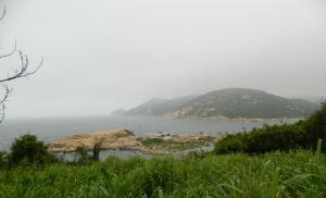
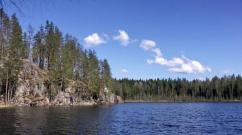
The East Siberian Sea has a coastline that is very different in its relief in the eastern and western parts. In its landscapes there are quite large bends, which in some places protrude far into the interior, and in others they go far into the land. In addition to them, straight sections are also quite common. Small meanders are common at river mouths. The coastline of the islands is monotonous and low-lying. A similar situation is also typical for the mouth of the southern part of the Longa Strait, the shores are covered with a mixture of pebbles and sand, which separate chains of lagoons.

It should be noted that the size of depths in coastal regions is significantly influenced by the amount of sediment carried by rivers. Under their influence, bars are also formed - alluvial shoals. Among other things, river runoff increases water temperature, resulting in thermal abrasion in estuarine areas. Its speed is from one to fifteen meters per year.
Bottom structure
The seabed is formed by a shelf, the topography of which is mostly flat. It is slightly inclined in a north-east direction. On the western side there is the so-called “shallow depth area”. This is what formed the Novosibirsk shoal. As for deeper places, they are typical for the northeastern region. A significant portion of the bottom here is covered with a sedimentary cover of small thickness. Many archipelagos and islands of the East Siberian Sea (of which there are not so many here) were formed precisely due to this foundation. These include Ayon, Medvezhye, and the New Siberian Islands. As various aeromagnetic images show, the bottom sediments of the shelf mainly include sandy silt, pebbles and crushed boulders. There is every reason to believe that some of them are fragments of some islands that were carried by ice throughout the territory.

Climate
Many people are interested in the question: “The East Siberian Sea - what ocean is the water area?” Despite the fact that the reservoir belongs to the Arctic Ocean basin, it is also subject to atmospheric influence from the Pacific and Atlantic. The climate here is arctic. With him in winter time The average temperature is -30 degrees, and in summer - about +2. Most of the year the sea surface is covered with ice. In the eastern region it is often floating ice are located close to the coast even in the summer months.
In winter, the East Siberian Sea is influenced by southern and southwestern winds, the speed of which is about seven meters per second. They bring cold air from the continent. In summer, the pressure increases here, and therefore northern directions begin to predominate among the winds. They are quite weak at the beginning of the season, but towards the middle of the season their power only increases, and their speed reaches 15 meters per second. At this time, the weather here is mostly cloudy with sleet or drizzling rain. Due to the fact that this body of water is quite remote from the centers affected by the atmosphere, in the fall there is almost never a return of heat here.

Water temperature and salinity
Throughout the year, the surface temperature of sea water decreases from south to north. In the winter season in the areas of river mouths it is about -0.5 degrees, while in the northern borders it is about -1.8 degrees. In summer, everything depends on the ice conditions. At this time, in the bays the temperature reaches +8 degrees, in ice-free areas it is about +3 degrees, and at the ice edge it averages zero degrees. In spring and winter, the change in water temperature as you dive is insignificant. In summer, closer to the bottom, the water becomes colder, especially in the western region.

The water salinity level in the sea changes in a northeast direction. In spring and winter it ranges from 4 ppm near the Indigirka and Kolyma rivers to 32 ppm in the central and northern regions. In summer, melting ice and a significant influx of river water lead to the fact that this figure decreases. It should also be noted that the water salinity level does not increase much closer to the seabed. As for this indicator, it is highest in the autumn-winter period. In addition, it grows as it dives deeper.
Hydrology
The East Siberian Sea is not very high compared to other representatives of the Arctic Ocean basin. The largest of the rivers that flows into it is the Kolyma. Its flow is approximately 132 cubic kilometers per year. The second largest river in terms of this value is the Indigirka River, which brings half as much water over the same period. At the same time, even in conditions of relatively large size, coastal runoff has little effect on the overall hydrological situation. At present, the system of currents in this sea is not very thoroughly studied. It is safe to say that the general water circulation here is cyclonic in nature. As for precipitation, its average annual value ranges from 100 to 200 millimeters. Due to the fact that there are no deep trenches here, and a significant area is shallow water, Arctic surface waters occupy a lot of space.

Tides
The sea is characterized by semidiurnal regular tides, which are caused by waves moving towards the continental coast from the north. They are best expressed in the northwestern and northern regions, weakening in south direction. This can be explained by the fact that in shallow water the tidal wave is dampened. For example, while in the area from Cape Shelag to the level fluctuations are practically unnoticeable, at its mouth the topography and configuration of the banks lead to an increase in tides by about 25 centimeters. The highest water level is typical for the month of June-July, because at this time the largest river inflow is. In winter, the level gradually decreases and reaches its minimum value in March.
Flora and fauna
The resources of the East Siberian Sea, namely flora and fauna, are quite poor. First of all, this is due to the harsh conditions created here by nature itself, so only those that turned out to be the most resistant to low temperatures took root here. In the regions of river mouths there are often quite large schools of white fish. Here you can also find omul, grayling, whitefish, navaga, polar flounder, cod and others. Representatives of mammals here are polar bears, seals and walruses. As for birds, among them we can note cormorants, sea gulls and guillemots. It is possible that a polar shark, reaching six meters in length, also lives in local waters, but no clear evidence of this has yet been found.

Sea problems
The problems of the East Siberian Sea are in many ways similar to the problems of other northern seas, for example the Barents, Kara, White and others. In this case, we are talking primarily about the environmental component. Despite the fact that the water here is relatively clean, Europeans have been destroying local biological resources, especially whales, for years. Over time, this led to a significant reduction in their numbers and even to the extinction of some species. It is impossible not to note another problem that has recently become global. We are talking about which the local fauna suffers. Among other things, the state of the water area is also negatively affected by human activity associated with the development of oil and gas fields.
Economic situation
In 1935, regular ship voyages began along the so-called East Siberian Sea. At the same time, one cannot help but focus on the fact that the navigation season here lasts only three months - it begins at the end of July and ends at the beginning of November. However, navigation is permitted only at this time and in the coastal strip.
East Siberian Sea- marginal sea of the Arctic Ocean, located between the New Siberian Islands and Wrangel Island. Surface area 913,600 km². Already from the name it is clear that this sea is located off the northern coast of Eastern Siberia. The boundaries of the East Siberian Sea are mainly conventional lines, and only in some parts is it limited by land. The waters of this sea communicate well with the waters of the Arctic Ocean, therefore the East Siberian Sea belongs to the type of continental marginal seas. There are very few islands in the waters of the East Siberian Sea. Coastline The sea has large bends.

|
Sailing
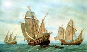
The Cossacks who mastered the Kolyma and Indigirka in the first half of the 17th century went downstream, went out to sea and went to Taimyr, where they dragged themselves to the Yenisei, on the banks of which they hunted. The first exploratory voyage in the historical era was made by the Yakut Cossack Mikhailo Stadukhin in 1644. Stadukhin's assistant Semyon Dezhnev in June 1648 on 7 kochas sailed the entire eastern part of the sea from the mouth of the Kolyma and further through the Long Strait and the Bering Strait to the Gulf of Anadyr, where he founded the city of Anadyr. Thus, in 1648, the possibility of end-to-end navigation along the entire coast of the East Siberian Sea was demonstrated.
The mainland seashores and islands were described in the first half of the 18th century by the Great Northern Expedition. All these discoveries were made not on ships, but on sleds. In 1823, Wrangel heard a story from the Chukchi about big island in the north (not yet discovered Wrangel Island), where storms sometimes carried fishing boats. Wrangel Island was discovered in 1849 by the British frigate Herald, approaching it from the Chukchi Sea. West Coast The islands were discovered in 1867 by the American whaler Thomas Long on the schooner Nile, whose ship passed between the mainland and the island through a strait that is now called Long's Strait. In September 1875, Baron Adolf Erik Nordenskiöld crossed the East Siberian Sea on the sailing and steam ship Vega - the first navigator who managed to navigate the Northern Sea Route along the entire coast of Asia. Then the De Long Islands were discovered. In 1913, the icebreaking steamships "Taimyr" and "Vaigach" discovered an island named after the assistant chief of the expedition, Vilkitsky. The last discovery was made by the next expedition of "Taimyr" and "Vaigach" on August 27, 1914, when Lieutenant Zhokhov, the watchman of "Vaigach", noticed an island with coordinates 76 ° 10 "N 153 ° E, which was named Zhokhov Island. After 1932 , when the icebreaker “Sibiryakov” passed the Northern Sea Route in one navigation, regular ship voyages are made to the East Siberian Sea.
Bottom relief
The sea lies on the shelf. The underwater relief of the space occupied by the East Siberian Sea is a plain. This plain slopes slightly from southwest to northeast. The seabed is mostly flat, without significant depressions or hills. Most of the water expanses of the East Siberian Sea have a depth of up to 20 - 25 m. The deepest trenches are located on the bottom of the sea in the northeastern part from the mouths of the Indigirka and Kolyma rivers. There is an assumption that these trenches used to be areas of river valleys. But later these rivers were flooded by the sea. In the northeast the seas are quite deep places. Maximum depth - 915 meters.
Climate and hydrological regime
The climate of the East Siberian Sea has a distinctive feature: the sea is influenced by the Atlantic and Pacific Oceans. Average temperature in January it is approximately – 28 – 30 0 C. In winter, the weather is mostly clear. Only sometimes cyclones disrupt the established calm weather for several days. Atlantic cyclones, which prevail in the western part of the sea, contribute to stronger winds and higher temperatures. Pacific cyclones, which prevail in the southeastern part of the sea, bring strong winds, snowstorms and cloudy weather. The average July temperature is about 0+4 0 C. The decrease in temperature in the northern part of the sea is affected by the influence of Arctic ice. In the southern part of the sea, proximity to the warm continent contributes to an increase in temperature. The East Siberian Sea is characterized by cloudy weather in the summer. Very often there is light rain, and occasionally even sleet.
Temperatures sea water low, in the north they are close to −1.8°C in both winter and summer. To the south, in summer the temperature rises in the upper layers to 5°C. The salinity of the sea is different in the western and eastern parts of the sea. River flow leads to a decrease in salinity to 10-15‰, and at the mouths of large rivers to almost zero. With depth, salinity increases to 32‰. The sea is covered with ice almost all year round. In the eastern part of the sea, floating multi-year ice remains even in summer.
Flora and fauna
Vegetable and animal world The East Siberian Sea is poor due to harsh ice conditions. But in the areas adjacent to the river mouths, you can find omul, whitefish, grayling, polar smelt, navaga, polar cod and flounder, salmonids - char and nelma. Mammals include the walrus, seals, and polar bear; of birds - guillemots, gulls, cormorants.
Economic importance
The coastal zone is characterized as an area with weak economic activity. Fishing is of local importance. The Northern Sea Route passes through the East Siberian Sea; the main port is Pevek (Chaun Bay). The East Siberian Sea is a promising oil and gas bearing area, the development of which is difficult due to harsh natural conditions.
Ecology
The waters of the East Siberian Sea are relatively clean. Only in Pevek Bay there has been slight water pollution, but recently the environmental situation here has been improving. The waters of Chaunskaya Bay are slightly polluted with petroleum hydrocarbons.
Due to the harsh climate, the East Siberian Sea has developed its own life. Only the most resilient representatives of flora and fauna live here, which have adapted to low temperatures. Its waters contain the same microscopic phytoalgae and organisms that are found in the neighboring Laptev Sea. Mostly diatoms are found, with red and brown algae appearing from time to time - in coastal area western part of the sea. Compared to neighboring seas, there are few bottom dwellers here. After all, not every species can survive in low temperatures. Therefore, only some species of crustaceans, valves, echinoderms and coelenterates are found.
Among the mammals of the East Siberian Sea are seals, beluga whales, cetaceans and walruses. Along with all the coastal zones of the northern seas, walruses are hunted on its territory, but only for the needs of the local population. After all, since 1956, walruses have been under state protection. The islands are also home to the polar bear, which is a semi-marine mammal. Smaller predators come to the shores of the East Siberian Sea for food, such as sea otters and arctic foxes.
There is no information that sharks live in the waters of this sea. Perhaps here you can meet a polar shark - an inhabitant of Arctic waters. Such a six-meter shark almost never comes to the sea surface. It feeds on tiny organisms, animal remains and small fish. The polar shark is lazy, like many other Arctic giants, so you should not expect an attack on active living creatures. Scientists say swimmers in this harsh sea may not be afraid of the teeth of man-eating sharks. Therefore, you can often meet travelers here.
This is the Arctic sea, part of the. Located near Eastern Siberia. Entirely located above the Arctic Circle. Its boundaries are almost everywhere conditional lines. Only in the south is the sea limited to the mainland. It is connected through straits to the Chukchi Sea.
The area of the sea is 913 thousand sq. km. The depth is small and averages 54 meters, the maximum is 915 meters.
The shores are indented by bays (Kolyma Bay, Omulyakhskaya and Chaunskaya Bay). The western coast of the mainland is flat, the eastern coast is mountainous with cliffs.
A few islands form groups: the New Siberian Islands, the Bear Islands, and the Shalaurov Islands. Some islands are being destroyed because they are made entirely of sand and ice.
Rivers flowing into the sea: Lapcha, Khroma, Kolyma, Alazeya, etc. 
This sea is completely located on the shelf, as a result of which its bottom is a plain, gradually descending to the north. There are no significant elevations or depressions; the depth almost everywhere does not exceed fifty meters.
Climate on the East Siberian Sea Arctic, influenced by air masses of two oceans: and. Winter is characterized by clear weather with temperatures down to -30 degrees. Summer is gloomy, cold and windy, with precipitation in the form of sleet and rain quite often. In winter, almost the entire sea is covered with ice; in summer, the coastal part in the west is free of ice; in the east there are floating ice floes.
In the expanses of water East Siberian Sea There are whitefish (such as omul, muksun). Mammals are represented by seal, walrus, and polar bear.
The famous Northern Sea Route passes through the East Siberian Sea. The most important ports are Pavek and Ambarchik.
The Greenland Sea is one of the marginal seas of the Arctic Ocean.
The sea, with an area of 1205 thousand sq. km, is located between the islands of Bear, Spitsbergen, Iceland, Greenland and Jan Mayen. The average depth of this sea is 1641m, while the maximum reaches 5527m.
The bed of the Greenland Sea is a large basin, which is limited in the east by the Mon and Knipovich ridges, and in the south by the Greenland-Iceland threshold.
The climate of Greenland [...]
East Siberian Sea marginal sea of the Arctic Ocean off the northeastern coast of Asia, between the New Siberian Islands and the island. Wrangel. In the west it borders on the Laptev Sea, connecting with it by the Dmitry Laptev, Eterikan, Sannikov straits and to the north of the island. Kotelny, in the east - with the Chukchi Sea, with which it is connected by the Long Strait and to the north of the island. Wrangel. The northern border runs approximately along isobath 200 m. The sea area within these limits is 936 thousand. km 2. Water volume 42 thousand. km 3. Average depth 45 m, highest - 155 m. The coastline is relatively weakly indented. Forms bays: Chaunskaya Bay, Kolyma Bay, Omulyakhskaya and Khromskaya Bays. There are several island groups in the sea: the Novosibirsk islands (along the border with the Laptev Sea), Medvezhye, Ayon and Shalaurov islands. Some islands are composed entirely of fossil ice and sand and are subject to intense destruction. Large rivers flow into the V. m.: Kolyma, Alazeya, Indigirka, Khroma. The coast of the western part of the sea (from the New Siberian Islands to the Kolyma River) is low-lying, while the eastern coast (from the Kolyma River to the Longa Strait) is mountainous and steep in places. V. m. is located within the shelf. 72% of its bottom area is occupied by depths less than 50 m. The bed has a leveled relief and slopes gently to the north. In the formation of the relief, the presence of permafrost and fossil ice plays an important role, as well as thermal denudation and the associated leveling of the surface. The southern part is characterized by small trenches - flooded areas of river beds of pre-glacial and glacial times and depressions tectonic origin. Bottom sediments are gray silt, near the coast - silt with sand. The climate is arctic. The average air temperature in summer is from 0 to 2°C in the north, up to 4°C in the south; in winter it reaches -28°C, -30°C. Precipitation 100-200 mm per year. Continental runoff in V. m. averages 250 km 3 per year (90% in summer) and forms a layer of water equal to 265 mm. The area of desalinated waters (salinity less than 25 ‰) is 340 thousand. km 2, i.e. more than 36% total area seas. Under the influence of river waters, the salinity of water in the south varies from 5-10 ‰ to 18-20 ‰. In the north its value is about 30 ‰. The water temperature in summer near river mouths is from 4 to 8°C; in the open sea it quickly decreases to 0 and -1°C. In winter, under the ice, the temperature, depending on salinity, ranges from -1.2 to -1.8°C. In the deep layer, the temperature is below -1.5°C, the salinity is about 30 ‰. The currents form a cyclonic gyre; in the northern part the current is directed to the west, in the southern part - to the east. The tides are regular semidiurnal, the amplitude of level fluctuations is from 5-7 cm up to 25 cm. The magnitude of wind fluctuations in some areas may exceed 2 m. In winter, the entire sea is covered with ice. In summer, in the western part, the coastal zone with a width of several tens of km up to several hundred km; in the eastern part, floating ice usually stays off the coast throughout the summer, moving slightly to the north only under particularly favorable conditions. The coastal waters are home to valuable whitefish (muksun, broad whitefish, omul). Mammals include seals and walruses; There is a polar bear on the ice. V. m. is part of the Northern Sea Route (See Northern Sea Route). Main ports: Pevek (Chaunskaya Bay), Ambarchik (mouth of the Kolyma). The beginning of the exploration of the sea by Russian sailors dates back to the 17th century, when voyages were made along the coast between river mouths. In 1648, S. Dezhnev, F. Popov and others made a voyage from the river. Kolyma on the east to the Bering Strait and to the river. Anadyr. In the 18th century The first works were carried out to describe the coast and islands of the V. m., and maps were drawn up. Particularly significant work was done by the participants of the Great Northern Expedition (1735-42). A more accurate inventory of the shores was carried out by the expeditions of P. Anjou (1822) and F. P. Wrangel (1820-24). In the 20th century the maps were updated by K. A. Vollosovich (1909) and G. Ya. Sedov (1909), the hydrographic expedition of the Arctic Ocean (1911-14) on the Taimyr ships. After the through voyage of the icebreaker Sibiryakov along the Northern Sea Route (1932), regular voyages of merchant ships were made to V.M. Lit.: Antonov V.S., Morozova V.Ya., Chernyaeva F.A., Hydrology of rivers of the Soviet Arctic, “Tr. Arctic and Antarctic Research Institute", 1957, v. 208; Dobrovolsky A.D., Zalogin B.S. Seas of the USSR, M., 1965. East Siberian Sea.
Great Soviet Encyclopedia. - M.: Soviet Encyclopedia. 1969-1978 .
See what the “East Siberian Sea” is in other dictionaries:
East Siberian Sea ... Wikipedia
Geographical encyclopedia
The marginal sea of the Arctic Ocean, between Novosibirsk about you and about. Wrangel. Area 913 thousand km². Located on the shelf. The average depth is 54 m, the maximum is 915 m. It is covered with ice most of the year. Salinity from 5. near river mouths to... Big Encyclopedic Dictionary
EAST SIBERIAN SEA, marginal sea of the Arctic Ocean, between Novosibirsk and about. Wrangel. Pl. 913 thousand km2. Located on the shelf. Wed. depth 54 m, maximum 915 m. Part of the year is covered with ice. Salinity from 5%0 near... ...Russian history
East Siberian Sea- The Arctic Ocean, off the coast of Russia, between the New Siberian Islands and Wrangel Island. Area 913 thousand km2, depth up to 915 m. Large islands: Novosibirsk, Bear, Aion. Bays: Chaun Bay, Kolyma Bay, Omulyakh Bay. They fall... ... Illustrated Encyclopedic Dictionary
The marginal sea of the Arctic Ocean, between the New Siberian Islands and Wrangel Island. Area 913 thousand km2. Located on the shelf. The average depth is 54 m, the maximum is 915 m. It is covered with ice most of the year. Salinity from 5‰ near... ... Encyclopedic Dictionary
East Siberian Sea- North Arctic Ocean, between Novosibirsk about you and about. Wrangel. The name was assigned in 1935 by the Central Executive Committee of the USSR on the recommendation of the Russian Geogr. about va. Until the beginning of the 20th century. the sea did not have a specific name and was called Kolyma or Indigirka after... ... Toponymic dictionary
East Siberian Sea- East Siberian Sea, a marginal sea of the Arctic Ocean, between the New Siberian Islands and Wrangel Island. In the west by the Dm. Laptev, Eterikan and Sannikova are connected to the Laptev Sea, in the east by the Long Strait with... ... Dictionary "Geography of Russia"
East Siberian Sea- Eastern Siberian Sea... Russian spelling dictionary
East Siberian Sea- (East Siberian Sea)East Siberian Sea, part of the Arctic Ocean between Novosibirsk about you and about. Wrangel, north of Yakutia and Chukotka, Siberian regions of Russia... Countries of the world. Dictionary
Books
- East Siberian Sea, Zonn Igor Sergeevich, Kostyanoy Andrey Gennadievich, Semenov Alexander Vyacheslavovich. The publication is dedicated to one of the smallest Russian northern seas - the East Siberian Sea, which is part of the Arctic Ocean. The encyclopedia contains about 600 articles on hydrographic, geographical…