UNESCO World Heritage Site in Brazil. South America World Natural Heritage Sites
At the end of 2002, 104 sites were included in the UNESCO List, located in 23 countries in this region. Most of them
In Mexico (22),
In Brazil (16) and
To Peru (10)
Of these, 71 objects cultural heritage
Chronologically, they cover the period of time from the second millennium BC to the present day. But basically they represent the periods of the Middle Ages and modern times. Accordingly, they can be divided into objects of the pre-Columbian and post-Columbian eras
TO pre-Columbian era
The heritage sites of the three already mentioned Latin American civilizations are included.
In Mesoamerica these are world famous
Monuments of the Mayan Indians - the ruins of the cities of Palenque,
Chichen Itza,
Uxmal in Mexico,
on the Yukotan Peninsula,
Copan in Honduras
Monuments of the Aztecs in Central Mexico (Teotihuacan).
They are characterized by such monumental structures as
like step pyramids-teocalli,
palaces of rulers,
ball game courts.
In the Andean region, many objects date back to this era.
in Peru - the famous mysterious geoglyphs of the Nazca desert,
Fragments ancient capital Inca city of Cusco
in Colombia - archaeological parks of San Agustin and Tierradentro
in Bolivia - the archaeological region of Tiwanaku near Lake. Titicaca
With a certain degree of convention, the world famous stone statues of Easter Island can be attributed to the Andean region Pacific Ocean, described by Thor Heyerdahl and other travelers
Post-Columbian era
Associated mainly with the Spanish and Portuguese colonization of the Middle and South America after the start of the Great geographical discoveries.
From Spanish Heritage objects of this era include
Cities with a rectangular layout characteristic of Spanish architecture of that time, central area(“plaza mayor”), numerous Catholic cathedrals and monasteries, palaces of the nobility.
In the West Indies this is, for example,
City of Santo Domingo in the Dominican Republic, associated with
named after Columbus
The old part of Havana with its fortifications in Cuba
In Central America
Historical centers of Mexico City, Puebla - in Mexico
Cities and fortresses in Guatemala, Nicaragua, Panama
Monuments of Cartagena in Venezuela,
Quito in Ecuador,
Cusco in Peru
Mining city of Potosi in Bolivia
Legacy of colonial Portugal widely represented in Brazil (the cities of Salvador, Olinda, Ouro Preto, etc.)
To objects modern times include
The new capital of Brazil is Brasilia, designed and built by Brazilian architects Luis Costa and Oscar Niemeyer and having in its plan the symbolic shape of an airplane with a “fuselage” and “wings”. This is one of the most grandiose and organic urban planning projects of the 20th century in terms of design and execution.
Objects natural heritage in the region 30.
This national parks and reserves. Most Famous
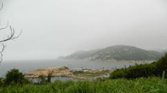
Iguazu in Brazil and Argentina
Los Glaciares in Argentina
Manu in Peru
Galapagos Islands in Ecuador
Introduction
Criteria and conditions for inclusion natural objects to the list World Heritage
1 Terms
2 Natural criteria
South America. World Natural Heritage Sites
1 Argentina
2 National Park Los Glaciares
3 Iguazu National Park
4 Peninsula Valdez
5 Natural parks Ischigualasto and Talampaya
Bolivia
1 Noel Kempff Mercado National Park
Brazil
1 Iguazu National Park
2 Serra da Capivara National Park
3 Forest reserves of the eastern Atlantic coast
4 Forest reserves of the southeast Atlantic coast
5 Complex of reserves of Central Amazonia
6 Pantanal Protected Area
7 Brazilian Atlantic Islands: Fernando de Noronha and Rocas Atoll
8 National parks of the Campos Cerrado zone: Chapada dos Veadeiros and Emas
Venezuela
1 Canaima National Park
Colombia
1 Los Catios National Park
2 Malpelo Island
1 Machu Picchu Historical Reserve
2 Huascaran National Park
3 Manu National Park
4 Rio Abiseo National Park
Suriname
1 Nature protected area Central Suriname
Ecuador
1 Galapagos Islands
2 Sangai National Park
Conclusion
List of references and online resources
Introduction
UNESCO World Heritage - natural or man-made objects, the priority tasks in relation to which, in the opinion of UNESCO, are their conservation and popularization due to their special cultural, historical or environmental significance.
In 1972, UNESCO adopted the Convention Concerning the Protection of the World Cultural and Natural Heritage (entered into force in 1975). By September 2012, the convention had been ratified by 190 participating countries.
Every year the World Heritage Committee holds sessions at which "World Heritage Site Status" is awarded.
As of 2013, there are 981 sites on the World Heritage List, of which 759 are cultural, 193 natural and 29 mixed.
There are 67 UNESCO World Heritage Sites in South America.
1. Criteria and conditions for including natural sites on the World Heritage List
.1 Conditions
As defined in Article 2 of the World Heritage Convention, natural heritage includes the following:
) natural monuments created by physical and biological formations or groups of such formations, having outstanding universal value from an aesthetic or scientific point of view;
) geological and physiographic formations and strictly limited areas representing the range of endangered animal and plant species of outstanding universal value from a scientific or conservation point of view;
) natural sites or strictly defined natural areas of outstanding universal value from the points of view of science, conservation or natural beauty.
Outstanding Universal Value means cultural and/or natural significance that is so exceptional that it transcends national boundaries and is of universal value to present and future generations of all humanity. The continued protection of this heritage is therefore of paramount importance to the international community as a whole. A natural heritage property meeting one of the above definitions that is nominated for inscription on the World Heritage List is considered to be an Outstanding World Heritage Site for the purposes of the Convention if the Committee is able to satisfy itself that the property satisfies one or more of the criteria as well as the conditions of integrity.
1.2 Natural criteria
The main purpose of the World Heritage List is to make known and protect sites that are unique in their kind. For this purpose and because of the desire for objectivity, evaluation criteria were drawn up. Initially (since 1978) there were only criteria for cultural heritage sites - this list consisted of six points. Then, to restore some kind of balance between the various continents, natural objects and for them a list of four points. And finally, in 2005, all these criteria were brought together, and now every World Heritage site has at least one of them in its description: - include the greatest natural phenomena or places of exceptional natural beauty and aesthetic value; - represent an outstanding example , reflecting major stages of Earth's history, including traces of ancient life, ongoing geological processes of development of important land forms, or significant geomorphological and physiographic phenomena; - represent an outstanding example of important and ongoing ecological and biological processes in the evolution and development of land, river and lake , coastal and marine ecosystems and plant and animal communities; - include natural habitats that are most important and significant from the point of view of conservation of biological diversity, including habitats of endangered species of outstanding global value from the point of view of science and nature conservation.
2. South America. World Natural Heritage Sites
South America is the southern continent in America, located mainly in the Western and Southern Hemispheres of planet Earth, however, part of the continent is also located in the Northern Hemisphere. It is washed in the west by the Pacific Ocean, in the east by the Atlantic Ocean, in the north it is limited by North America, the border between the Americas runs along the Isthmus of Panama and the Caribbean Sea.
.1 Argentina
unesco monument landmark area
The list of UNESCO World Heritage Sites in Argentina includes 8 items (as of 2011), 4 sites are included according to natural criteria. Los Glaciares and Iguazu recognized natural phenomena or spaces of exceptional natural beauty and aesthetic importance. Among them:
· Los Glaciares National Park (1981)
· Iguazu National Park (1984)
· Peninsula Valdez (1999)
· Natural Parks of Ischigualasto and Talampaya (2000)
In addition, as of 2010, 8 objects on the territory of the state are among the candidates for inclusion in the World Heritage List, including 5 according to cultural, 1 - according to natural and 2 - according to mixed criteria.
Argentina ratified the Convention Concerning the Protection of the World Cultural and Natural Heritage on August 23, 1978. The first site in Argentina was listed in 1981 at the 5th session of the UNESCO World Heritage Committee.
2.2 Los Glaciares National Park
Los Glaciares National Park (Spanish: Parque Nacional Los Glaciares, glaciers) is a national park located in Patagonia (South America), in the Argentine province of Santa Cruz. The area of the park is 4459 km ². In 1981 it was included in the World Heritage List.
Founded in 1937, Los Glaciares is Argentina's second largest national park. The park gets its name from the huge ice cap in the Andes, which feeds 47 large glaciers, of which only 13 flow towards the Atlantic Ocean. This ice massif is the largest after the ice of Antarctica and Greenland. In other parts of the world, glaciation begins at least 2500 m above sea level, but in Los Glaciares Park, due to the size of the ice cap, glaciers begin at an altitude of 1500 m and slide down to 200 m, eroding the slopes of the mountains underlying them.
The territory of Los Glaciares, which is 30% covered with ice, can be divided into two parts, each of which has its own lake. Lake Argentino, the largest in Argentina (area 1466 km ²) is located in the southern part of the park, and Lake Viedma (area 1100 km ²) - in the north. Both lakes feed the St. Croix River, which flows to the Atlantic Ocean. Between these two parts there is the Central Zone (Zona Centro), closed to tourists, in which there are no lakes.
The northern half of the park includes part of Lake Viedma, the Viedma Glacier, small glaciers and several mountain peaks popular with climbers and mountain tourists, such as Fitzroy and Cerro Torre.
The southern half of the park, along with small glaciers, includes the main glaciers that flow into Lake Argentino: Perito Moreno, Uppsala and Spegazzini. A typical boat tour includes exploring the otherwise inaccessible Uppsala and Spegazzini glaciers. The Perito Moreno Glacier can be reached by land.
Los Glaciares Park is popular destination V international tourism. Tours begin in the village of El Calafate, located on Lake Argentino, and in the village of El Chaltén, located in the northern part of the park at the foot of Mount Fitz Roy.
Climate . The entire natural appearance of the park and its originality are associated primarily with the climatic characteristics of the region. Nowhere on the globe are there such favorable conditions for the development of modern glaciation in such low sprats; the “Roaring Forties” westerly winds encounter on their way over the oceanic expanses of the World Ocean of the Southern Hemisphere only a single obstacle in the form of the Patagonian Andes. The winds hit their western (Chilean) slopes with terrible force and release almost all the moisture accumulated from the ocean.
Completely different climatic conditions are characteristic of the eastern (Argentine) slopes and foothills of the Patagonian Andes, where the national park is located. Having lost strength and moisture on the western slopes, the air masses of the “roaring forties” arrive on the eastern slopes “weakened” and almost dried up. Being in the "rain shadow" of the Andes, the park's territory receives much less rainfall - up to 900 mm on the mountain slopes and 500 mm in the east of the park. The average annual precipitation for the entire park is 809 mm, and the average annual temperatures are +7.5 °C, minimum +3.3 °C, maximum + 12 °C. Here, unlike the eastern slopes of the Patagonian Andes, the sun shines most of the year. Only from April to May the sky is overcast, it rains in the foothills, and snow falls in the mountains. In winter, which is June - August in the Southern Hemisphere, snowfalls are common. In early spring and summer, strong hurricane winds sweep over the park's territory from the west and south - from Antarctica.
Flora. In addition to snow-capped peaks (of undoubted interest for climbers), huge glacial fields and amazingly beautiful lake surfaces, in Los Glaciares National Park you can also get acquainted with the unique flora of Patagonia.
The park contains two types of plant communities - subantarctic Patagonian forests (in the west) and Patagonian steppes, characteristic of the flat-platagonal part (in the east).
Fauna. The vertebrate fauna of the national park, with the exception of avifauna, has not yet been sufficiently studied. About 100 species of birds have been recorded here, of which the most notable are the Andean condor and the long-billed (Darwinian) rhea.
Among the birds, the Andean spur duck and chaffinch are very numerous.
There is a small population of Andean deer. The Andean deer is listed in the International Red Book.
In the park there are individual individuals of the mountain veskashi from the order of rodents. More often you can see llamas and guanacos.
The ichthyofauna of glacial lakes and small streams is very rich. Many tourists come to Los Glaciares National Park specifically for sport fishing. In lakes Viedma and Lago Argentino, two species of salmonid fish were introduced specifically for sport fishing.
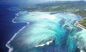
.3 Iguazu National Park
Iguazu National Park (Spanish: Parque Nacional Iguaz ú) - a national park in Argentina, located in the department of Iguazu, in the northern part of the province of Misiones, in the Argentine Mesopotamia.
The park was created in 1934 and partially contains one of the natural monuments of South America - Iguazu Falls, surrounded by subtropical jungle. On the other bank of the Iguazu River lies a Brazilian park with the same name (Iguazu National Park). Both parks were declared UNESCO World Heritage Sites (in 1984 and 1986, respectively).
Flora. The flora includes 2 thousand species of plants, in particular: one of the endangered species of aspidosperm trees - Aspidosperma polyneuron (English), rarely found outside the park due to cutting down for edible fruits, one of the types of cabbage palm - Euterpe edulis (English. ), phoebe, holly, footcarp, recently increasingly rare cedrela, araucaria, palo rose. Trees of the burzer family and many vascular plants grow. Among the flowers there are bromeliads and various types of orchids.
Fauna. The park's fauna includes 70 species of mammals, 400 species of birds, 40 species of reptiles, several hundred species of butterflies, including endangered species. The most common fauna are: jaguar, jaguarundi, mazama deer, lowland tapir, capybara, water possum, ocelot, giant anteater, Brazilian otter, bush dog, puma, monkeys (capuchins and howler monkeys), nosoha, Paraguayan caiman, broad-faced caiman, coral asp. Birds such as swifts and large toucans can also be found there. Wine-breasted Amazon, American swift, Tirika, Brazilian merganser, bronze penelope (English) Russian, South American harpy, hummingbird, common to these places. Among the known representatives of bats, the most common type of vampire bat is the common vampire.
Geography of waterfalls. The complex is 2.7 km wide and includes approximately 270 individual waterfalls. The height of the water fall reaches 82 meters, but at most waterfalls it is a little more than 60 meters. The largest waterfall is the "Devil's Throat" - a U-shaped cliff 150 meters wide and 700 meters long. This waterfall marks the border between Brazil and Argentina.
There are three towns in the vicinity of the falls - Foz do Iguaçu on the Brazilian side, Puerto Iguaçu on the Argentine side and Ciudad del Este on the Paraguay side.
The most famous names of the waterfalls: "Adam and Eve", "Three Musketeers", "Two Sisters", "Salto Escondido" ("hidden jump"), "Salto Floriano" ("flower jump"), "San Martin" , "Ramirez" and a number of others.
Tourism. Iguazu Falls is one of the most visited tourist destinations in South America. Every year there are 1.5-2 million visitors. Observation platforms are equipped especially for tourists. In the vicinity of the waterfall there are hiking and car routes. Tourists are also offered waterproof clothing, since the routes go to the very foot of the waterfalls. In the vicinity of Iguazu Falls is located international airport, dozens of hotels, campsites, access roads, and walking trails have been built. The local population is also involved in this industry; there are specially equipped areas for them where they show local dances and songs, while dressing in local costumes.
.4 Peninsula Valdez
Valdez is a peninsula on the Atlantic coast of Argentina. Area - 3625 km ². It is connected to the mainland by the Carlos Ameghino isthmus. The Bay of San Jose juts out from the north, and Golfo Nuevo from the south. Most of the peninsula is uninhabited. There are several salt lakes, the largest of which lies 40 meters below sea level. This is the lowest point on land for South America.
In 1999, the Valdez Peninsula was included in the UNESCO World Heritage List - primarily for its unique and rich fauna.
Physiographical features. The peninsula is located in the northeast of the province of Chubut, and is washed by the waters of the Atlantic Ocean. From the north and south, its coasts are washed by the bays of San Jose and Nuevo.
The relief of the territory is a typical Patagonian plateau, which ends in the sea with steep banks. The coast is composed of marine sediments that are subject to constant erosion. Part coastline It is represented by beaches, among which rocky ones stand out - a favorite place for elephant seals.
The climate on the peninsula is transitional between the temperate climate of the central part of the country, with maximum precipitation in the hot months, and the cold climate with winter rains, which is more typical of Patagonia. Summers on the peninsula are hot but short, and winters are cold.
Diversity of flora and fauna. The main vegetation of sea shores is algae. They cover rocky shores with colorful blankets: blue-green, green, brown, red or yellow-green, depending on the pigment in the plant cells.
The Valdez Peninsula in Patagonia is of great importance for the conservation of marine mammals. The population of the endangered Australian subspecies of the southern right whale breeds here. The peninsula is famous all over the world for its excellent viewing opportunities for these giants. They arrive on shore in June and stay until December to give birth. The southern right whale reaches a length of approximately 14 meters and weighs up to 50 tons. Females carry their young for a whole year, and give birth to only one offspring at a time.
Southern elephant seals and southern sea lions also breed here, and resident killer whales use a unique hunting strategy adapted to the local coastline conditions.
The peninsula is also home to many species of birds and land animals, such as guanacos, foxes, rheas, pampas ptarmigan, and the Patagonian hare.
2.5 Ischigualasto and Talampaya Natural Parks
Ischigualasto and Talampaya Natural Parks - Two contiguous parks covering an area of over 275,300 hectares in the desert region along the western border of the Sierra Pampeanas mountains in Central Argentina. Here you can see the most complete fossil record, dating back to the Triassic period (245-208 million years ago). Six geological formations in the parks contain the fossilized remains of numerous living precursors to mammals, dinosaurs and plants, revealing the evolution of vertebrates and the nature of the paleographic environment during the Triassic period. Included in the UNESCO List in 2000.
Flora and fauna of Ischigualasto. The fauna and flora of Ischigualasto are unique. All inhabitants demonstrate amazing adaptation to the desert arid climate. Some of the most common species of animals that travelers can not only see, but also feed, are gray Argentine foxes, viscachas and rabbits. While traveling through the park, guests also come across peculiar animals - mara, which are also called Patagonian hares, although they have nothing to do with hares.
Of the predators that live in Ischigualasto, one of the most common are the “damage” skunks, since these animals, which protect themselves with the help of the foul-smelling secretions of the anal glands, have a particular preference for open areas.
Among the canids, the gray Argentine fox, or “sorro de la pampa,” is widespread here.
In the protected area there are condors, two species of South American vultures - turkey and urubu, and many songbirds. And even representatives of the parrot family, which in our minds are characteristic exclusively of tropical forests.
Surprisingly, these arid lands are even home to several species of frogs and toads.
The vegetation is represented mainly by cacti, rare thorny bushes and trees, such as retama, chanyar, algorobo and others. Many of the plants found here are used in medicine.
Attractions of Talampaya Park
· The dry bed of the Talampaya River, where dinosaurs lived several million years ago - as in Ischigualasto, fossils from that era can be found here.
· Talampaya Canyon - the height of the walls reaches 143 m, the minimum width is 80 m.
· Remains of indigenous settlements, such as the petroglyphs at Puerta del Canyon.
· A botanical garden with native flora in a narrow part of the canyon.
· Fauna of the region: guanacos, hares, maras, foxes and condors.
3. Bolivia
Bolivia has only 1 World Natural Heritage Site - Noel Kempff Mercado National Park. In addition, as of 2010, 7 objects on the territory of the state are among the candidates for inclusion in the World Heritage List, including 4 according to cultural, 1 - according to natural and 2 - according to mixed criteria.
.1 Noel Kempff Mercado National Park
Noel Kempff Mercado National Park is located in the province of José Miguel de Velasco, department of Santa Cruz in eastern Bolivia on the border with Brazil. The territory of the park is 15,838 km ² , making it one of the largest parks in the entire Amazon basin. In 2000, the park was included in the UNESCO World Heritage List.
Climate. The climate is distinctly seasonal with approximately 1400-1500mm of average annual precipitation. There is a dry season of about 4-6 months (from May to September) when there is a decrease in rainfall. The average annual temperature is 25-26 °C, but during the dry season the temperature can drop to 10 degrees for several days when cold, dry Patagonia air masses (surazos) reach the park.
Flora and fauna. The inaccessibility of these places serves as a good natural protection for the virginity of the park, which includes five ecosystems located at altitudes from 200 to 1000 m above sea level: montane evergreen forests, deciduous forests, dry savanna, wet savanna and tropical rainforests. The diverse flora includes 4,000 plant species, of which 2,700 species have been identified. Among them are several types of palm trees, cedar, oak, vines and bromeliads, and many types of orchids. Captivating colors and smells, exotic passion fruit and mangabe fill these places.
The park is home to more than 630 species of birds, 139 species of mammals - this is more than in all of North America, including: jaguar, puma, river dolphin, giant anteater, maned wolf, tapirs, capybaras, swamp deer. Many species of butterflies and other insects, 62 species of amphibians, including the South American side-necked turtle and black caiman, 127 species of reptiles. Two species of anacondas are found here at the same time - the common green and yellow Paraguayan. There are about 254 species of fish in the rivers.
Some of these fauna species are endangered in other areas of Bolivia.
4. Brazil
There are 8 natural sites on the UNESCO World Heritage List in Brazil. Among them, 4 objects are recognized as “natural phenomena of exceptional beauty and aesthetic importance” (criterion vii).
· Iguazu National Park (1986)
· Serra da Capivara National Park (1991)
· East Atlantic Coast Forest Reserves (1999)
· South East Atlantic Coast Forest Reserves (1999)
· Complex of reserves of Central Amazonia (2000)
· Pantanal Protected Area (2000)
· Brazilian Atlantic Islands: Fernando de Noronha and Rocas Atoll (2001)
· National parks of the Campos Cerrado zone: Chapada dos Veadeiros and Emas (2001)
.1 Iguazu National Park
Iguazu is a national park in Brazil and a UNESCO World Heritage Site located in the state of Paraná. It is renowned for its waterfall (part of which is located in Argentina's Misiones province) and its spectacular wildlife (especially its wide variety of birds), which includes rare and endangered species. This is the most unique place in the world, as 5 forest species are concentrated on one piece of land.
4.2 Serra da Capivara National Park
Serra da Capivara National Park is a national park in the state of Piaui in northeastern Brazil. The park contains many sites of prehistoric rock art, which were discovered by archaeologist Niede Guidon. On her initiative, a park was created to preserve images. In 1991 it was listed as a World Heritage Site. The area of the park is 1291.4 km².
As archaeological research shows, in ancient times the Serra da Capivara was very densely populated; here was the largest concentration of prehistoric peasant farms in ancient America.
Climate, flora and fauna. The climate in these places is very hot and arid, and therefore the vegetation of the park is represented by thorny trees and shrubs, as well as cacti, of various bizarre shapes, more reminiscent of a candelabra. Despite the dry climate, which, it must be said, is not at all typical for Brazil, in these places it is not difficult to meet anteaters, armadillos, snakes, jaguars, pumas, and various parrots. Also in these places lives an interesting animal - a false vampire. This is a bat with a meter-long wingspan.
Park attractions. In the Brazilian Serra da Capivara National Park there are caves where distant human ancestors lived 50 thousand years ago. Most likely this is the oldest community of people in South America. The national park is located near the city of San Raimondo Nonato (central part of the state of Piaui).
Scientists have counted more than three hundred archaeological sites in this place. The main images are well preserved and date back to 22-25 thousand years before the Birth of Christ. Extinct animals that will never exist on planet Earth are painted on the rocks.
4.3 East Atlantic Coast Forest Reserves
Eight protected natural areas (including three national parks) with a total area of 112 thousand hectares are located in the states of Bahia and Espirito Santo and include Atlantic rainforests and bushland (restinga). In terms of biodiversity, this area is one of the richest on the planet. The reserves are home to a number of endemic species, which makes it possible to trace the evolutionary path of living organisms, and this, in turn, is of great importance from both a scientific and environmental point of view.
Biodiversity. Although the ecoregion has suffered greatly from deforestation for agriculture and urbanization (out of a million square kilometers of virgin forest, about 7% remains), the flora and fauna here are very rich, with 450 species of trees growing on one hectare. There are many endemics, for example, 92% of local amphibians are found nowhere else. An example of a primate is the genus Leontopithecus. The collared sloth (Bradypus torquatus) is found only in the Brazilian Atlantic Forest. Birds include the blue-capped tanager (Tangara cyanocephala), red-billed crax (Crax blumenbachii), blue-bellied parrot (Triclaria malachitacea), three-toed jacamara (Jacamaralcyon tridactyla), etc.
.4 Forest reserves of the southeast Atlantic coast
The forest reserves of the southeast Atlantic coast contain the finest and most extensive examples of Atlantic forest in Brazil. The 25 protected areas that make up this monument, covering a total area of approximately 470,000 hectares, demonstrate the biological richness and evolutionary history of the last remnants of the Atlantic Forest. The area is diverse and beautiful and is of great scientific importance.
Biodiversity. Partially isolated since the Ice Age, the Atlantic Forest has developed into a complex ecosystem with exceptionally high levels of endemism (70% tree species, 85% primates and 39% mammals).
The designated World Heritage Site contains well-preserved areas of highly diverse Atlantic tropical forests. More than 450 species of trees per hectare can be found in some areas. The forest canopy along the river valleys is higher with isolated trees reaching up to 30 m in height.
There is a very diverse fauna. Mammals include 120 species, probably the largest number in Brazil. Some notable species are the jaguar, ocelot, bush dog, La Plata otter, 20 species of bats and various species of endangered primate, especially the muriqui and brown howler monkey. The avifauna is very diverse with 350 recorded species.
.5 Complex of reserves of Central Amazonia
A huge zone (more than 6 million hectares) of unique world treasures of nature is a delightful complex of reserves in the Central Amazon. This region is distinguished by a wide variety of biological objects. For example, the reserves include such valuable protected areas as: Jau National Park, the Anavillanas Archipelago and the Amazon Forest. The diverse ecological systems of "Warzea" and "Igapo" make the reserves an invaluable world attraction. The unique ecology of these places is an excellent habitat for the world's largest electric snakes, Amazonian manatees, black caiman, as well as the giant fish - arapaima. In the rivers and lakes that form a bizarre aquatic system, two species of dolphins can be found here.
Flora. The Igapo flora is relatively poor, most characteristic of it is the imbauba cecropia, which grows quickly but not high (usually about 10 m), with wide, palmate, almost white leaves and aerial roots that support it under water. Near the surface of the water, in backwaters covered with huge leaves of Victoria reggae, bushes of inconspicuous Ivoreiana stretch. During the retreat of floods, thickets of tall, tough grasses develop. These gloomy forests are decorated with climbing vines and epiphytes, including many orchids. The Amazon forests are the kingdom of vines. They spread along the ground in garlands, climb up onto trunks, are thrown from branch to branch, from one tree to another, hanging from trees.
Fauna. Numerous lakes and channels form a mosaic aquatic system on the territory of the site, which is in a state of constant development and serves as a habitat for the world's largest population of electric eels.
Rare and endangered species include the Amazonian manatee, the black caiman (the largest South American alligator, 5 m long), two species of river dolphins, and the giant arapaima fish.
There are many herbivores on the site, forest deer and antelope are especially common; There are anteaters, a sloth, a tapir, peccaries, an armadillo, and many rodents. Monkeys can be seen everywhere; they are very numerous and varied: capuchins, duruculas, uakari, howler monkeys. There are a lot of bats in the forests.
.6 Pantanal Protected Area
The Pantanal is a vast swampy tectonic basin in Brazil, small parts of which are also located in Bolivia and Paraguay, in the Paraguay River basin. It is located in the west of the state of Mato Grosso do Sul and in the south of the state of Mato Grosso. The total area is approximately between 150-195 thousand km ², it is one of the largest wetlands on the planet.
Geography and geology. The predominant heights are 50–70 m above sea level. From the north, east and southeast, the territory is sharply limited by the cliffs of the Brazilian Plateau. Natural conditions this region are very contrasting. Floods during the wet summer season turn the Pantanal into a huge lake-swamp and alternate with winter droughts, forming a patchy landscape of persistent semi-overgrown swamps, lakes, barely visible wandering river beds, salt marshes, sandbanks and grassy areas.
Biodiversity. There is a huge variety of flora and fauna here. More than 3,500 plant species grow throughout the Pantanal. There are 650 species of birds, 230 species of fish and 50 species of reptiles, and more than 80 species of mammals. There are about 20 million crocodiles alone. On the territory of the Pantanal there is a specially protected natural reserve - the Pantanal, which is a UNESCO World Heritage Site.
The Pantanal Nature Reserve is a unique and at the same time wonderful attraction in Brazil. Its borders touch Paraguay and Bolivia. The prevailing heights are within 50-70 meters. This amazing savanna is separated to the north by the Amazon jungle, and to the south by dense coastal Atlantic forests. The Paraguay River flows through the Pantanal, which creates numerous swamps, lakes and water meadows.
Among this richest fauna on the planet are such well-known species as the hyacinth macaw, toucans, capybaras, guara wolves, many species of monkeys, deer, coatis, armadillos, anteater, sloth, more than 1000 species of butterflies, etc. Many of the endangered animals extinct in other areas of South America, they live specifically in the Pantanal. Not far from the reserve is the small and wonderful town of Bonito, which is surrounded by greenery. The Brazilians dubbed it the gateway to the Pantanal. Thousands of tourists from all over the world visit this protected area all year round. natural park amazing beauty and diversity.
.7 Brazilian islands in the Atlantic: Fernando de Noronha and Rocas Atoll
The Fernando de Noronha archipelago and Rocas Atoll, which are the exposed peaks of the underwater South Atlantic Ridge, lie off the eastern coast of Brazil. These islands are among the largest in this area of the Atlantic, and their coastal waters are highly bioproductive and play an exceptional role as habitats and breeding grounds for tuna, sharks, sea turtles and marine mammals. The islands contain the largest concentrations of tropical seabirds in the Western Atlantic; There is also a large local dolphin population here. During low tides on Rokas Atoll you can see an impressive picture: shallow lagoons teeming with fish.
Flora and fauna of Fernando de Noronha. The island was covered with forest until the nineteenth century, when a prison was opened on the island and the forest began to be cut down for the construction of escape rafts. The islands are now predominantly covered with bush, and some areas have recently been replanted with new forest.
The islands are home to 2 species of endemic birds - Noronha Elaenia (Elaenia ridleyana) and Noronha Vireo (Vireo gracilirostris). Both are on the main island; Noronha Vireo is also present on Ilha Rata. In addition, there are the Long-eared Dove Noronha auriculata Zinaida, a rodent, Noronhomys vespuccii, mentioned by Amerigo Vespucci, which has now disappeared.
Geography of Rokas Atoll . It is of volcanic origin, formed by corals. The only atoll in the South Atlantic, one of the smallest atolls in the world.
The atoll has an oval shape, its length is approximately 3.7 km, width - 2.5 km. The depth of the lagoon is 6 m, area - 7.1 km ². The area of the two islets of the atoll (Cemit ério in the southwest, Farol Cay in the northwest) is 0.36 km ², of this, Farol Cay accounts for approximately two-thirds of the area. The most high point- a sand dune in the south of Farol Cay, its height is 6 m. The atoll consists mainly of corals and red algae. The coral ring is practically closed, except for a 200-meter wide channel on the northern side and a much narrower channel on the western side.
Both islands are overgrown with grass, shrubs, and several palm trees grow on them. The islands are home to crabs, spiders, scorpions, sand fleas, beetles, and many species of birds. Turtles, sharks, and dolphins live near the atoll.
.8 National parks of the Campos Cerrado zone: Chapada dos Veadeiros and Emas
"Campos Cerrado" is one of the ecoregions of the tropical Brazilian savanna, which occupies about 20% of the country's territory. This area contains two Brazilian national parks (Emas and Chapada dos Veadeiros), which are not just protected areas, but also UNESCO World Heritage Sites. Their flora and fauna is distinguished by its biodiversity and at the same time is one of the oldest ecosystems in the tropical zone, which impresses with its amazing contrasts. These places have been pleasing to the eye for thousands of years, and also serve as a reliable refuge for a wide variety of animals and plants.
Emas. Emas National Park is located in the central part of the Brazilian Highland savannah. The country's authorities, or rather President Juscelino, made this territory a reserve back in 1961, but Emas was added to the list of UNESCO World Heritage Sites in 2001. The park is rich in wooded savannah flora. It is here that you can find amazing palm trees typical of wooded savannas. In the park, tourists can see the round crowns of huge babasu palms, reaching 75 meters in height.
The Emasa Savanna has helped preserve many species of living organisms during climate change. Among the most interesting representatives of the fauna are the large anteater, the armadillo and the maned wolf. As for the climate, winters are cold and summers are hot. Curious tourists are offered such types of entertainment as fishing, horseback riding or boat trips.
Chapada dos Veadeiros. An equally interesting site is the Chapada dos Veadeiros Park. Which also became a protected area in 1961. The park is located in the state of Goiás on an ancient plateau. If Emas is very rich in fauna, then nature has endowed Chapada dos Veadeiros with a wide variety of flora. There are more than 25 species of trees on the territory of the reserve. Animal world The region is also quite bright and colorful (swamp deer, armadillos, tapirs). On hot summer days, temperatures up to 40 degrees can be observed here, but in winter there is sometimes slight frost.
5. Venezuela
There are 3 names on the list of UNESCO World Heritage Sites in Venezuela (as of 2010), this is 0.3% of the total (981 as of 2013). 2 objects are included in the list according to cultural criteria, 1 object - according to natural ones (Kanaima National Park).
In addition, as of 2010, 3 objects on the territory of the state are among the candidates for inclusion in the World Heritage List. The first site on Venezuelan territory was inscribed in 1993 at the 17th session of the UNESCO World Heritage Committee.
.1 Canaima National Park
Canaima National Park is a park in southeastern Venezuela, on the border with Brazil and Guyana. The park area is about 30,000 km ². Located in the state of Bolivar and occupies approximately the same territory as the Gran Sabana Natural Park.
The park was opened on June 12, 1962 and is the second largest in the country, second only to Parima-Tapirapeco Park. In 1994, Canaima was listed as a UNESCO World Heritage Site. The main attraction and value of the park are the tepuis (flat-topped mountains) located there.
Flora and fauna. The territory of Canaima is home to such representatives of the animal world as: tapir - a large herbivorous mammal (somewhat reminiscent in shape of a pig, but has a short trunk adapted for grasping), peccaries - a large artiodactyl similar to a pig, agouti - rodents, relatives of guinea pigs, moving on long limbs, anteater, puma, jaguar, as well as wide-faced caiman, etc. In the village The Pemon Indians live with many rabbits that children chase. The local jungle is famous for its special abundance of different types of orchids, of which there are about 500 species.
Attractions. Like fragments of another world, the Table Mountains stand here - the unique Gran Sabana plateau, part of the Guiana Plateau, whose two-kilometer steep walls, absolutely flat at the top, rest against the clouds. These mountains, called tepuis, are among the oldest formations on Earth, dating back countless years when Africa and South America were one continent. Arthur Conan Doyle, inspired by the surreal landscape, settled tyrannosauruses and pterodactyls on the tops of the plateau. Of course, there are no ancient lizards on Gran Sabana, but the microcosm that lives at an altitude of two thousand meters above the rest of the surrounding world is truly unique.
Another attraction of Kanaim is the waterfalls, the highest on the planet. Falling from the sheer ledges of the mesas, these waterfalls are an impressive sight. The most famous of them, Angel Falls, falls from the top of one of the highest tepuis - Auyantepui, which deservedly means "devil's mountain".
6. Colombia
There are 2 sites on the list of UNESCO World Natural Heritage sites in Colombia:
· Los Catios National Park (1994)
· Malpelo Island (2006)
.1 Los Catios National Park
It was created in the north of Colombia, in the border area with the state of Panama. On the other side of the border, another environmental protection zone has been created - the Darien National Park. Los Catios National Park appeared on the territory of Colombia in 1976; today its area has grown to 72 thousand hectares. The nature of the park is represented by the following natural zones: tropical forests and floodplain swamps. The area of Los Catios Park lies around the Atrato River. A total of about 600 plant species have been discovered on its banks and among nearby wet forest complexes. A rather remarkable local species is the cottonwood tree. This is a typical tropical species that belongs to the malvaceae family. The homeland of this species is considered to be Mexico, some countries of Central America, Caribbean Islands, tropical region West Africa.
.2 Malpelo Island
Malpelo is an island in the eastern Pacific Ocean, 500 km from the shores of Buenaventura Bay in South America. Belongs to Colombia, part of the department of Valle del Cauca. Area 0.35 km².
On July 12, 2006, Malpelo, together with the adjacent water area of 857,150 hectares, was included in the UNESCO World Heritage List. It is the largest no-fishing zone in the eastern tropical Pacific.
Geography. The island is a rock without much vegetation, maximum height- 376 m (Mount Mona, Spanish: Cerro de la Mona). Length about 1850 m, width up to 600 m. Surrounded by small rocks. The Malpelo Natural Protected Area occupies a circle with a radius of 9.656 km around a point with coordinates 3°58?30? With. w. 81°34?48? h. d. (G) (O).
The area around Malpelo is home to populations of silky sharks, frilled sharks, whale sharks, hammerhead sharks and sandbar sharks, making the island a popular destination for divers.
The island is composed of effusive rocks, volcanic breccias and Tertiary basaltic dikes. Vegetation - algae, lichens, mosses, some types of shrubs, ferns.
Biodiversity. Malpelo Island is a haven for a range of rare marine species. Many sharks, giant groupers, and marlins gather here. This is one of the few places on Earth where reliable encounters with a deep-sea sand shark have been recorded. These depths support stable populations of large marine predators and pelagic species, in particular, aggregations of more than 200 hammerheads, over 1 thousand frilled sharks, as well as whale sharks and tuna. 17 species of marine mammals, including humpback and blue whales, 5 terrestrial and 7 marine reptile species, 61 bird species, 394 fish species and 340 shellfish species have been recorded on Malpelo .
7. Peru
For 2012, the list includes 11 objects, 2 of which are natural and 2 are mixed:
Machu Picchu (1983)
· Huascaran National Park (1985)
Manu (1987)
· Rio Abiseo National Park (1992)
.1 Machu Picchu Historical Reserve
The city of ancient America, located on the territory of modern Peru, on top mountain range at an altitude of 2450 meters above sea level, dominating the valley of the Urubamba River. In 2007, it was awarded the title of New Wonder of the World.
In 2011, it was decided to limit the number of visitors. According to new rules, only 2,500 tourists per day can visit Machu Picchu, of which no more than 400 people can climb Mount Wayna Picchu, which is part of the archaeological complex. In order to preserve the monument, UNESCO requires reducing the number of tourists per day to 800.
Flora and fauna. On the territory of Machu Picchu you are constantly surrounded by landscapes of dazzling beauty. The splendor of the archaeological ruins is harmoniously combined with a huge variety of flora and fauna. Throughout the entire area of the lost city, which is approximately 32,520 hectares, you will see exotic pisonai and cunewal trees, shield palms, alders - they amaze with their grandeur. About 400 species of begonias and orchids grow here, of which only 260 species are classified.
The animals that live in Machu Picchu are also amazing in their diversity. The city is home to approximately 375 species of birds, of which 200 species can always be seen during a tour. One of the brightest representatives of birds is the Cock of the Rock, which is the symbol of Peru. The bird is easily recognized by its colorful plumage and can be easily found on river banks.
In terms of animals, the endangered Andean bear is of particular interest. In these parts he is known as the "Spectacled Bear". The animal is absolutely safe, eats only plant foods. Due to his shy nature, it is not often possible to photograph him. In Machu Picchu you can also see vicuñas, white-tailed deer, wild llamas and other representatives of exotic fauna.
Current state. Machu Picchu, especially after receiving UNESCO World Heritage status, has become a center of mass tourism. In 2011, it was decided to limit the number of visitors. According to new rules, only 2,500 tourists per day can visit Machu Picchu, of which no more than 400 people can climb Mount Wayna Picchu, which is part of the archaeological complex. In order to preserve the monument, UNESCO requires that the number of tourists per day be reduced to 800. Machu Picchu is located in a remote region. To support tourism, a railway was built to neighboring city Aguas Calientes from Cusco via Ollantaytambo, there are more than ten trains a day from Ollantaytambo. There is a bus from the Aguas Calientes train station to Machu Picchu, which covers eight kilometers of steep serpentine ascent. UNESCO opposed the construction of the cable car to limit the flow of tourists. As a result of the 2004 earthquake, the area railway was badly damaged, but was restored.
At the 35th session of the UNESCO World Heritage Committee, it was decided that ancient city will be removed from the list of World Heritage Sites in Danger from 1 February 2012.
7.2 Huascaran National Park
A national park located in the Ancash region of Peru, in the Cordillera Blanca.
The park area is 3400 km ². Declared a nature reserve on July 1, 1975. UNESCO World Heritage Site since 1985. The name of the park comes from the name of the high peak Peru - Huascaran, 6768 m high. The park is home to many rare and endemic plants and animals. For example, Puya raimondi is a plant of the bromeliad family up to 10 meters high, whose age can reach up to 100 years.
Climate. The climate in the national park, in addition to being characterized by the typical altitude zone for mountains, is divided into two seasons a year. One of them is humid, caused by strong warm winds blowing from the Amazon jungle, and lasts from December to March. The other, lasting from May to October, is dry, characterized by a large number of sunny days. The temperature at this time can rise to 25 degrees Celsius, but the nights are very cold, and the thermometer often drops below 0 degrees.
Flora and fauna. The fauna of the White and Black Cordillera is represented mainly by birds and mammals. Some species have not yet been described or our knowledge about them is extremely poor. Scientists estimate that 112 bird species representing 33 different families are found in Huascaran National Park. These include the Andean condor, the Andean spur-tailed duck and the Andean tinamous. Mammals are represented in the park by only ten species. However, among them are such amazing, rare and beautiful animals as the Pampas cat, Andean cat, spectacled bear, vicuna and Peruvian deer.
Flora Huascaran National Park is more diverse in terms of species growing here. The park has seven climate zones and a huge number of microclimates. All this contributes to the development of unique plants, occupying literally every area of the mountain surface suitable for life and growth. In total, scientists have described 779 plant species in Huascaran, belonging to 340 genera and 104 families.
.3 Manu National Park
The park was established in 1977 in the regions of Madre de Dios and Cusco, and in 1987 it was recognized as a UNESCO World Heritage Site. Manu Area - 19,098 km ², of which the national park occupies 15,328 km ², the rest is a reserve zone. The main part of the territory is Amazonian forest, but some part is in the Andes at an altitude of up to 4200 m. Manu is home to a large number of species of flora and fauna. More than 15 thousand plant species and about a thousand bird species were found on its territory (more than a tenth of all bird species and about 1.5 times more than in Russia). The population of the Inca toad, endemic to Peru, is protected within the park.
.4 Rio Abiseo National Park
Rio Abiseo National Park is a national park located in the Peruvian region of San Martin. Since 1990 it has been included in the UNESCO World Heritage List. The park is home to many species of flora and fauna and is home to more than 30 pre-Columbian archaeological sites. Since 1986, certain parts of the park have been closed to tourists due to the fragility of both the natural and archaeological environment. The largest and most famous archaeological site within the park is Gran Pajaten, located on a hilltop near the border of the region. Nearby are the ruins of Los Pinchudos (discovered in 1965), which are a series of stone graves. Most archeological research in the park is carried out by staff from the University of Colorado.
Geography and climate. Rio Abiseo National Park is located on the eastern slope of the Peruvian Andes between the Marañon and Huallaga rivers, covering an area of 2,745.2 km ². In particular, the park covers about 70% of the Abiseo River basin. Altitudes in the park range from 350 m to 4200 m above sea level.
The park has seven climate zones, ranging from alpine meadows and mountain forests to dry forests and tropical rainforests. Precipitation varies from 500 to 2000 mm per year. The moist montane forest, which occupies most of the park, consists of low trees, mosses and lichens. This ecosystem exists at altitudes of about 2300 m. The humidity here is constant and rain falls throughout the year, especially at high altitudes. The soils are acidic.
8. Suriname
There are 2 names on the list of UNESCO World Heritage Sites in Suriname (as of 2010), this is 0.2% of the total (981 as of 2013). 1 object is included in the list according to cultural criteria, 1 object - according to natural ones (Conservation Area of Central Suriname).
.1 Central Suriname Conservation Area
Conservation Area of Central Suriname - protected area in Suriname. The territory of the reserve occupies 16 thousand km ², consists primarily of tropical forests of the Guiana Highlands. The reserve is home to many species of animals, which are also under state protection.
On the territory of the reserve there is a unique granite monolith - Voltzberg, whose age is 1.8 - 2 billion years. It has two peaks separated by a crack: one of them has a height of 245 meters above sea level, the other 209 meters. The monolith itself is located at an altitude of 150 meters above the surrounding area. This monolith is 1.1 km long in a north-south direction and up to 700 meters wide in an east-west direction. Only at the top of the monolith is there sparse vegetation.
9. Ecuador
There are 4 names on the list of UNESCO World Heritage Sites in Ecuador (as of 2010), this is 0.4% of the total (981 as of 2013). 2 objects are included in the list according to cultural criteria, 2 objects - according to natural ones:
· Galapagos Islands (1978)
· Sangai National Park (1983)
In addition, as of 2010, 7 sites on the territory of the state are among the candidates for inclusion in the World Heritage List. The first site in Ecuador was listed in 1978 at the 2nd session of the UNESCO World Heritage Committee.
.1 Galapagos Islands
The Galapagos Islands are an archipelago in the Pacific Ocean, 972 km west of Ecuador, consisting of 13 main volcanic islands, 6 small islands and 107 rocks and alluvial areas.
Climate . Despite its latitude, due to the cold current, the climate in the Galapagos is much cooler than other areas on the equator. The water temperature sometimes drops to 20 °C, and the annual average is 23- 24°C.
Flora and fauna. The inability of large predators to evolve on the islands has allowed many species of wildlife to thrive on these islands. Therefore, the Galapagos is home to large quantity endemic and unique animals such as sea lions, native penguins, Galapagos tortoises, dolphins, Vampire finch, marine iguanas, lava lizards, whales, sharks, etc. There is also a large variety of seabirds such as frigatebirds, flamingos and albatrosses. Plants of Galapagos are also surprising in their diversity; a wide variety of endemic trees, tree ferns, and other types of shrubs and flowers grow on the islands. The archipelago has some rare species of cotton, tomatoes, peppers, guavas and orchids. The underwater life in the Galapagos Islands is also very beautiful. The surrounding waters are home to many species of fish, animals and aquatic plants, making the Galapagos Islands considered one of the wonders of the underwater world.
Fortunately, due to the remoteness of the islands from the continent and active sea communications, the wildlife here has been virtually unaffected and remains the same as Charles Darwin once found it. Tourists arrive to the Galapagos Islands mainly by plane. The Galapagos is probably the only place on Earth where you can dive with a penguin or swim among sea lions. The Galapagos Islands are one of the planet's most precious treasures and one of the world's last refuges for wildlife.
.2 Sangai National Park
Sangay National Park is located in the highlands of Ecuador. The territory of the Andes, included in the national park, is full of volcanoes. The most important volcano in the park is named Sangay. The approaches to it in Ecuador have been protected since 1975, when the Sangay National Park was created. To this day, the territory of the park has grown to 500 thousand hectares. Basically, the park's expanses include areas of tropical rainforest, as well as cloudy mountain forests.
Flora and fauna. As for the massifs of tropical rainforest, the following types of vegetation dominate among them: mulberry trees, palm trees, laurel trees, lianas. And in the high mountain zone of cloud forests the following species prevail: various orchids and ferns, thickets of bamboo and shrubs. The diversity of plant species in the park is a completely natural phenomenon, because there is a very large range of altitudes, which ranges from 1000 to 5230 m above sea level. In total, as many as 8 altitudinal vegetation zones can be observed in Sangay Park; in general, about 1,000 species have been recorded in the region.
The fauna of the Sangay volcano is represented by the following species: mountain tapir, vicuña, dwarf deer; the avifauna is dominated by the red bird, condor and other birds. As for mountain inhabitants, such as the mountain tapir, we have enough information about them.
The Red Bird is one of the most amazing birds in Sangai Park. The red bird is also often called the bird of paradise and belongs to the passerine order. The bird is medium in size, about 30 cm in length, with a wing length of about 16 cm and a tail - 12 cm. It has golden-green plumage, a small crest on the back of the head. The bird's chest and wings, as well as its legs, are bright red. The back has a gray-yellowish tint, the throat is dark green.
Quite limited areas of the park are home to animals such as puma, Andean fox, spectacled bear, pudú deer, ocelots and jaguars, and guinea pigs. Of the birds, such unique species as cubillin and quilimas, vultures, giant hummingbirds, etc. were ignored.
Conclusion
Thus, using the example of the South American region, one could get acquainted with the UNESCO World Heritage Program, which began its existence in 1975. Since 1977, every year the World Heritage Committee has held sessions at which the program objects are determined - natural or man-made objects, the priority tasks in relation to which are conservation and popularization due to their special cultural, historical or environmental significance.
The main purpose of the World Heritage List is to make known and protect sites that are unique in their kind. For this purpose and because of the desire for objectivity, evaluation criteria were drawn up. The first six criteria have been in force since 1978 and identify cultural sites; natural sites have been included in the list since 2002, when four additional natural inclusion criteria appeared.
Also, in the course of the work done, it was possible to verify that the “World Heritage Site Status” provides the following advantages (for natural heritage sites): it is an additional guarantee of the safety and integrity of unique natural complexes; increases the prestige of the territories and the institutions that manage them; promotes the popularization of objects included in the List and the development of alternative types of environmental management (primarily eco-tourism); ensures priority in attracting financial resources to support world cultural and natural heritage sites, primarily from the World Heritage Fund; promotes the organization of monitoring and control over the state of conservation of natural objects.
States on whose territory World Heritage sites are located undertake obligations to preserve them.
List of references and online resources
Drobot V.I. The concept of World Natural Heritage: a textbook / Mar. state University; V.I. Drobot. - Yoshkar-Ola, 2008. - 122 p.
2. Gebel P. Natural heritage of humanity: landscapes and natural treasures under UNESCO protection. M.: Publishing house BMN AO. 1999. - 256 p.
Maksakovsky N.V. World Natural Heritage. - M.: Education, 2005. - 396 p.
Cattaneo M. Treasures of Humanity. UNESCO World Heritage Site. - AST; Astrel, 2005. - P. 512.
Official information website "UNESCO: World Heritage Sites" http://unesco.heritage.ru
Http://world heritage.rf
http://ru.wikipedia.org/
http://umeda.ru
Http://7-chudes-sveta.ru
http://whc.unesco.org/
http://www.vokrugsveta.ru/encyclopedia/
Tutoring
Need help studying a topic?
Our specialists will advise or provide tutoring services on topics that interest you.
Submit your application indicating the topic right now to find out about the possibility of obtaining a consultation.
At the end of 2008, 120 sites in Latin America, located in 30 countries in this region, were included in the UNESCO List. Most of them are in Mexico (28), Brazil (16) and Peru (10).
Of the total number of objects, the vast majority (82) belong to the category of cultural heritage objects. Chronologically, they cover the period of time from the second millennium BC to the present day. But for the most part they represent the periods of the Middle Ages and modern times. Accordingly, they can be divided into objects of the pre-Columbian and post-Columbian eras.
The objects of the pre-Columbian era mainly include the heritage of the three already mentioned Latin American civilizations. In Meso-America, these are such world-famous monuments of the Mayan Indians as the ruins of the cities of Palenque, Chichen Itza, Uxmal in Mexico, on the Yucatan Peninsula, Copan in Honduras, as well as monuments of the Aztecs in Central Mexico (Teotihuacan). They are characterized by such monumental structures as stepped pyramids-theocalli, palaces of rulers, steles, and ball courts. Most of them were discovered in the 19th century. and now attract numerous tourists. In the Andean region, many objects in Peru (including the famous mysterious geoglyphs of the Nazca desert, fragments of the ancient Incan capital of Cusco), in Colombia (archaeological parks of San Agustin and Tierradentro), in Bolivia (archaeological region of Tiwanaku near Lake. Titicaca). With a certain degree of convention, another world-famous heritage site can be attributed to the Andean region - the stone statues of Fr. Easters in the Pacific Ocean, described by Thor Heyerdahl and many other travelers and explorers.
The post-Columbian era, associated mainly with the Spanish and Portuguese colonization of Central and South America after the start of the Great Geographical Discoveries, was also widely reflected in the cultural heritage sites of Latin America (Fig. 243). The objects of this era include mainly cities with a rectangular layout characteristic of Spanish architecture of that time, a central square (“Plaza Mayor”), numerous Catholic cathedrals and monasteries, and palaces of the nobility. In the West Indies, this is, for example, the city of Santo Domingo in Dominican Republic, associated with the name of Columbus, the old part of Havana with its fortifications in Cuba, in Central America - the historical centers of the cities of Mexico City, Puebla and some others in Mexico, as well as cities and fortresses in Guatemala, Nicaragua, Panama. Of the Spanish heritage of this era in South America, the most famous are the monuments of Cartagena in Venezuela, Quito in Ecuador, Cusco in Peru, and the mining city of Potosi in Bolivia. The legacy of the Portuguese colonial empire is widely represented in Brazil (the cities of Salvador, Olinda, Ouro Preto, etc.).
The objects of recent times in the region include the already mentioned new capital of Brazil - the city of Brasilia, designed and built by Brazilian architects Luis Costa and Oscar Niemeyer and having in plan the symbolic shape of an airplane with a “fuselage” and “wings”. This is one of the most ambitious and organic urban planning projects of the 20th century in concept and execution.
World Natural Heritage Sites in Latin America 35. These are mainly national parks and reserves. Among them there are such famous ones as Iguazu in Brazil and Argentina, Los Glaciares in Argentina, Manu in Peru, and the Galapagos Islands in Ecuador. And among the mixed cultural and natural sites here are the ruins of the Mayan city of Tikal in Guatemala, the Inca mountain fortresses of Machu Picchu and Rio Abysseo in Peru.
The Federative Republic of Brazil is a hospitable country that attracts millions of tourists from all over the world. Climatic conditions allow you to come here all year round, but Brazil experiences a real tourism boom on the eve of Easter, when the famous carnival is held in Rio de Janeiro.
Brazil is also famous for its bustling white sand beaches, picturesque nature and original local cuisine. In this country it is worth visiting the amazing Amazon, the swampy Pantanal, the sandy Lencois Maranhenses and other national parks where you can see an anaconda or fish for piranhas.
Since Brazil was previously involved in the slave trade, in some of its cities, such as Diamontina, Olinda, Ouro Preto, Sao Luis and Goiás, colonial architecture has been preserved almost in its original form. Among all the diversity Brazilian cuisine, it is definitely worth highlighting the unusual assortment of feijoada, pureed meat and tutu beans, marinated sarapatel liver and cured meat carne do sol.
The best hotels and inns at affordable prices.
from 500 rubles/day
What to see in Brazil?
The most interesting and beautiful places, photographs and brief description.
1. Iguazu Falls
The Iguazu River waterfall complex is located on the border between Brazil and Argentina. To fully enjoy the beauty of the waterfalls, tourists can take a sightseeing tour not only on foot or by car, but also by helicopter or boat. The unique local ecosystem is protected by UNESCO.
2. Christ the Redeemer Statue
One of the seven "new wonders of the world", the monument to Christ the Savior, is located in Rio de Janeiro. This is the hallmark of the city, as well as a popular tourist attraction. The monument was opened in 1931, and in 1965 Pope Paul VI re-consecrated the statue of Christ the Savior.

3. Ipanema Beach
Popular and safe - this is how Ipanema beach can be described. Small waves prevail here, which makes swimming quite calm. Beach cafes in Ipanema sell a variety of drinks, ice cream, sandwiches or fruit. The shops, hotels and houses surrounding the beach are considered the most expensive in Rio de Janeiro.

4. City of Ouro Preto
Ouro Preto is an ancient picturesque town founded in 1711. In the 17th-18th centuries, gold was mined here, which contributed to the rapid development of the city. At the end of the 19th century, gold mining ceased and Ouro Preto fell into disrepair. For its numerous well-preserved architectural examples of the colonial baroque, the city is included in the UNESCO list.

5. Serra da Capivara National Park
The northeast of the country is occupied by the Serra da Capivara National Park, protected by UNESCO, whose territory exceeds 120 thousand hectares. The park is valued primarily for its unique rock paintings dating back to the 14th century BC. There are 64 archaeological sites in the Serra da Capivara, with 14 hiking trails leading to them.

6. Teatro Amazonas
A bright representative of eclecticism, the pompous Amazonas Opera House was opened in 1896 in the city of Manaus. The building was erected with the money of the rich rubber tycoons, but over time, when the city became poorer, the theater fell into disrepair. Restoration work in 1990 restored the building to its former beauty, and today the theater again gives performances.

7. Fernando de Noronha
The unique ecosystem of the Fernando de Noronha archipelago has been declared a World Heritage Site by UNESCO since 2002. Thanks to their well-thought-out infrastructure, all 20 islands of the archipelago are considered a high-class ecotourism center. You can also go diving or surfing here.

8. Historic center of Olinda
The foundations of the city of Olinda, located in the northeast of the country, were laid back in the 16th century. Portuguese colonialists. The buildings of the historical center date back to the 18th century and are considered the best-preserved example of the first period of settlement. Since 1982 historical center Olinda is included in the UNESCO List.

9. Beaches of El Salvador
Salvador is a colorful city and the birthplace of the Brazilian martial art of capoeira. El Salvador was once a slave port, but today it is a popular beach resort. El Salvador offers its tourists about 20 equipped beaches with a length of more than 40 km. Capoeira masters perform every evening in Pelourinho Square.

10. Pantanal
A wetland reserve home to giant butterflies, rare birds and animals. In the most visited city of the Pantanal, Cuiabé, you can book a tour. In addition to the usual entertainment, in the Pantanal you can fish for piranhas or take part in a night boat safari.

11. Carnival in Rio de Janeiro
Every year in February, Rio de Janeiro receives millions of tourists who strive to get to the famous Brazilian carnival. The highlight of the carnival is the parade of samba schools, for which the performers spend many months preparing. To attend the four-day carnival, tourists should make hotel reservations in advance.

12. Historic center of Salvador da Bahia
Thanks to perfectly preserved examples of colonial architecture, the historical areas of Salvador da Bahia were included in the UNESCO List in 1985. Tourists here should visit Pelourinho Square, a local cathedral and the Elevador-Lacerda elevator.

13. Amazon Rainforest
The rainforests that surround the Amazon River are over 55 million years old. A huge number of animals, birds and insects live here. Tourists from all over the world come here to see the local aborigines, swim in a canoe under the moon, or catch a couple of piranhas.

14. Karakol waterfall
The very popular Karakol waterfall, from which there is an extraordinary view beautiful view on the surrounding landscape, located 7 km from the city of Canela. An observation deck for tourists, equipped with an elevator, was built a short distance from the waterfall. There are also souvenir shops and cafes here.

15. Jesuit missions of the Guarani region
In 1983, five Jesuit missions from the 17th and 18th centuries were inscribed on the UNESCO List. These reduction missions, which were mini-cities with all the accompanying infrastructure, were built to convert local tribes, in particular the Guarani Indians, to Catholicism.

16. Pedra Pintada
Pedra Pintada is a famous archaeological site in Brazil. Inside this 35 meter rock, caves with white and pink rock paintings were discovered. Experts date these drawings to the 10th millennium BC. Various household items of ancient people were also found here.

17. Portuguese Royal Library
Located in Rio de Janeiro, the Royal Portuguese Library was founded in 1837 and has been public since 1900. The library building, built in neo-Manueline style, combines Gothic and Renaissance elements. About 350 thousand books in Portuguese are stored here.

18. Lencois Maranhenses National Park
Located in the northeast of the country, Lencois Maranhenses National Park was founded in 1981. More than 1000 km2 of the park are occupied by amazing sand dunes, the height of which is about 40 m. After rains, the water forms lagoons suitable for swimming. Entrance to the park is free, but there is a fee for renting bicycles and sandboards.

19. Sugarloaf Mountain
One of the symbols of Rio de Janeiro is Sugarloaf Mountain. Located near Guanabara Bay, this 396 meter high mountain is a beautiful observation deck. You can get to the mountain on foot, by cable car or along one of the many climbing routes.

21. Ibirapuera Park
The city park of São Paulo, Ibirapuera, whose buildings were designed by the famous Oscar Niemeyer, was opened in 1954. Due to its vast green area, this popular attraction is also called the lungs of the city. Ibirapuera is home to a planetarium, the Museum of Contemporary Art, the Obelisk of São Paulo and the Bandeiras Monument.

22. Capacabana Beach
The world famous Capacabana beach is located in Rio de Janeiro. This four-kilometer recreation area has been used more than once as a concert venue. Rod Stewart, Elton John, Mick Jagger and Lenny Kravitz performed here. Many coastal hotels, cafes, discos and casinos make your holiday in Capacabana truly unforgettable.

23. Bom Jesus do Congonhas
This is an unusually beautiful church complex, which was built from 1773 to 1809. Bom Jesus do Congonhas consists of a church, seven chapels of the Way of the Cross of Christ, as well as sculptures of the prophets. Since 1985, this church complex has been protected by UNESCO.

24. Historic center of Diamantina
In the Espinhaço mountains there is the town of Diamantina, where you can see well-preserved buildings from the 18th century. The visiting card of the city deserves special attention - the Gloria complex, consisting of two buildings of the 18th and 19th centuries. Since 1999, the historical center of Diamantina has been included in the UNSCO list.

25. Chapada dos Veadeiros National Park
Chapada dos Veadeiros National Park is located in the center of the country, just a few kilometers from the capital. It was created in 1961, and in 2001 it was included in the UNESCO list. You can only move around the park on foot, but this is more than compensated by the beautiful scenery. There are several canyons and waterfalls here.

We considered the eastern and southern parts of South America as part of two tourist mesoregions of the macroregion. One of them is the Brazilian tourist mesoregion, the second is the tourist mesoregion Temperate South America, which includes four countries (Paraguay, Argentina and Chile). Brazil is famous for its recreational resources, diverse nature and cultural heritage colonial era. The countries of Temperate South America amaze, first of all, with the picturesqueness of their virgin nature and the uniqueness of cultural monuments.
The cultural specificity of Temperate South America is determined by the Catholic religion. In the interior regions of Brazil (in) local traditional beliefs have been preserved. The indigenous Indian peoples of Chile belong to the Andean family: Quechua, Aymara, Araucanians, etc. The Indians of Brazil and Paraguay belong to two language families: Equatorial-Tucanoan (Arawak, Tupi, Tucano, etc.) and Pano-Caribbean (Caribbean, pano, etc.). The majority of the population consists of peoples of the Romance group of the Indo-European family: Chileans, Argentines, Uruguayans, Paraguayans speaking the language, as well as Brazilians speaking the Portuguese language.
By its name Federative Republic of Brazil(8 million 547.4 thousand sq. km, 196.3 million people in 2008) is due to the brazil tree (from brasa - “heat, hot coals”). This is how the Portuguese named red sandalwood - a tree with dense yellow-red wood, used at that time in the dyeing business. Brazil was originally called the Land of the Holy Cross. But Brazil wood was the main export item from this country, for which the latter received the name Brazil (Russian form - Brazil). The consolidation of this name was facilitated by the fact that in Europe from the 14th century. the mythical island of Brazil was known, lying somewhere in and classified as “vagrant”, i.e. changing their location.
Name Republic of Paraguay(406.8 thousand sq. km, 6.8 million people in 2008) comes from the river of the same name, which means “big” or “river-river” in translation from local Indian languages.
The name came about similarly Uruguay- from the river of the same name, the name of which in the language of the Tupi Indians means “bird or chicken river.” The full name of the state, adopted in 1830, is the Eastern Republic of Uruguay (176.2 thousand sq. km, 3.5 million people in 2008), which is due to the location of the republic on the eastern bank of the Uruguay River. During colonial times, the country's territory was part of the Spanish General Government as the Province of the Eastern Bank, and since 1815 - the Eastern Province.
Argentine Republic occupies an area of 2 million 780 thousand square meters. km, the population in 2008 was 40.5 million people. The name Argentina appeared after the country's liberation from Spanish rule in 1826 and means “silver.” Prior to this, the territory of Argentina was called La Plata, after the common name of the river and bay, Rio de la Plata (“silver river”), adopted at that time.
Republic of Chile occupies an area of 756.6 thousand square meters. km, the population in 2008 was 16.5 million people. The name Chile in the language of the Arawak Indians means "cold, winter", which is associated with their perception of the snowy peaks of the Andes.
In total, 31 sites are included in the UNESCO World Heritage List in Brazil and Temperate South America, of which 20 are cultural monuments.